France High-Resolution Map: Detailed Regions, Cities & Terrain
France high-resolution map page offers a comprehensive collection of detailed cartographic resources showcasing the country's geography, infrastructure, administrative divisions, and travel network. Explore high-resolution France physical maps, topographic and elevation maps with major cities and rivers, and detailed terrain maps highlighting mountains and waterways, alongside insightful population density maps. You'll also find practical tools such as France road and highways maps with cities, large city maps with road networks, and maps with clearly defined boundaries and regions.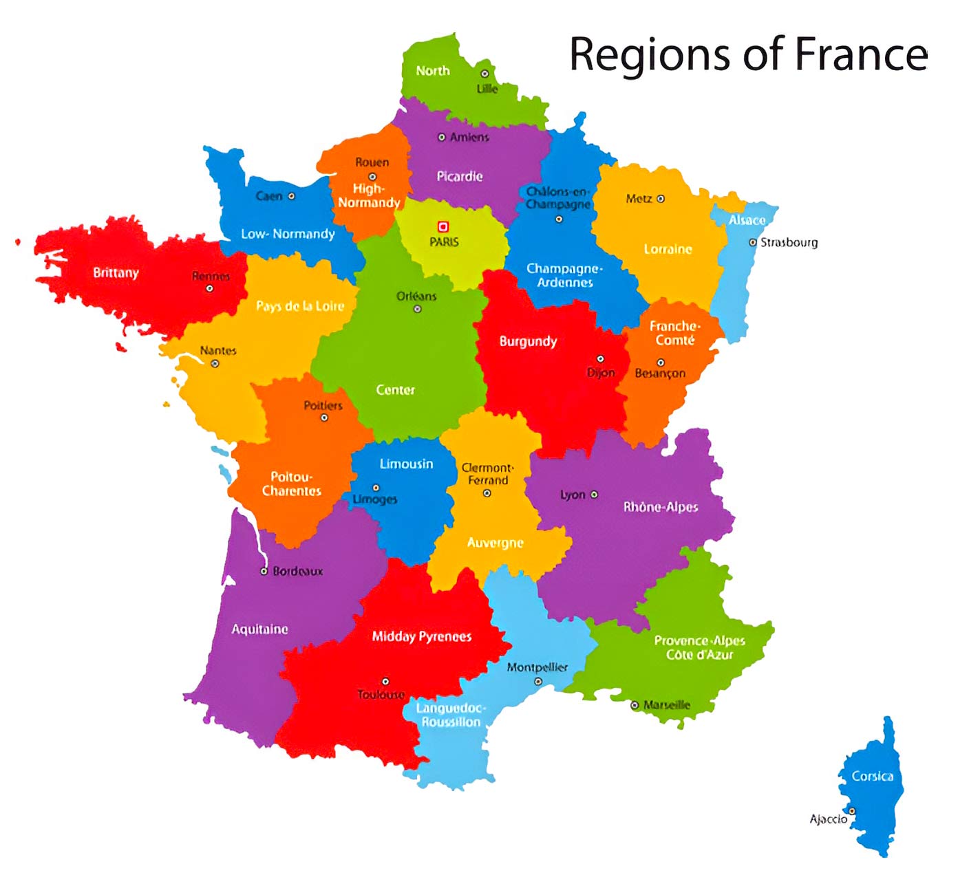
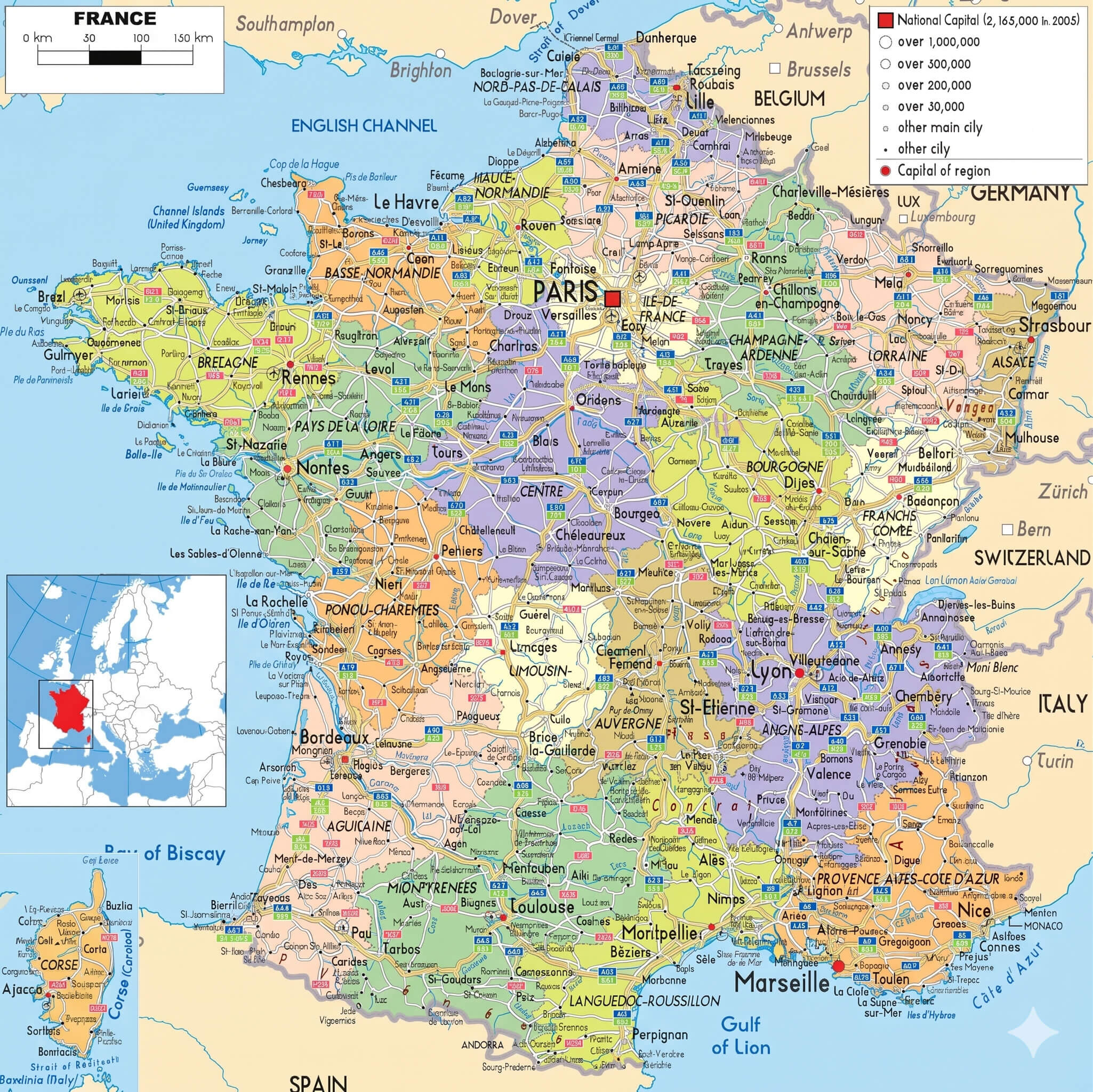
France highways map with cantons
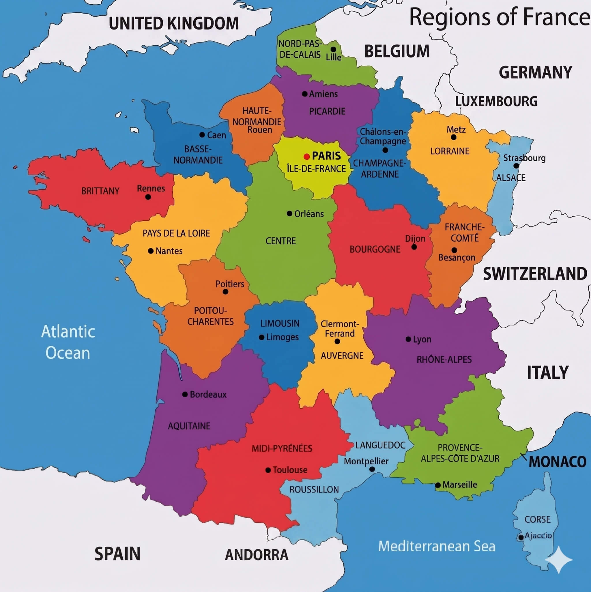
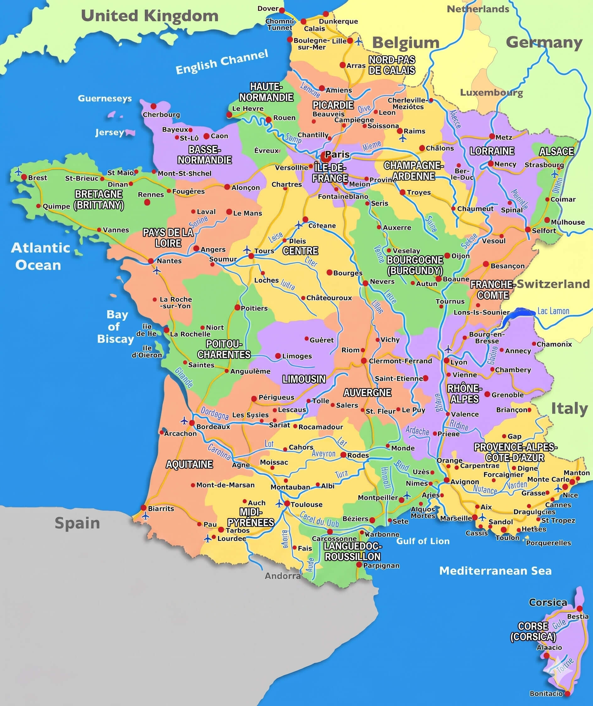
Colorful France map with regions
France satellite map
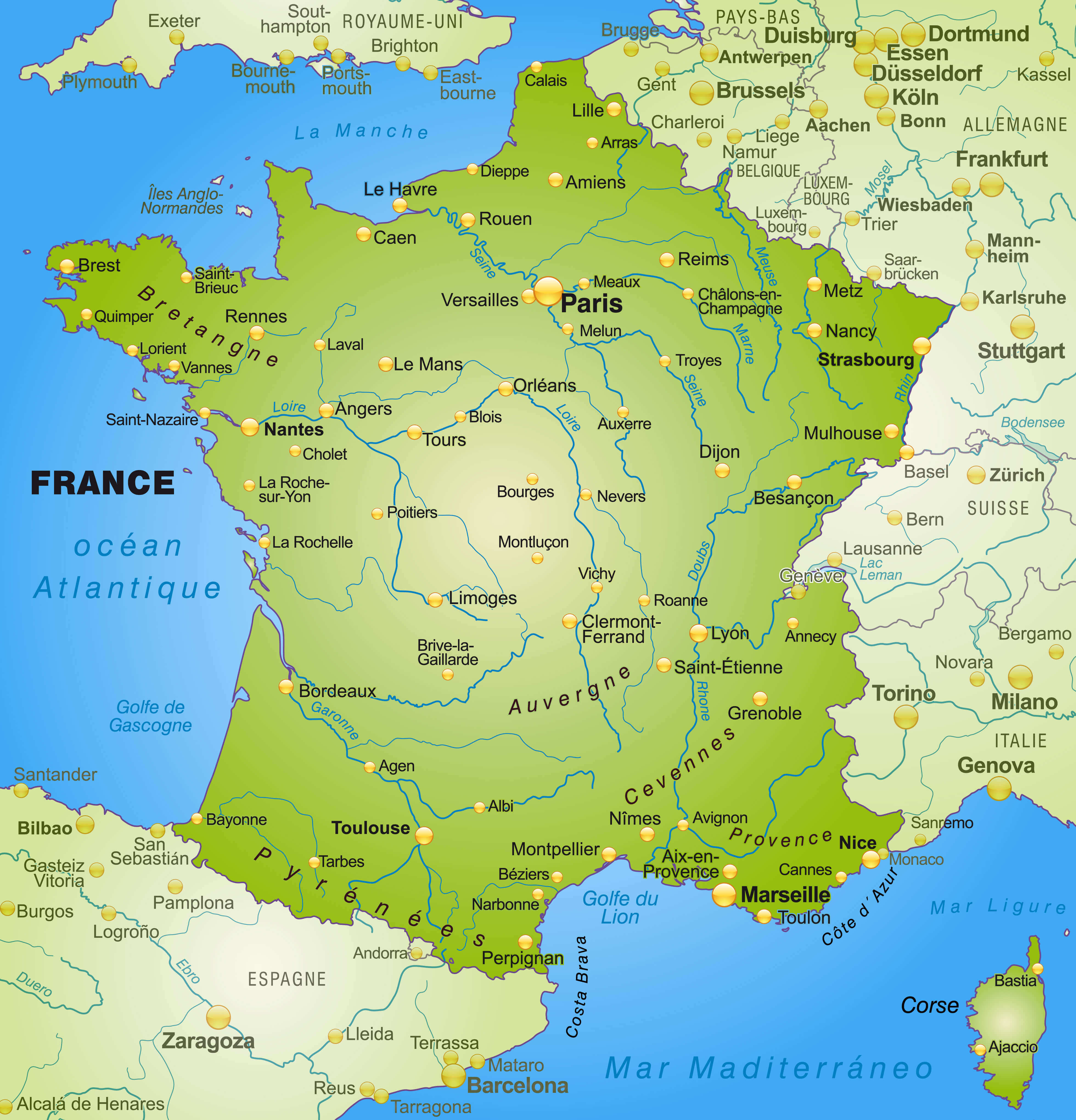
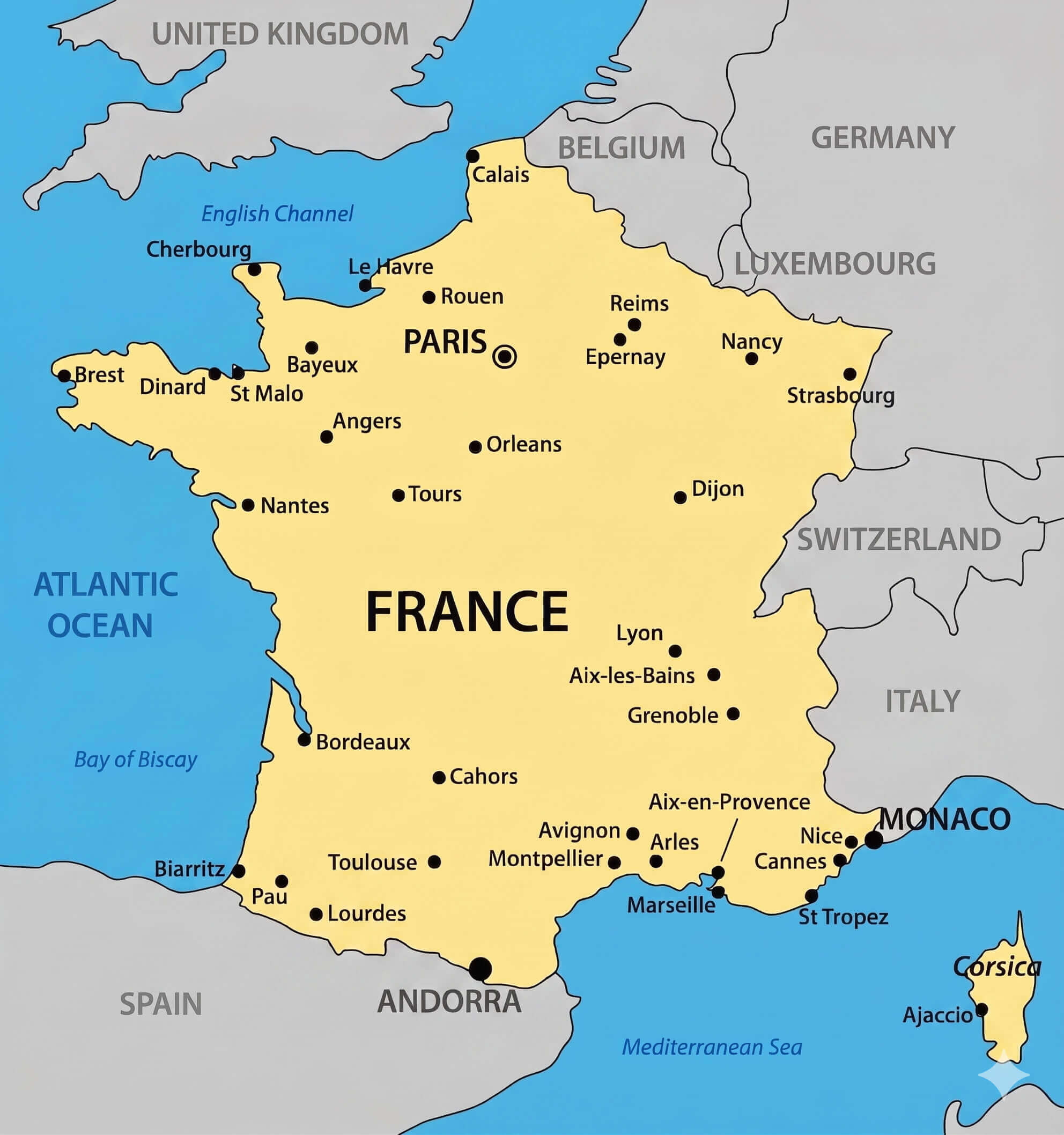
France major cities map with rivers
Users can also explore a wide range of France administrative maps with regions and roads, along with political maps in French featuring international borders, tourism-focused political maps, and detailed travel and tourism maps of France. The collection also includes vintage maps of France, offering historical perspective alongside modern cartography. Covering regions, overseas territories, Francophone connections, and major urban networks, this curated archive delivers a comprehensive, high-resolution overview of France—ideal for education, research, publishing, and travel Mapning.
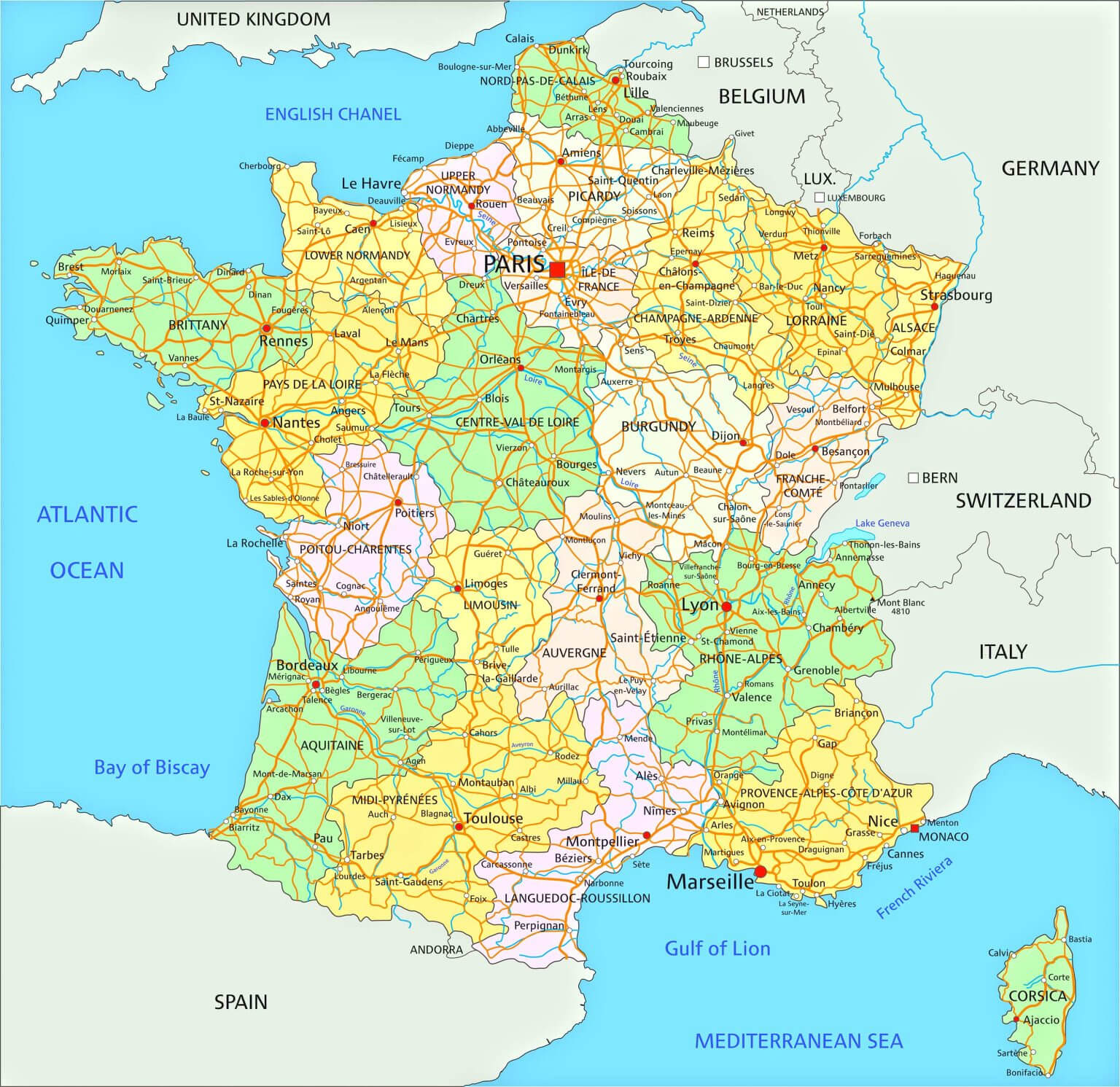
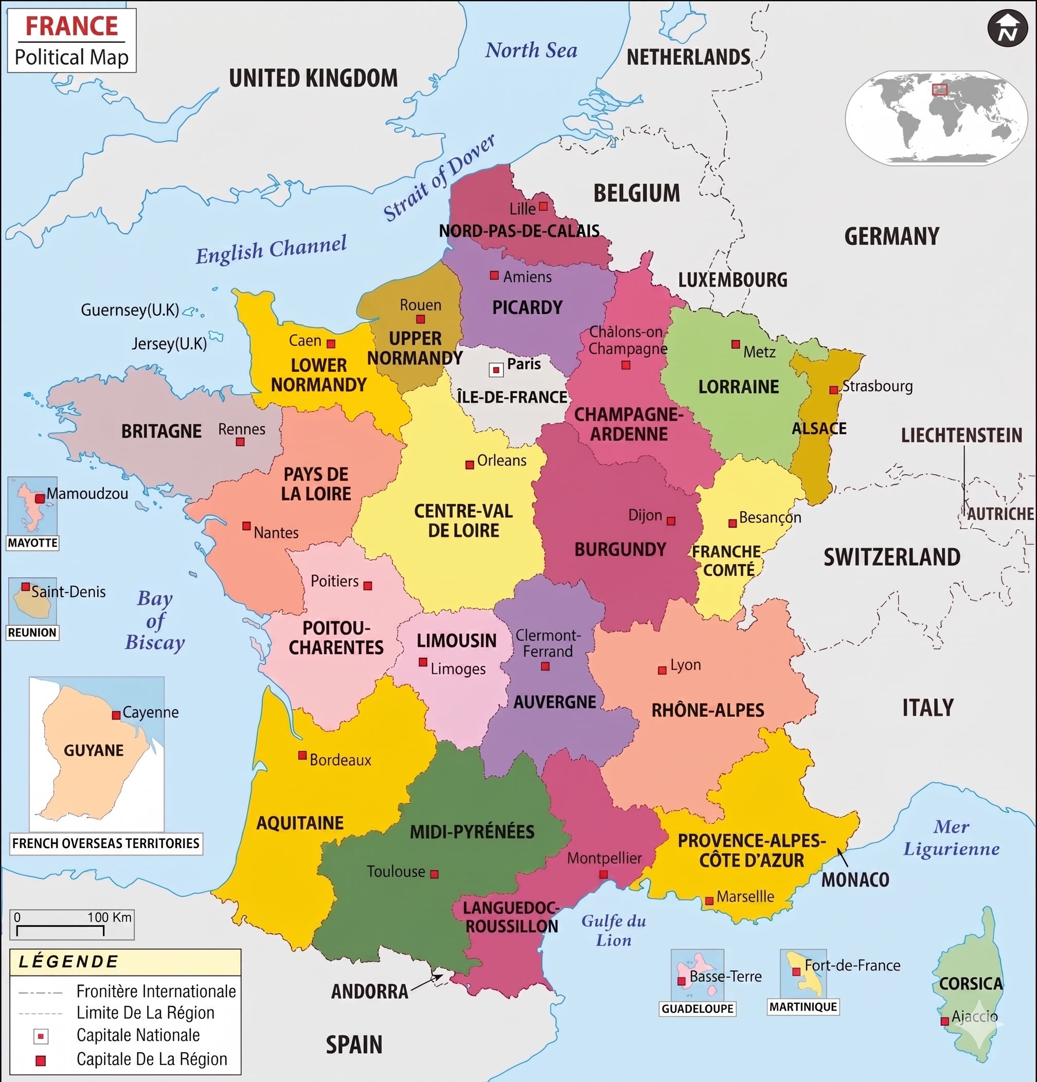
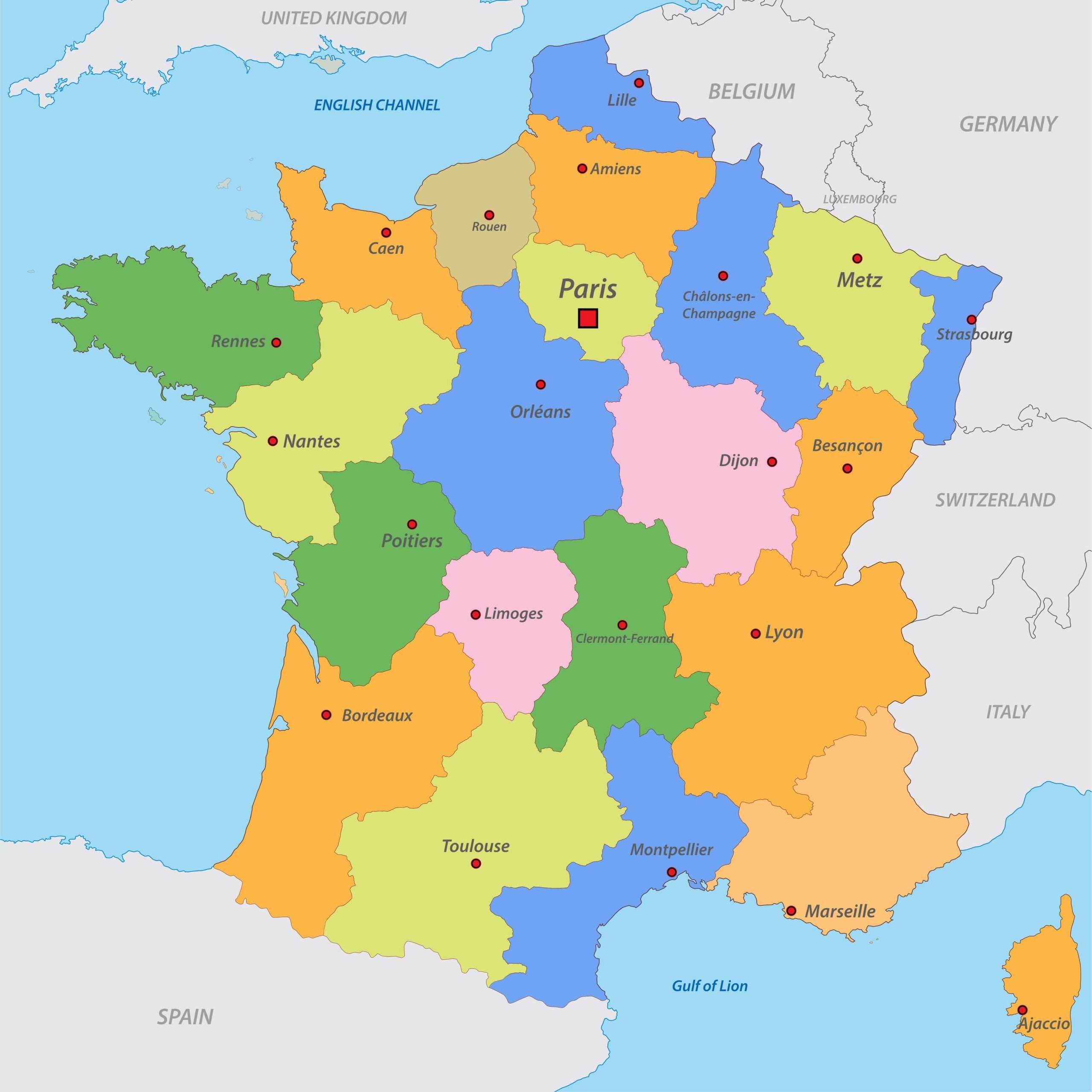
France administrative map with regions and roads
France administrative map
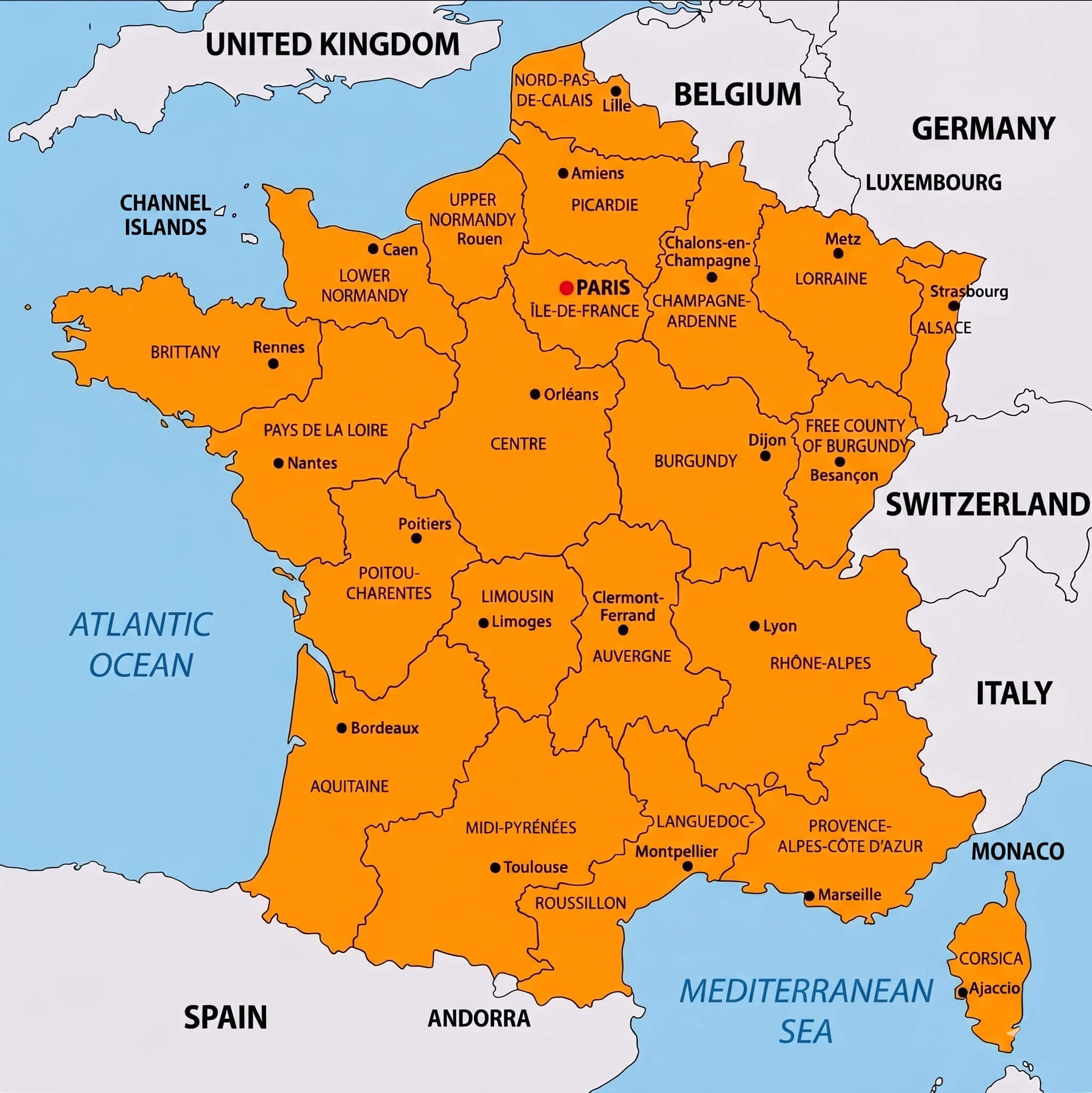
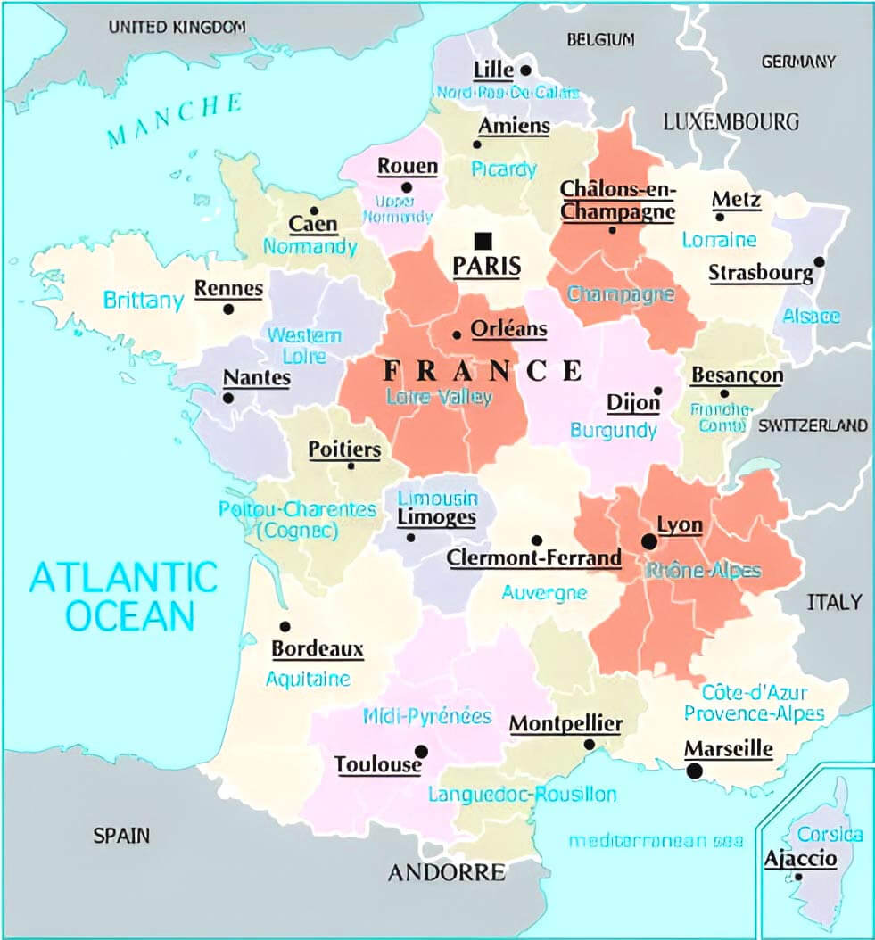
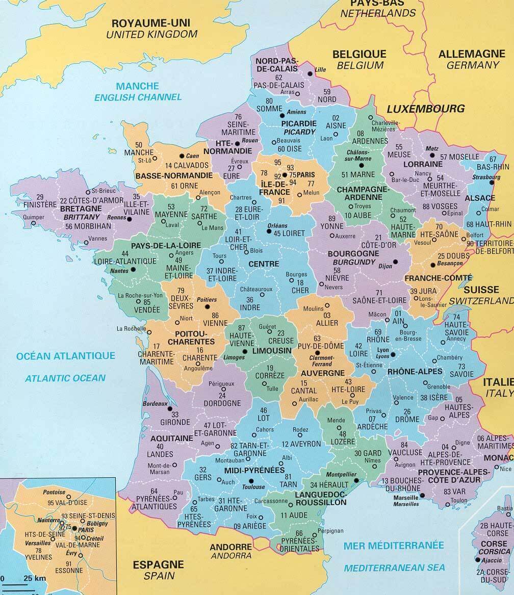
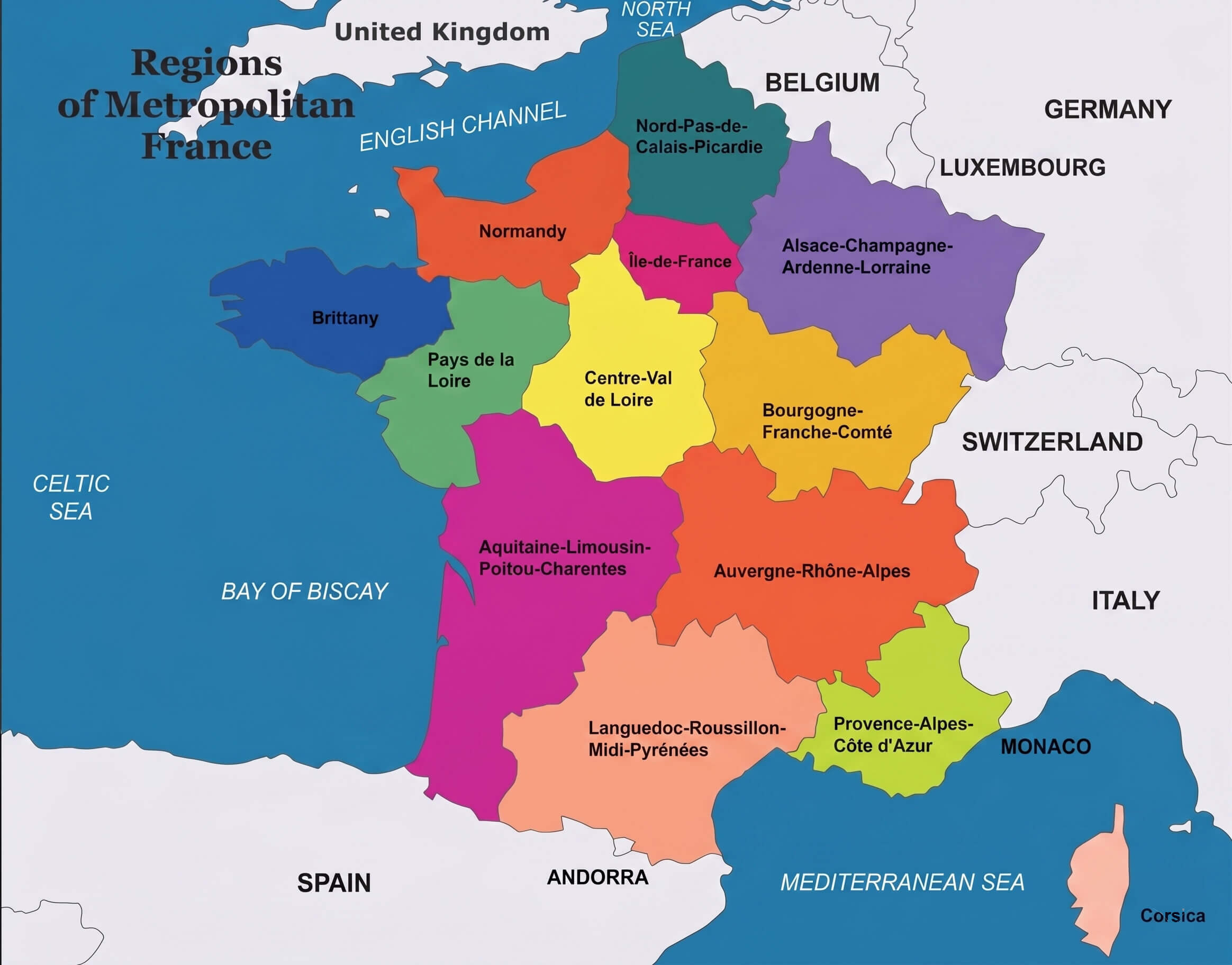
France regions map
France cantons map with major cities
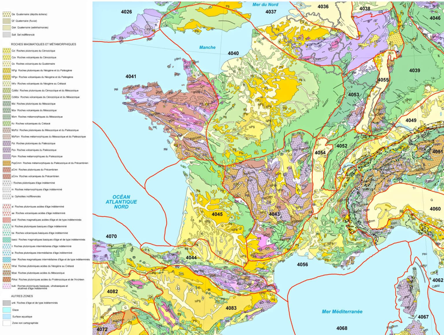
France geologic map
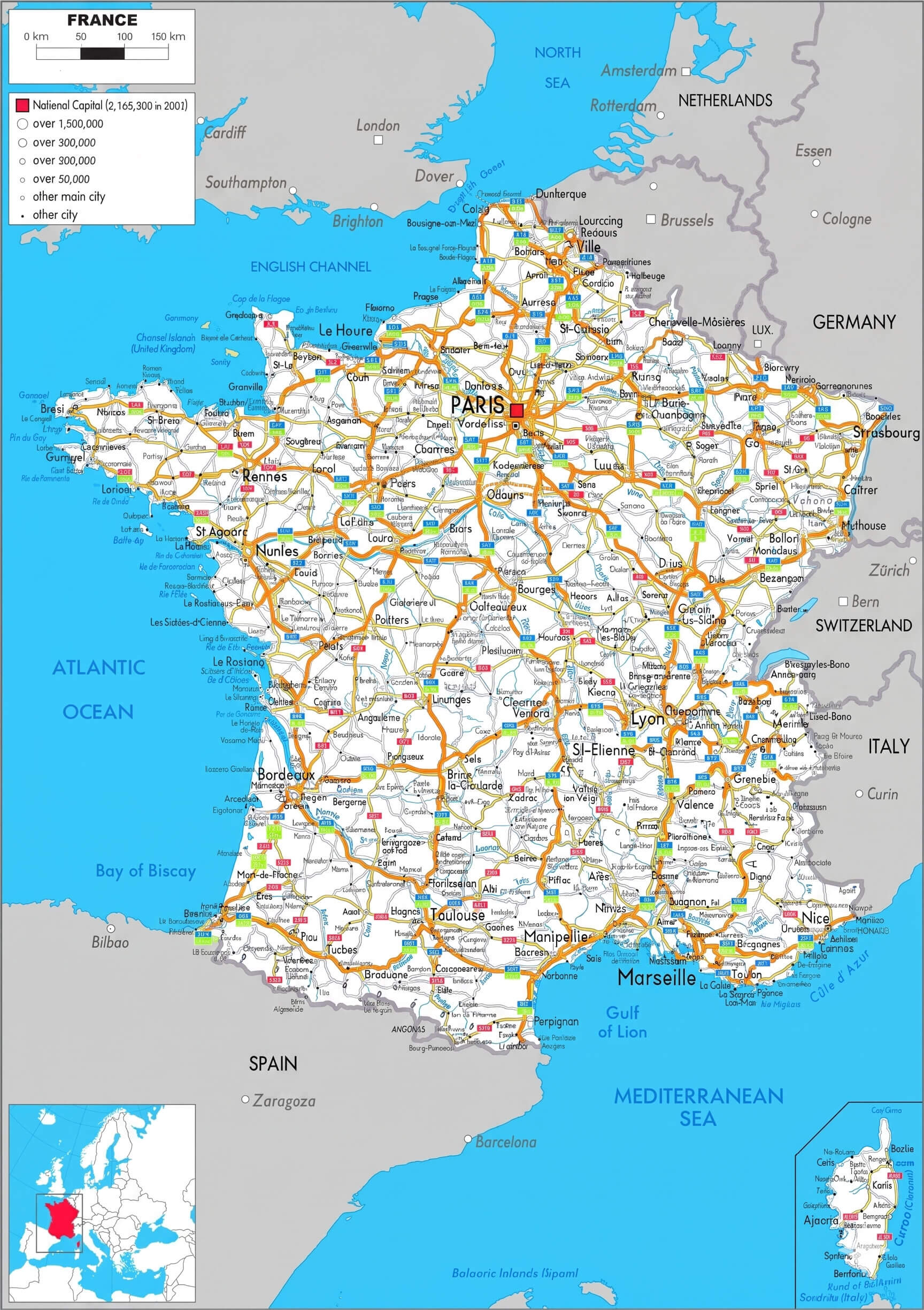
France highways map with cities
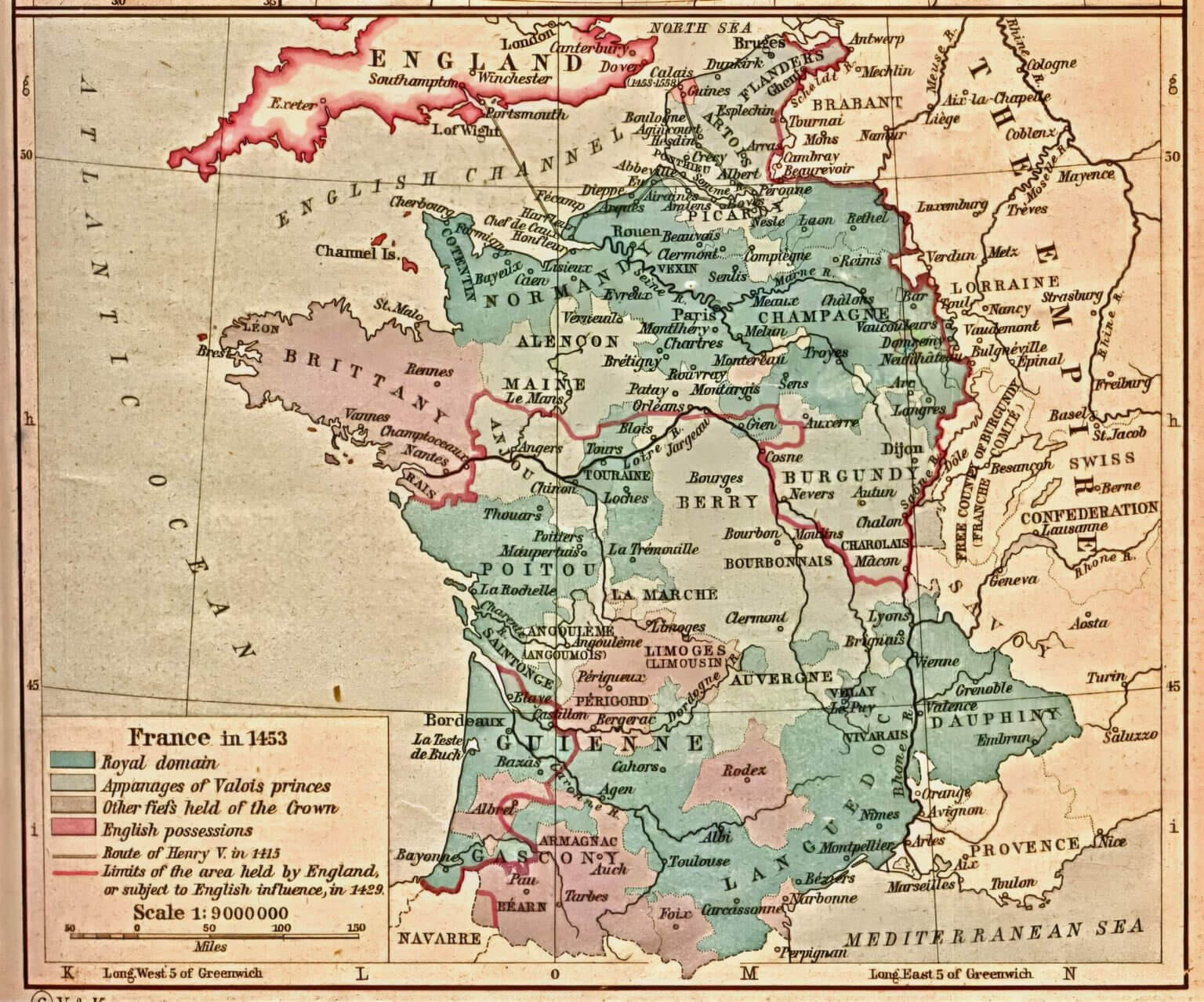
France historical map
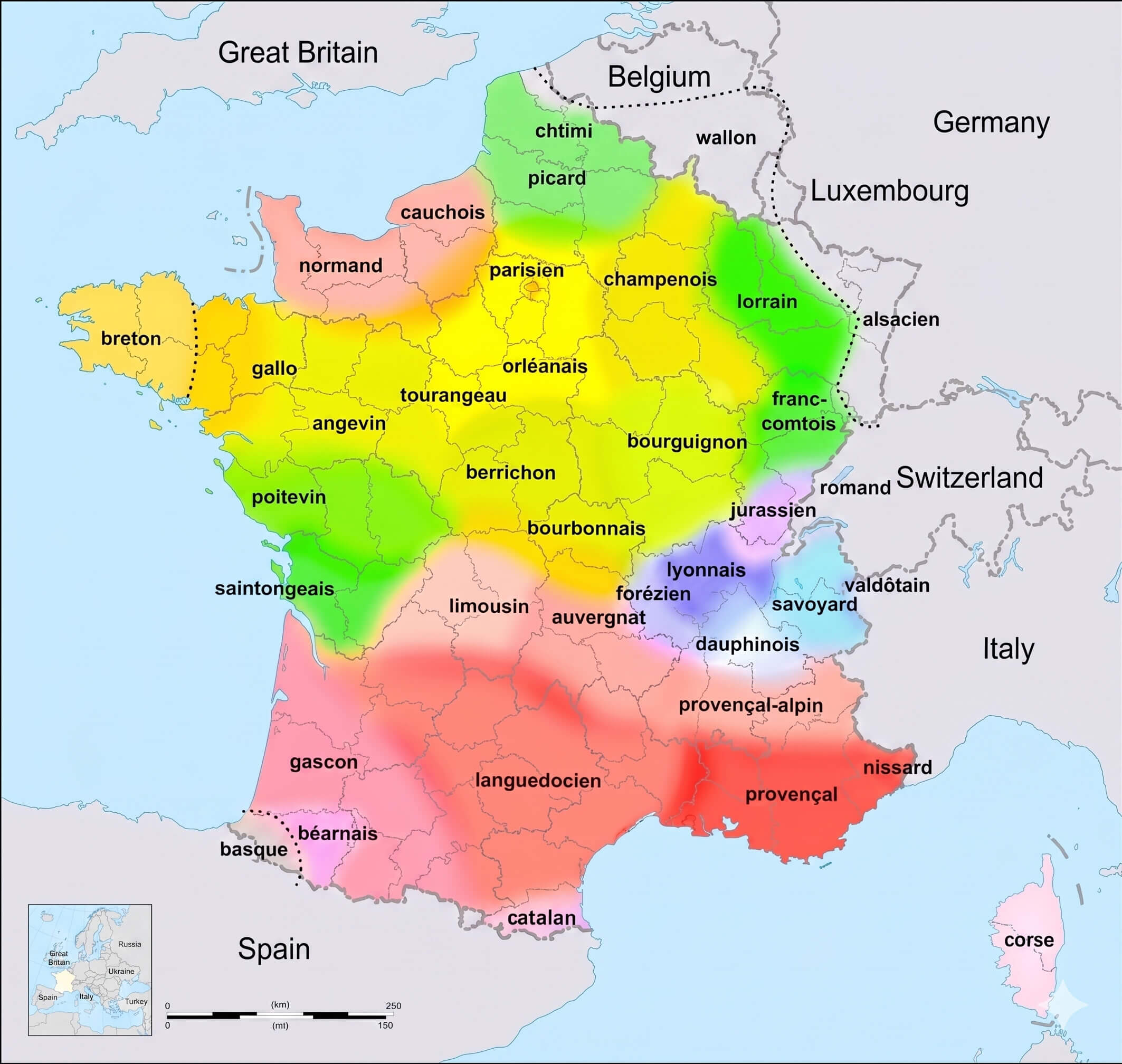
France linguistic map
France major cities map
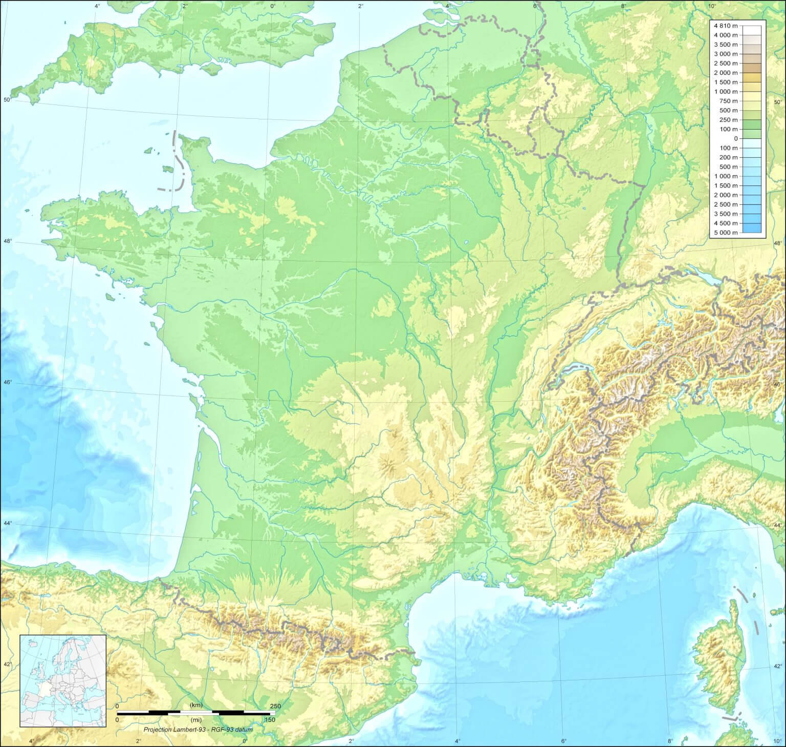
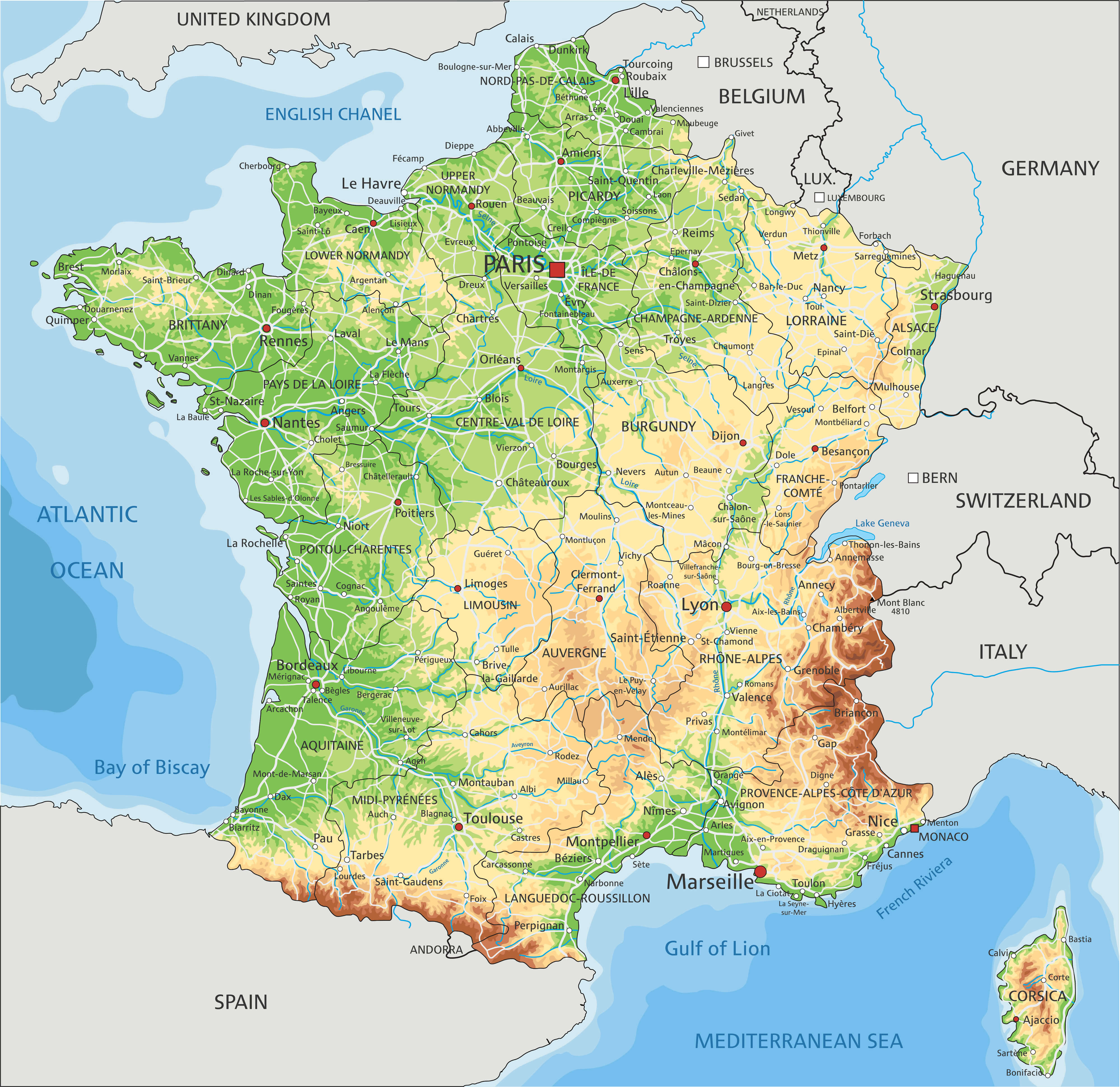
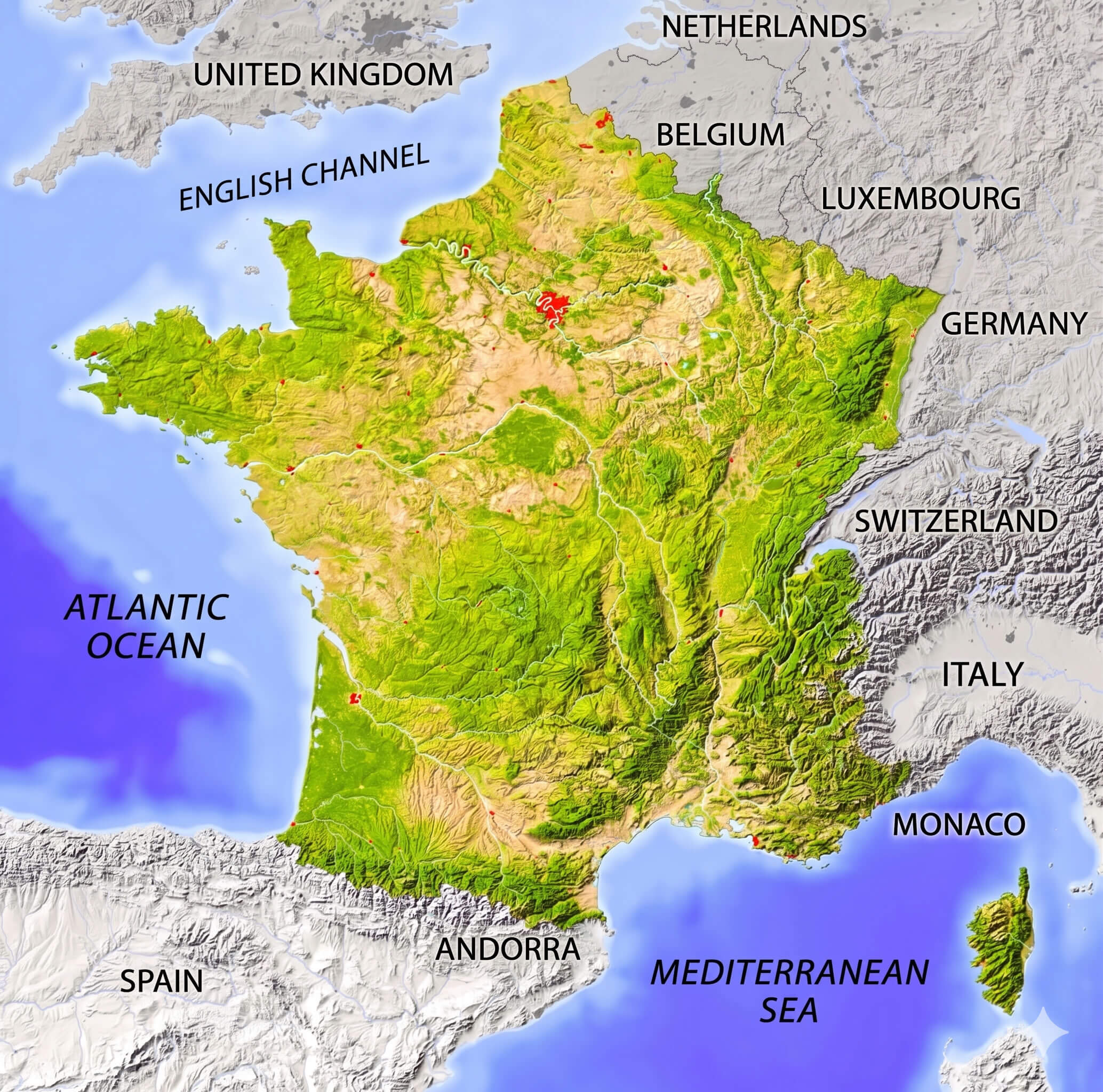
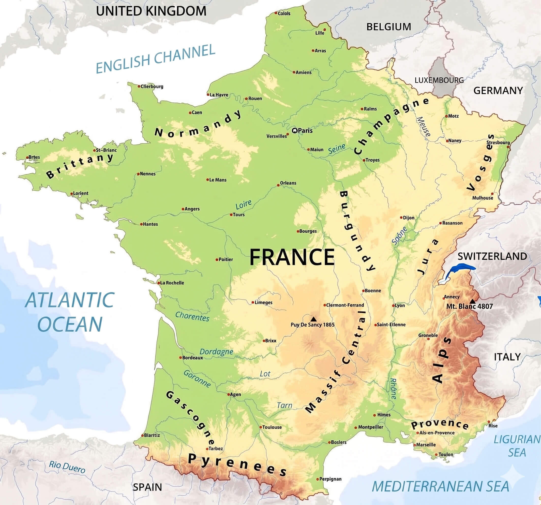
France physical map
France political map
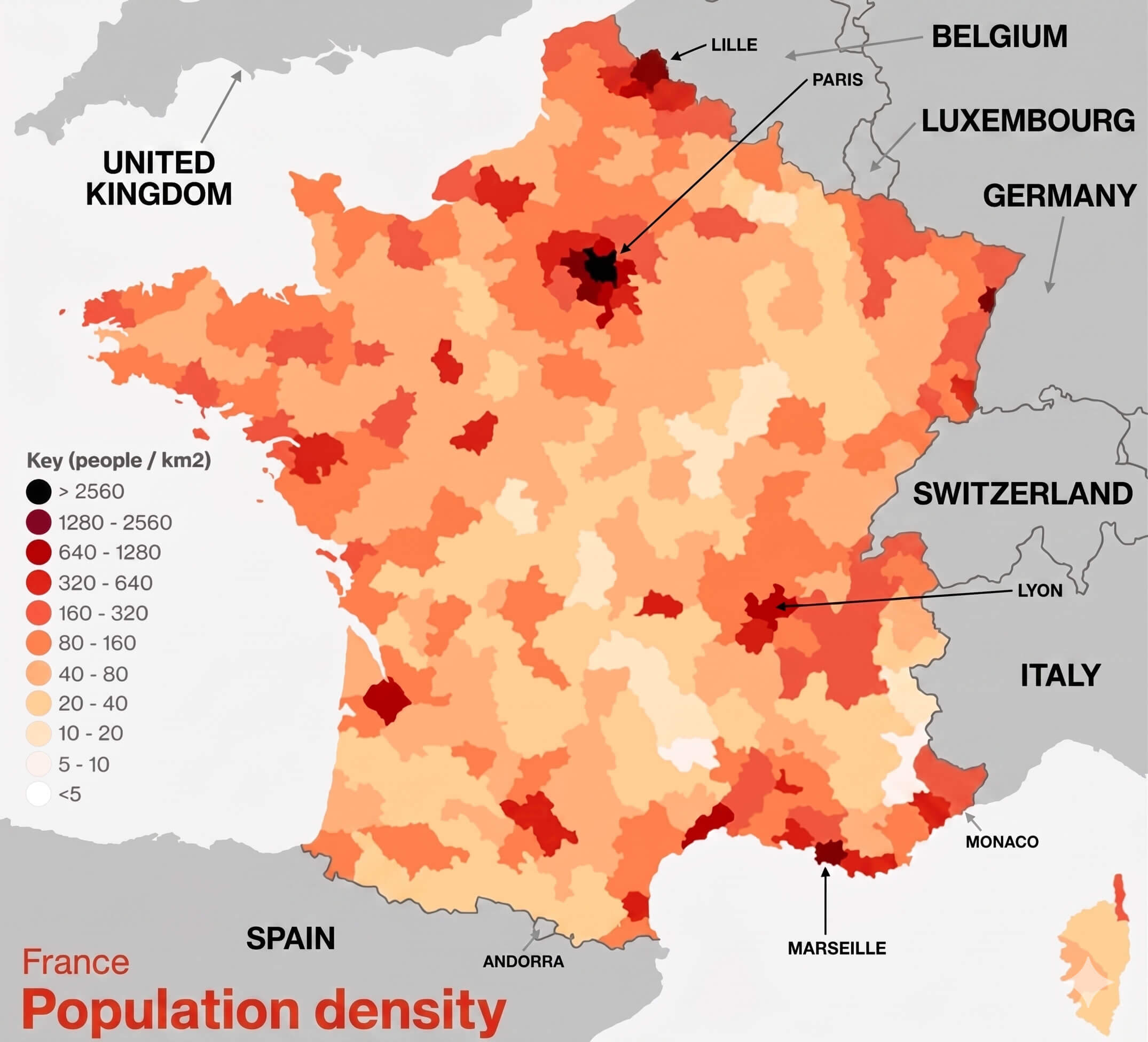
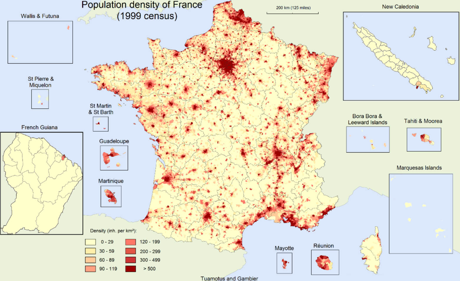
France population density map
France provinces map
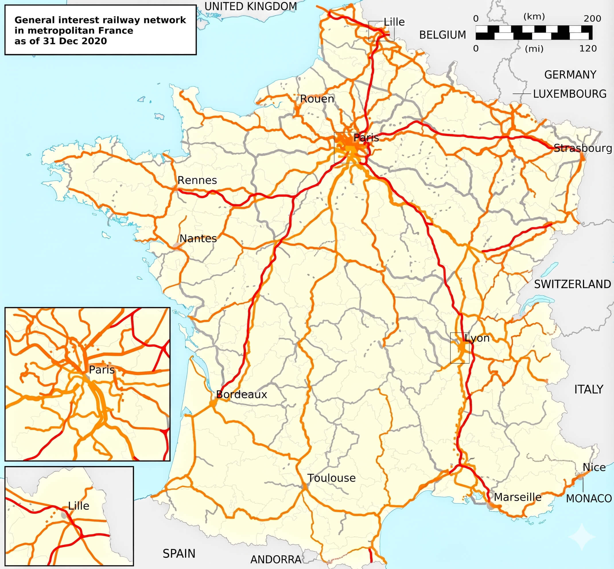
France railway network map
France relief map
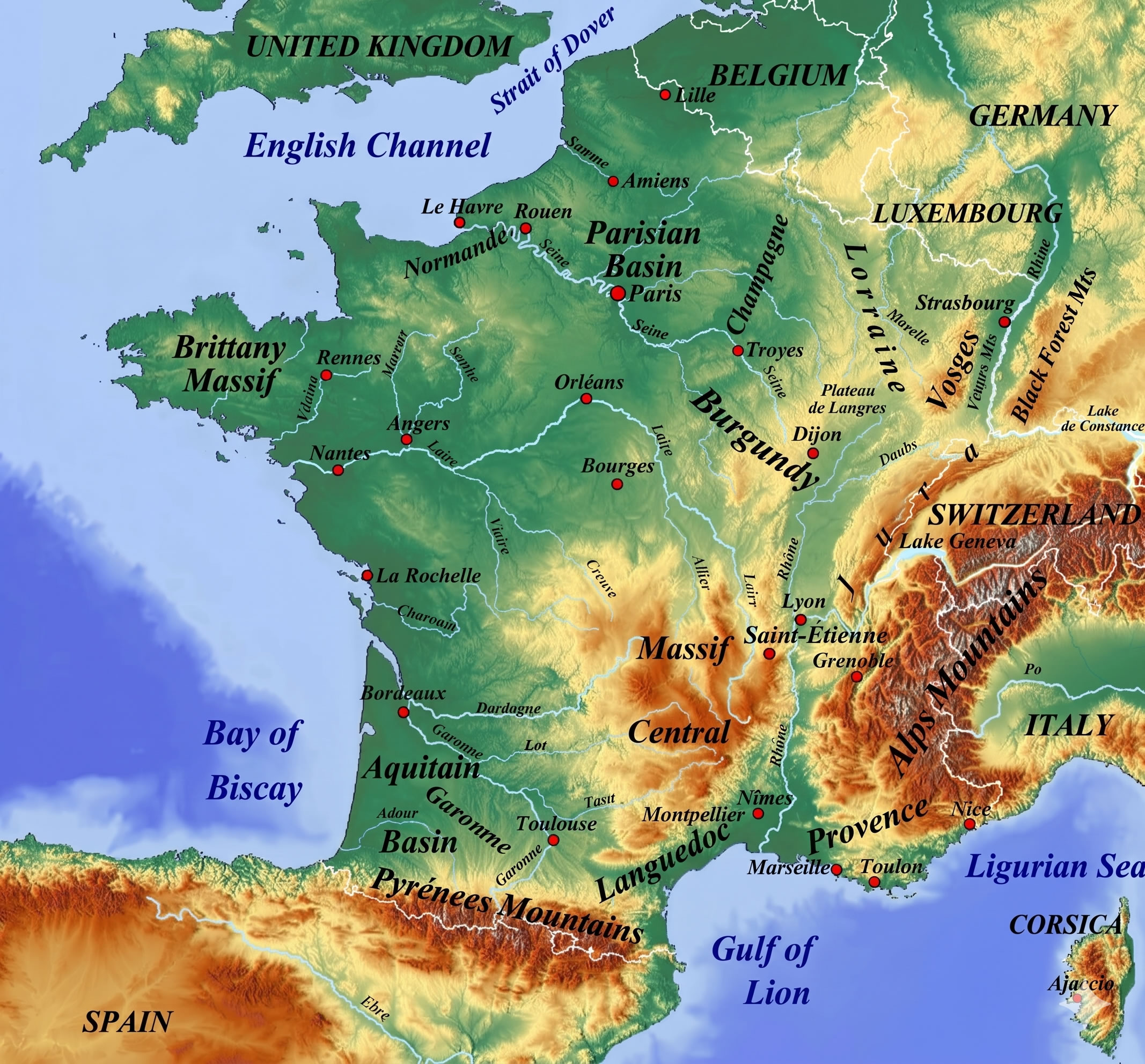
France topographic map mountains rivers
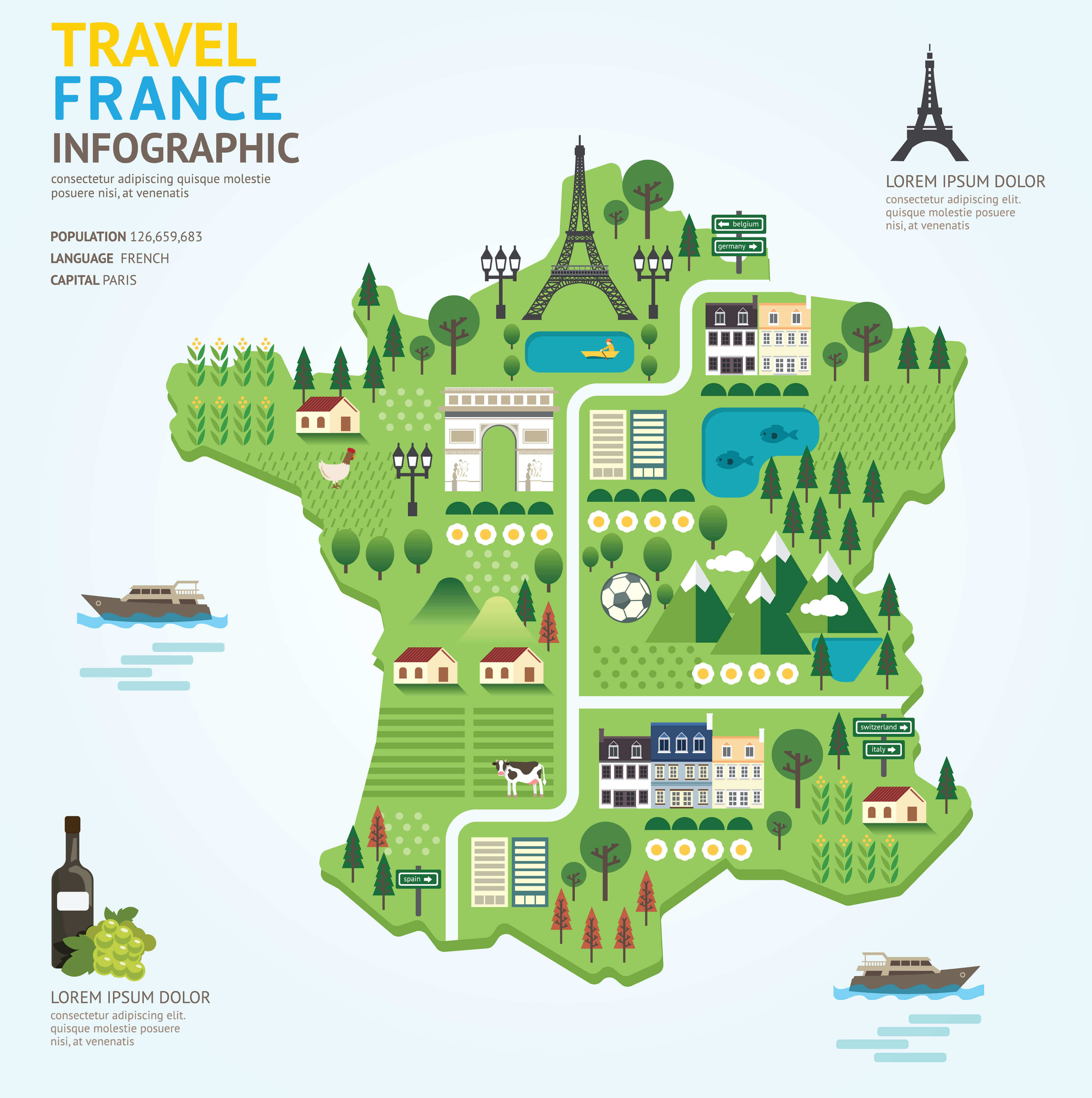
France tourism map
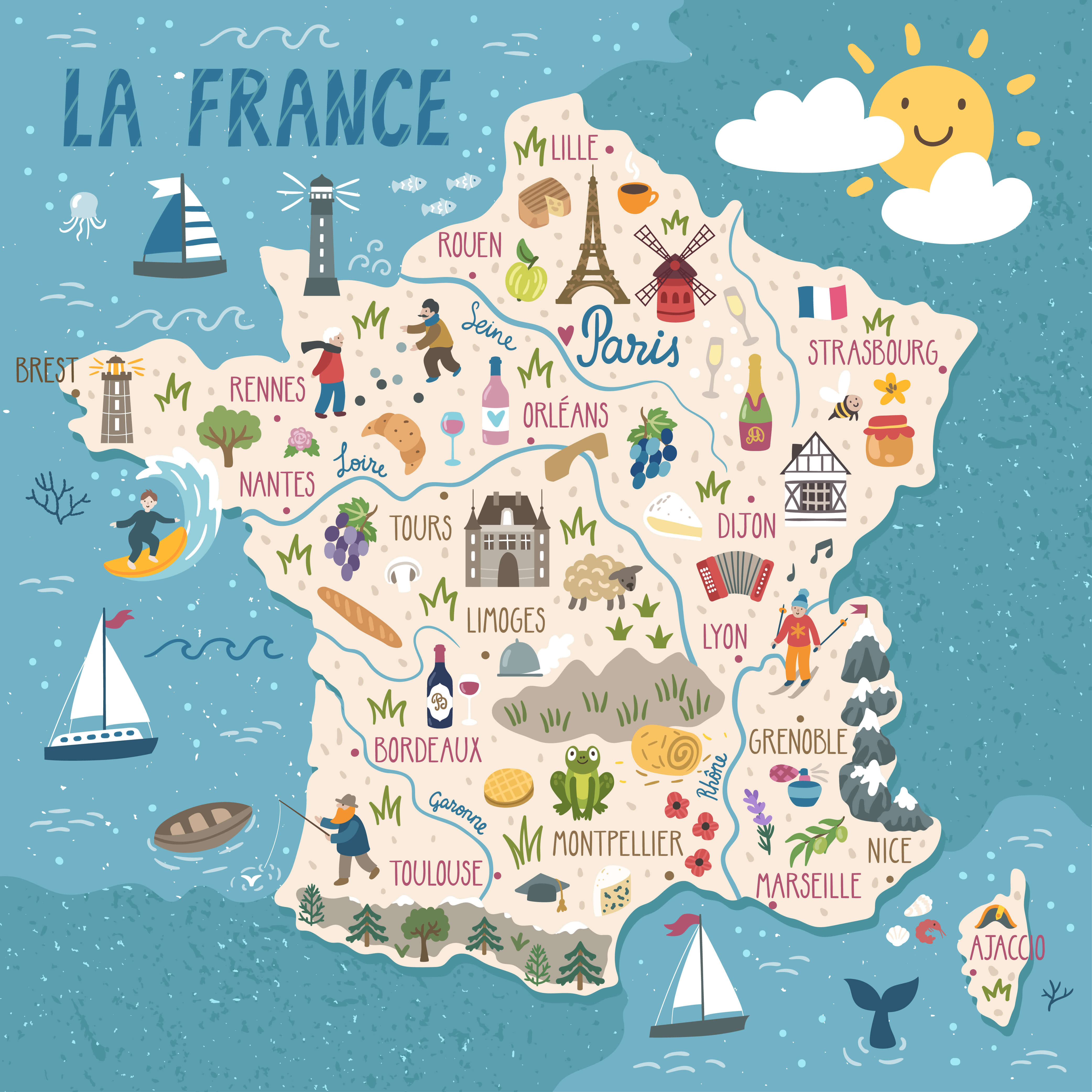
France travel map
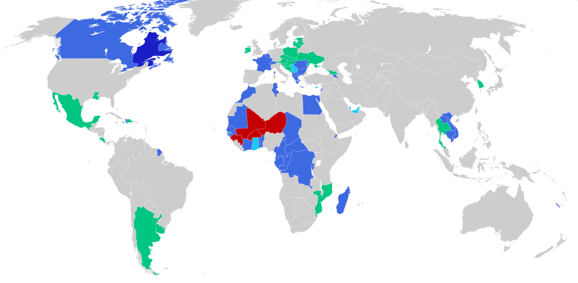
Francophone countries map in the World
Map of France with regions labeled
Map of France with rivers
Physical map of France rivers and mountains
Population density map of France
Regions of France Map
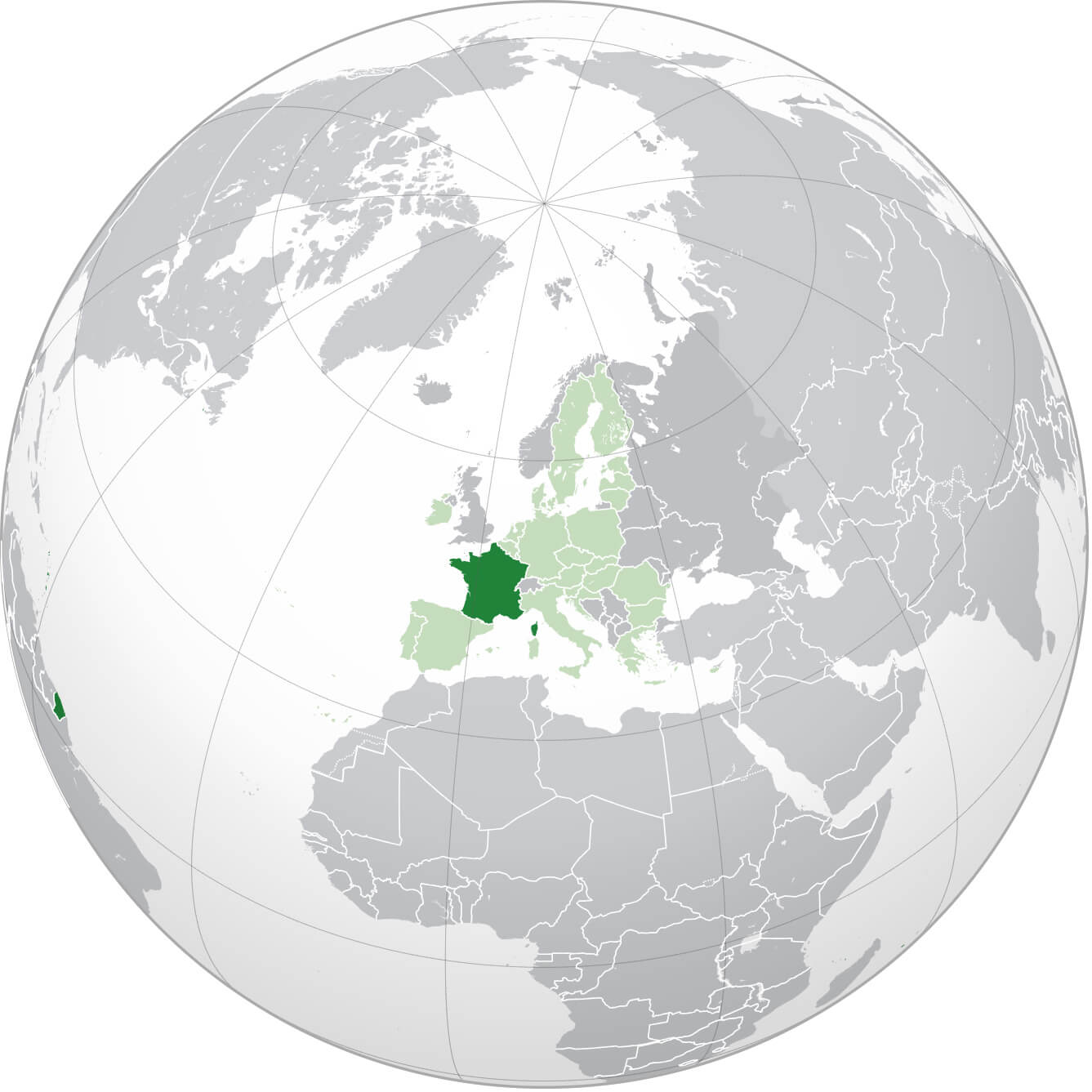
Where is France on the World map
Feel free to explore these pages as well:
Paris Map Lyon Map Marseille Map Lille Map Strasbourg Map Bordeaux Map Nice Map Saint Etienne Map Toulouse Map Montpellier Map Grenoble Map Toulon Map Rouen Map Mulhouse Map Le Havre Map Metz Map Chambery Map Annecy Map Colmar Map Besancon Map Le Mans Map Caen Map Valence Map Avignon Map Nantes Map Angers Map Nancy Map Nimes Map Rennes Map Annemasse Map Cannes Map Brest Map Dijon Map Clermont Ferrand Map Aix en Provence Map- Head of Performance Marketing
- Head of SEO
- Linkedin Profile: linkedin.com/in/arifcagrici