Cote d'Ivoire Map: Political, Physical, Regions, and Cities Maps
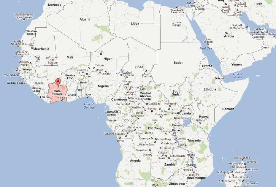
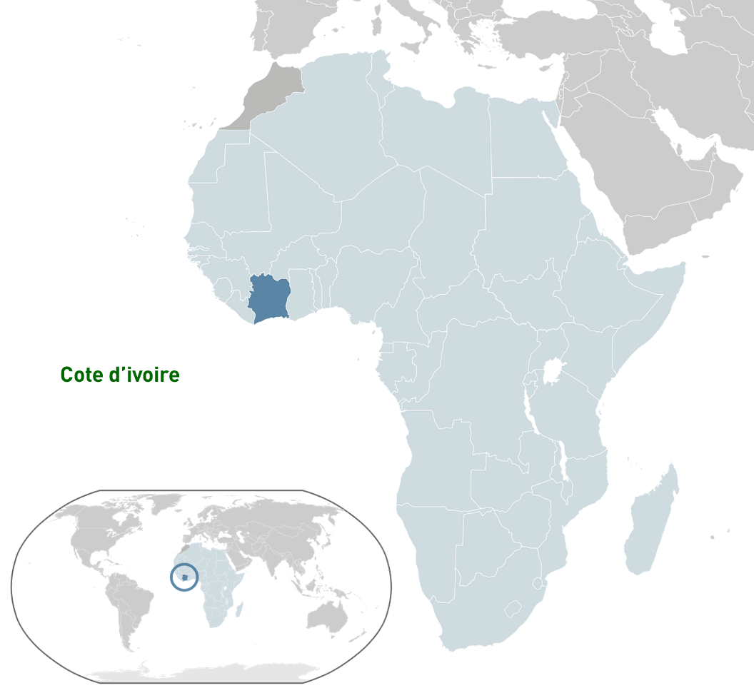
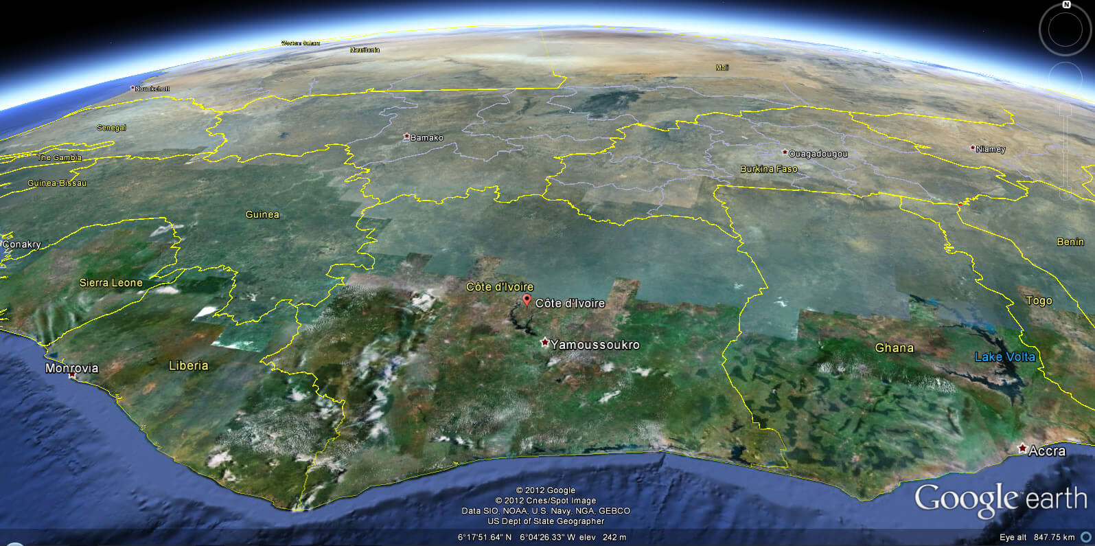
Where is Côte d'Ivoire located on the world and Côte d'Ivoire map? Côte d'Ivoire (Ivory Coast) lies in West Africa along the Gulf of Guinea with a southern Atlantic coastline. Bordered by Liberia and Guinea to the west, Mali and Burkina Faso to the north, and Ghana to the east, its location links coastal economies with inland Sahelian regions—useful context on any map.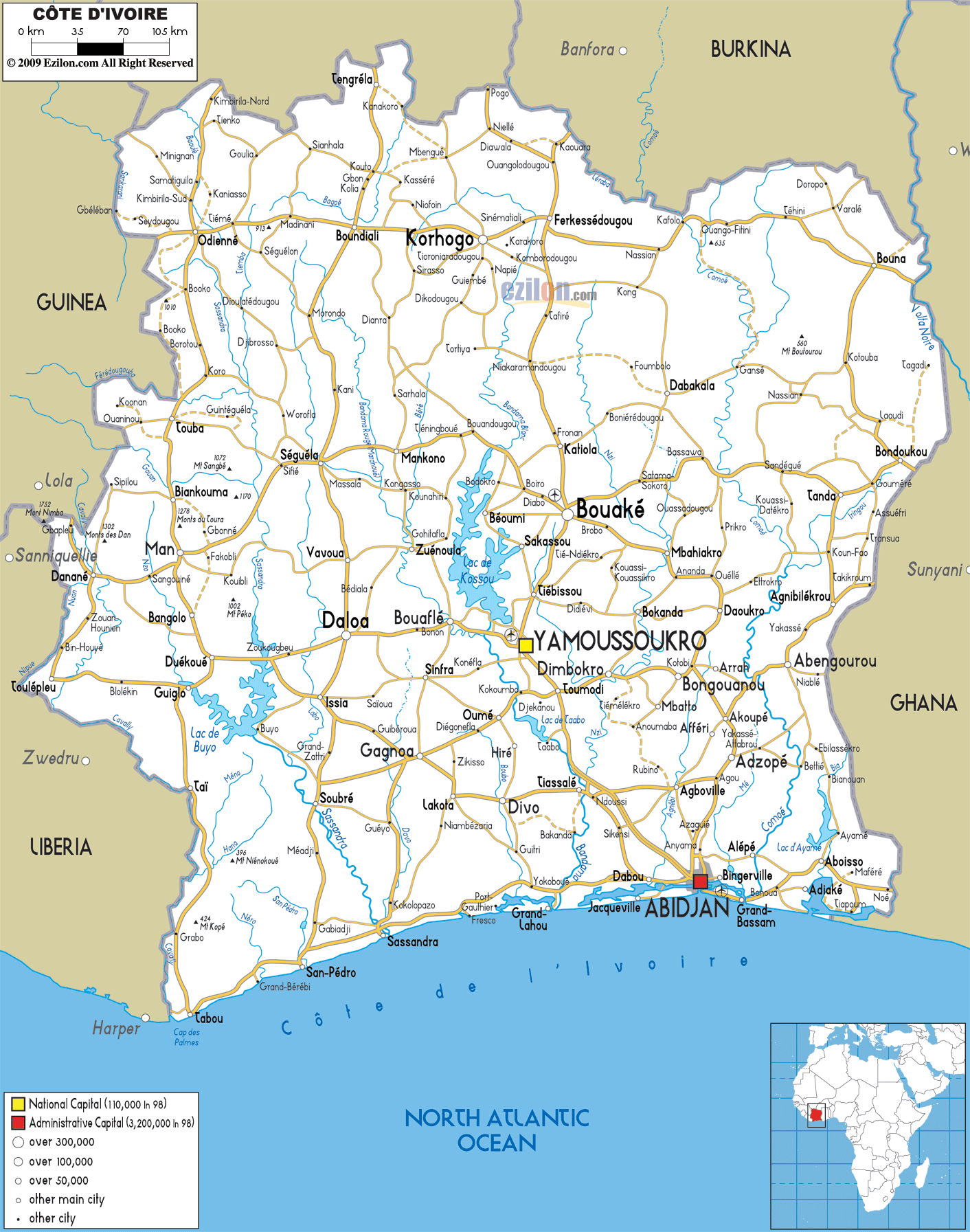
Cote d'Ivoire location map
Brief information about Cote d'Ivoire
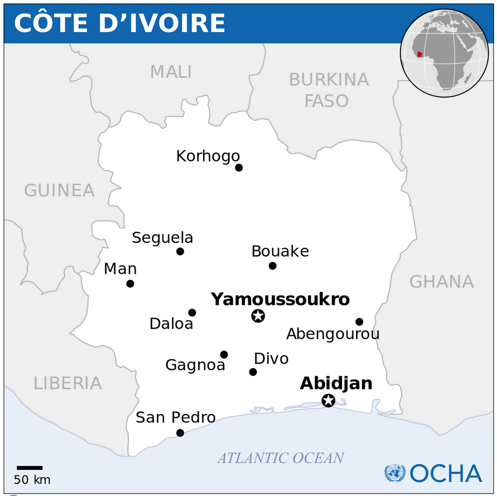
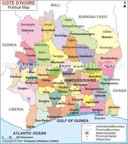
Côte d'Ivoire, also known as Ivory Coast, is a country in West Africa, bordered by Liberia and Guinea to the west, Mali and Burkina Faso to the north, Ghana to the east and the Gulf of Guinea to the south. Its largest city, Abidjan, is a major economic centre, while the capital, Yamoussoukro, serves as the political centre.
Known for its vibrant culture and history, Côte d'Ivoire is a leading producer of cocoa, making it one of the world's largest exporters. The country boasts diverse landscapes, including tropical rainforests, savannahs and stunning beaches along its coastline. It is rich in cultural heritage, with traditional festivals, music and art reflecting its diverse ethnic groups.
Ivory Coast Road Map — Major Highways, Cities and Coastal Routes
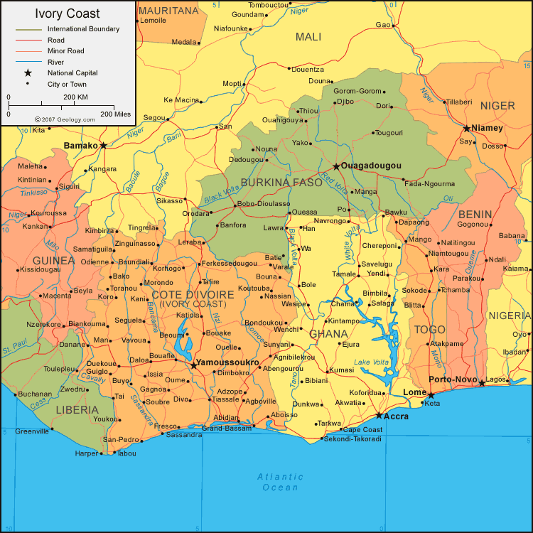
Ivory Coast road map showing major cities, highways and coastal routes.This road map of Côte d’Ivoire highlights primary and secondary roads, major cities (Abidjan, Yamoussoukro, Bouaké), ports and border crossings. Coastal Gulf of Guinea routes, inland connectors to northern regions, and key transport corridors are shown for navigation, logistics and travel planning.
Map of Ivory Coast africa
Where is located Cote d'Ivoire on the World and Côte d'Ivoire Map?
 Where is located Cote d'Ivoire on the World Map
Côte d'Ivoire, or Ivory Coast, is located in West Africa on the Gulf of Guinea. It borders Liberia and Guinea to the west, Mali and Burkina Faso to the north, and Ghana to the east. Its southern border is a coastline along the Atlantic Ocean.
Cote d'Ivoire political map
Situated just above the equator, Côte d'Ivoire enjoys a tropical climate, with lush rainforests in the south and savannahs in the north. Its strategic location on the Gulf of Guinea makes it a major hub for trade and commerce in West Africa.
On the world map, Côte d'Ivoire is located in the western part of Africa, and its ports connect the region to global markets. This location, combined with its rich cultural and natural resources, underlines its importance as a key country in the region.
Here are some statistical information about Cote d'Ivoire:
 Area: 322,462 km2 (124,503 sq mi)
 Map of Cote d'Ivoire
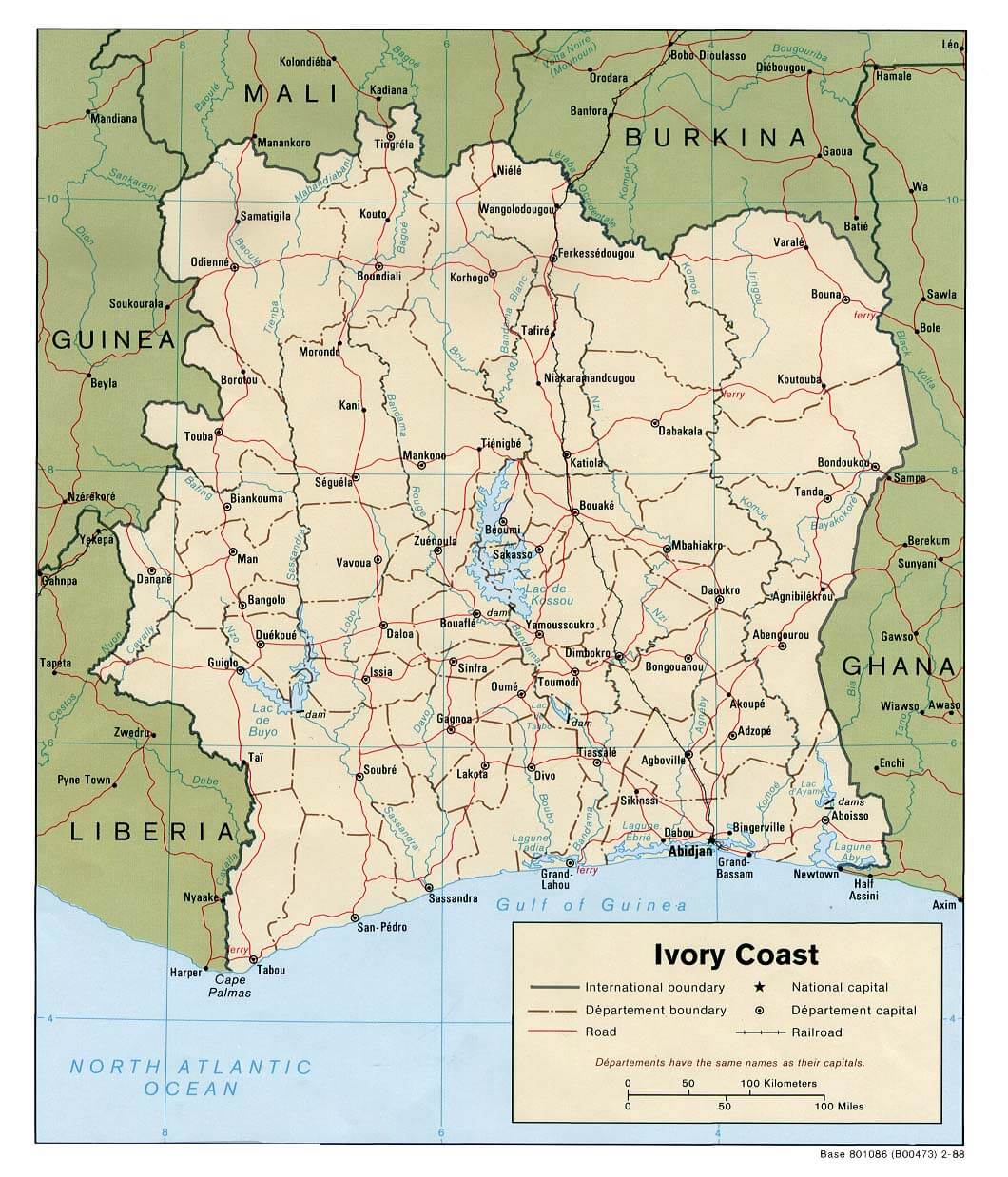
 Côte d’Ivoire map with cities, roads, and neighboring countries.
This map highlights Côte d’Ivoire (Ivory Coast) with its national capital Yamoussoukro and economic hub Abidjan. It shows major roads, rivers, and borders with Liberia, Guinea, Mali, Burkina Faso, and Ghana. Coastal access along the Gulf of Guinea is also displayed.
GDP (nominal): $79.430 billion (2023 estimate)Cote d'Ivoire Earth map
Major cities map of Cote d'Ivoire
Cote d'Ivoire regions map
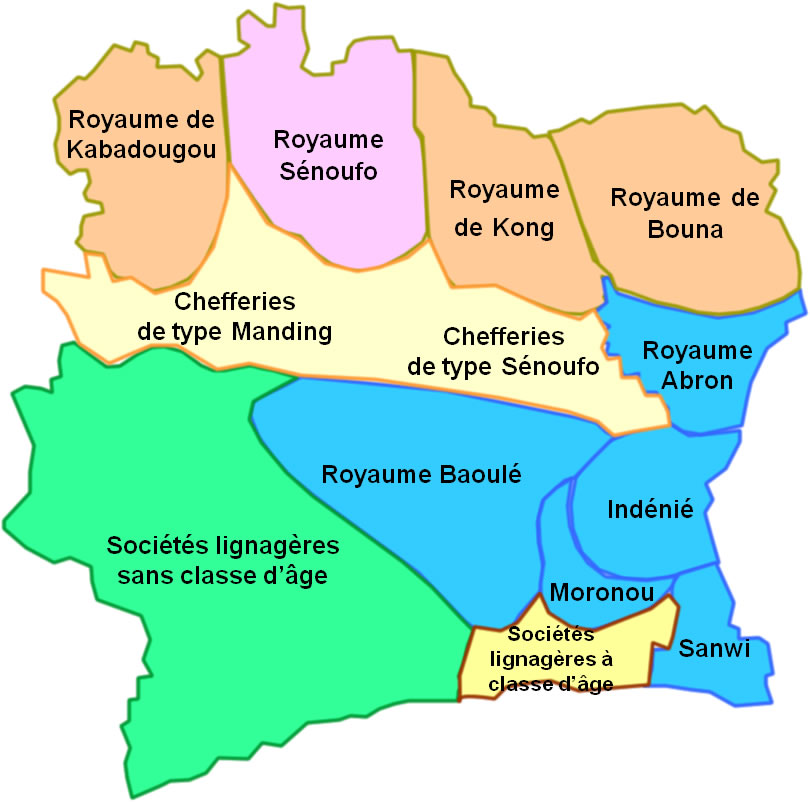
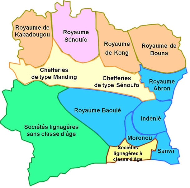 Map of Côte d’Ivoire’s historical kingdoms and cultural regions.
This map highlights the historical and cultural regions of Côte d’Ivoire, including kingdoms like Baoulé, Sénoufo, and Kong, as well as traditional societal structures. It showcases the diverse cultural heritage across the country’s regions.
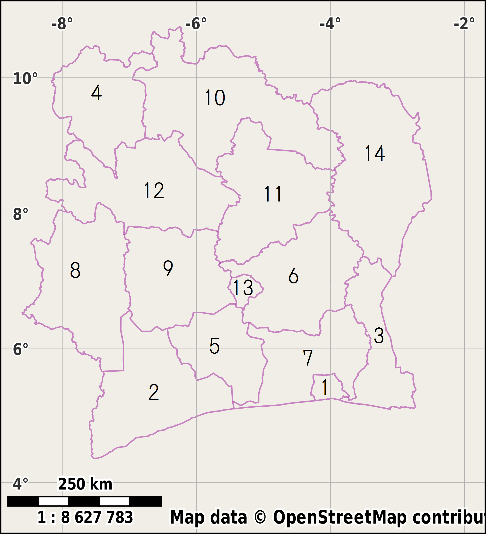
Districts of Côte d'Ivoire
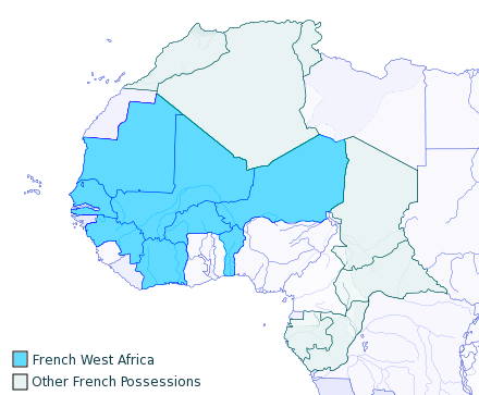
French West Africa 1913 and Ivory Coast map
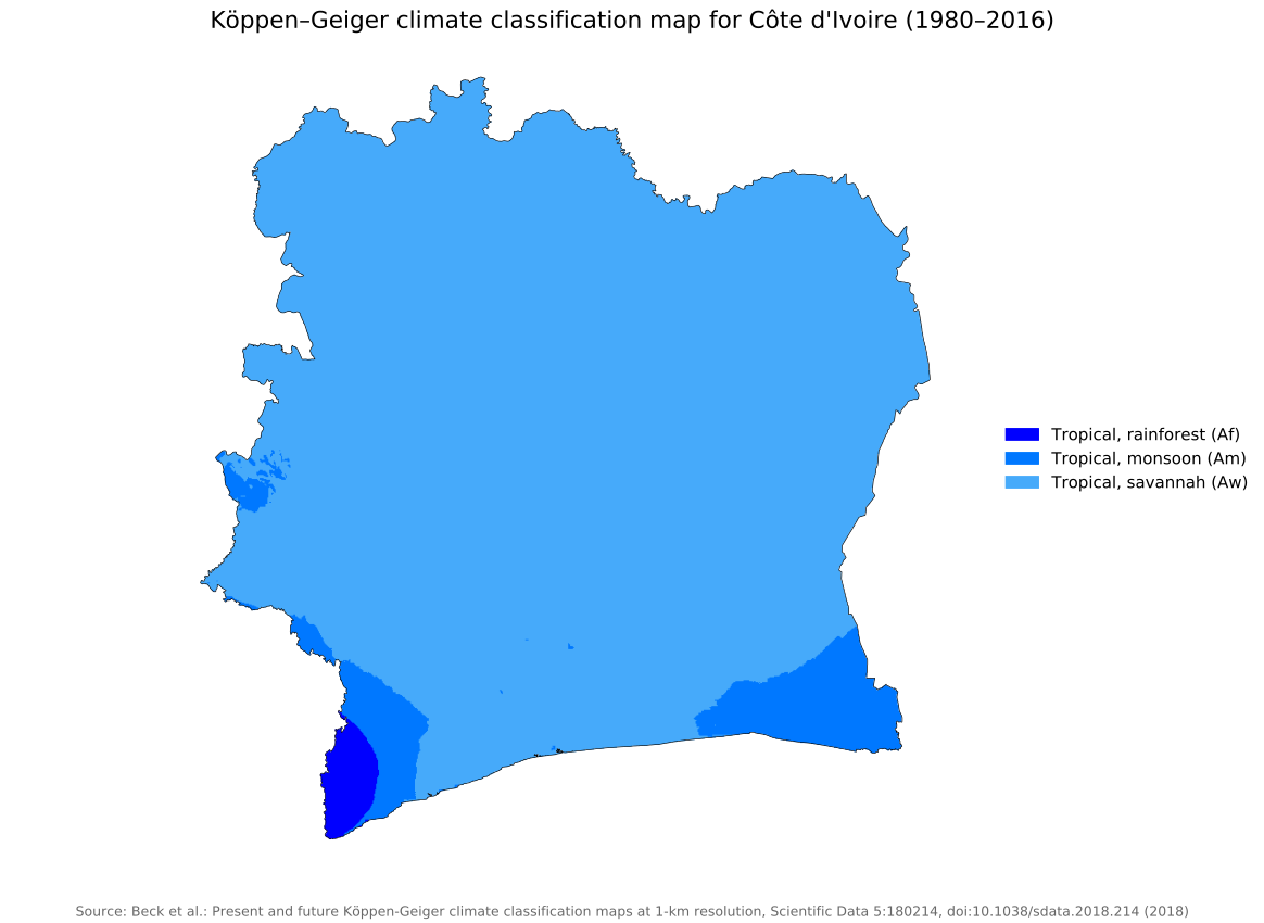
Koppen geiger map Cote d'Ivoire present
Ivory Coast map
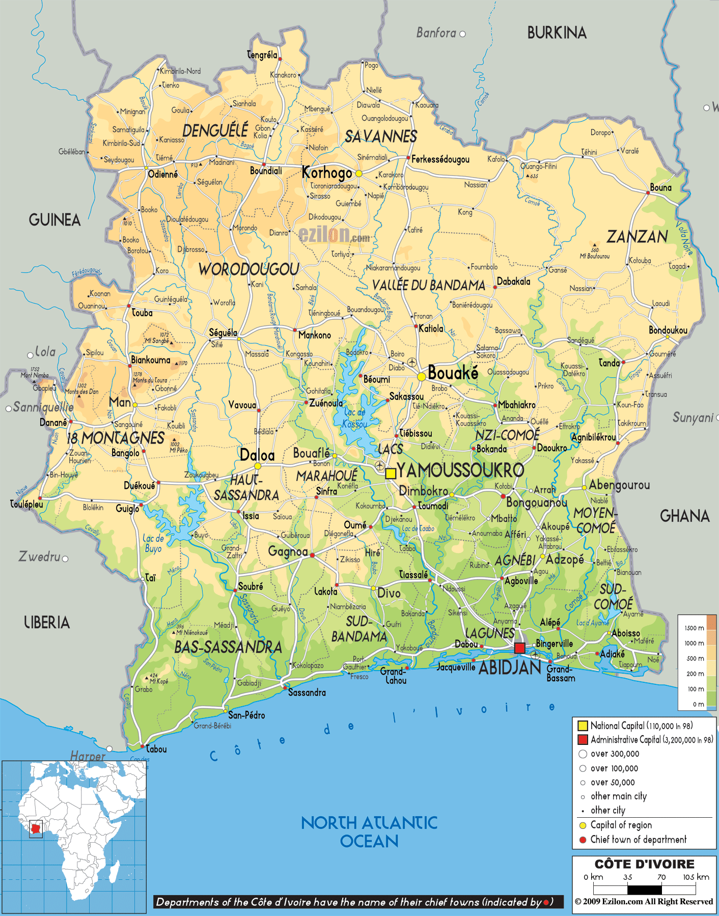
 Côte d’Ivoire map showing departments, cities, and borders.
This map provides a detailed view of Côte d’Ivoire’s departments, highlighting its national capital Yamoussoukro and the major city of Abidjan. It shows road networks, railroads, and borders with Guinea, Mali, Burkina Faso, Ghana, and Liberia, along with access to the Gulf of Guinea.
Ivory Coast physical map
 Côte d’Ivoire map with regions, cities, and physical features.
This map shows Côte d’Ivoire’s administrative regions, key cities like Yamoussoukro and Abidjan, and its physical landscape. It highlights roads, rivers, and borders with Guinea, Mali, Burkina Faso, Ghana, and Liberia. The map also features its coastline along the North Atlantic Ocean.
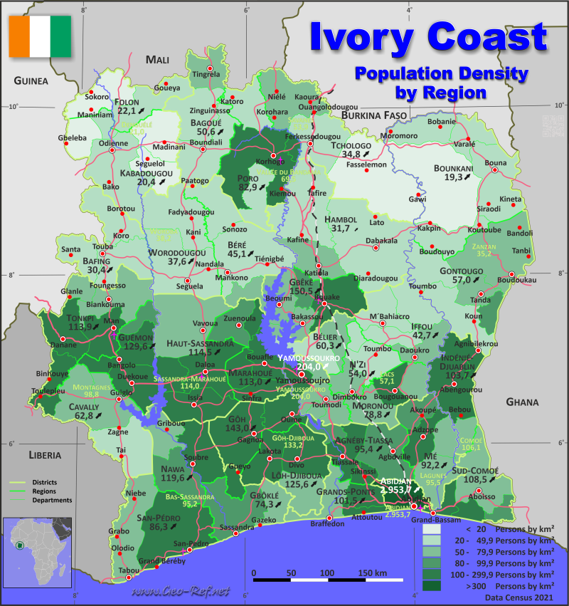
Ivory Coast population map
Pre European kingdom and côte d'ivoire map
Where is côte d'ivoire on the world map
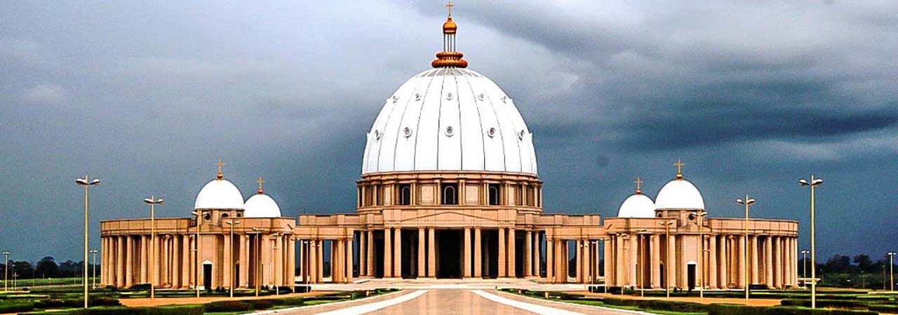
Yamoussoukro Côte d'Ivoire
Feel free to explore these pages as well:
- Head of Performance Marketing
- Head of SEO
- Linkedin Profile: linkedin.com/in/arifcagrici