Large Map of Namibia: Political, Physical, and Cities Maps
Where is Namibia Located on the World and Africa Map?
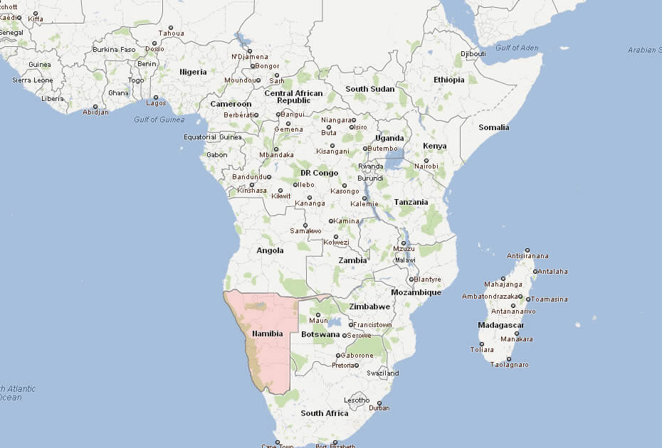
Namibia is a country in southern Africa, situated along the western coast of the continent. It borders the Atlantic Ocean to the west, Angola and Zambia to the north, Botswana to the east, and South Africa to the south. Known for its dramatic landscapes and the Skeleton Coast, Namibia is a key part of the Southern African region.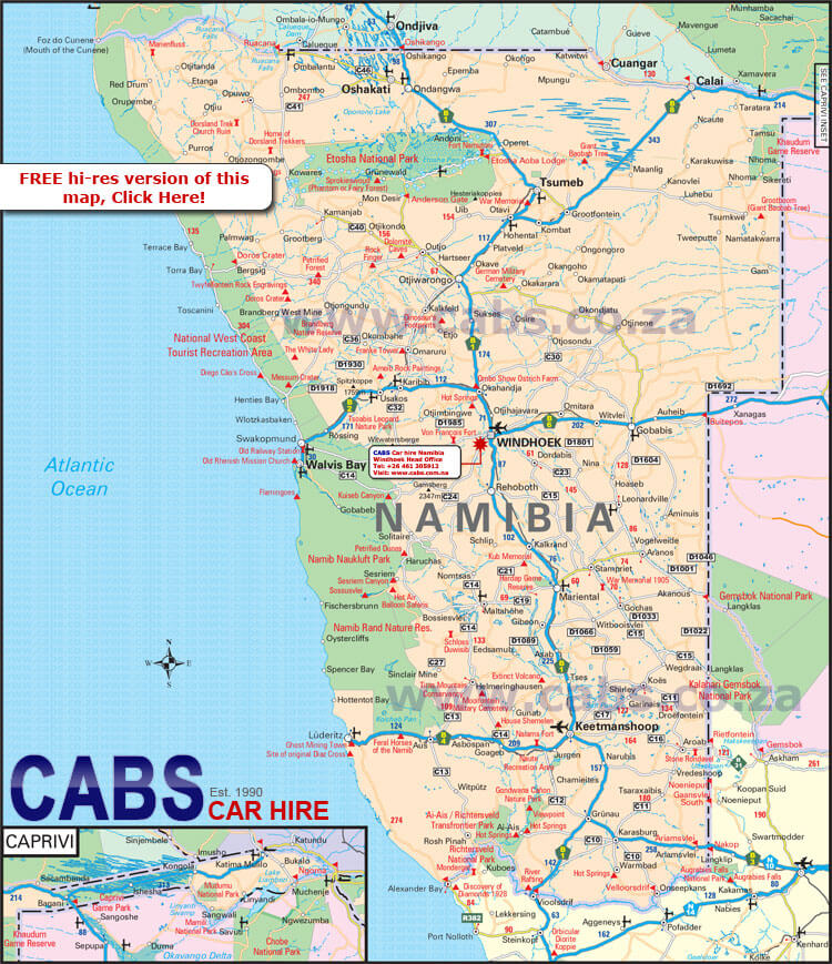
Map of Namibia
Namibia cities map
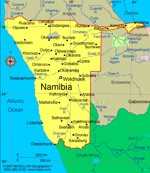
Namibia Map
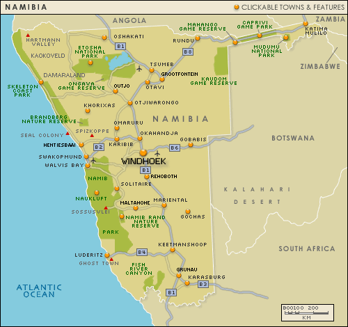
Namibia map showing major cities, roads, national parks, and key tourist destinations, including Windhoek, Swakopmund, and Etosha National Park.This map highlights Namibia’s main cities, tourist attractions, and transportation routes. Windhoek is the capital, and Etosha National Park stands out as a key destination for wildlife enthusiasts. National parks and scenic routes are marked clearly.
Brief information about Namibia
Namibia, located in southern Africa, is a country known for its stunning landscapes and vast wilderness. It borders Angola and Zambia to the north, Botswana to the east, South Africa to the south and the Atlantic Ocean to the west. Namibia's capital and largest city is Windhoek. The country gained independence from South Africa in 1990 and has been a stable democratic republic ever since. It is celebrated for its rich cultural diversity, with several ethnic groups, including the Himba, Herero and San, contributing to its vibrant heritage.
Namibia's natural attractions are world-renowned, from the towering red dunes of Sossusvlei in the Namib Desert to the wildlife-rich Etosha National Park. The country is also home to the Skeleton Coast, where the desert meets the ocean, creating an eerie yet mesmerising landscape. Namibia's economy is based on mining, agriculture and tourism, with diamonds and uranium being the main exports. Its commitment to conservation and sustainable tourism has earned it a reputation as a world leader in wildlife protection.
Where is located Namibia on the World and Africa and Africa Map?
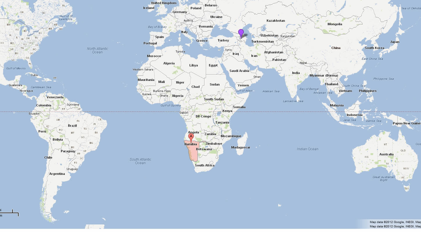
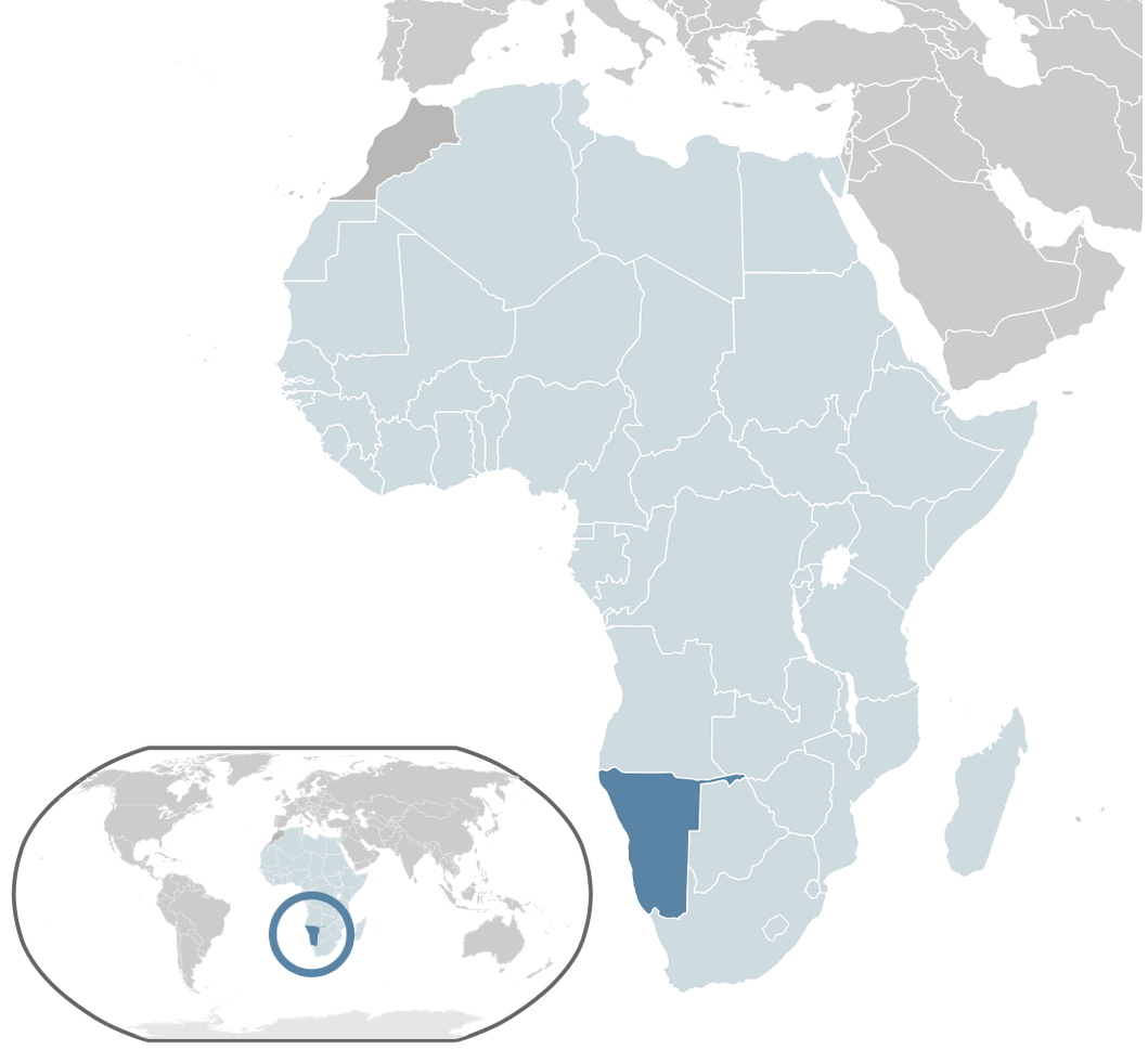 Where is located Namibia on the World Map
Namibia is located in southern Africa, on the western edge of the continent. It is bordered to the west by the Atlantic Ocean, which gives the country a stunning coastline known for its rugged beauty and the famous Skeleton Coast. Namibia borders Angola and Zambia to the north and Botswana to the east. South Africa lies to the south of Namibia, making it an integral part of the Southern African region.
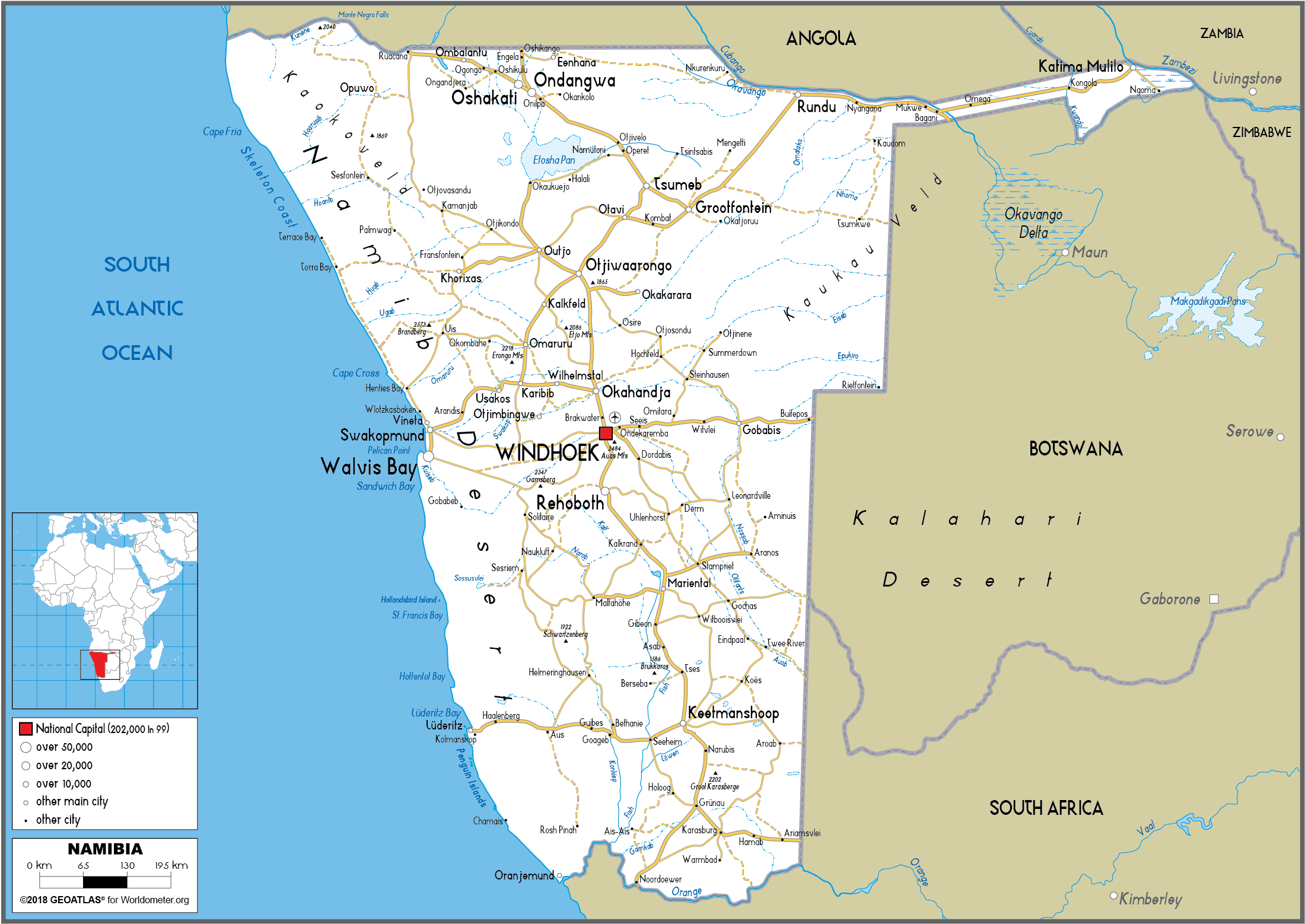
Namibia Map Political
The country lies just north of the Tropic of Capricorn, which runs through its southern part, giving it a predominantly arid and semi-arid climate. Its geographical coordinates are roughly between 17°S and 29°S latitude and 12°E and 25°E longitude. This location places Namibia in the south-western quadrant of Africa, making it an important geographical link between the central and southern parts of the continent.
Namibia's vast landscapes include the Namib Desert, one of the oldest deserts in the world, which stretches along the western coast. The Kalahari Desert lies along its eastern border, which it shares with Botswana. Its central plateau is home to the capital, Windhoek, which is a hub for trade and transport. Namibia's location, combined with its unique natural features, has made it a popular destination for travellers seeking adventure, wildlife and cultural experiences.
Here are some statistical information about Namibia:
 Area: 825,615 km2 (318,772 sq mi)
 Windhoek Namibia
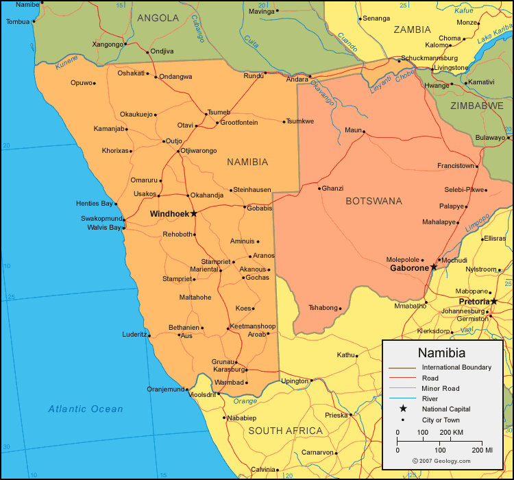
Namibia Physical Map
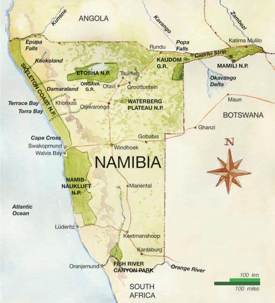 Namibia physical map showing national parks and key natural landmarks.
This map highlights Namibia's major national parks like Etosha, Namib-Naukluft, and Waterberg Plateau. Key features include Skeleton Coast, Fish River Canyon, and the Caprivi Strip, along with surrounding countries and natural boundaries.
Religion: 87.9% Christianity (43.7% Lutheranism, 22.8% Catholicism, 17.0% Anglicanism, 4.4% other Christian), 10.2% traditional faiths, 1.6% no religion, 0.3% other.Namibia Location Map
Map of Namibia Africa
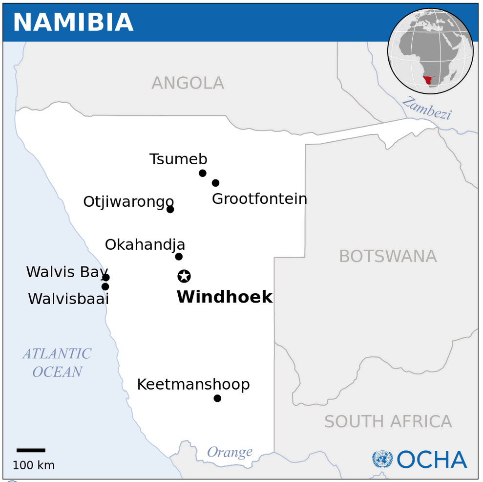
Namibia road map
Map of Namibia World
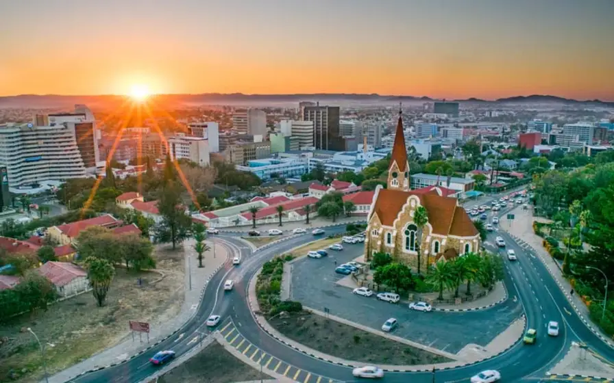
Namibia Map Windhoek
 Namibia map showing Windhoek, national parks, game reserves, and major towns.
This map outlines Namibia's key regions, including Windhoek as the capital, along with national parks like Etosha and Namib-Naukluft. The map emphasizes game reserves and coastal towns, offering a clear view of Namibia’s major travel routes and attractions.
Namibia population map
Namibia National Map
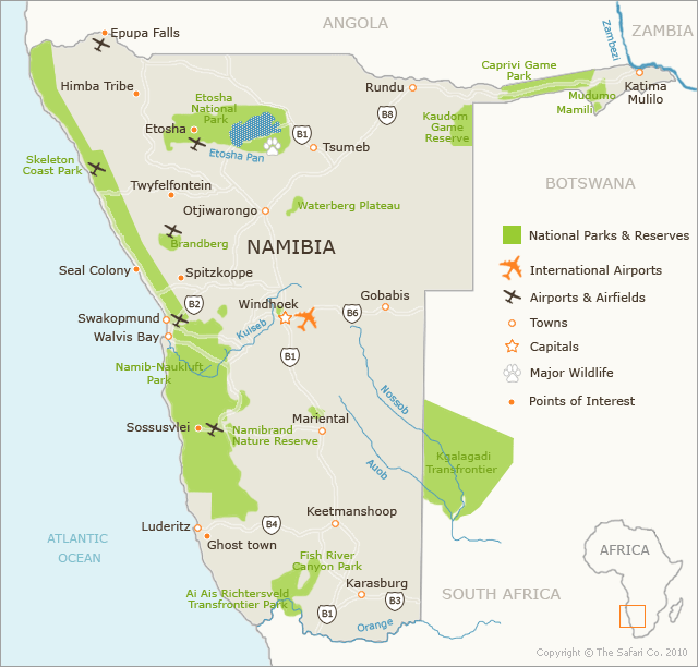 Namibia map highlighting national parks, reserves, towns, and airports.
This map displays Namibia's national parks like Etosha and Namib-Naukluft, along with major points of interest such as Skeleton Coast Park, Sossusvlei, and Fish River Canyon. Towns, airports, and key travel routes are also clearly marked.
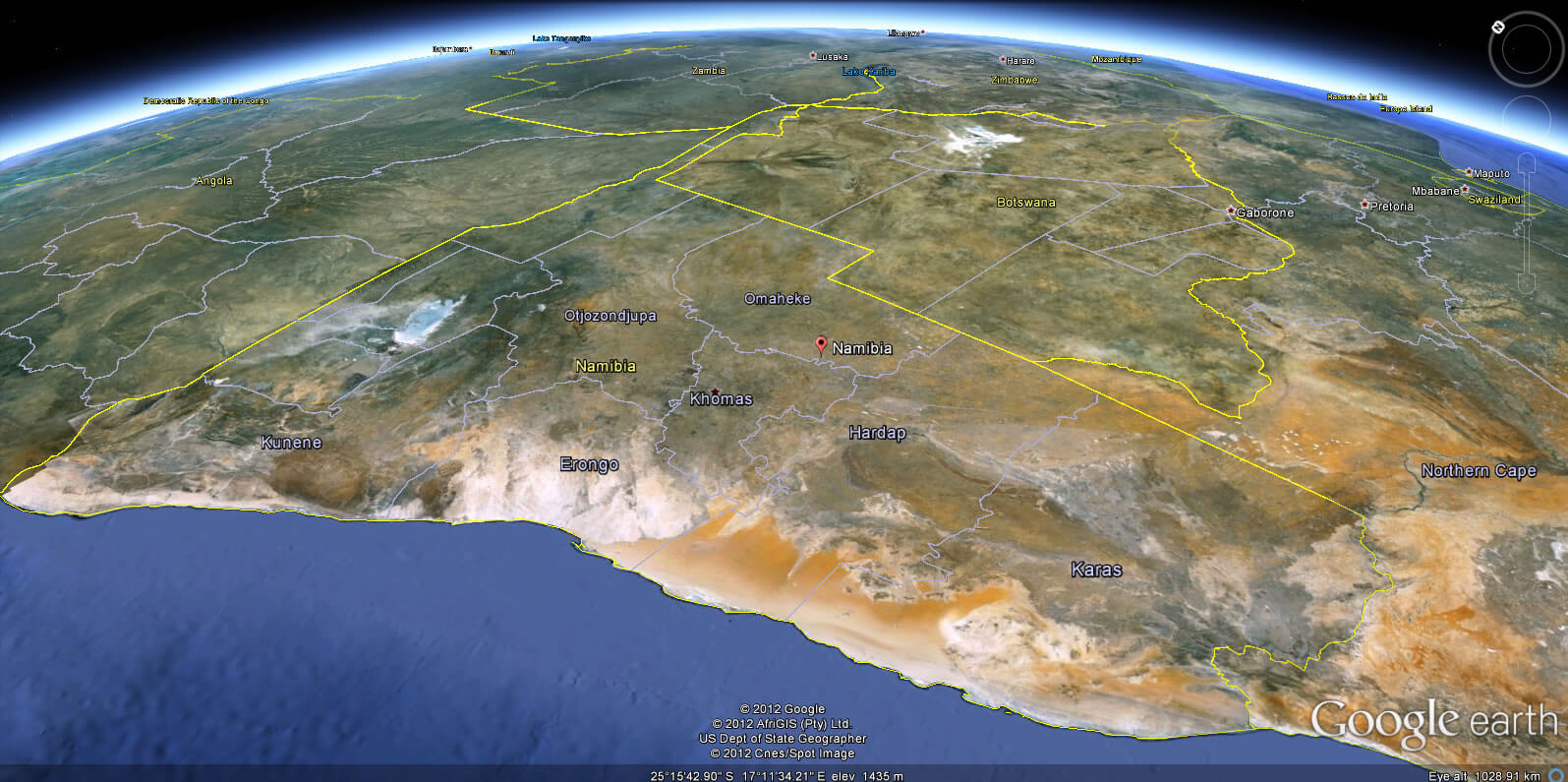
Namibia Earth Map
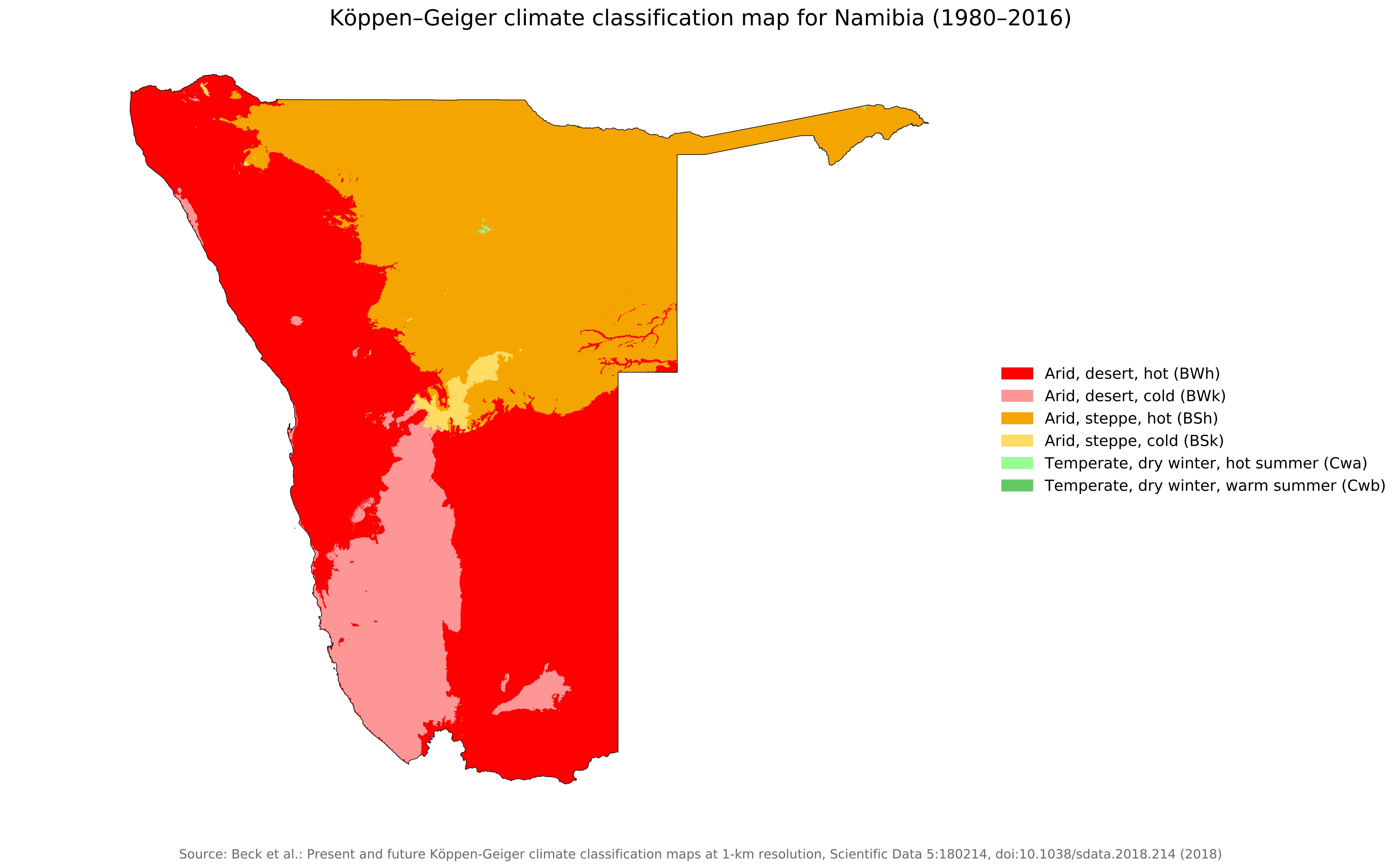
Koppen geiger map Namibia
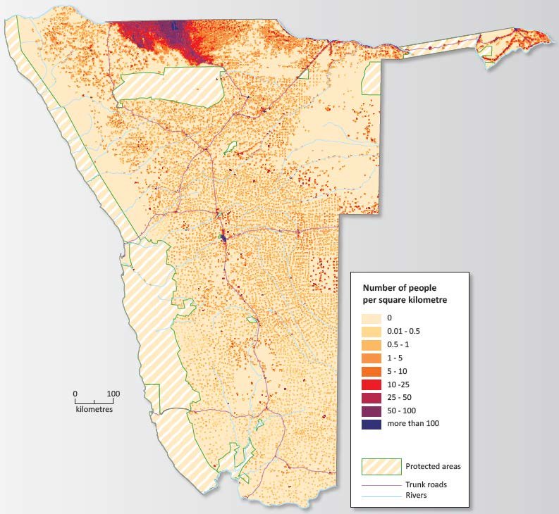
Namibia population density (2011)
.jpg)
Feel free to explore these pages as well:
- Head of Performance Marketing
- Head of SEO
- Linkedin Profile: linkedin.com/in/arifcagrici