High Resolution Guinea Map: Political, Physical, and Cities Maps
Where is Guinea Located on the World and Africa Map?
Guinea is a West African country situated on the Atlantic coast. It shares borders with Guinea-Bissau to the northwest, Senegal and Mali to the north and east, Côte d'Ivoire to the southeast, and Sierra Leone and Liberia to the south. Its coastal position gives Guinea strategic importance for trade and resources.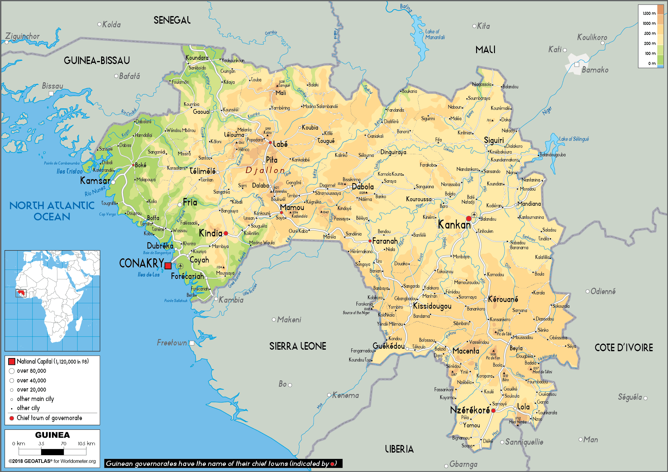
Maps of the Guinea
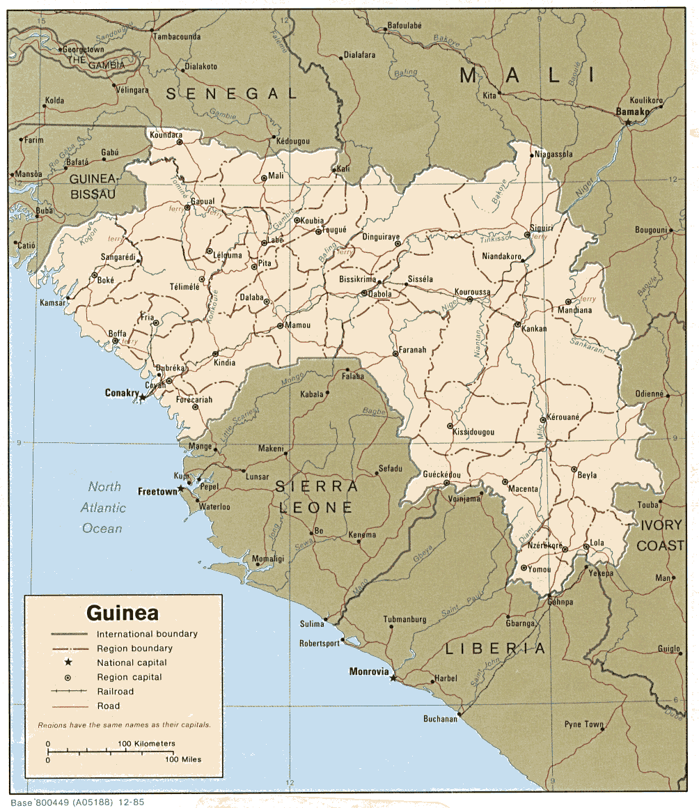
Guinea Road Map
 Detailed map of Guinea with cities, roads, and regional divisions.
This map provides a detailed view of Guinea’s road network and major cities, including Conakry, Kankan, and Nzérékoré. It highlights key regions and borders with neighboring countries like Sierra Leone, Mali, and Guinea-Bissau, as well as its Atlantic coastline.
Guinea Physical Map with Rivers, Mountains, and Major Cities
Physical map of Guinea showing mountains, rivers, and main cities.This physical map of Guinea displays the country’s varied landscape, from the coastal plains near Conakry to the Fouta Djallon highlands and the eastern plateaus. Major rivers such as the Niger and Milo originate here. Key cities like Conakry, Kankan, and Nzérékoré are also highlighted.
Brief information about Guinea
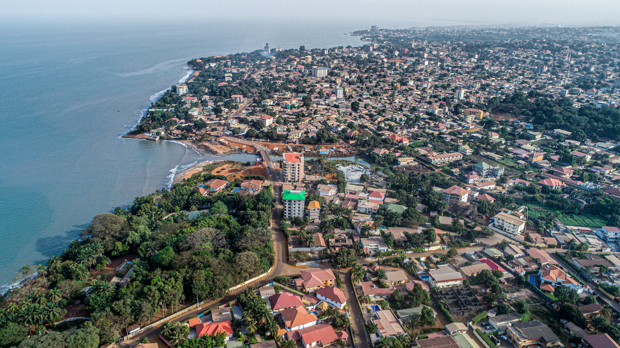
Guinea, West Africa's hidden gem, is a country of natural beauty and cultural richness. Known as the 'Water Tower of Africa', it's the source of many major rivers and home to lush rainforests, stunning waterfalls and breathtaking mountains such as Mount Nimba. The vibrant capital, Conakry, sits on the Atlantic Ocean and offers a lively mix of markets, music and history, making it a fascinating place to explore.
For the adventurous, Guinea's Fouta Djallon region is a must, with its green highlands, charming villages and scenic hiking trails. The country's diverse ethnic groups, such as the Fulani and Mandinka, add to its unique character through traditional music, dance and festivals. Guinea may not be a typical tourist destination, but its unspoilt charm makes it an unforgettable place to vis
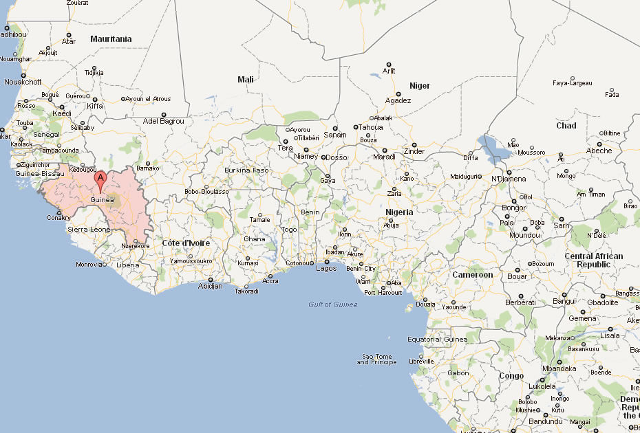
Where is located Guinea on the World and Africa Map?
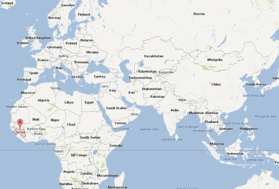
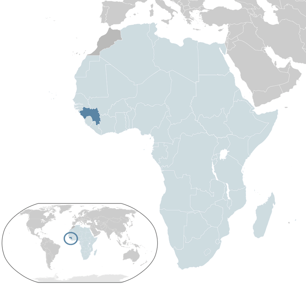 Where is located Guinea on the World Map
Guinea is located on the west coast of Africa, sandwiched between Guinea-Bissau to the northwest and Sierra Leone to the south. It borders Mali and Côte d'Ivoire to the east and the Atlantic Ocean to the west. Its strategic location in West Africa makes it an important country for trade and natural resources.
On the world map, Guinea lies just north of the equator, giving it a tropical climate with lush rainforests and rich biodiversity. The country is part of the western bulge of the African continent and is easily recognisable by its crescent-shaped coastline along the Atlantic Ocean.
Centrally located in West Africa, Guinea serves as a gateway to neighbouring countries linked by rivers and trade routes. Its unique geography, combining highlands, plateaus and coastal plains, makes it a diverse and fascinating destination for travellers and geographers alike.
Here are some statistical information about Guinea:
 Area: 245,857 km2 (94,926 sq mi)
 Guinea cities map
 Religion: Islam 86.8%, Traditional African religion 9.42%, Christianity 3.52%.
 Map of Guinea
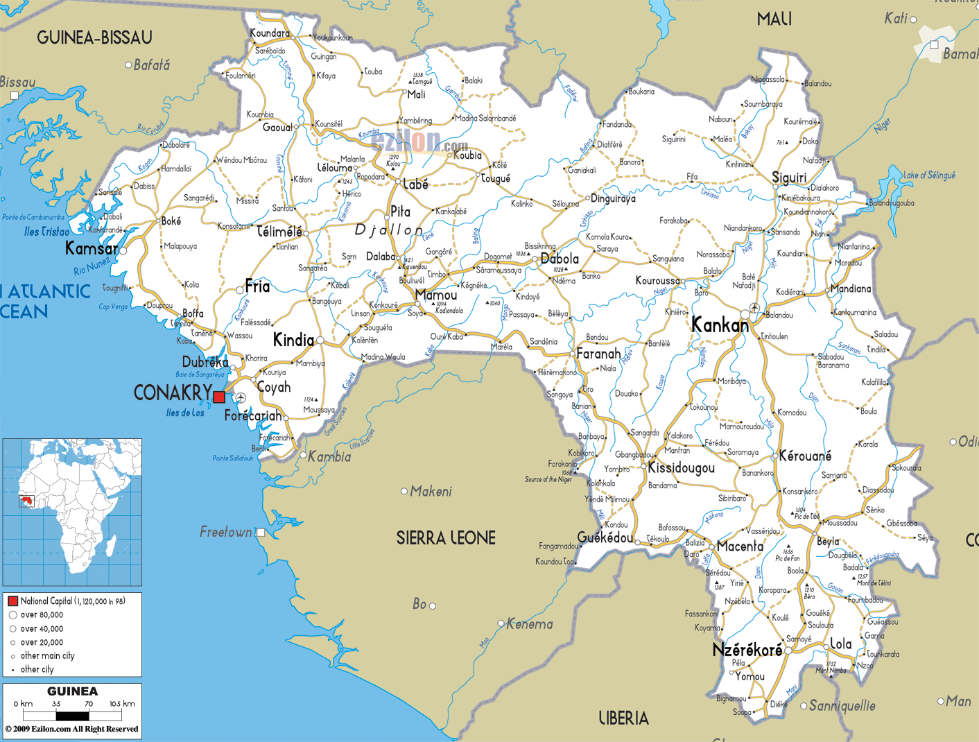
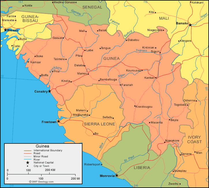 Map of Guinea highlighting roads, rivers, and neighboring countries.
This map of Guinea shows its main roads, rivers, and cities like Conakry, as well as its borders with countries like Mali, Sierra Leone, and Liberia. It highlights key geographic features, including Guinea's central location in West Africa.
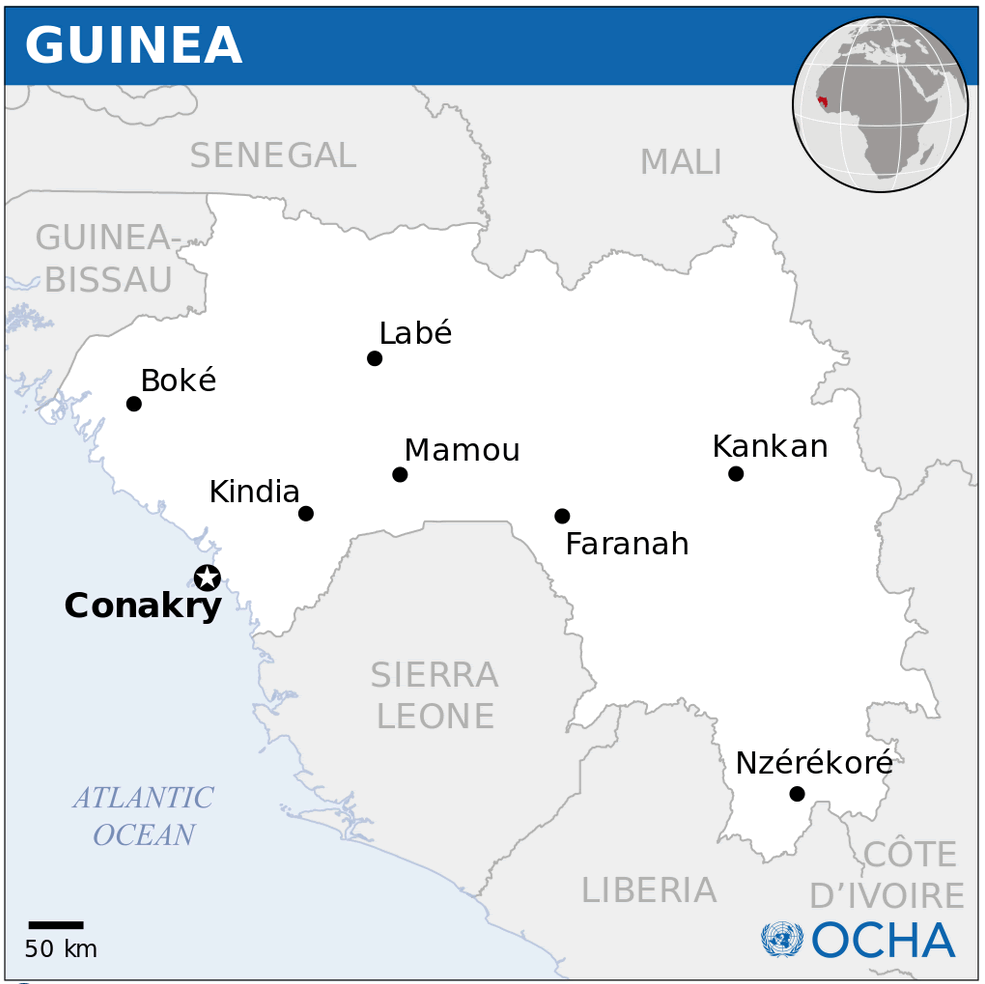
Guinea Location Map
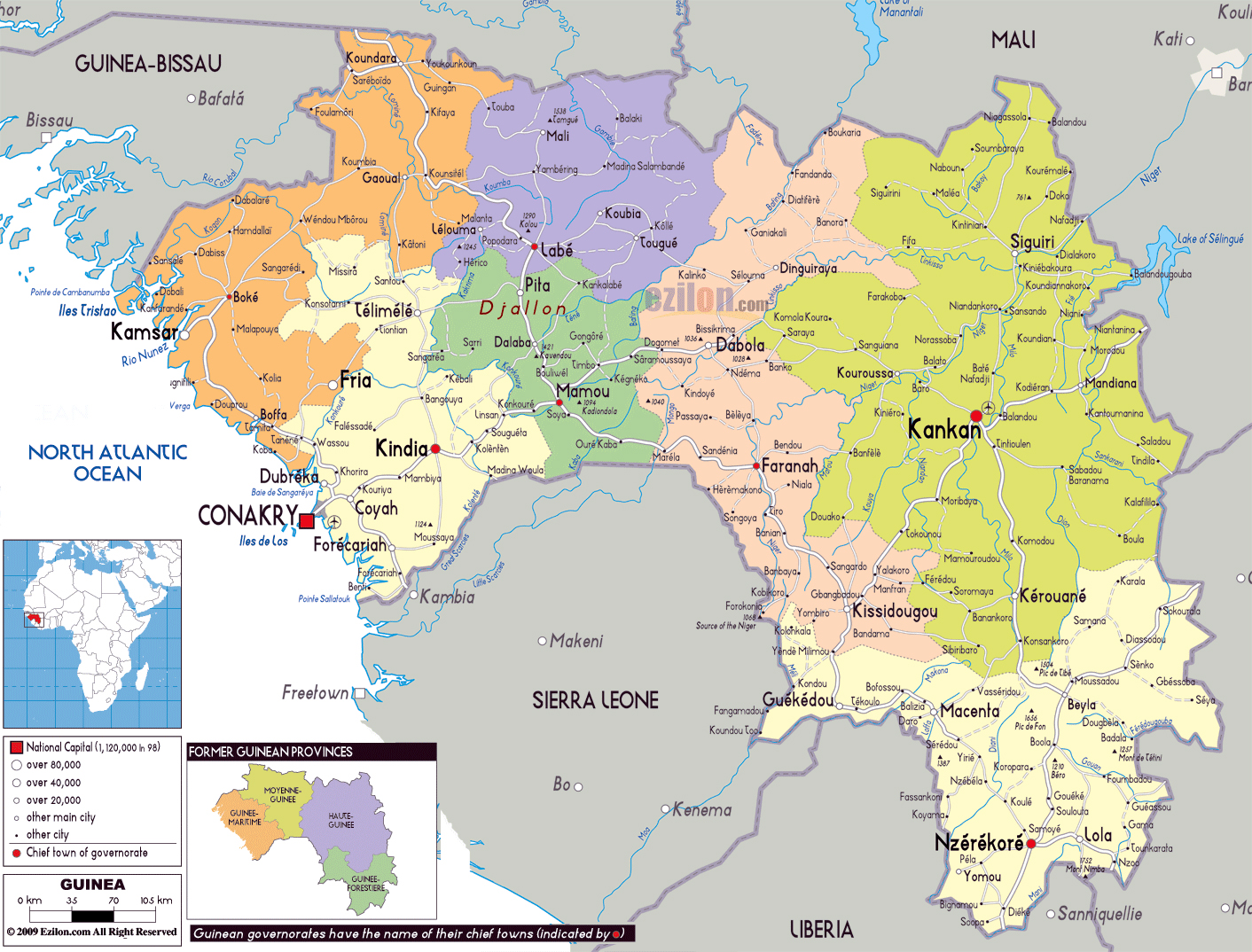
Guinea administrative divisions map
Guinea Relief Map
 Relief map of Guinea with roads, railroads, and regional boundaries.
This map highlights Guinea's geographic features, transportation network, and regional divisions. It includes railroads, major roads, and cities like Conakry while showing the country's borders with Sierra Leone, Liberia, and Mali.
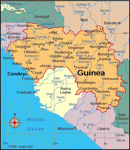
Map of Guinea Africa
Map of Guinea World
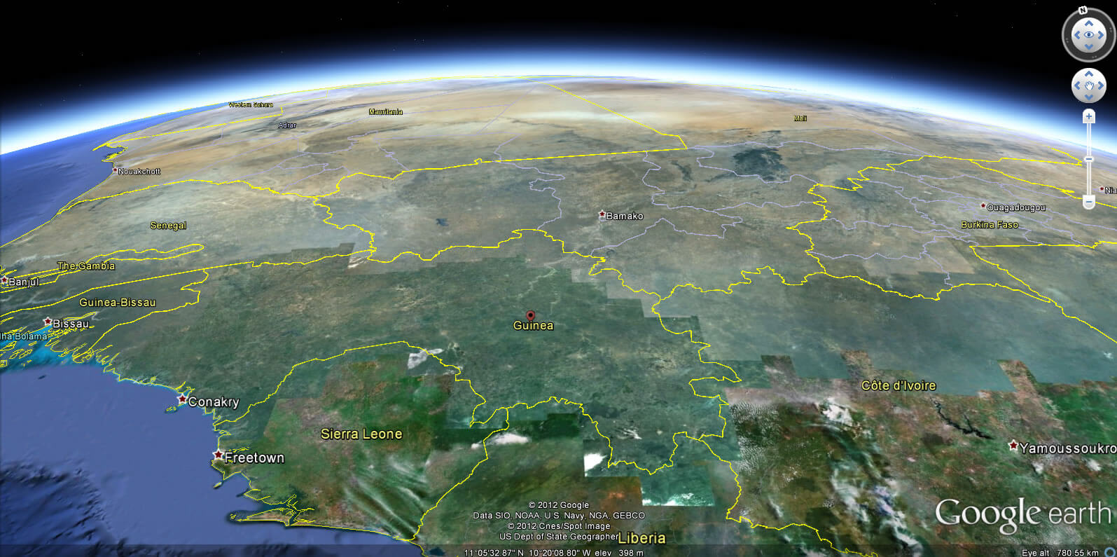
Guinea Earth Map
Guinea Maps
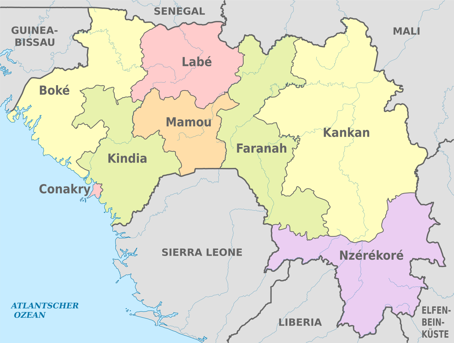
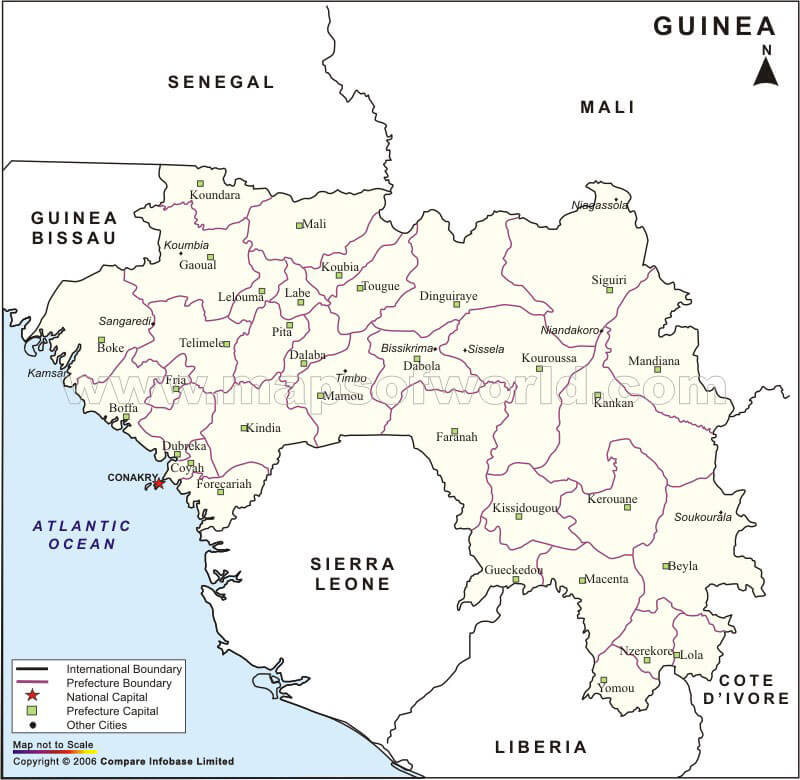 Administrative map of Guinea showing cities, regions, and borders.
This map displays Guinea’s administrative divisions, including prefectures and their capitals. It highlights the location of Conakry, the national capital, and shows neighboring countries such as Senegal, Mali, and Sierra Leone.
Guinea Map
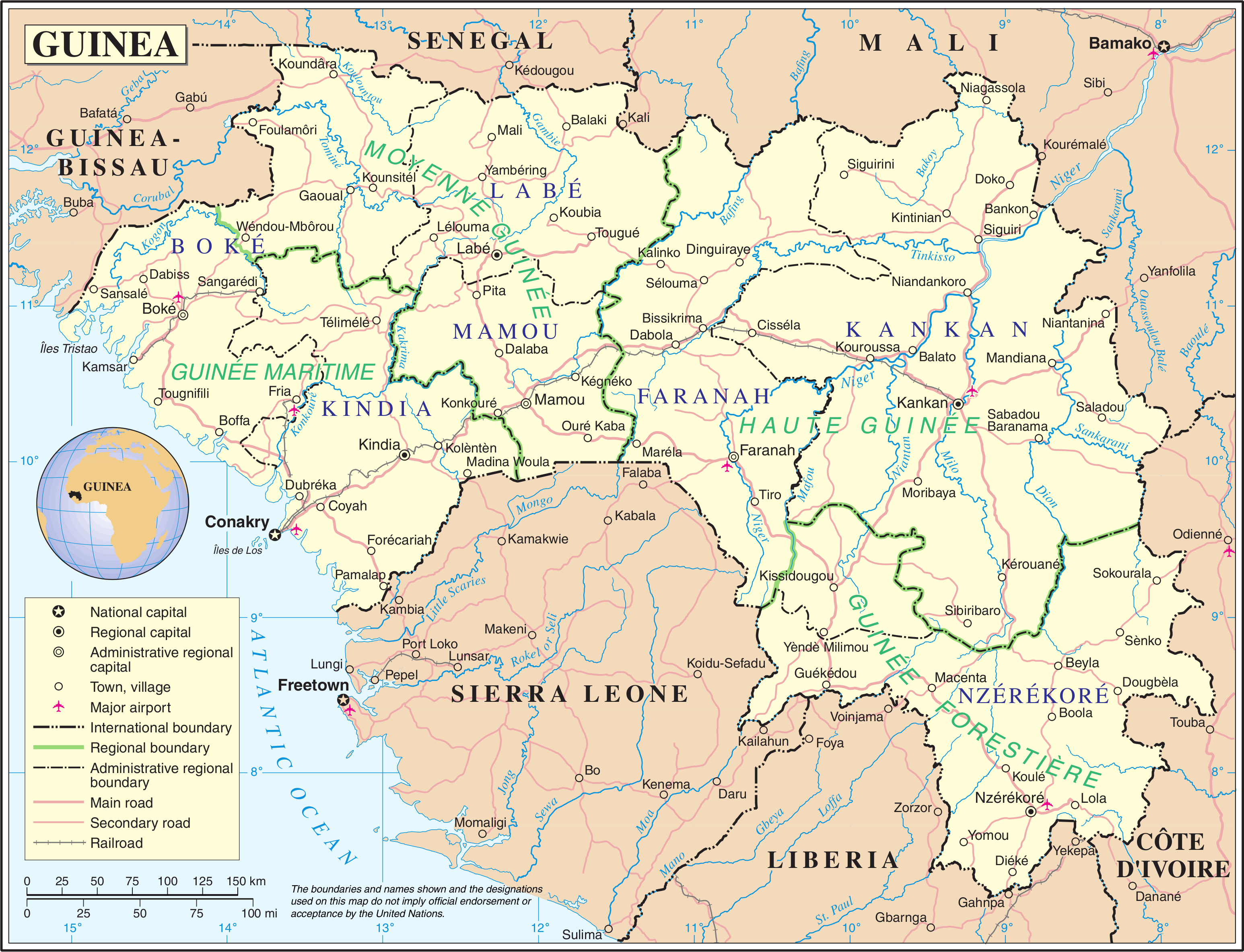
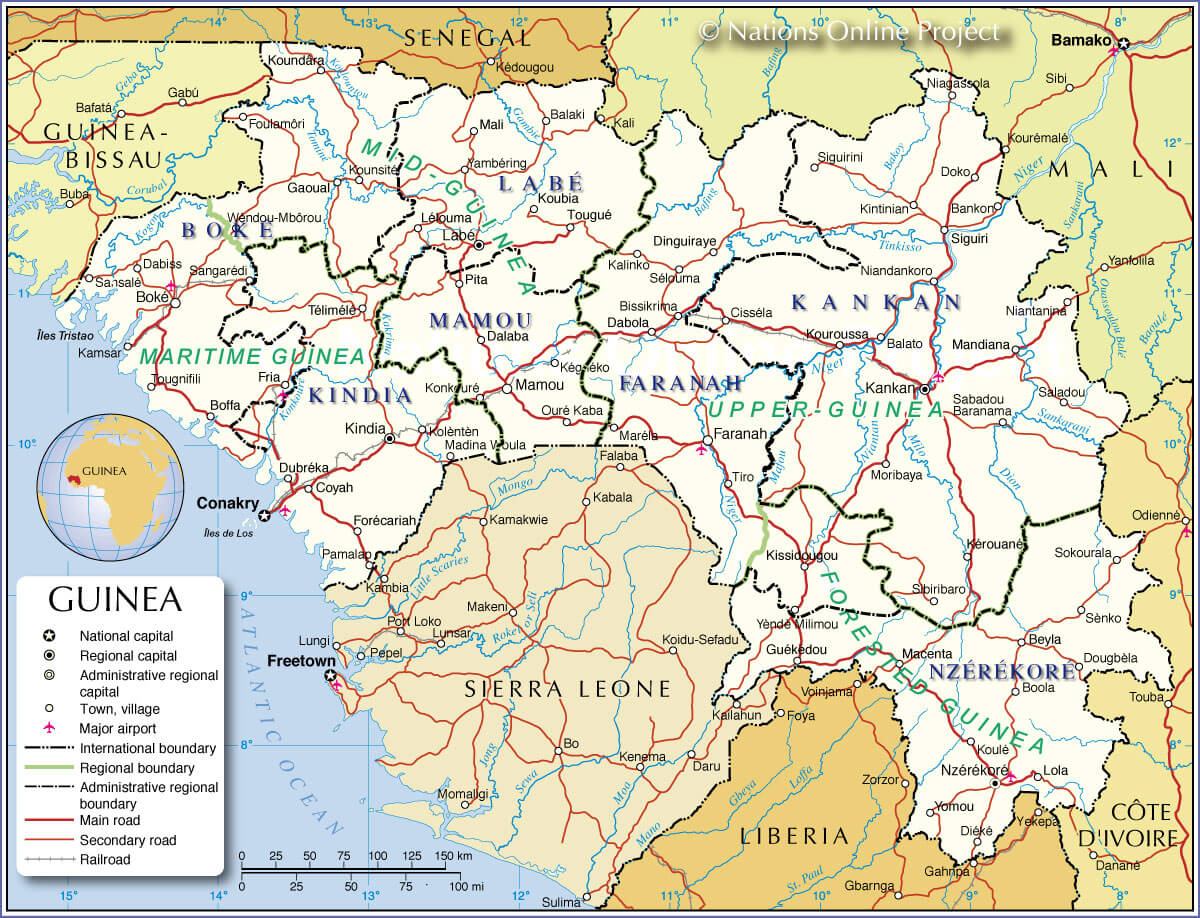 Map of Guinea showing regions, roads, rivers, and neighboring countries
This map highlights Guinea's geography, including its regions like Maritime Guinea, Upper Guinea, and Forest Guinea. It also marks cities, roads, and borders with countries like Mali, Sierra Leone, and Côte d'Ivoire.
Guinea Political Map
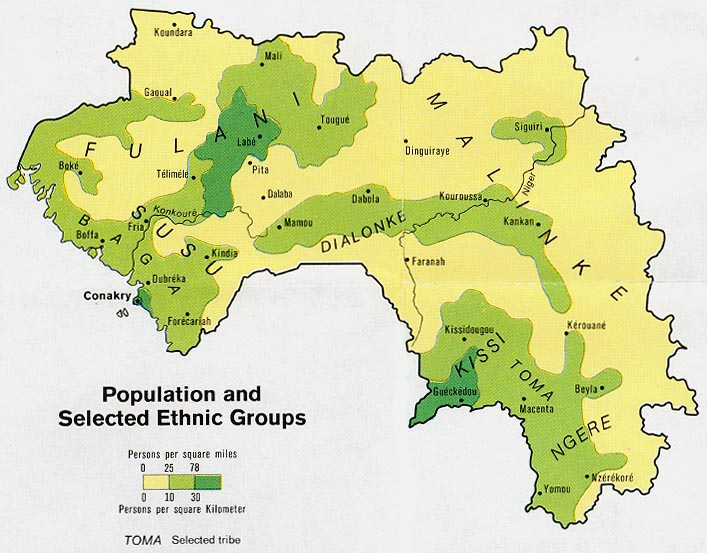
Guinea population map
Feel free to explore these pages as well:
- Head of Performance Marketing
- Head of SEO
- Linkedin Profile: linkedin.com/in/arifcagrici