Ghana Map: Political, Physical, and Cities Maps
Where is Ghana Located on the World and Africa Map?
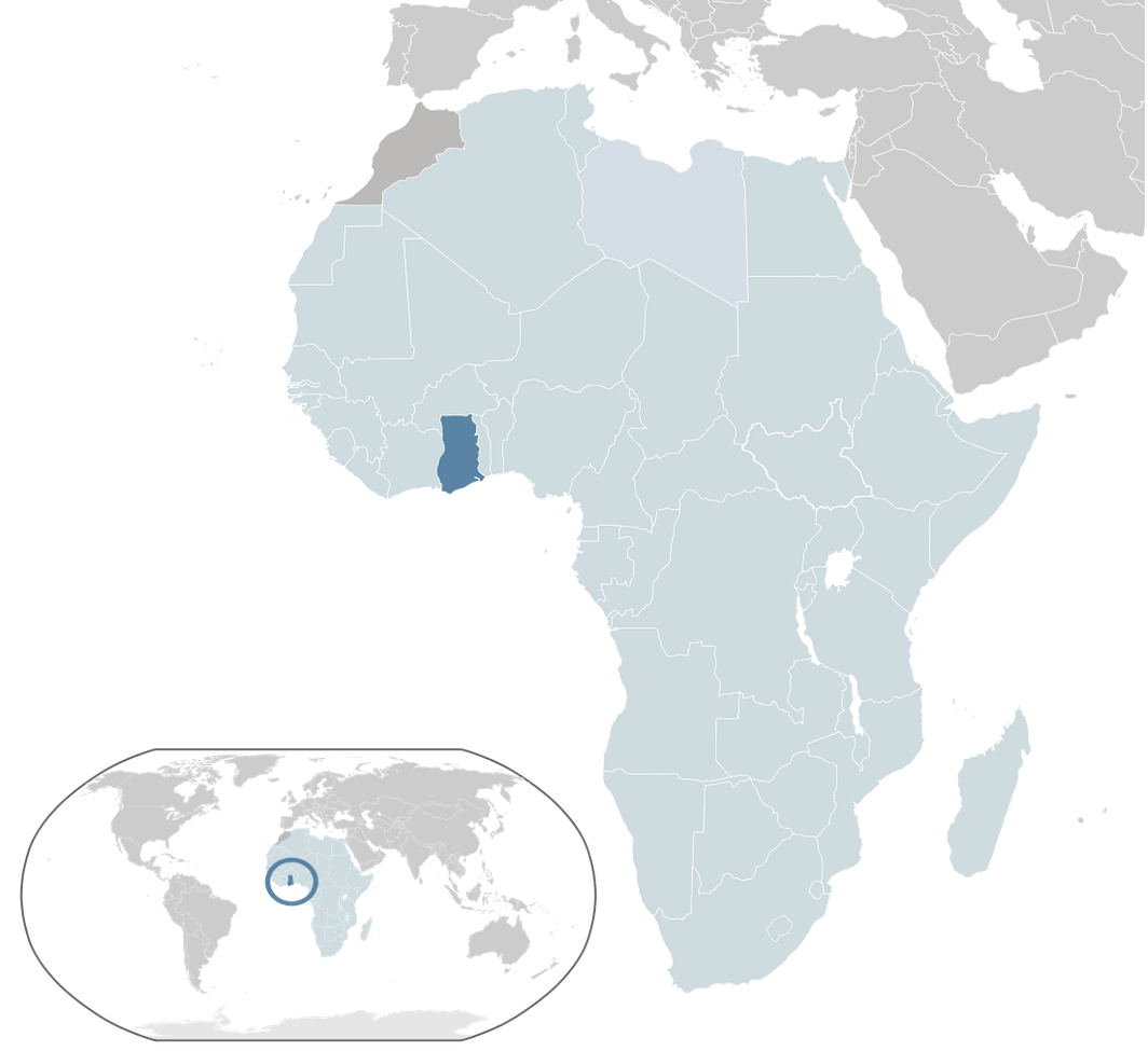
Ghana is a West African country situated along the Gulf of Guinea and the Atlantic Ocean. It shares borders with Côte d'Ivoire to the west, Burkina Faso to the north, and Togo to the east. Positioned just north of the Equator, Ghana features a tropical climate with diverse coastal, forest, and savannah landscapes.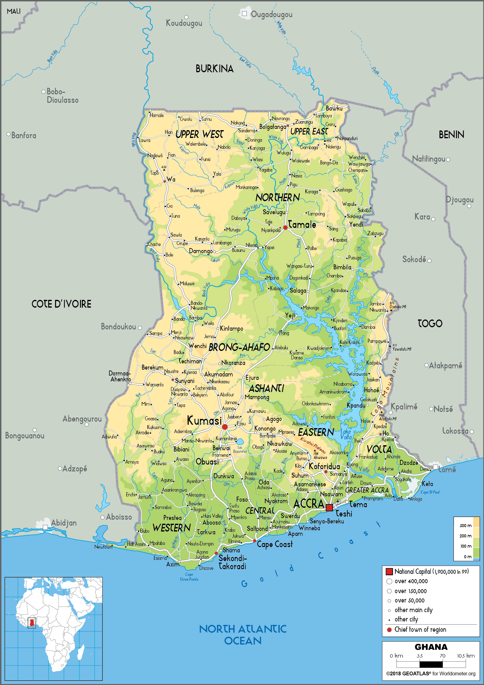
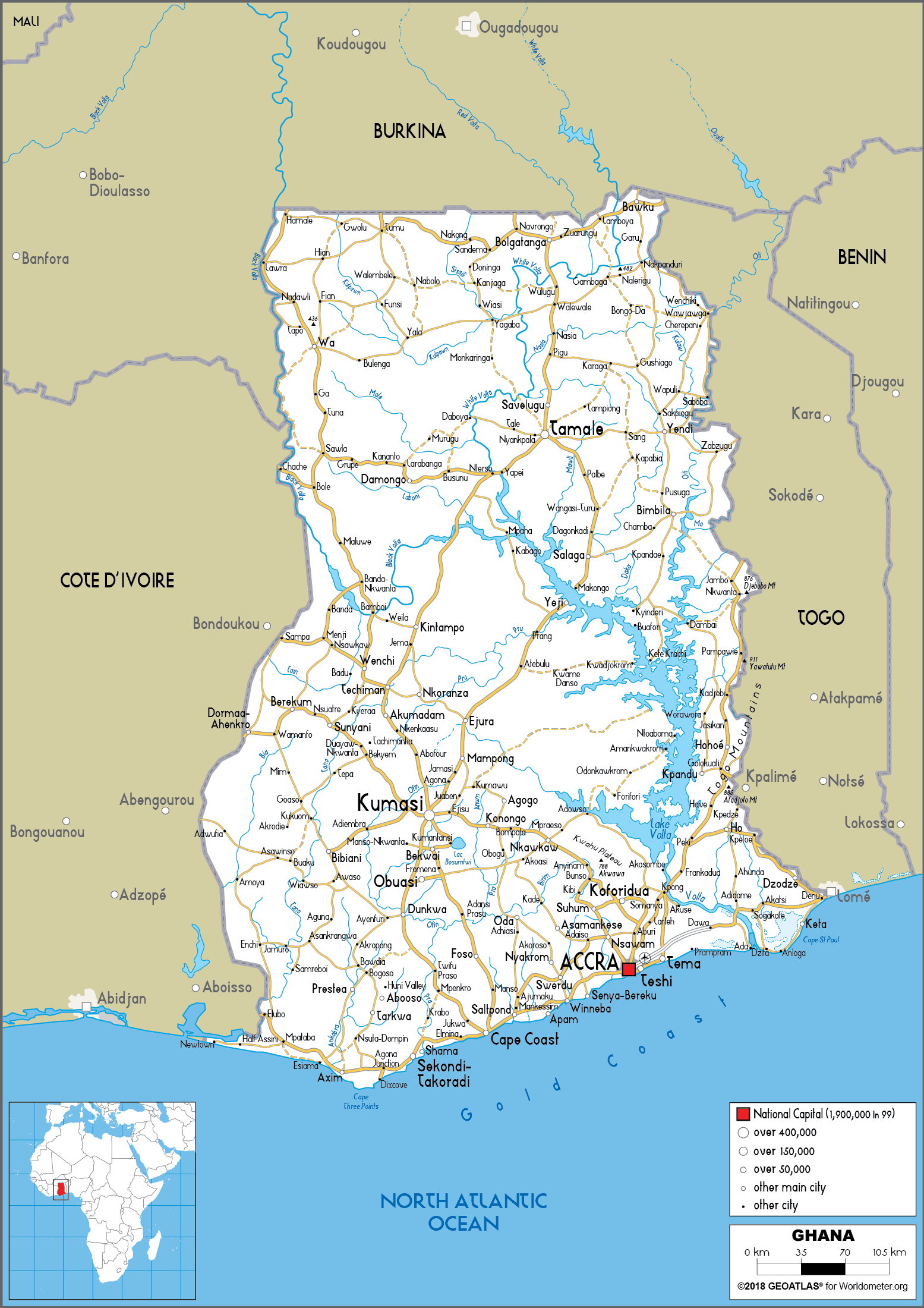
Ghana road map
Brief information about Ghana
Located in West Africa on the Gulf of Guinea and the Atlantic Ocean, Ghana is renowned for its rich history, cultural heritage and natural resources. It was the first African nation to gain independence from colonial rule in 1957 under the leadership of Kwame Nkrumah. Ghana is renowned for its diverse landscapes, including lush rainforests, savannahs and beautiful beaches. The country is home to iconic landmarks such as Cape Coast Castle, a UNESCO World Heritage Site that serves as a reminder of its role in the transatlantic slave trade.
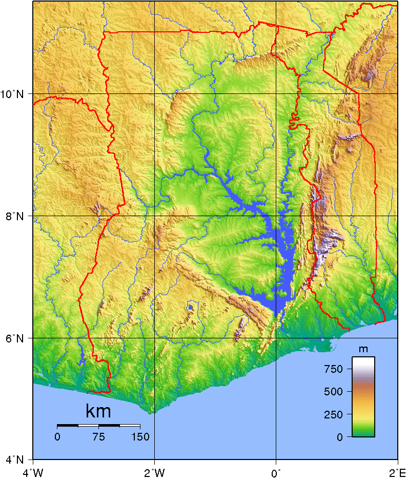
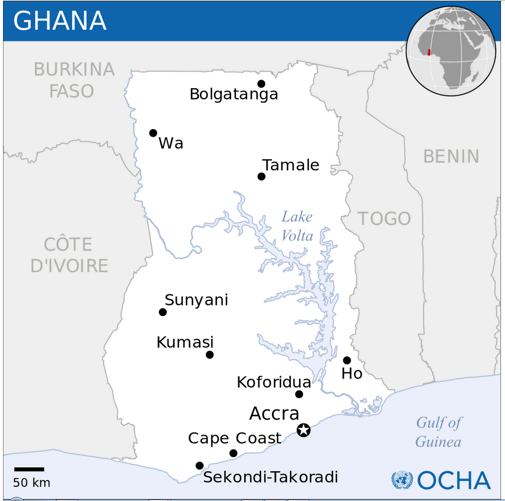
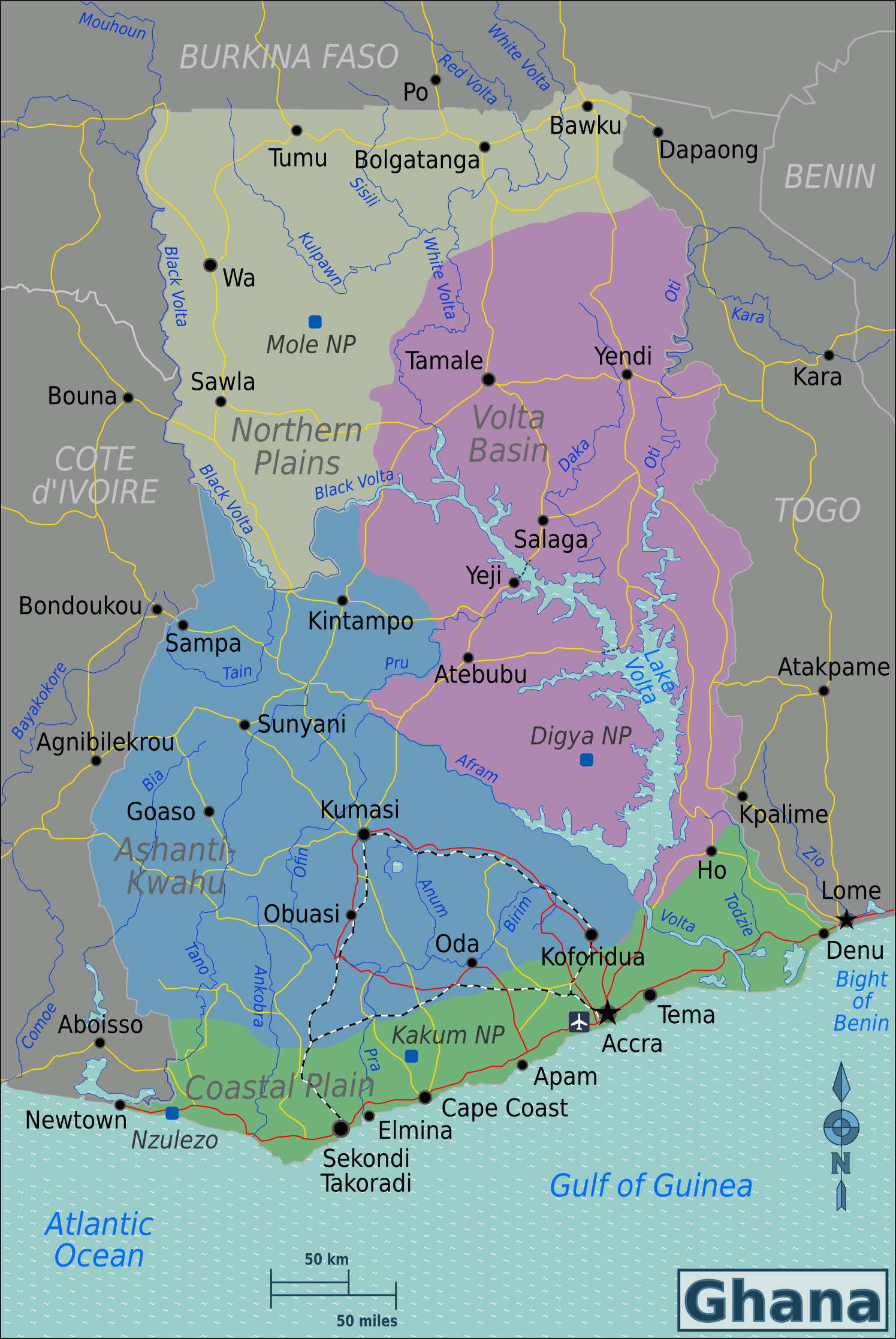
Ghana Physical Map with Rivers, Mountains, and Major Cities
Physical map of Ghana showing rivers, terrain, and major cities.This physical map of Ghana highlights the country’s diverse landscape, including mountains, rivers, and coastal plains. Major rivers like the Volta and key cities such as Accra, Kumasi, and Tamale are marked. The map also shows elevation changes, from coastal lowlands to northern highlands.
Map of Ghana
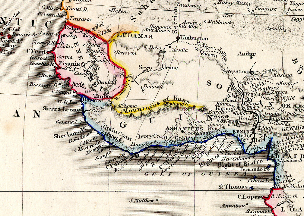
Ghana Map The Akan Kingdom of Ashant in 1850
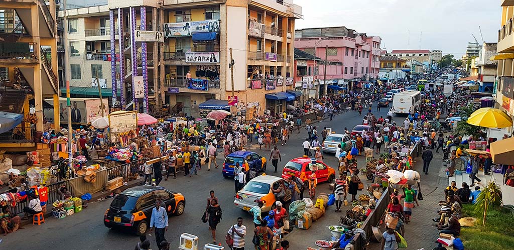
Today, Ghana is a stable democracy with Accra as its capital. Its economy is one of the fastest growing in Africa, driven by industries such as agriculture, gold mining and cocoa production. Known in colonial times as the 'Gold Coast', Ghana remains a top producer of gold and is also the world's second largest exporter of cocoa. Its vibrant culture is reflected in traditional festivals, kente cloth and energetic music and dance styles, making it a popular destination for tourists and heritage seekers alike.
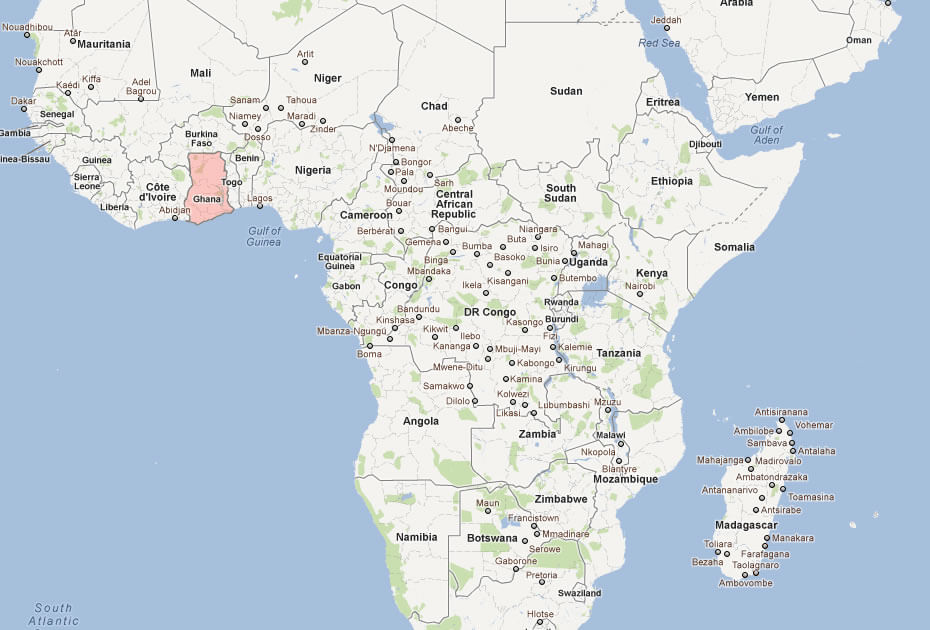
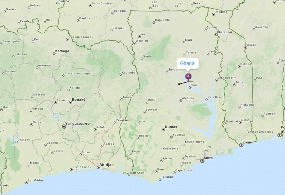
Where is located Ghana on the World and Africa Map?
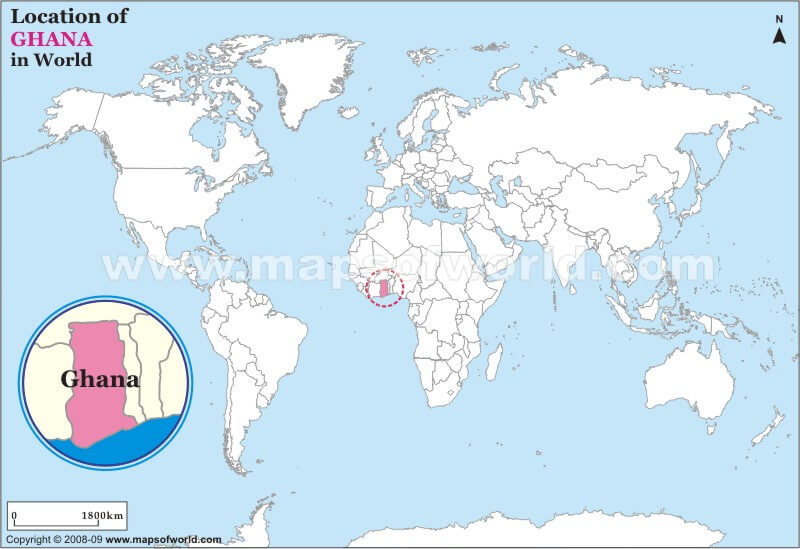
 Where is located Ghana on the World Map
Ghana is located in West Africa, on the Gulf of Guinea and the Atlantic Ocean. It borders Côte d'Ivoire to the west, Burkina Faso to the north and Togo to the east, while its southern coastline stretches along the Atlantic Ocean. Situated just a few degrees north of the equator, Ghana enjoys a tropical climate that varies between coastal, forest and savannah regions.
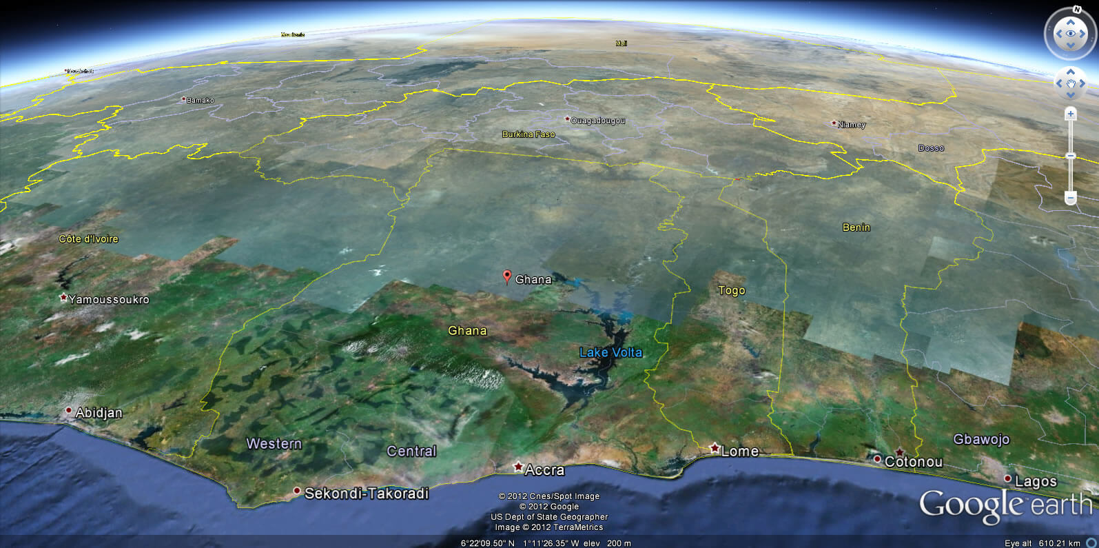
The country covers an area of approximately 238,533 square kilometres, making it relatively small compared to its neighbours. Its central location in West Africa makes Ghana an important hub for trade and cultural exchange in the region. The prime meridian (0° longitude) passes through the city of Tema, near the capital city of Accra, highlighting Ghana's unique geographical position on the globe.
On the world map, Ghana is easily identifiable on the western side of Africa, just south of the Sahara Desert and within the tropical belt. Its diverse geography includes coastal plains, dense rainforests and grassy savannahs, showcasing its natural beauty and rich ecosystems. Ghana's strategic location has played a key role in its history, from the rise of ancient kingdoms such as the Ashanti Empire to its importance during the era of transatlantic trade.
Here are some statistical information about Ghana:
 Area: 238,540 km2 (92,100 sq mi)
 Ghana Map World
Ghana topography map
 Official languages: English
 Ghana cities map
 Religion: 71.3% Christianity (49.0% Protestantism, 22.3% other Christian), 19.9% Islam, 3.2% traditional faiths, 1.1% no religion, 4.5% other/unspecified.
 Ghana Location Map
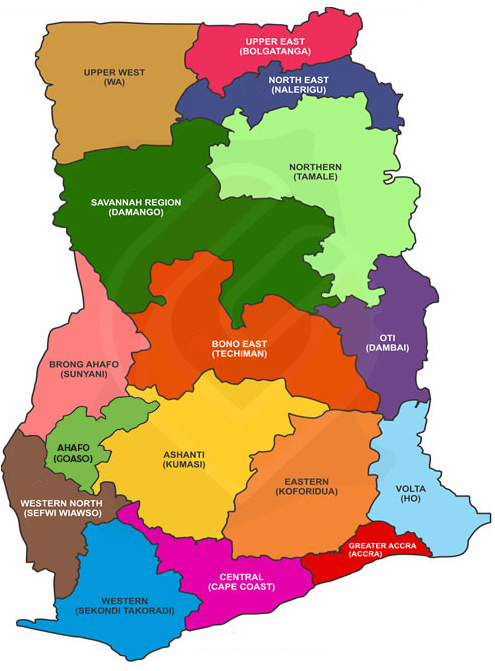
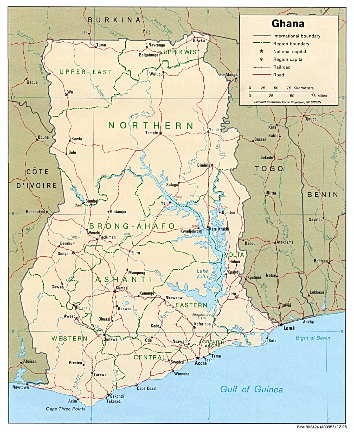
Ghana Regions Map
 Ghana administrative map displaying regions with boundaries.
This map highlights the administrative regions of Ghana, including Northern, Ashanti, Volta, and Greater Accra, with clear demarcation lines and color-coded regions, providing an overview of the country’s geographic divisions.
Ghana Tourist Map
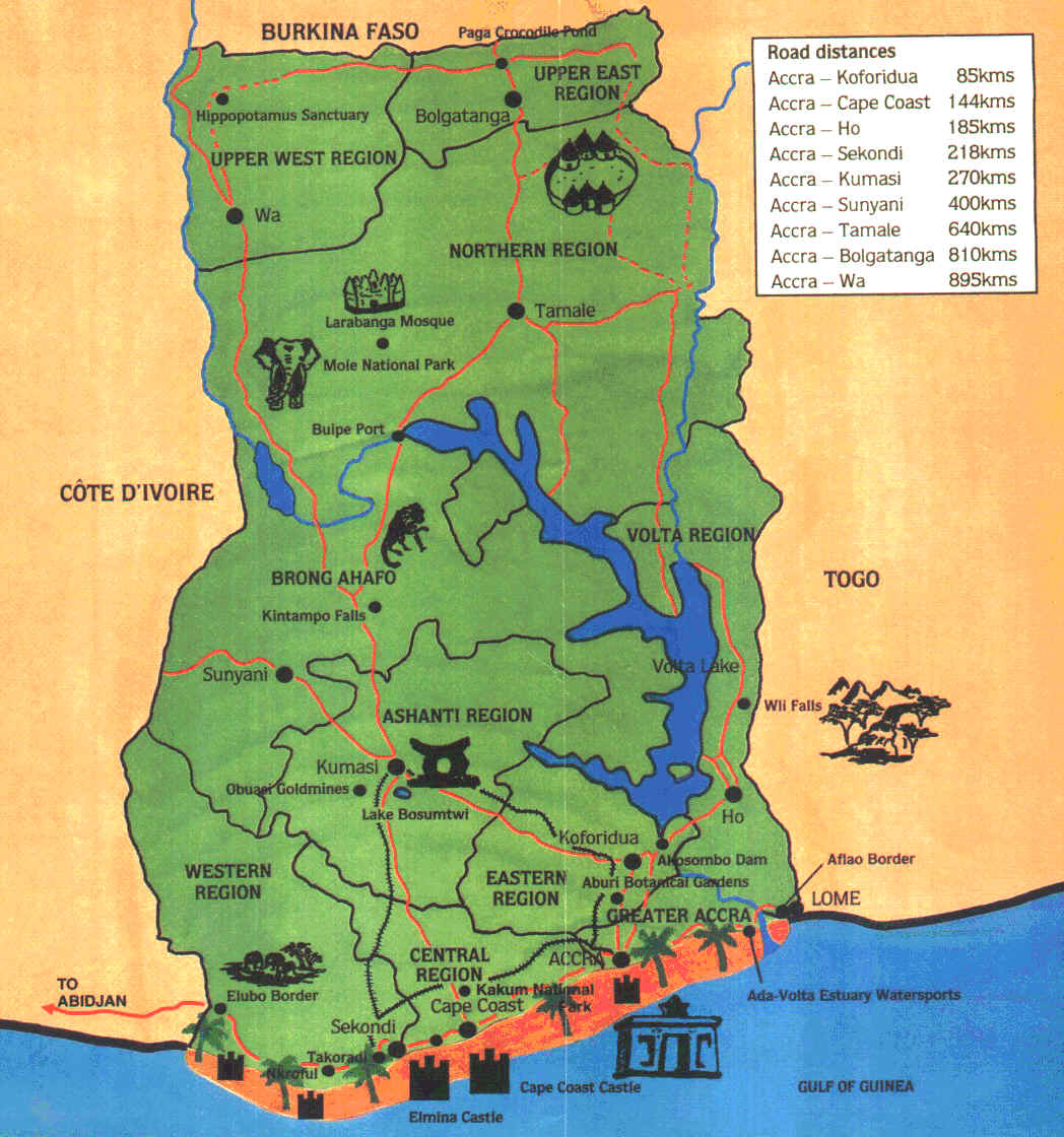 Ghana tourist map showing key regions, landmarks, and distances.
This map highlights Ghana's regions, major landmarks like Mole National Park, Cape Coast Castle, and Volta Lake, along with road distances from Accra to key cities, providing an overview for travelers exploring the country.
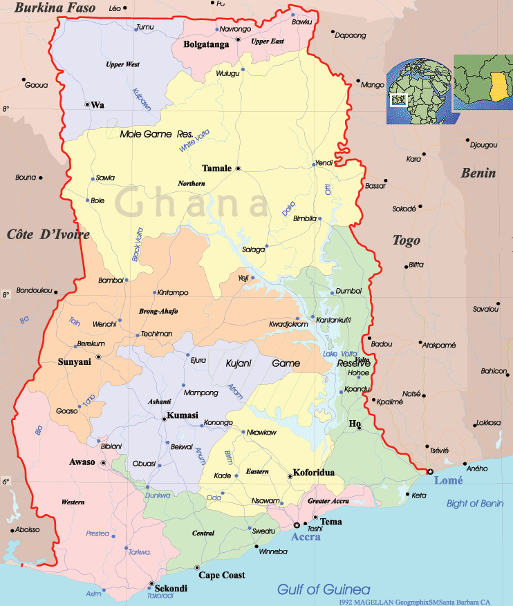
Ghana regions map
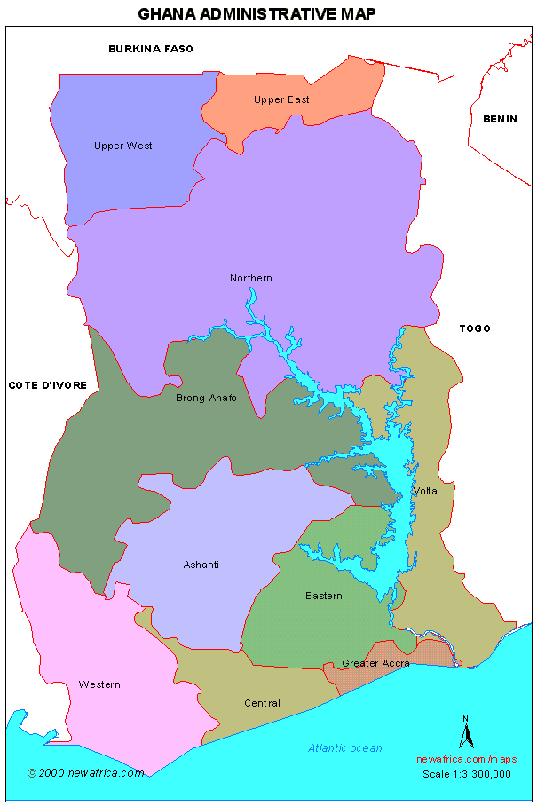
Ghana Political Map
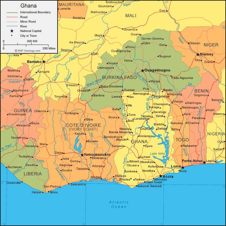
Map of Ghana Africa
Map Ghana
 Ghana map showcasing administrative regions, cities, and landmarks.
This detailed map illustrates Ghana's administrative regions, major cities like Accra and Kumasi, and natural features such as Lake Volta and Mole Game Reserve. It serves as a comprehensive guide for geographic and regional understanding.
Ghana Map
Ghana Earth Map
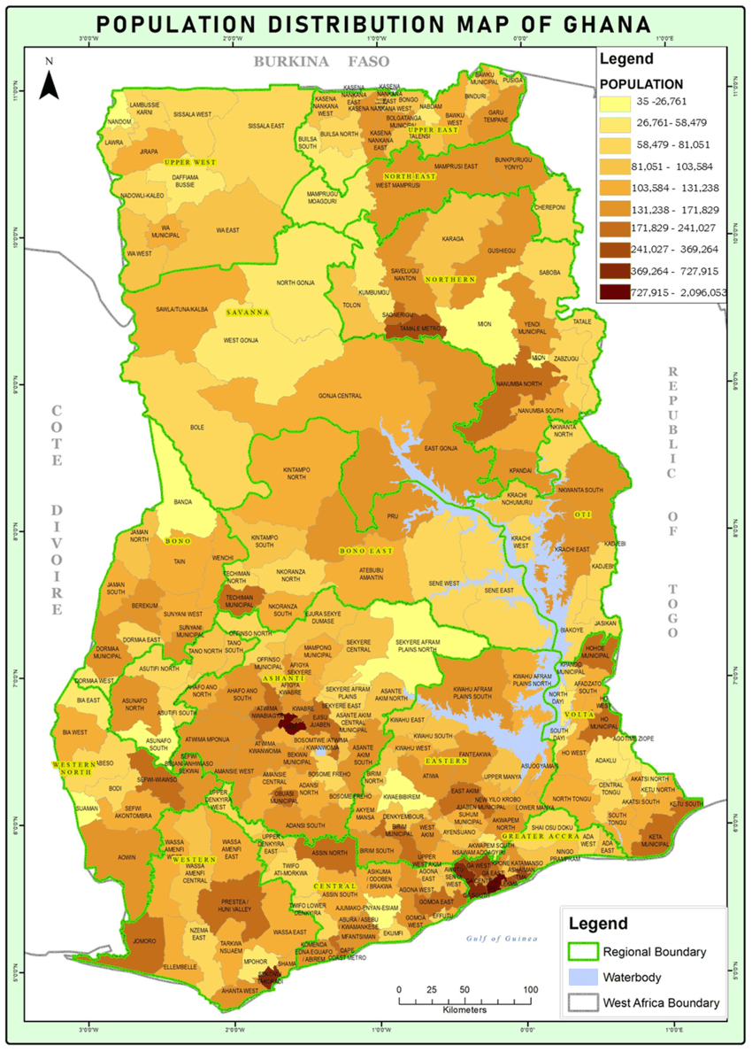
Ghana population map
Map of Ghana africa
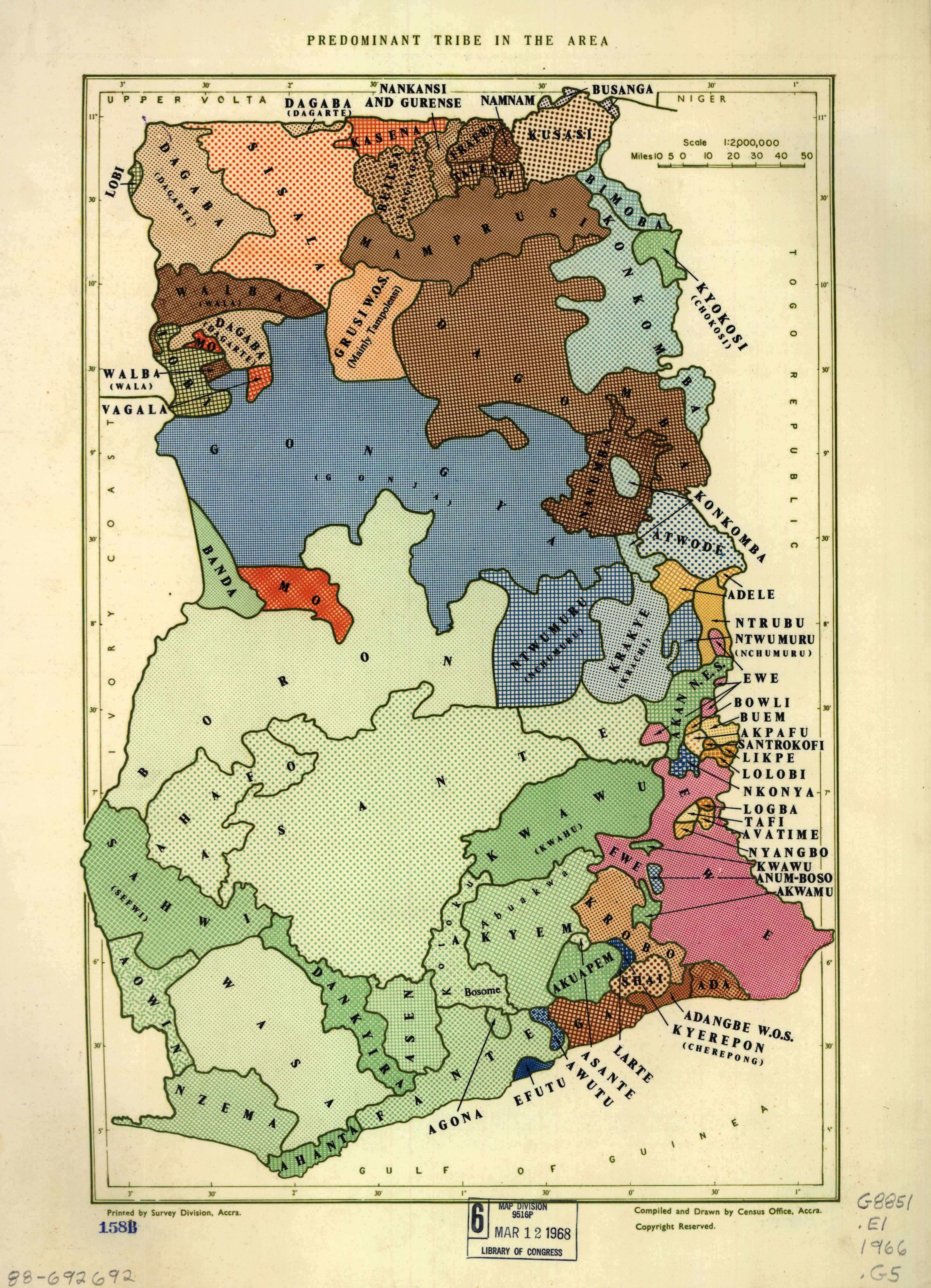
Predominant tribe in the area Ghana
Feel free to explore these pages as well:
- Head of Performance Marketing
- Head of SEO
- Linkedin Profile: linkedin.com/in/arifcagrici