Printable Map of Guadeloupe: Political, Physical, and Cities Maps
Where is Guadeloupe Located on the World and South America Map?
Guadeloupe is an island group in the eastern Caribbean Sea, forming part of the Lesser Antilles. It is located southeast of Puerto Rico and lies roughly midway between the Dominican Republic and Barbados. Guadeloupe's closest neighbors are Dominica to the south and Antigua and Barbuda to the north.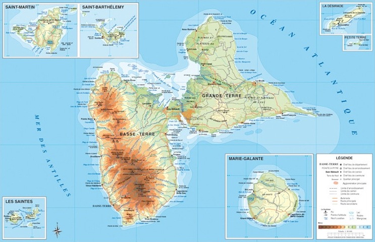
Guadeloupe cities map
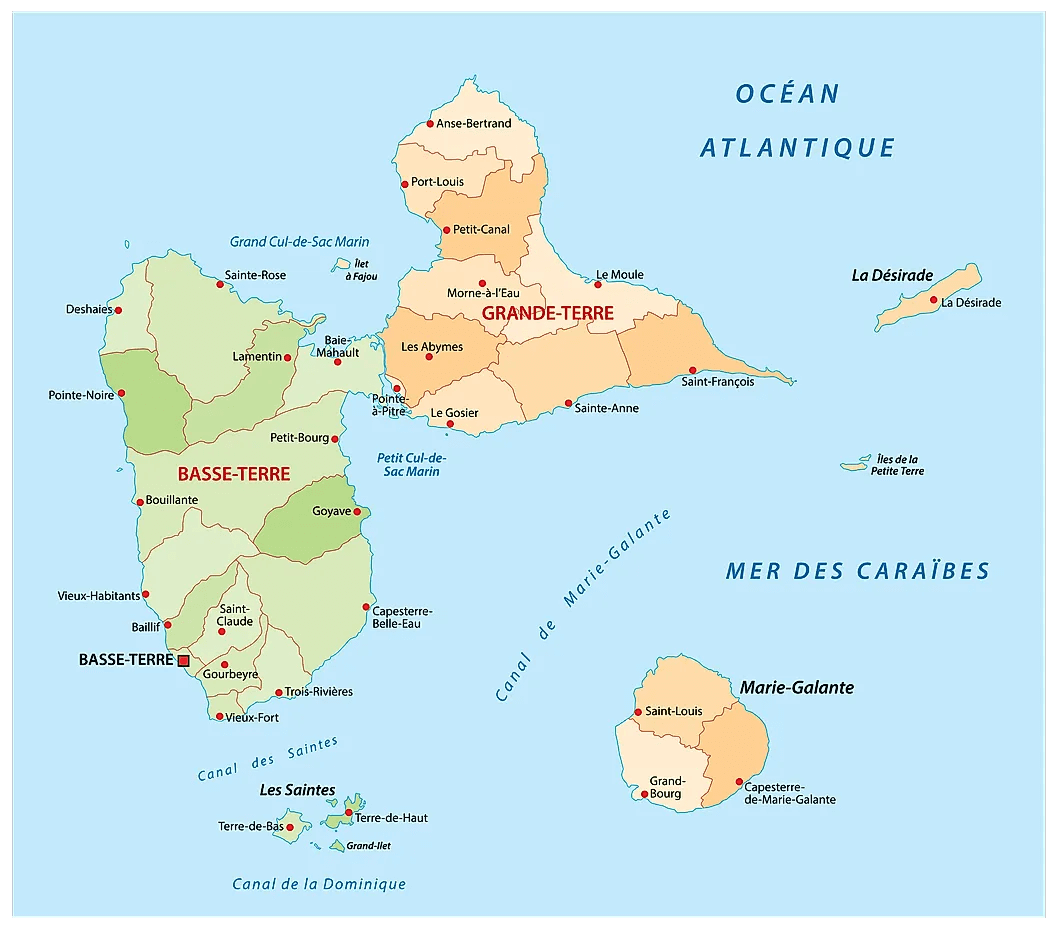
Guadeloupe Political Map
Relief Map of Guadeloupe with Islands and Elevation
Relief map of Guadeloupe showing terrain, mountains, and surrounding islands.This relief map of Guadeloupe highlights the island’s varied topography, including mountains, rivers, and coastal plains. It shows the main islands—Basse-Terre, Grande-Terre, Marie-Galante, Les Saintes, and La Désirade—along with elevations and key towns across the Caribbean archipelago.
Brief information about Guadeloupe
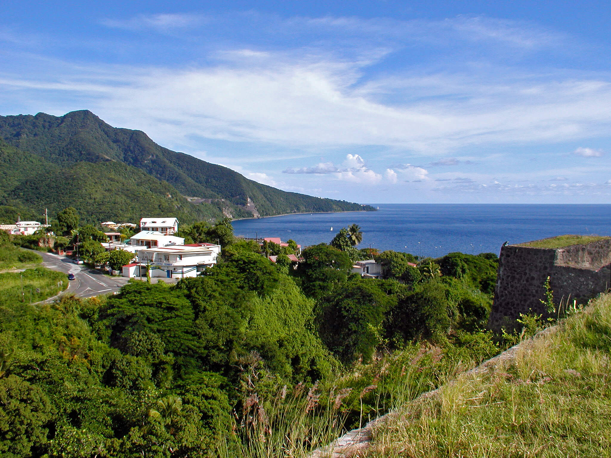
Guadeloupe, a French overseas territory in the Caribbean, is a stunning archipelago renowned for its diverse landscapes and vibrant Creole culture. Shaped like a butterfly, its two main islands, Grande-Terre and Basse-Terre, offer a mix of pristine beaches, lush rainforests and volcanic peaks. Visitors flock to the island to hike in Guadeloupe National Park, relax on the white sands of Sainte-Anne or marvel at the active Soufrière volcano.
As well as its natural beauty, Guadeloupe is celebrated for its unique blend of French and Caribbean influences. The local cuisine is a flavourful fusion of spices, with dishes such as colombo (a curry-style stew) and fresh seafood. With warm hospitality, colourful festivals like Carnival and a laid-back island vibe, Guadeloupe is the perfect destination for those seeking both adventure and relaxation.
Where is located Guadeloupe on the World and South America Map?
 Where is located Guadeloupe on the World Map
Nestled in the eastern Caribbean, Guadeloupe is part of the Lesser Antilles archipelago. This small but picturesque archipelago lies southeast of Puerto Rico and roughly halfway between the Dominican Republic and Barbados. Its nearest neighbours are Dominica to the south and Antigua and Barbuda to the north.
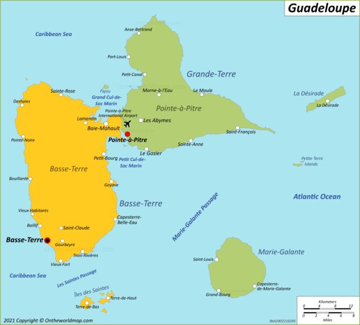
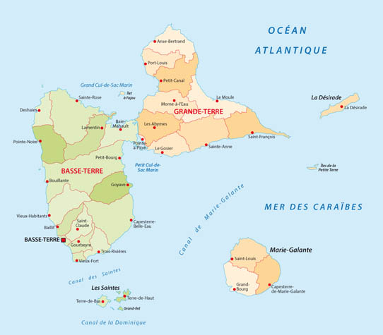
Physical Map Guadeloupe
 Physical map of Guadeloupe showing topography, roads, cities, and surrounding islands.
A detailed physical map of Guadeloupe highlighting Basse-Terre, Grande-Terre, La Désirade, Marie-Galante, and Les Saintes. It features mountains, natural parks, main roads, and major cities like Pointe-à-Pitre. The inset map provides a broader view of Guadeloupe’s location in the Caribbean.
As a French overseas territory, Guadeloupe is politically part of France, but geographically part of the Caribbean. This means that while you're exploring its lush rainforests and tropical beaches, you're technically in the European Union! It's an interesting mix of cultures, combining Caribbean charm with a touch of French sophistication.
Guadeloupe's prime location makes it a fantastic base for island-hopping adventures throughout the Caribbean. The surrounding waters are perfect for sailing, snorkelling and diving, making it a favourite for travellers seeking both relaxation and adventure in one beautiful location.
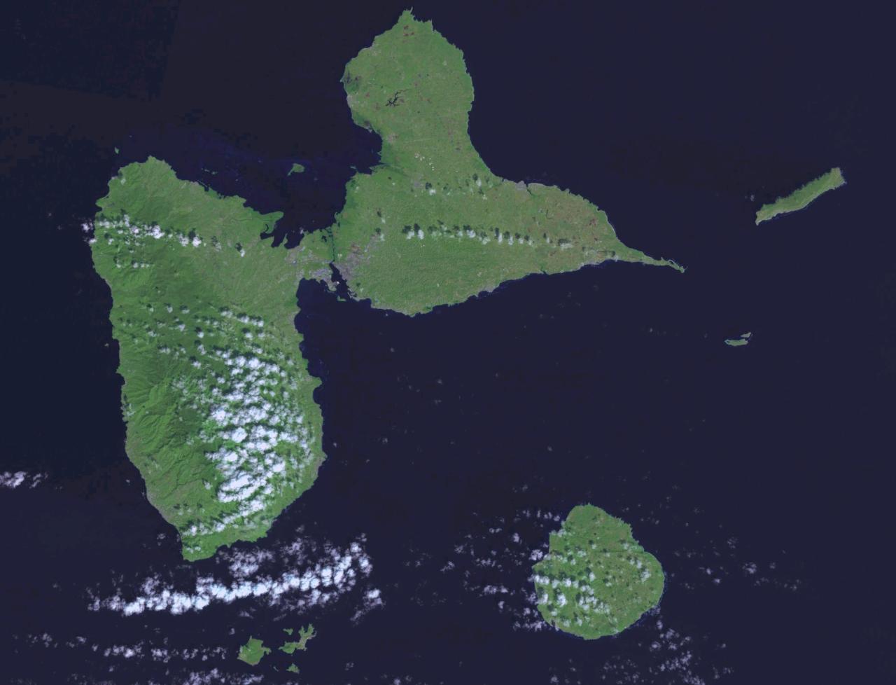
Guadeloupe satellite map
Here are some statistical information about Guadeloupe:
 Area: 1,628 km2 (629 sq mi)
 Guadeloupe road map
Guadeloupe Satellite Map

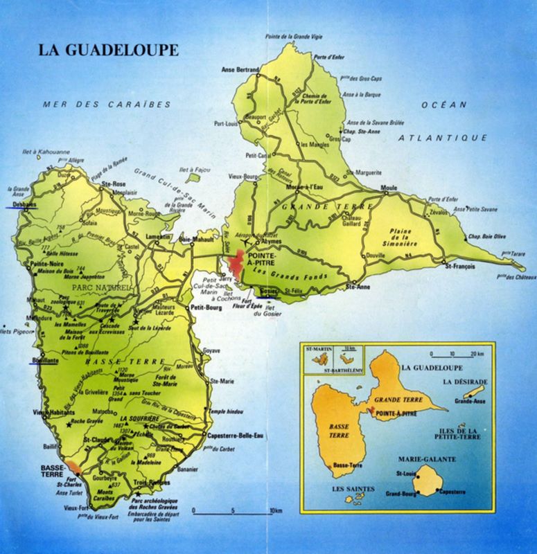
Map Guadeloupe
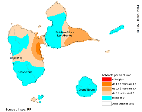
Guadeloupe population map
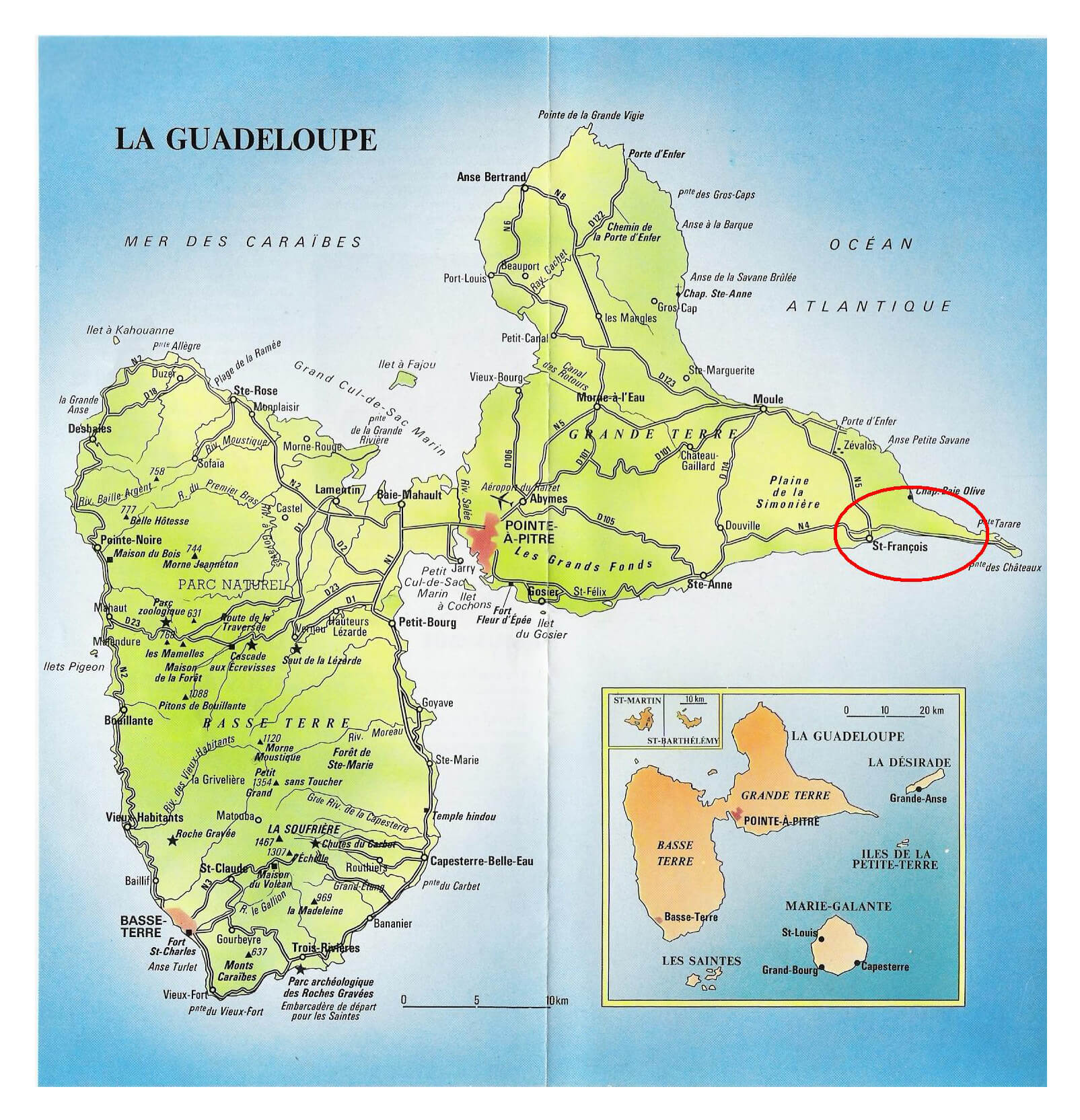
Guadeloupe Tourist Map
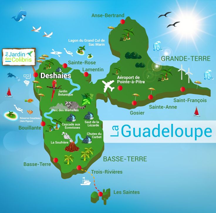 Colorful tourist map of Guadeloupe highlighting major attractions, cities, and natural landmarks.
A vibrant illustrated map of Guadeloupe, featuring key locations such as Pointe-à-Pitre Airport, Deshaies, Gosier, and Saint-François. It highlights natural attractions like La Soufrière volcano, Chutes du Carbet waterfalls, and Parc des Mamelles, along with beaches, hiking trails, and marine reserves. Perfect for travelers exploring the island's diverse landscapes and activities.
Guadeloupe Maps
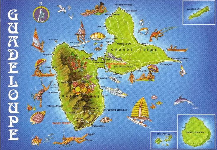 Illustrated map of Guadeloupe showing its main islands, key cities, local wildlife, and maritime activities.
A colorful illustrated map of Guadeloupe, highlighting Grande-Terre, Basse-Terre, La Désirade, Marie-Galante, and Les Saintes, along with major cities like Pointe-à-Pitre. The map features tropical wildlife, sailing, and local culture.
Guadeloupe Old Map
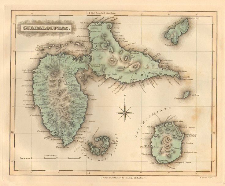 Antique map of Guadeloupe showing detailed topography, islands, and place names with a vintage cartographic style.
A historical map of Guadeloupe, featuring Basse-Terre, Grande-Terre, Marie-Galante, and surrounding islands. The map highlights mountainous terrain, rivers, and coastal features with fine cartographic details and a classic aged appearance.
Maps of Guadeloupe
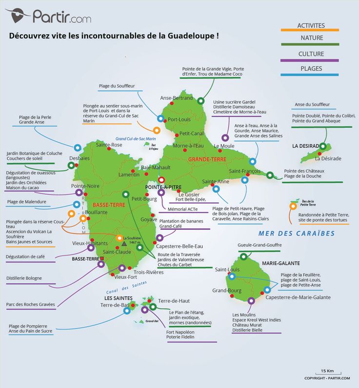 Detailed tourist map of Guadeloupe showing must-visit attractions, beaches, cultural sites, and natural landmarks.
A comprehensive travel map of Guadeloupe featuring beaches, hiking trails, cultural landmarks, and nature spots. Highlights include La Soufrière volcano, Chutes du Carbet waterfalls, Pointe-à-Pitre, Le Gosier, and Grand-Cul-de-Sac Marin. The map categorizes locations by activities, nature, culture, and beaches, making it a useful guide for travelers exploring the island.
Guadeloupe Islands Map
Guadeloupe 2021 map

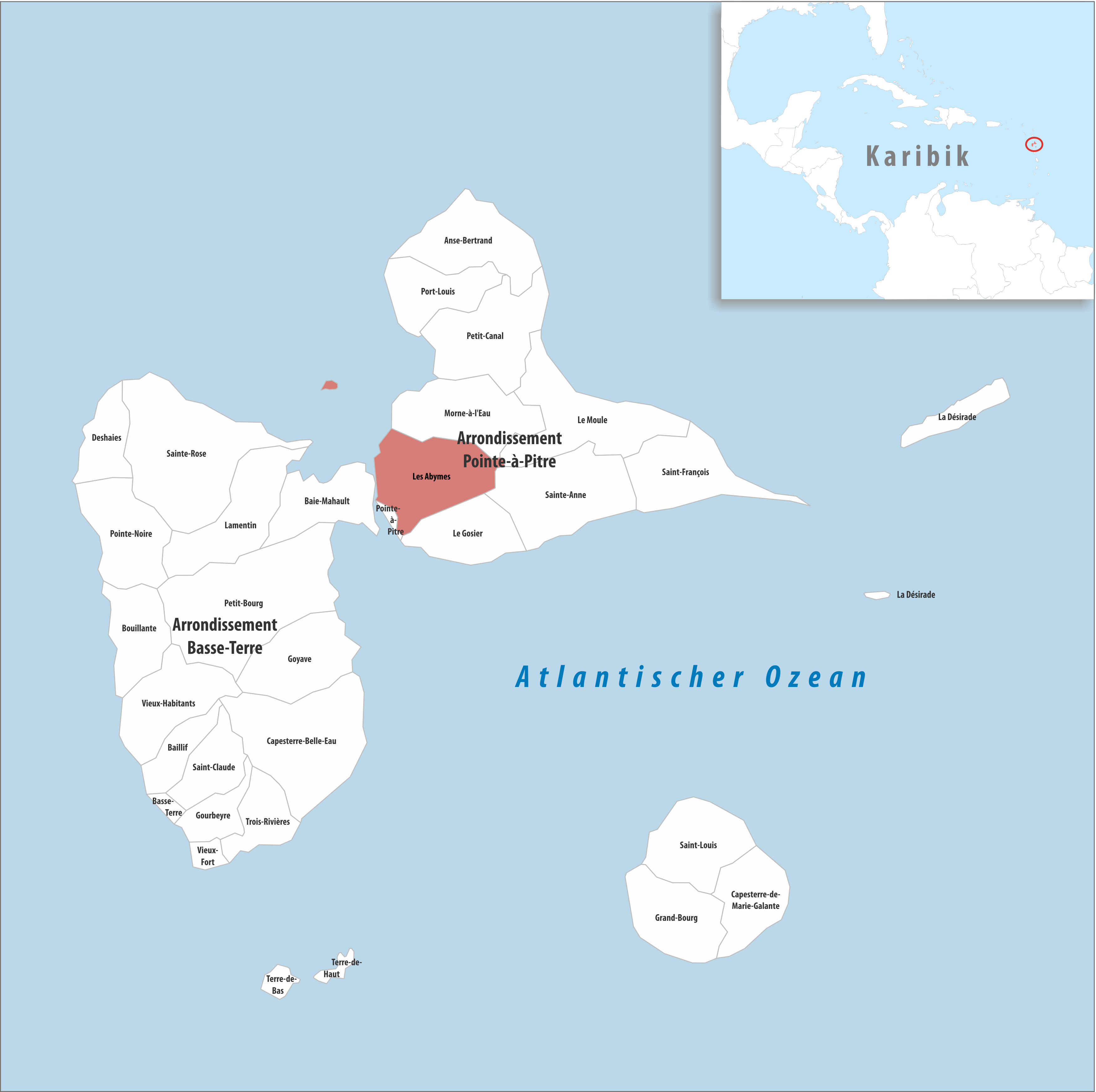
Locator map of les Abymes
Feel free to explore these pages as well:
- Head of Performance Marketing
- Head of SEO
- Linkedin Profile: linkedin.com/in/arifcagrici