Detailed Map of Madagascar: Political, Physical, and Cities Maps
Where is Madagascar Located on the World and Africa Map?
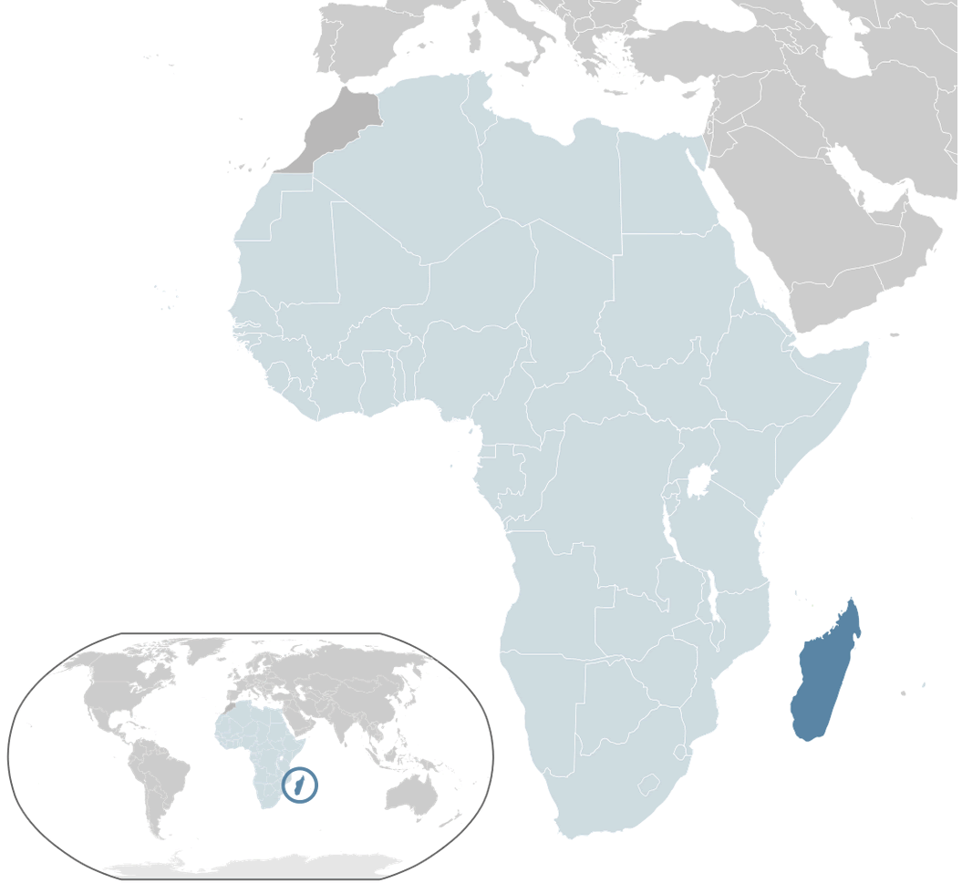
Madagascar is a large island nation in the Indian Ocean, located off the southeastern coast of Africa. Separated from mainland Africa by the Mozambique Channel, it lies east of Mozambique. As the world's fourth-largest island, Madagascar spans about 587,000 km² and features a tropical climate rich in biodiversity.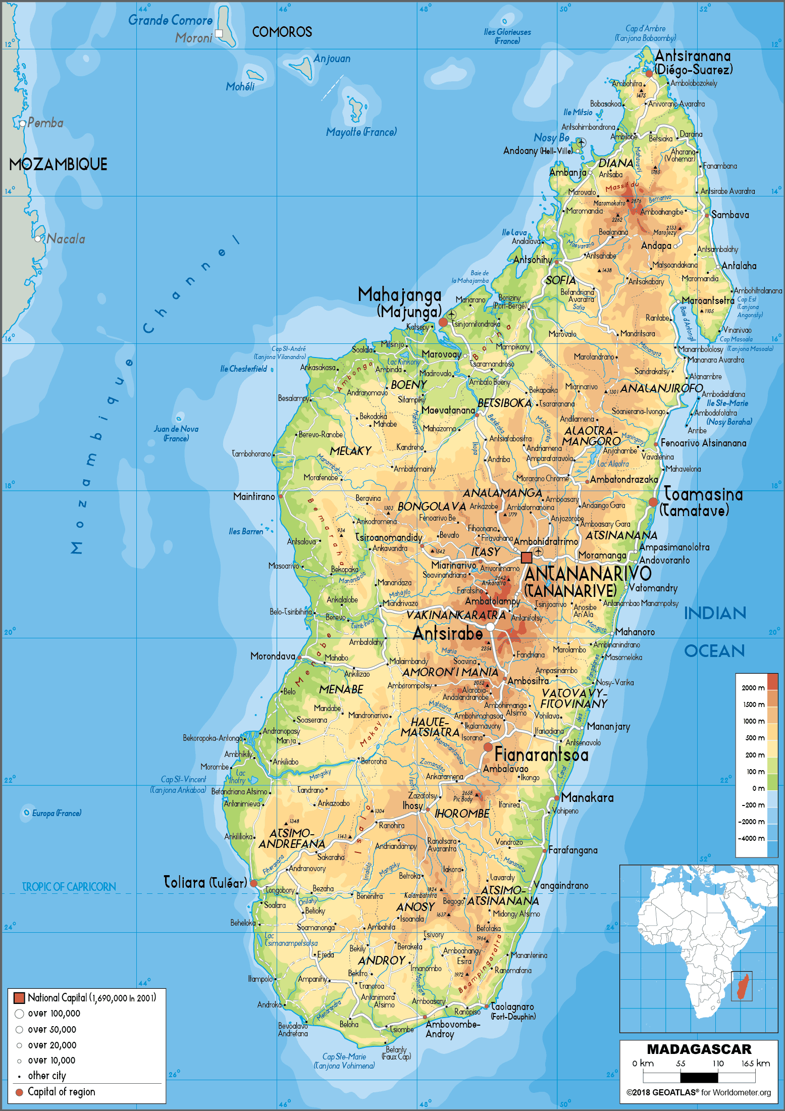
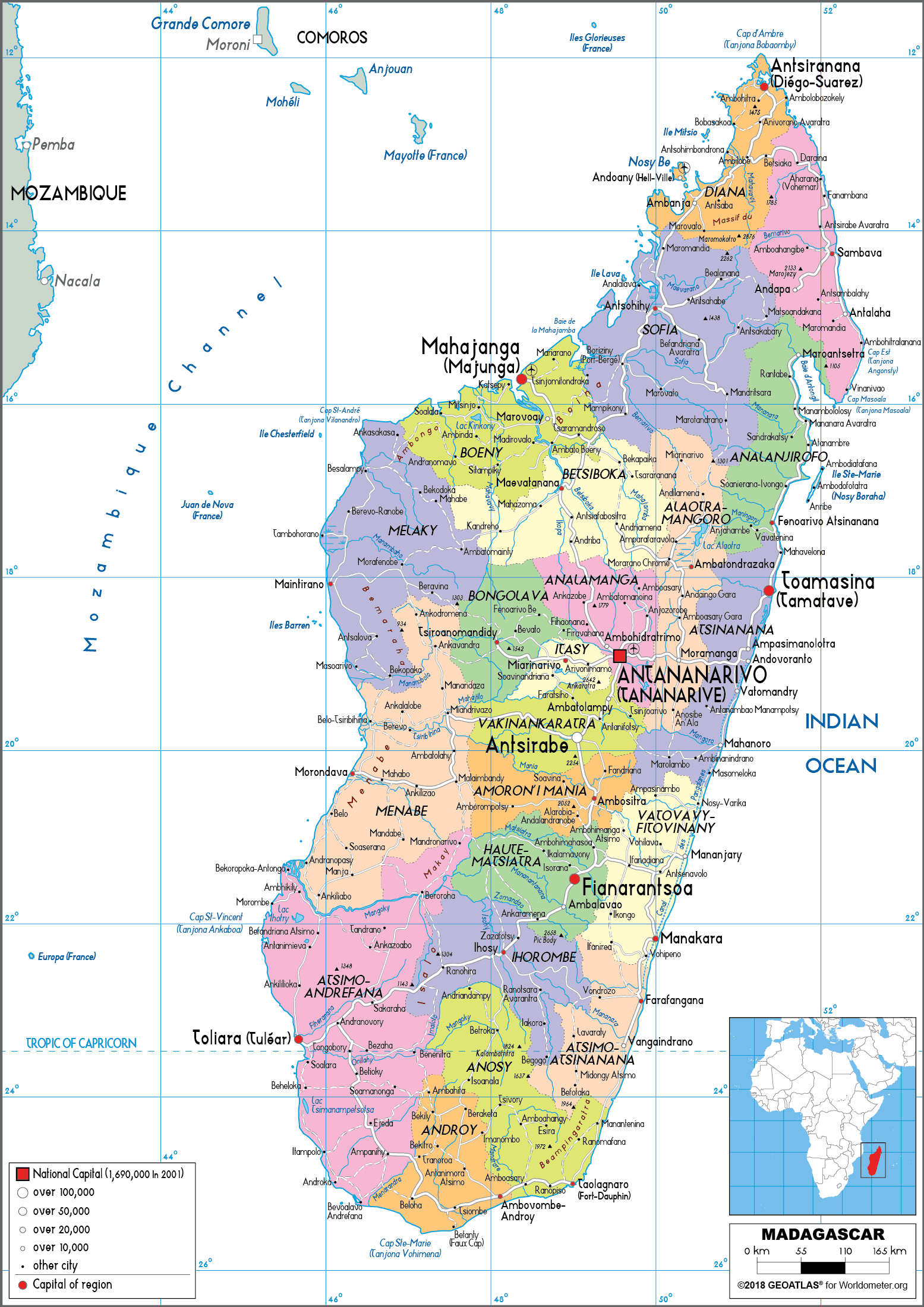
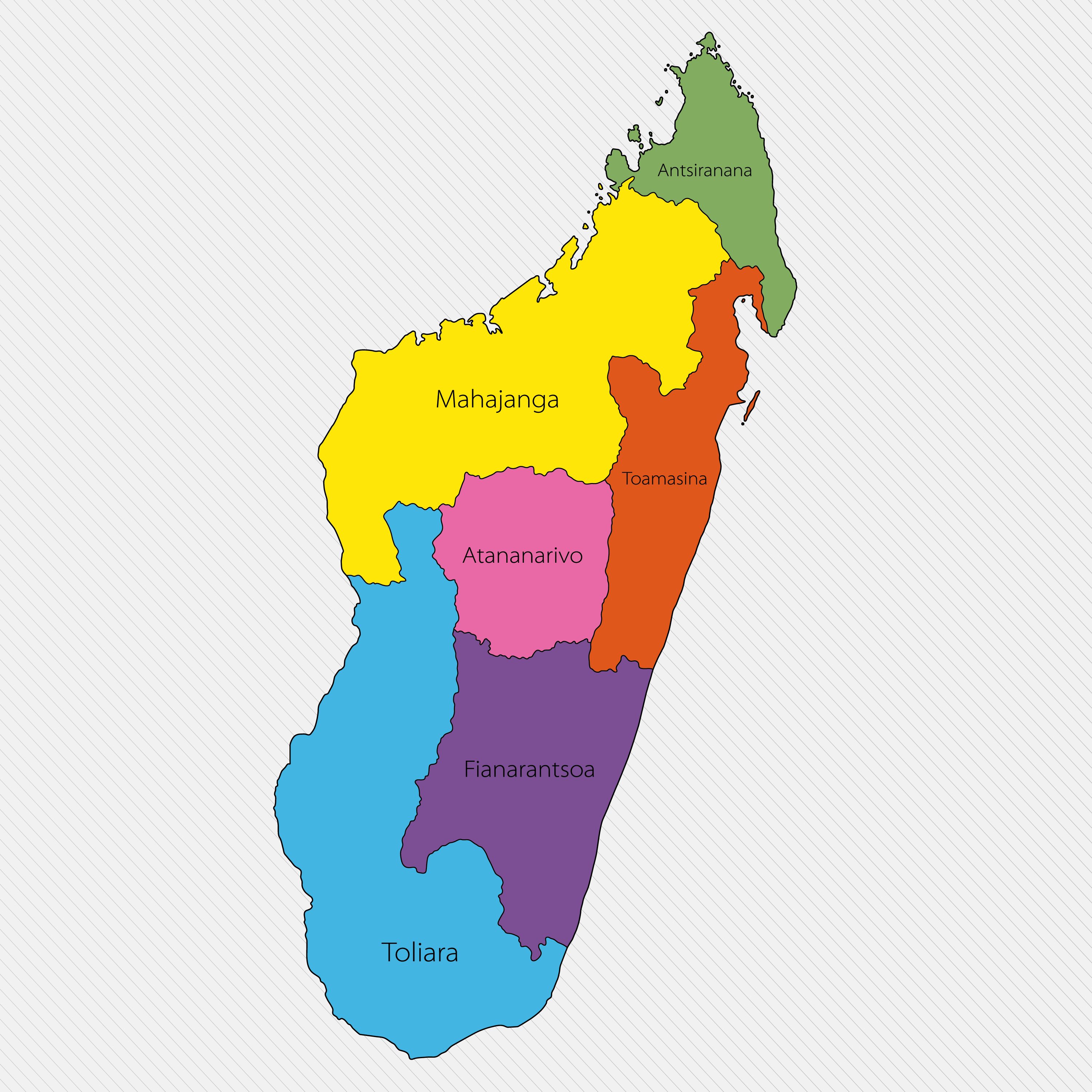
Madagascar political map
Brief information about Madagascar
Located in the Indian Ocean off the south-east coast of Africa, Madagascar is the fourth largest island in the world. Known for its extraordinary biodiversity, nearly 90% of its wildlife, including lemurs and the iconic baobab trees, is found nowhere else on Earth. Its landscapes range from dense rainforests to arid deserts and stunning coastlines, making it a dream destination for nature lovers and eco-tourists. The island is often referred to as a 'living laboratory' due to its unique ecosystems and endemic species.
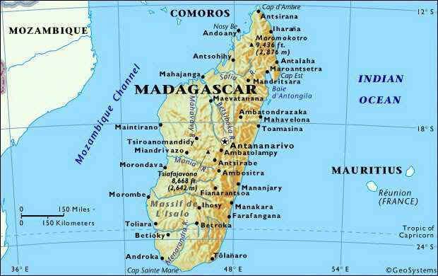
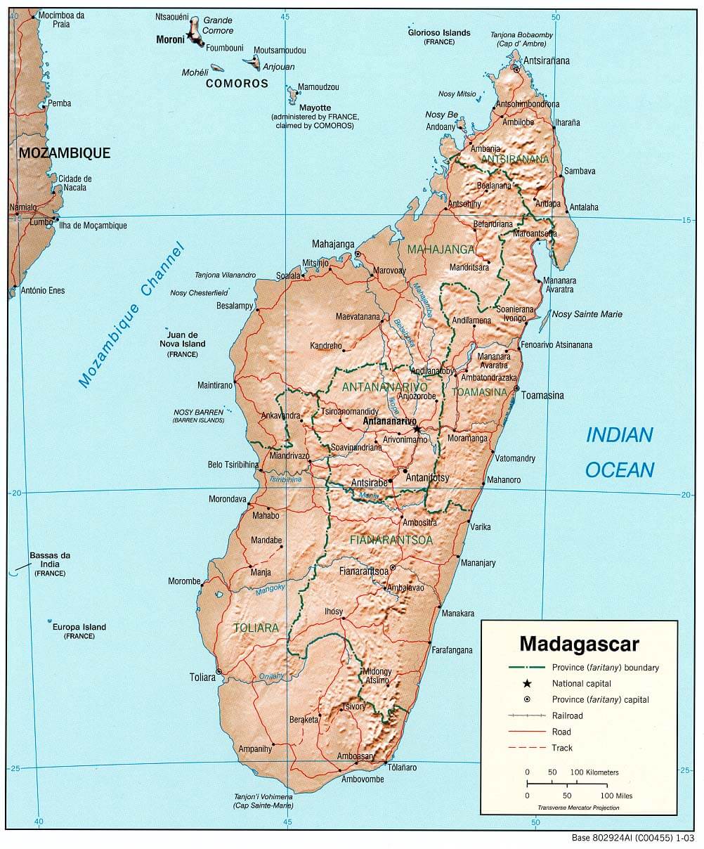
Madagascar Physical Map with Mountains, Rivers, and Cities
Physical map of Madagascar showing terrain, rivers, and major cities.This physical map of Madagascar highlights its diverse geography, including high plateaus, coastal plains, and mountain ranges. Major cities like Antananarivo, Toamasina, and Toliara are marked. The map also shows rivers, elevation levels, and surrounding islands in the Indian Ocean.
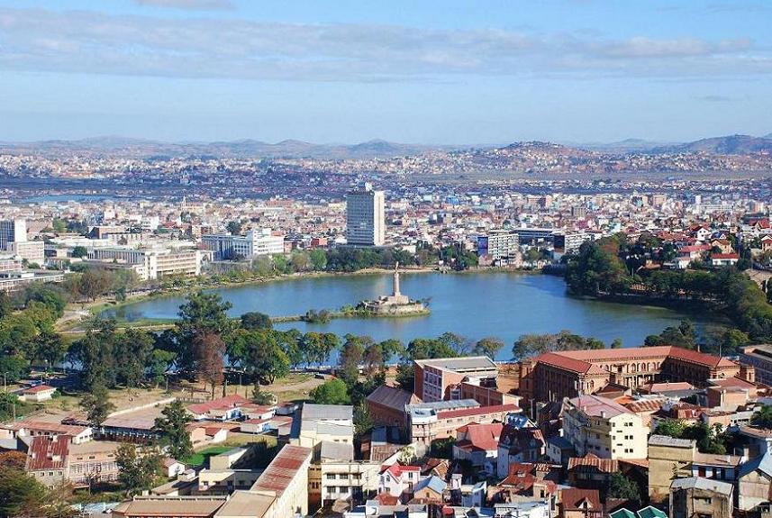
The capital, Antananarivo, is the heart of Madagascar's political and cultural life. The country's heritage reflects a blend of African, Asian and European influences in its languages, cuisine and traditions. While agriculture, particularly vanilla production, plays an important role in the economy, Madagascar faces challenges such as poverty and environmental degradation. Despite these problems, the island's natural beauty and rich culture continue to attract visitors from around the world.
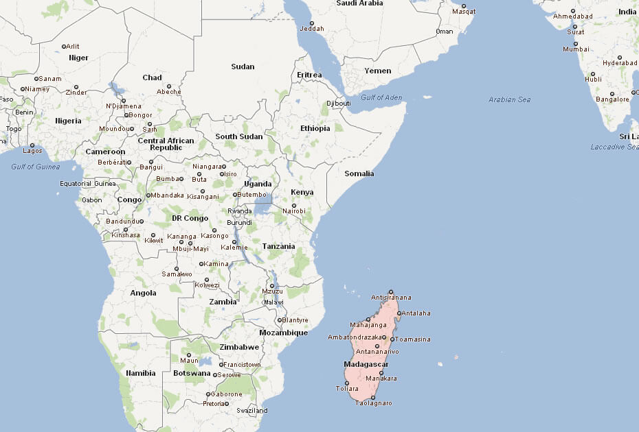
Where is located Madagascar on the World and Africa Map?
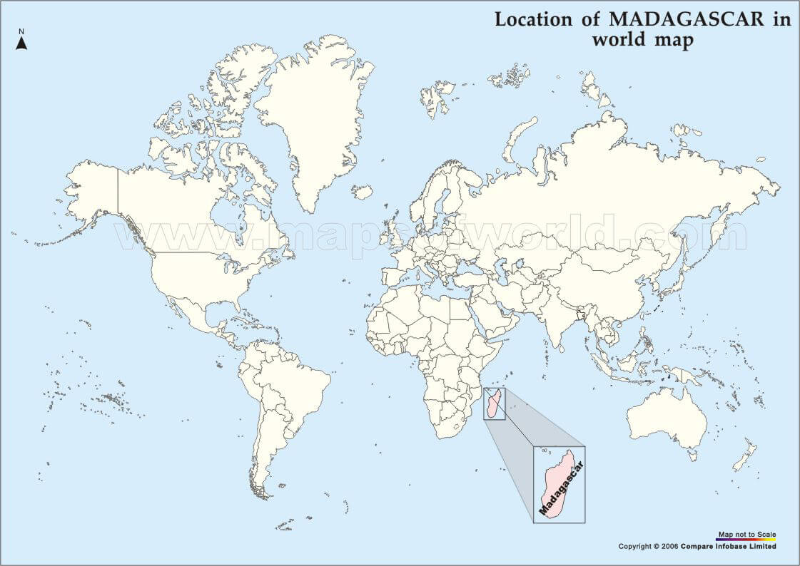
 Where is located Madagascar on the World Map
Madagascar is an island nation in the Indian Ocean, off the south-east coast of Africa. It is separated from the mainland by the Mozambique Channel and lies to the east of Mozambique. The fourth largest island in the world, Madagascar covers an area of approximately 587,000 square kilometres and is easily recognisable on the world map due to its size and distinctive shape. Located in the southern hemisphere near the Tropic of Capricorn, Madagascar enjoys a tropical climate that supports its rich biodiversity.
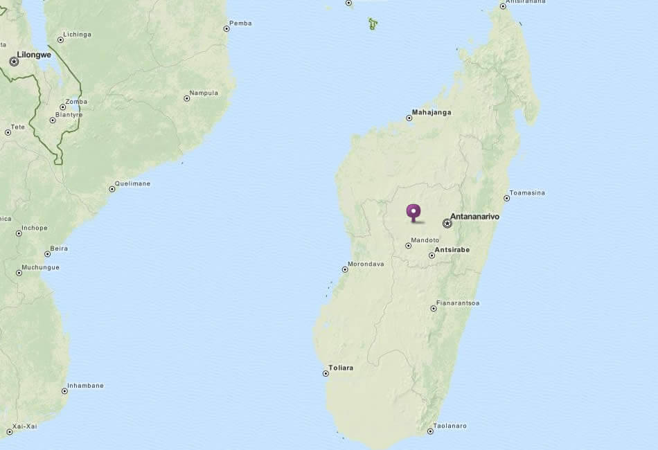
Madagascar Location Map
On the world map, Madagascar's strategic location makes it a unique geographical feature of the African region. Its proximity to the African mainland makes it part of the continent's cultural and historical narrative, yet it remains distinct in its development. The island's ecosystems, ranging from rainforest to desert, thrive on its isolation, which has allowed for a high number of endemic species, including lemurs, baobab trees and rare plants.
Madagascar's location has also influenced its history and development. The island has served as a crossroads for African, Asian and European cultures, which is reflected in its language, architecture and traditions. Despite its proximity to Africa, Madagascar's natural and cultural identity makes it a unique destination that continues to fascinate geographers, biologists and travellers alike.
Here are some statistical information about Madagascar:
 Area: 592,796 km2 (228,880 sq mi)
 Madagascar cities map
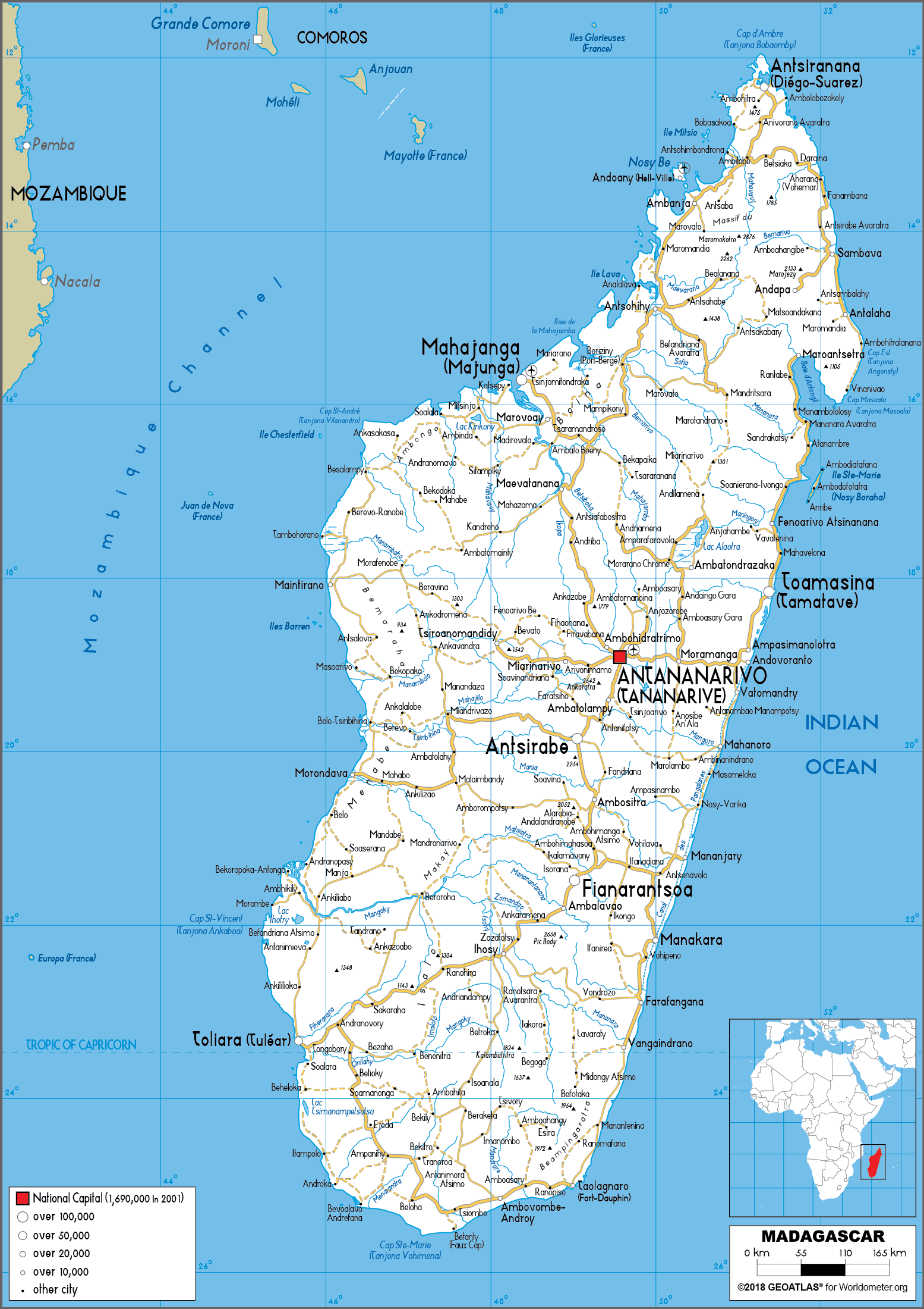
Map of Madagascar
City Map of Madagascar
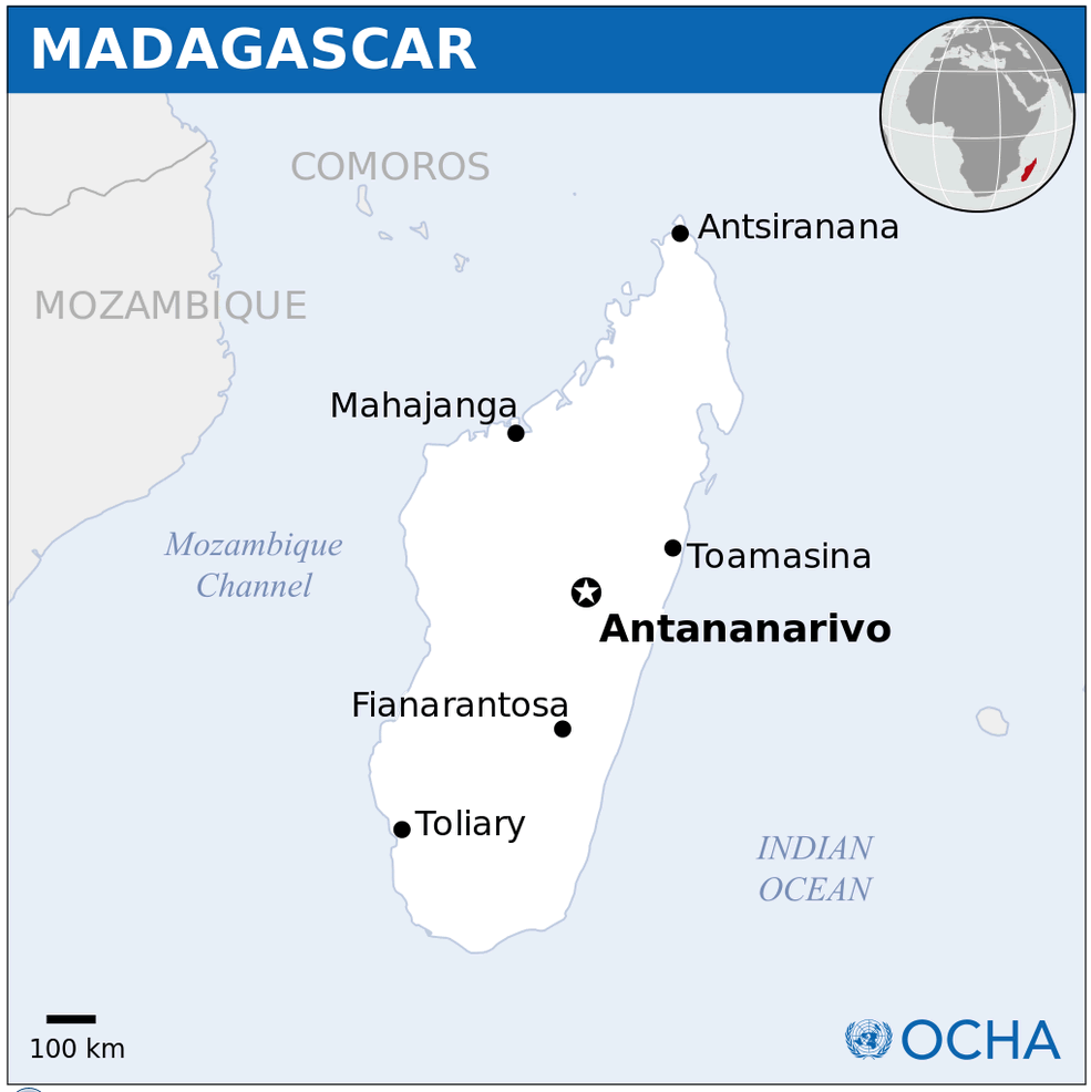
 Madagascar map showing cities, rivers, and the Mozambique Channel.
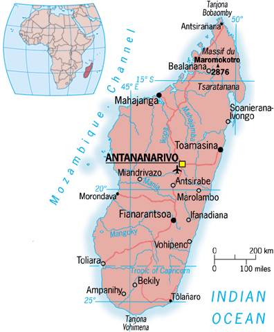
This map highlights Madagascar’s major cities, including the capital Antananarivo, and geographic features such as the Mozambique Channel and Indian Ocean coastline. It also shows prominent landmarks like the Massif du Maromokotro, the island’s highest peak.
Madagascar Map Mozambique
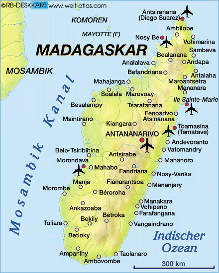
 Madagascar map with elevations, cities, and surrounding islands.
This map shows Madagascar’s physical features, including mountain ranges like the Massif du Tsaratanana and Mt. Maromokotro. It highlights key cities such as Antananarivo and coastal regions, along with nearby islands like the Comoros and Mauritius.
Madagascar Map World
Madagascar Map Antananarivo
 Madagascar map with cities, airports, and surrounding waters.
This map displays Madagascar’s key cities, including Antananarivo, and major airports such as Nosy Be and Toamasina. It highlights the island’s geographical position between the Mozambique Channel and the Indian Ocean.
Madagascar Map Indian Ocean
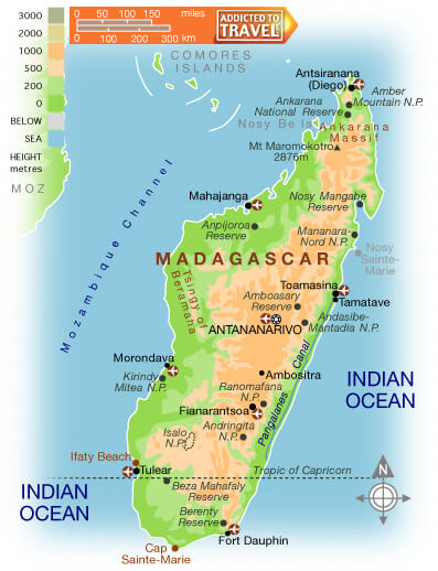 Madagascar map showing cities, national parks, and the Indian Ocean.
This map highlights Madagascar's natural reserves, including Andringitra and Masoala, along with cities like Antananarivo and Antsiranana. It showcases major geographic features such as Mt. Maromokotro, the Mozambique Channel, and the surrounding Indian Ocean.
Madagascar Relief Map
Map of Madagascar Africa
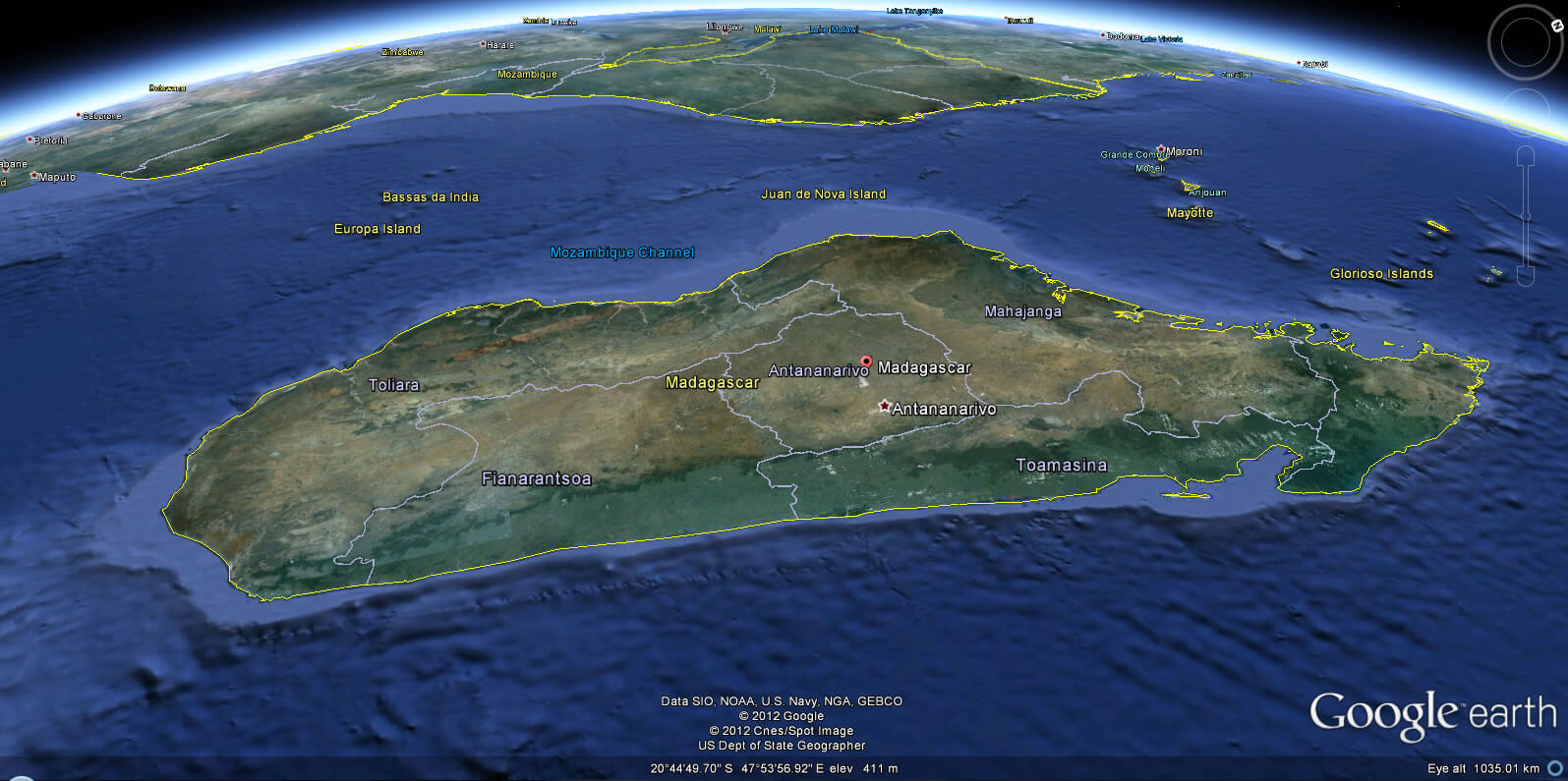
Madagascar Earth Map
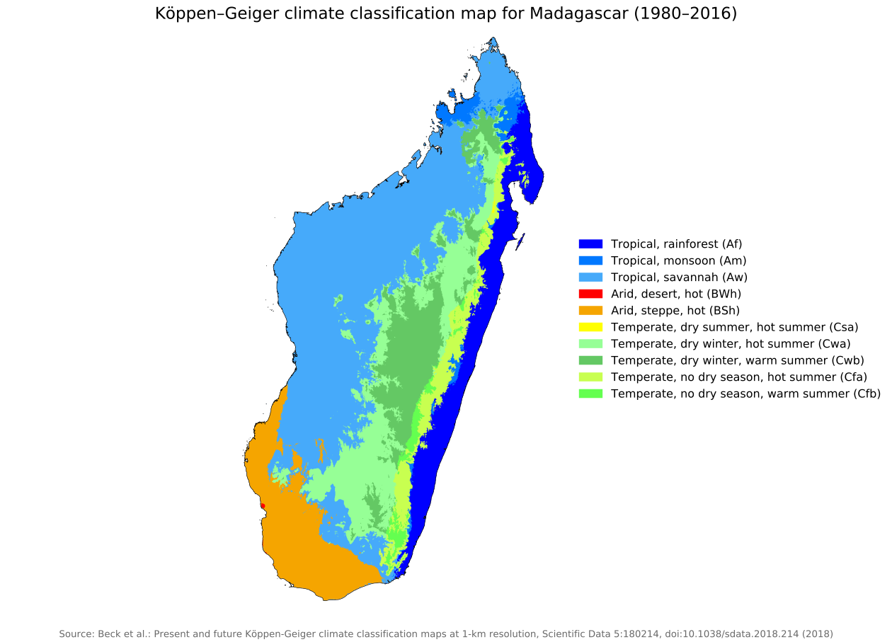
Koppen geiger Madagascar climate map
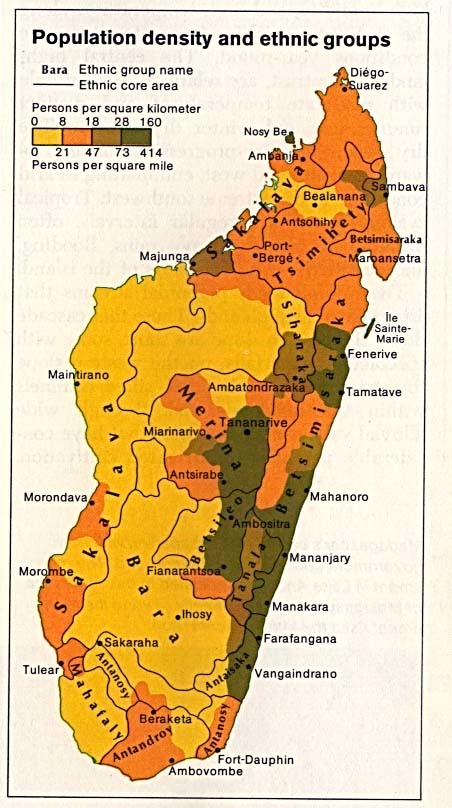
Madagascar population map
Madagascar road map
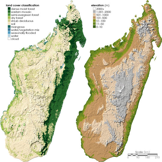
Madagascar topography map
Feel free to explore these pages as well:
- Head of Performance Marketing
- Head of SEO
- Linkedin Profile: linkedin.com/in/arifcagrici