Printable Map of Lesotho: Political, Physical, and Cities Maps
Where is Lesotho Located on the World and Africa Map?
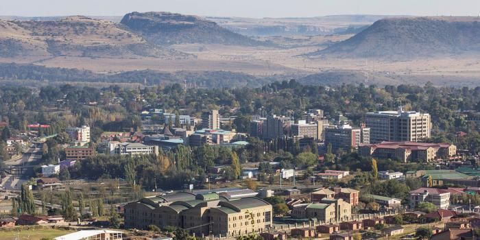
Lesotho is a small landlocked country in southern Africa, entirely surrounded by South Africa. Often called the "Kingdom in the Sky," Lesotho is the only nation on Earth with all its land above 1,000 meters (3,281 feet). Its breathtaking landscape features the Maloti and Drakensberg mountain ranges.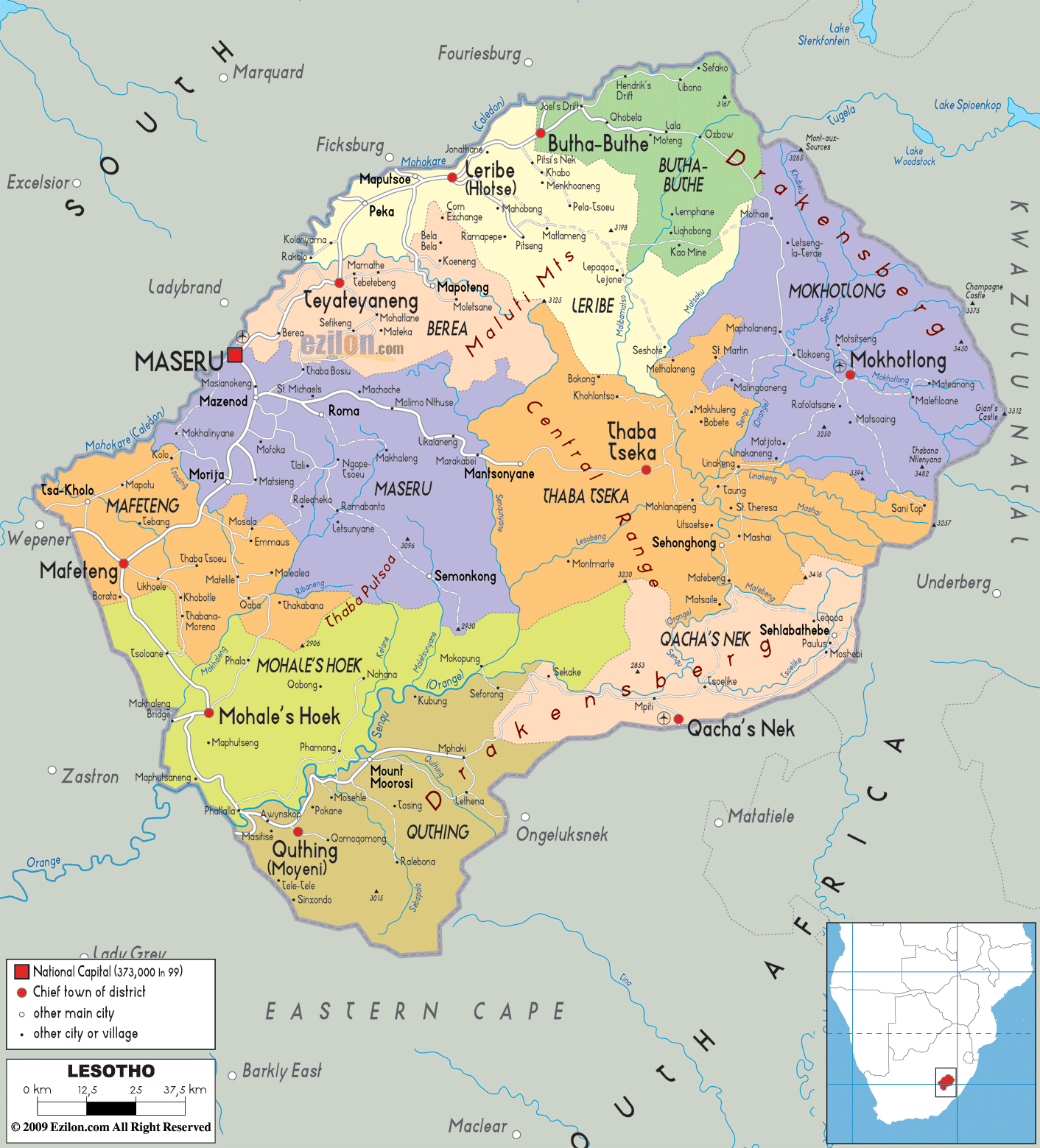
Lesohto Map
 Map of Lesotho showing regions, cities, and surrounding South Africa.
This map highlights Lesotho's administrative regions, major cities like Maseru, and key geographical features. It shows the country's borders entirely surrounded by South Africa, emphasizing its status as an enclaved nation in Southern Africa.
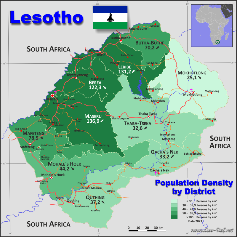
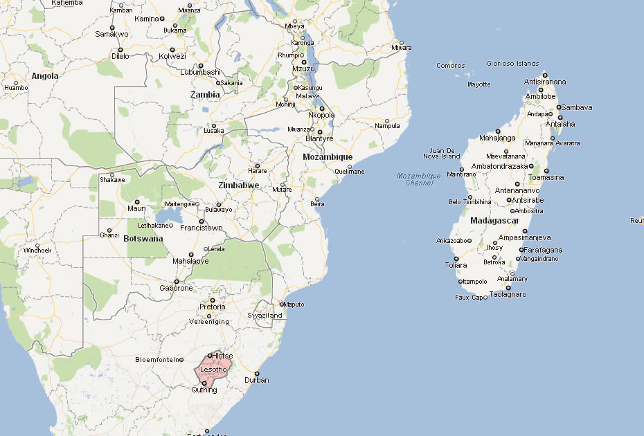
Lesotho population map
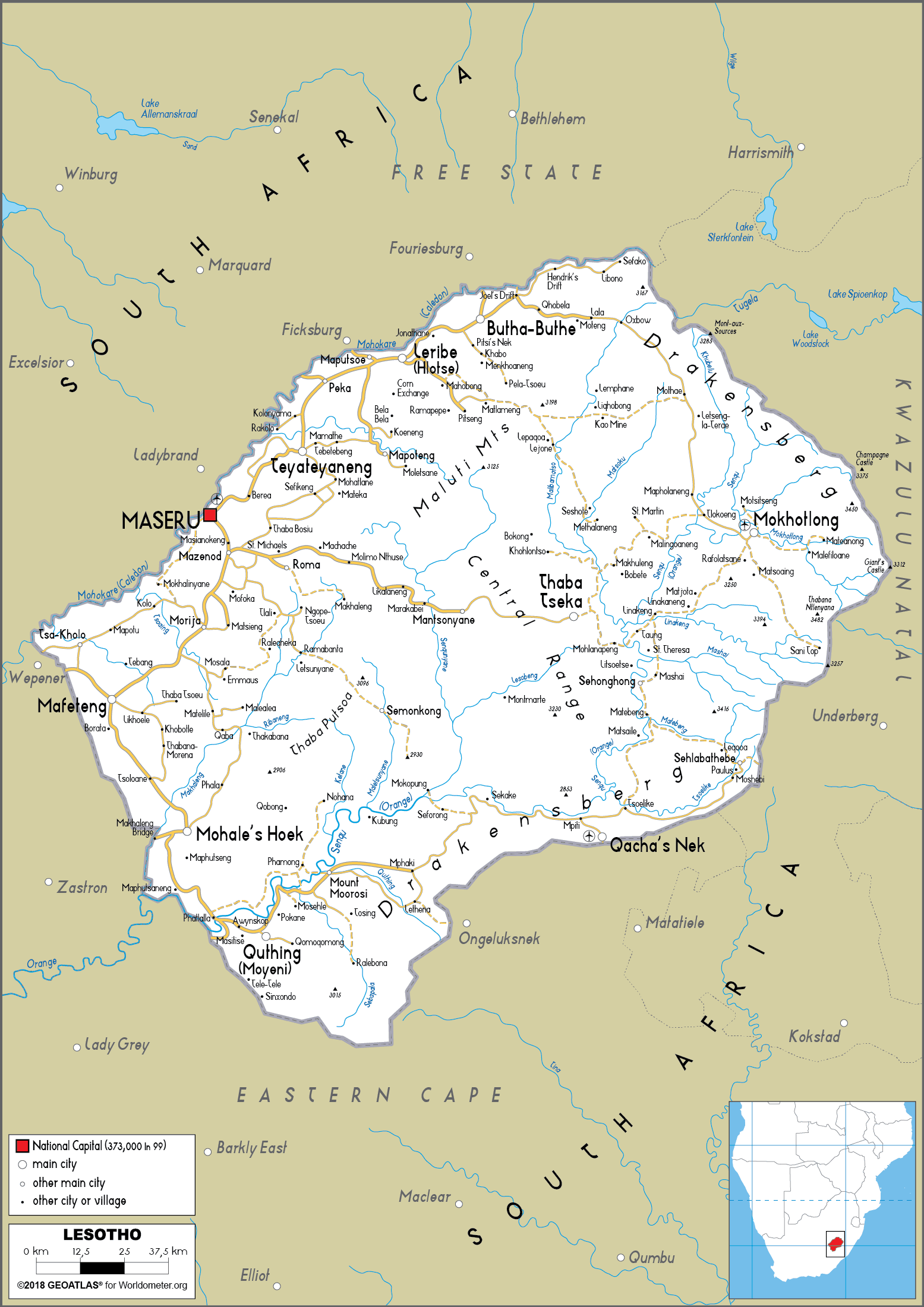
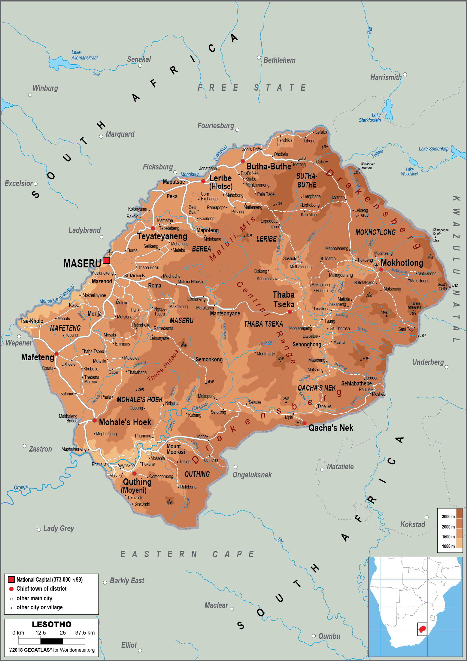
Political Map of Lesotho with Districts and Major Towns
Political map of Lesotho showing districts, borders, and major cities.This political map of Lesotho highlights the country's districts, main towns, and boundaries. The capital city, Maseru, lies along the western border with South Africa. Lesotho’s ten districts, including Leribe, Mafeteng, and Quthing, are marked in distinct colors, showing the nation’s administrative divisions.
Brief information about Lesotho
Lesotho, officially known as the Kingdom of Lesotho, is a small, landlocked country in southern Africa. Completely surrounded by South Africa, it's often referred to as the 'Kingdom in the Sky' because of its high-altitude landscapes. Lesotho is the only country in the world to be entirely above 1,000 metres (3,281 feet), with stunning mountains, plateaus and rivers.
The capital, Maseru, serves as the political and economic centre. Lesotho is known for its rich culture, including traditional Basotho blankets and pony trekking. It's also famous for its natural beauty, with attractions such as the Maloti-Drakensberg Mountains, Sehlabathebe National Park and Katse Dam.
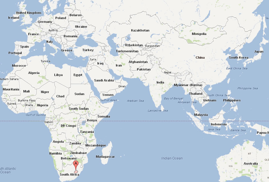
Where is located Lesotho on the World and Africa Map?
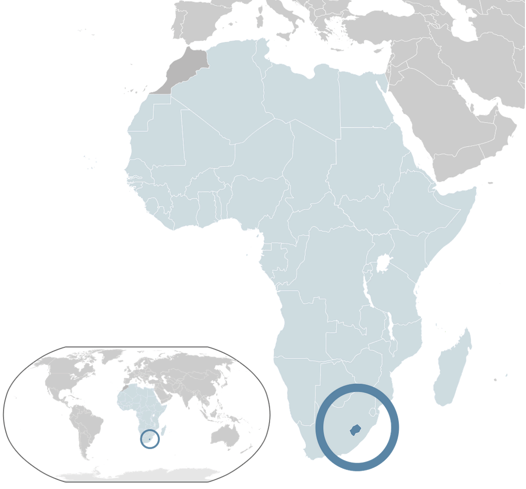 Where is located Lesotho on the World Map
Lesotho, a small landlocked country in southern Africa, is completely surrounded by South Africa, making it one of the few enclaved nations in the world. Known as the 'Kingdom in the Sky', Lesotho's unique geography is defined by its high altitude, with no part of the country below 1,000 metres (3,281 feet). This stunning mountainous terrain includes the Maloti and Drakensberg ranges, which dominate the landscape and contribute to its distinct natural beauty.
Lesotho Location Map
On the world map, Lesotho lies just south of the Tropic of Capricorn, nestled in the southeastern region of South Africa. Despite its small size, Lesotho stands out due to its elevated position and rugged geography. Its capital, Maseru, lies close to the western border and serves as a gateway for trade and cultural exchange with South Africa.
Lesotho's highlands are home to dramatic plateaus, rivers and waterfalls that attract adventurers and nature lovers. Iconic sites such as Sehlabathebe National Park and Katse Dam highlight the country's commitment to preserving its environment. With its rich Basotho culture, breathtaking scenery and strategic location, Lesotho offers a unique blend of tradition and natural wonder.
Here are some statistical information about Lesotho:
 Area: 30,355 km2 (11,720 sq mi)
 Lesotho road map
 Per capita: $1,110 (2023 estimate)
 Map of Lesotho
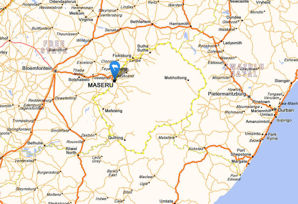
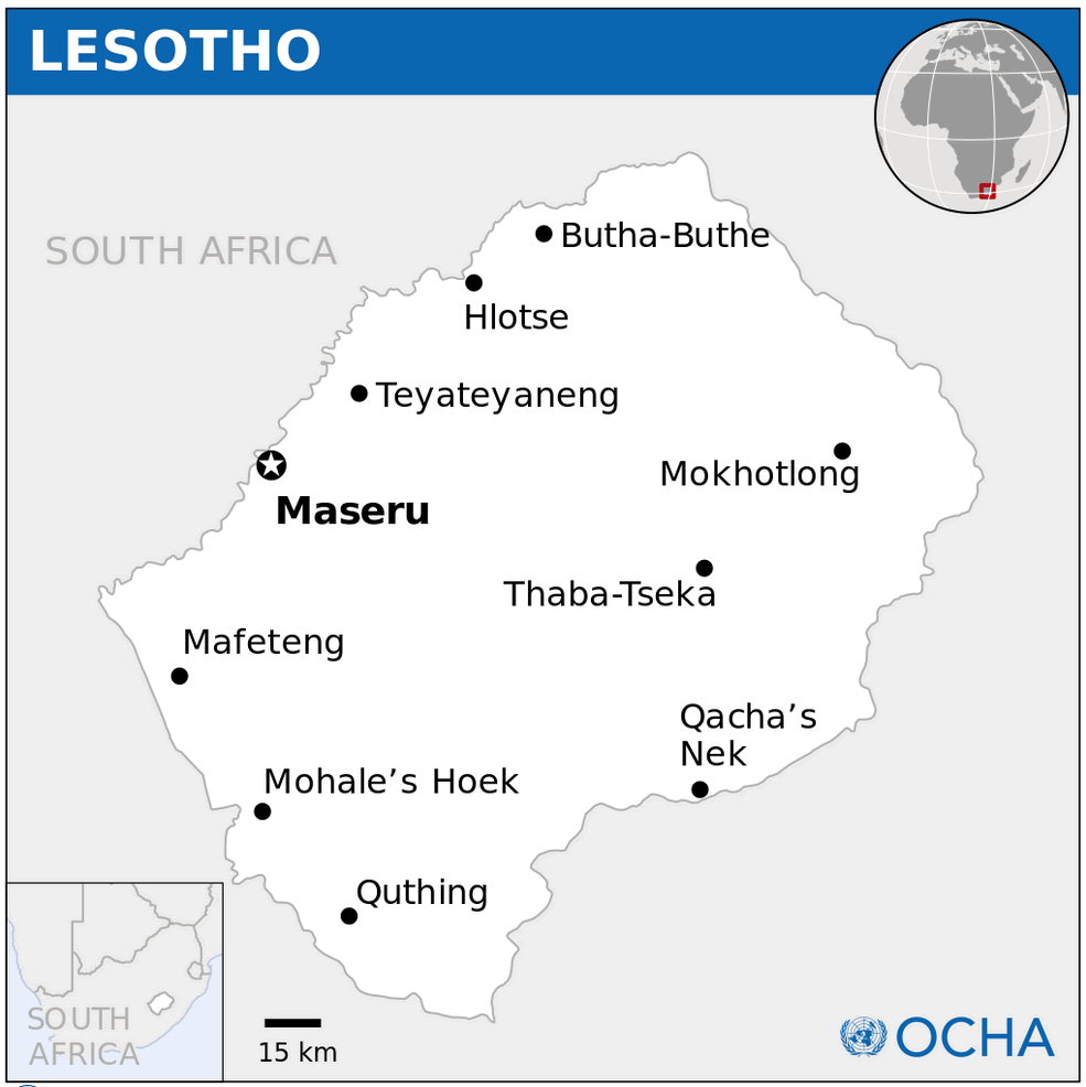
Lesotho Cities Map
 Lesotho map showing cities, rivers, and borders with South Africa.
This map outlines Lesotho’s major cities, including the capital Maseru, as well as key geographic features like rivers and mountain ranges. It emphasizes Lesotho’s landlocked position entirely surrounded by South Africa.
Lesotho Map South Africa
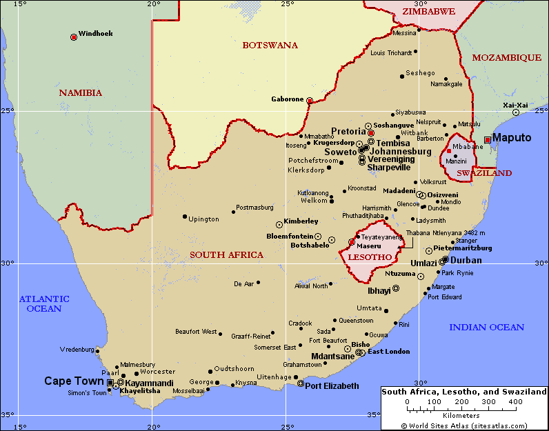 Map of Lesotho within Southern Africa showing neighboring countries.
This map places Lesotho in the broader context of Southern Africa, surrounded entirely by South Africa. It also highlights nearby countries like Namibia, Botswana, Zimbabwe, and Mozambique, along with key cities like Johannesburg and Cape Town.
Map of Lesotho Africa
Map of Lesotho World
Lesotho Earth Map
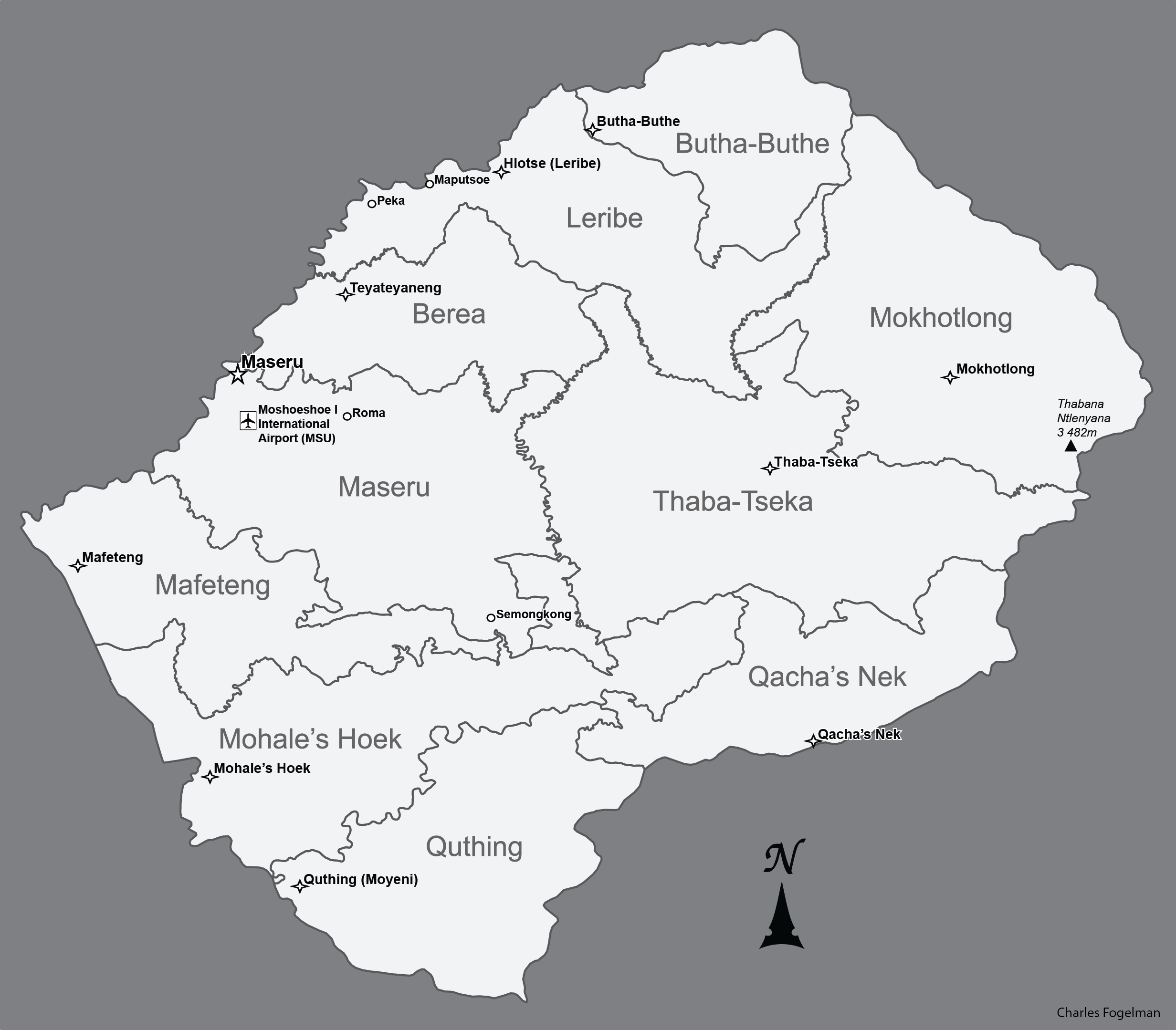
Lesotho Maps
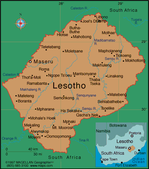
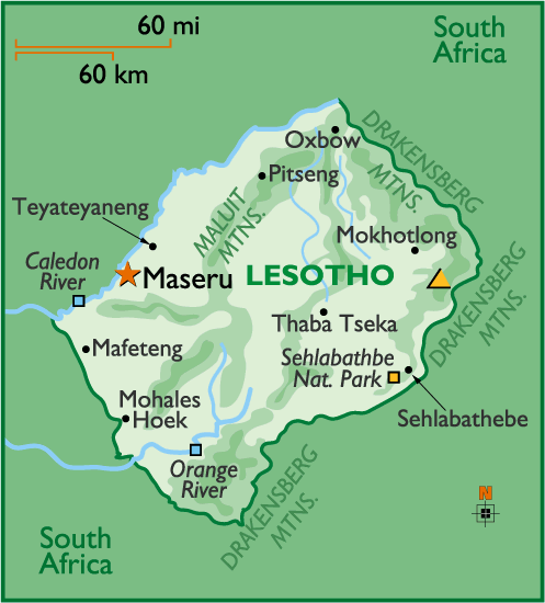 Lesotho map with cities, rivers, and mountain ranges.
This map showcases Lesotho’s key features, including its capital Maseru, major rivers like the Orange and Caledon, and the Drakensberg Mountains. It also highlights natural attractions such as Sehlabathebe National Park and surrounding South Africa.
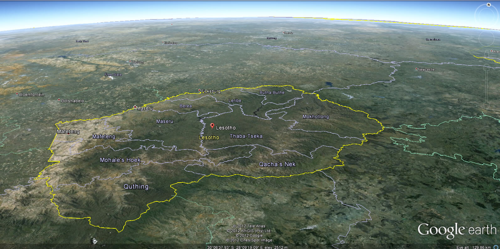
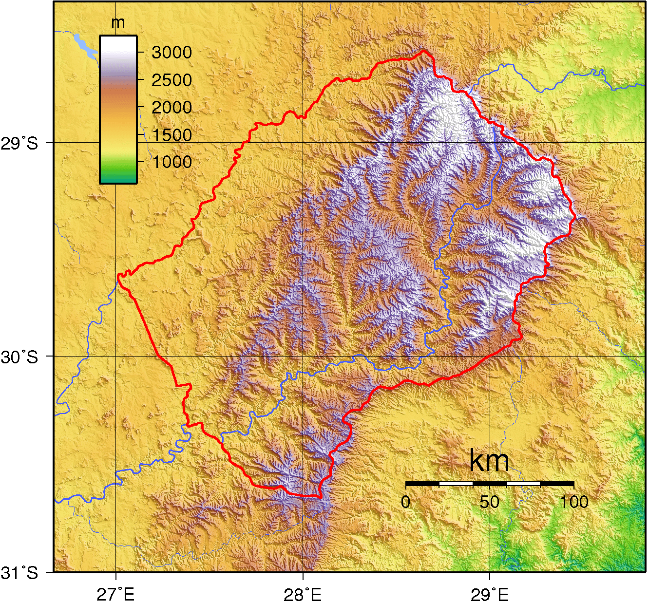
Lesotho physical map
Lesotho topography map
Map of Lesotho outlined
Feel free to explore these pages as well:
- Head of Performance Marketing
- Head of SEO
- Linkedin Profile: linkedin.com/in/arifcagrici