Printable Mauritius Map: Political, Physical, and Cities Maps
Where is Mauritius Located on the World and Africa Map?
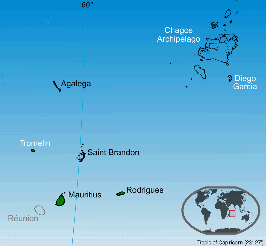
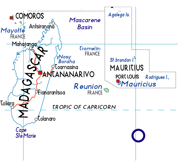
Mauritius is a small island nation in the Indian Ocean, located off the southeastern coast of Africa. It lies about 2,000 kilometers (1,200 miles) east of the African mainland and around 900 kilometers (560 miles) east of Madagascar. Part of the Mascarene Islands, Mauritius includes Rodrigues and lies near Réunion.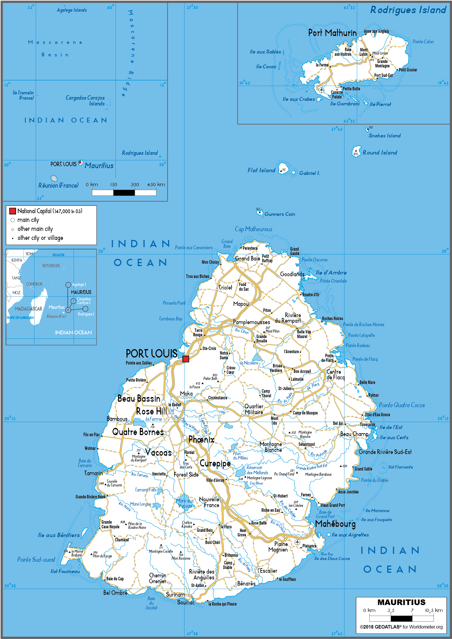
Mauritius Map
Mauritius Map Island
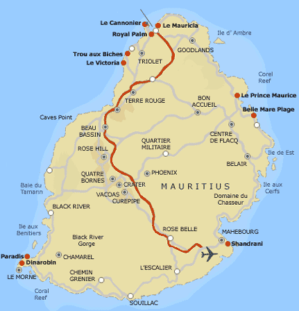 Map of Mauritius highlighting tourist resorts, cities, and main roads.
This map shows Mauritius’s main tourist destinations, including resorts like Le Cannonier and Belle Mare Plage. It highlights major towns such as Port Louis and Mahebourg, along with main roads and scenic areas like Black River Gorge and Le Morne.
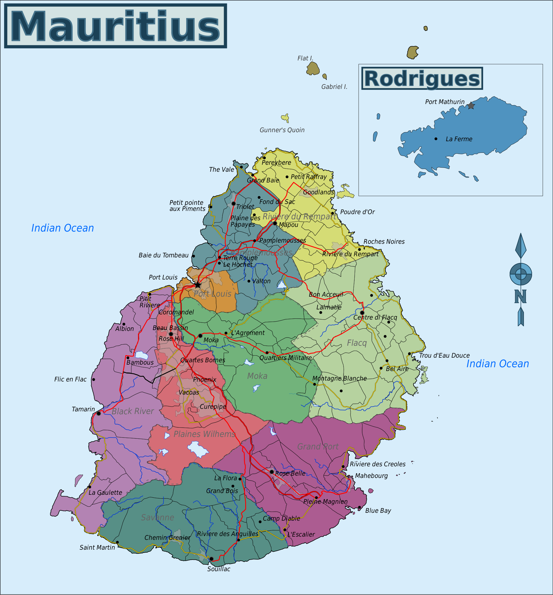
Mauritius Road Map with Major Cities and Highways
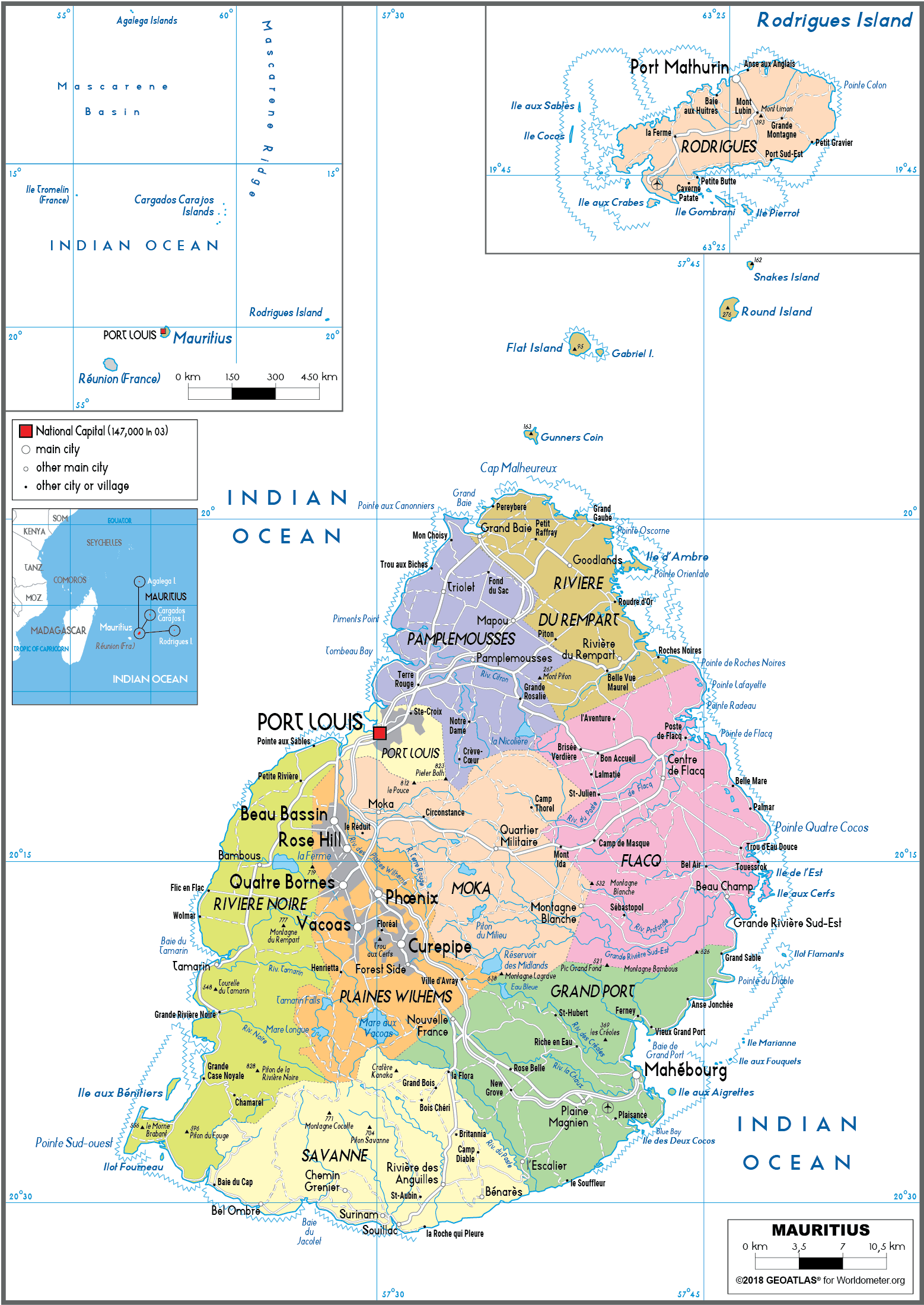
Road map of Mauritius showing main highways, towns, and Rodrigues Island.This road map of Mauritius highlights the island’s main highways, towns, and transport routes. Key cities like Port Louis, Curepipe, Quatre Bornes, and Mahebourg are marked, along with connecting roads to coastal and inland areas. The map also includes Rodrigues Island and nearby small islets.
Brief information about Mauritius
Mauritius, an island nation in the Indian Ocean, lies off the south-east coast of Africa, east of Madagascar. Famous for its pristine beaches, turquoise lagoons and vibrant coral reefs, it's a dream destination for nature lovers and beachgoers. Beyond the coastline, the island boasts volcanic mountains, lush rainforests and unique flora and fauna, including the now-extinct dodo bird, which was native to Mauritius.
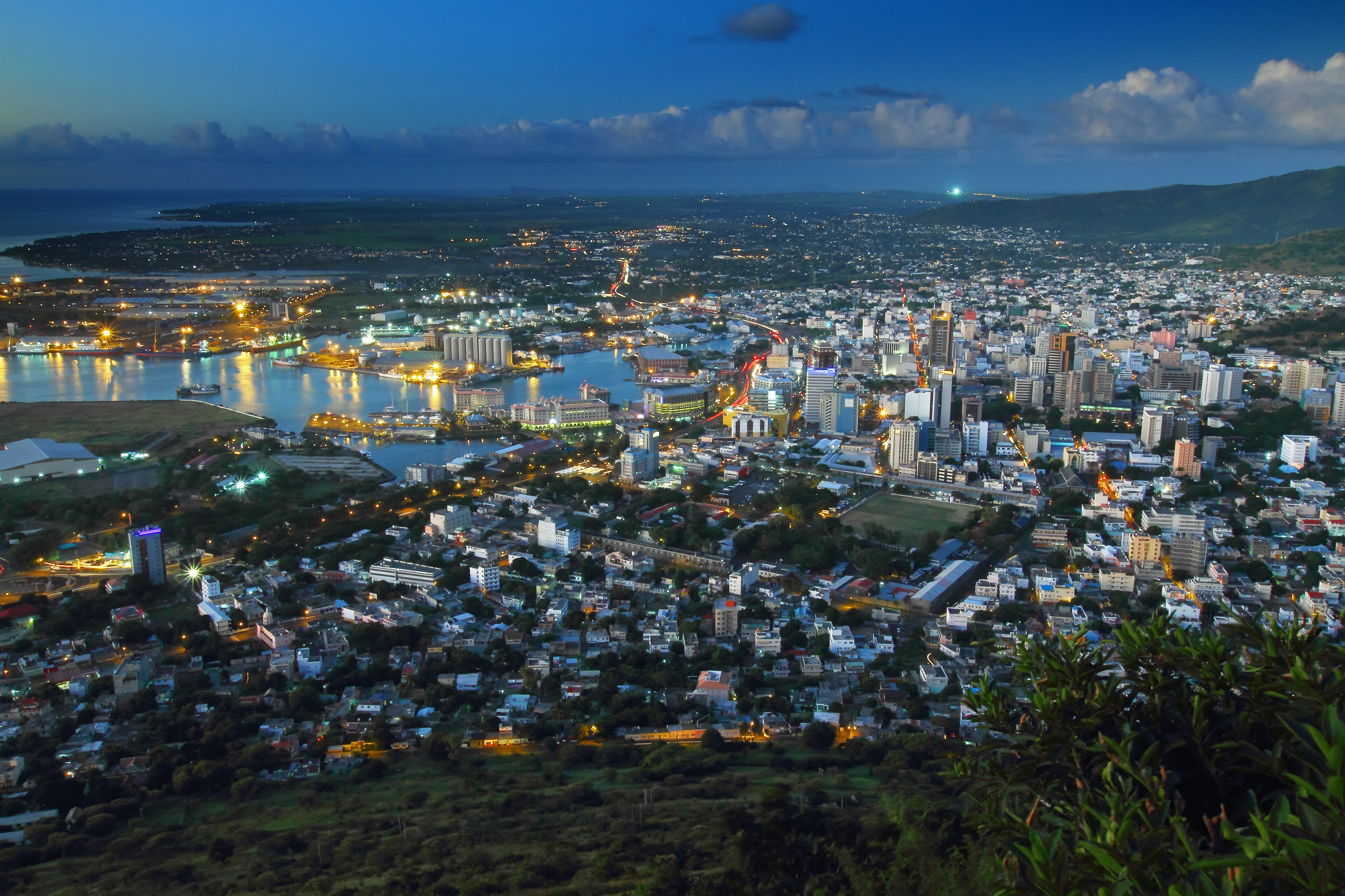
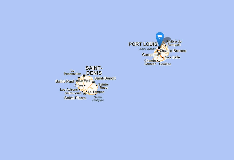
The capital, Port Louis, is a bustling centre where modern development blends with colonial history, showcasing the island's multicultural heritage. Influenced by African, Indian, European and Chinese communities, Mauritius is renowned for its diverse cuisine, festivals and languages. With a stable economy based on tourism, sugar production and textiles, Mauritius is often hailed as one of the most developed and peaceful countries in Africa, offering a perfect balance of natural beauty and cultural richness.
Where is located Mauritius on the World and Africa Map?
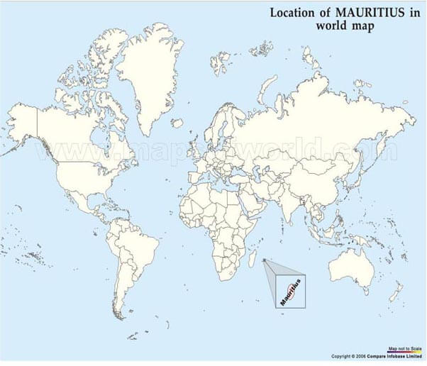
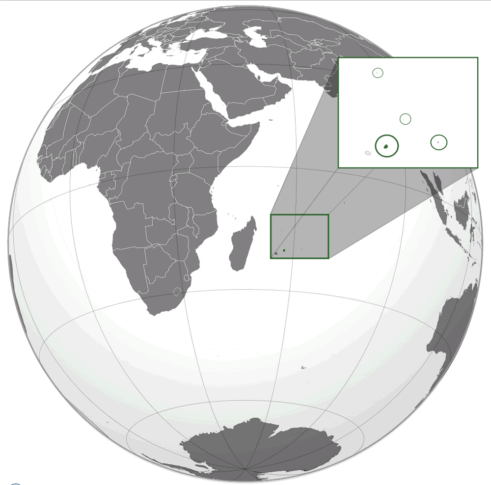 Where is located Mauritius on the World Map
Mauritius is a small island nation in the Indian Ocean, off the south-east coast of Africa. It lies about 2,000 kilometres (1,200 miles) east of the African mainland and about 900 kilometres (560 miles) east of Madagascar. The country is part of the Mascarene archipelago, a group that includes Réunion (a French overseas territory) and Rodrigues, which is also part of Mauritius.
On the world map, Mauritius is located just above the Tropic of Capricorn in the southern hemisphere, making it a tropical island with warm weather throughout the year. Its strategic location in the Indian Ocean has historically made it an important point of maritime trade and cultural exchange. Despite its small size, Mauritius' distinctive geography, including stunning beaches and coral reefs, makes it easy to spot on the map for those familiar with the region.
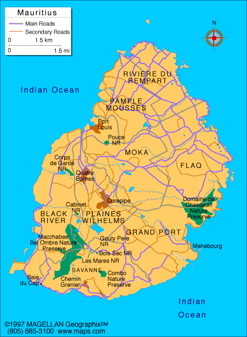
Mauritius Land Map
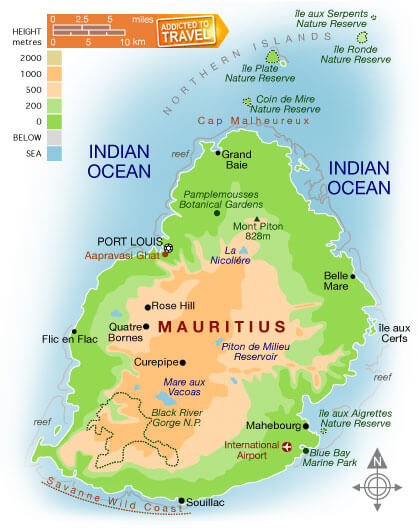 Map of Mauritius showing natural reserves, cities, and topography.
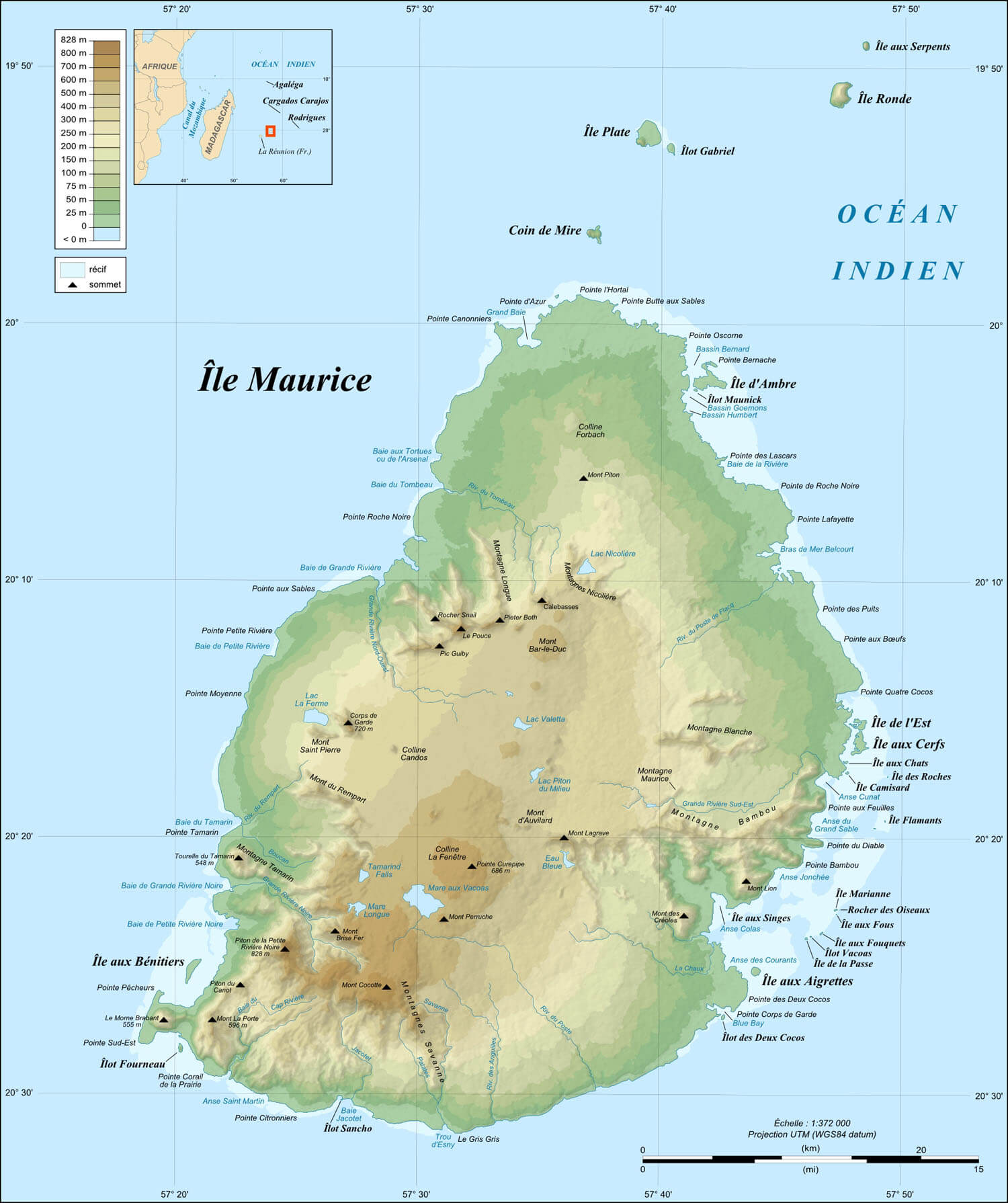
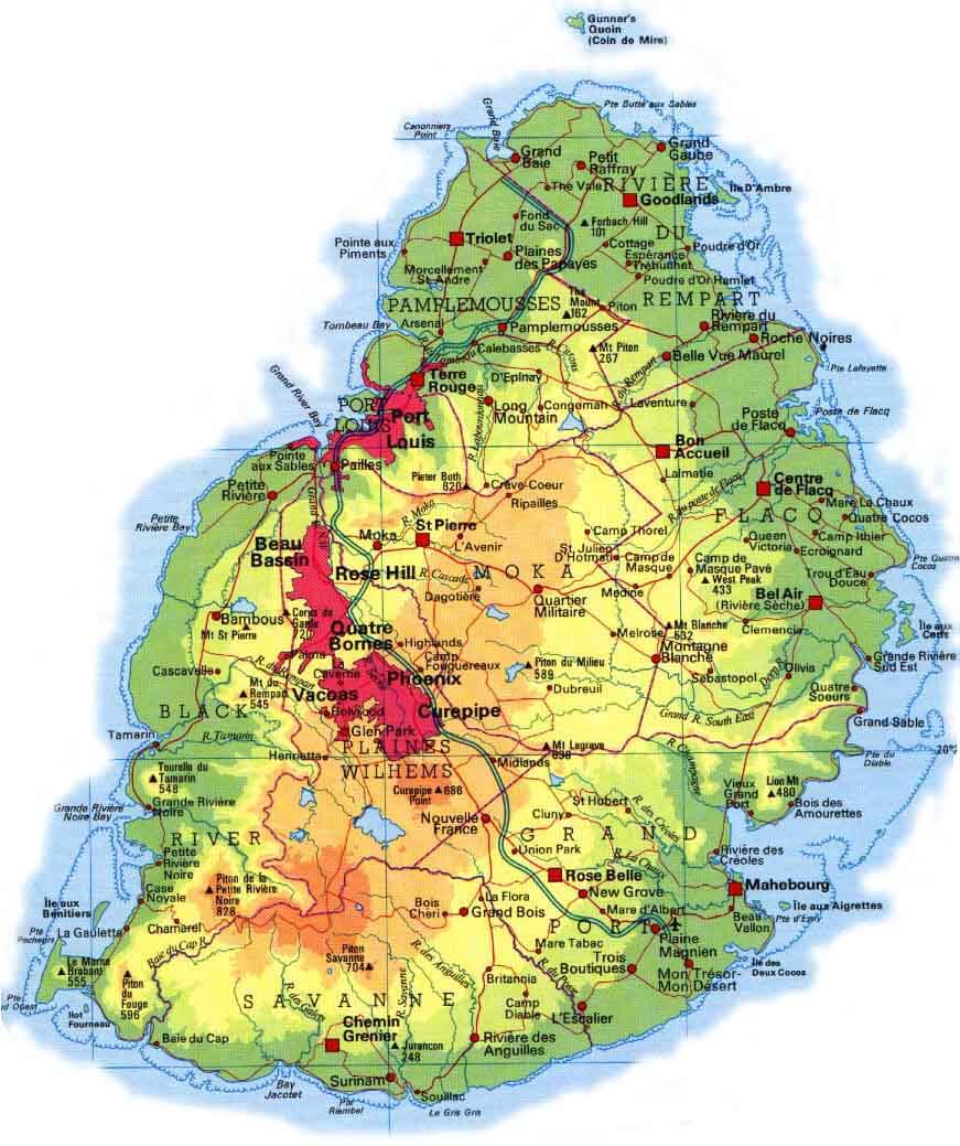
This map highlights Mauritius’s major landmarks, including Port Louis, nature reserves like Île Plate and Black River Gorges, and volcanic peaks such as Mont Piton (828m). It showcases the island's lush landscapes and surrounding Indian Ocean reefs.
Surrounded by vast expanses of ocean, Mauritius is a unique destination far from the influences of the mainland. Its isolation has contributed to the development of its diverse ecosystems and endemic species. In addition, its location makes it a key part of the wider Indian Ocean region, linking Africa, Asia and beyond through its cultural and economic ties.
Here are some statistical information about Mauritius:
 Area: 2,040 km2 (790 sq mi)
 Mauritius cities map
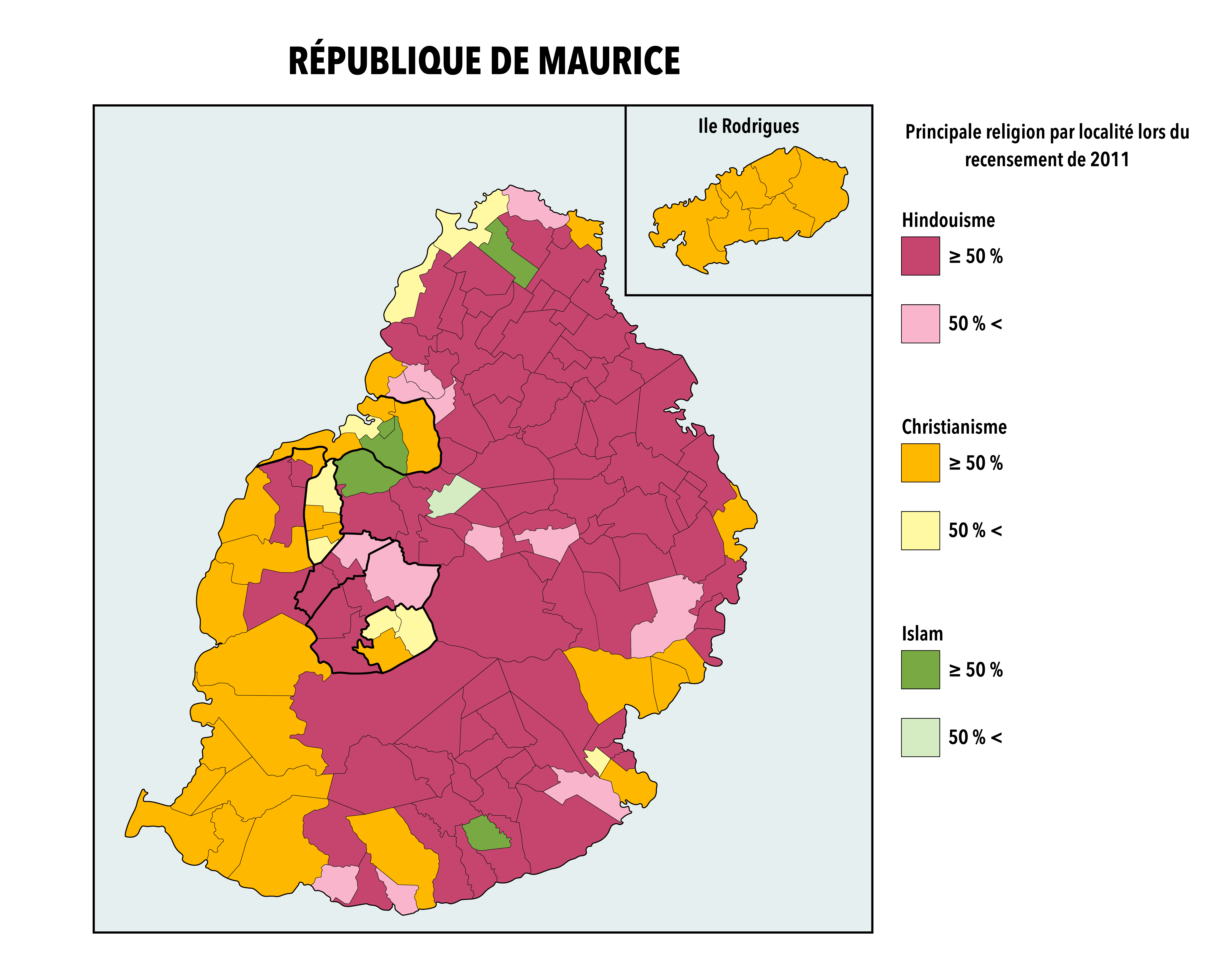
Mauritius religions 2011 map
 GDP (nominal): $16.359 billion (2024 estimate)
 Map of Mauritius
Mauritius Location Map
Mauritius Elevation Map
 Map of Mauritius showing topography, mountains, and surrounding islets.
This map highlights Mauritius’s topography, with elevations marked from coastal plains to higher volcanic peaks like Piton de la Petite Rivière Noire. It also shows surrounding islets such as Île Plate and Île aux Cerfs, emphasizing Mauritius's diverse landscape and geographic features in the Indian Ocean.
Mauritius Location Map World
Mauritius Map Madagaskar
Mauritius Physical Map
Mauritius Resorts Map
 Map of Mauritius showing tourist resorts, natural parks, and key sites.
This map highlights Mauritius’s popular tourist destinations, such as Pointe Aux Cannoniers, Flic En Flac, and Blue Bay. It showcases key attractions like Black River Gorges, Domaine de Chasseur, and Trou Aux Cerfs, making it a guide for travelers exploring the island.
Mauritius political map
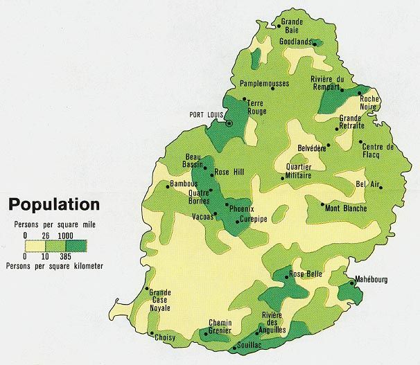
Mauritius population map
Feel free to explore these pages as well:
- Head of Performance Marketing
- Head of SEO
- Linkedin Profile: linkedin.com/in/arifcagrici