Large Mayotte Map: Political, Physical, and Cities Maps
Where is Mayotte Located on the World and Africa Map?
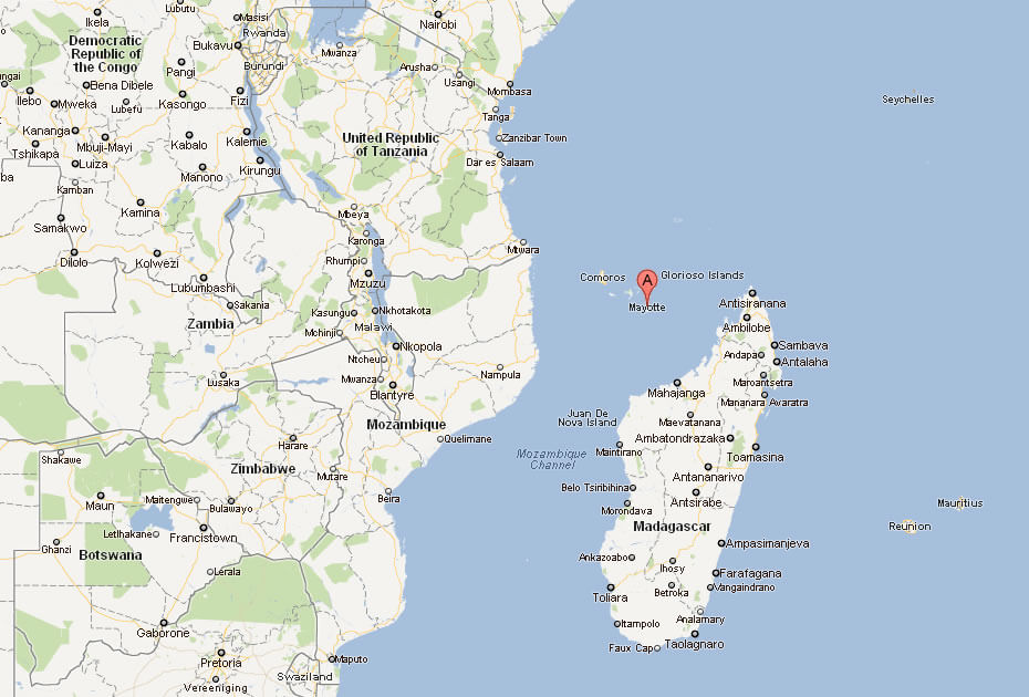
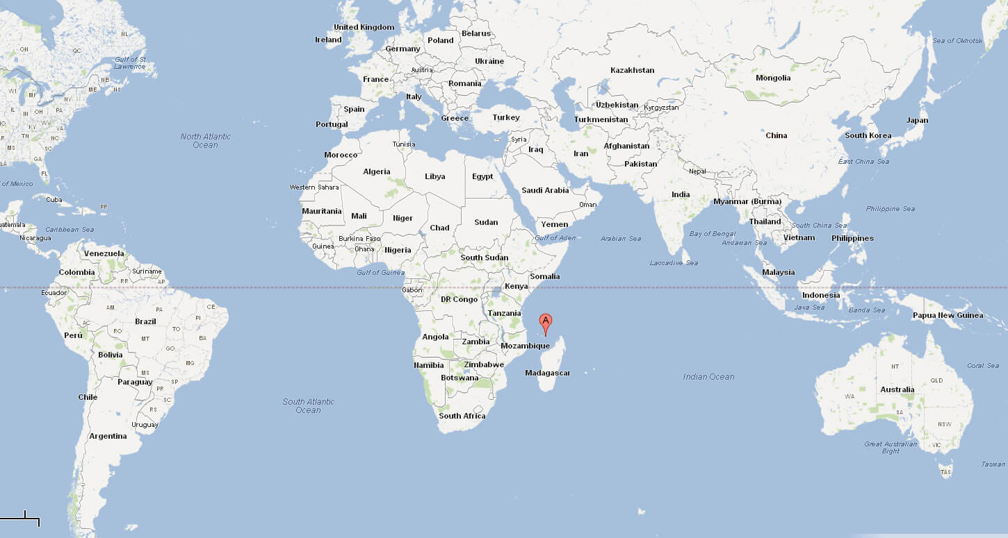
Mayotte is an island located in the Indian Ocean between the east coast of Africa and the northern tip of Madagascar. It belongs to the Comoros archipelago and lies near Mozambique and Tanzania. Although geographically part of Africa, Mayotte is a French overseas department with a unique status.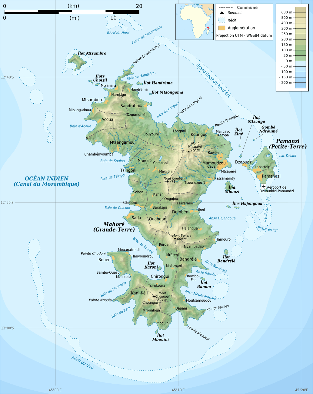
Comoros Mayotte Map
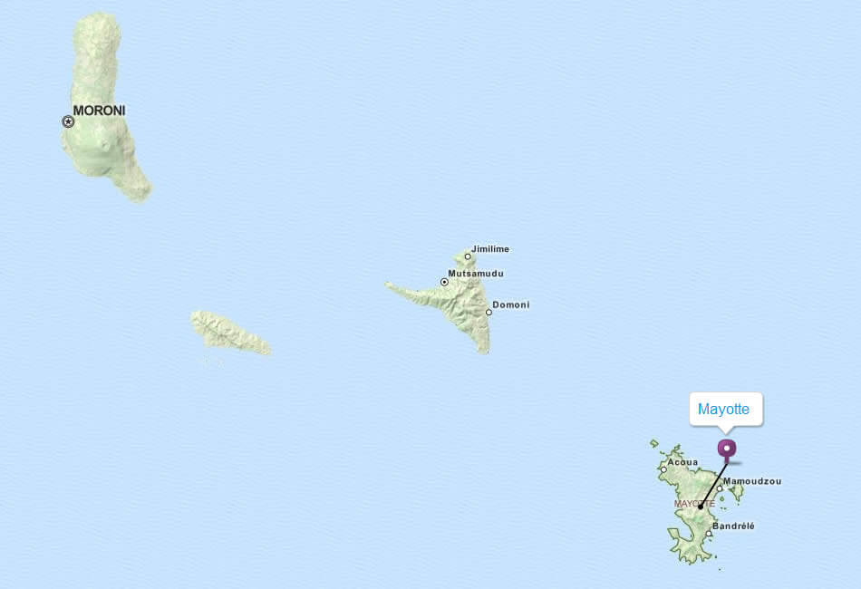
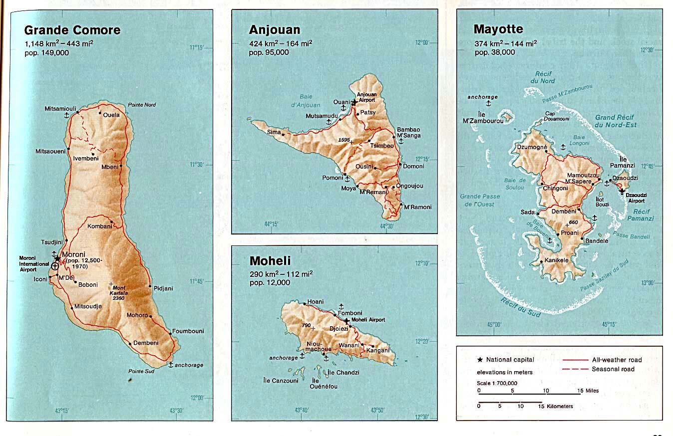 Maps of Mayotte, Grande Comore, Anjouan, and Moheli with elevations and roads.
This set of maps highlights Mayotte alongside the islands of the Comoros—Grande Comore, Anjouan, and Moheli. It shows detailed elevations, major towns, roads, and geographic features, offering insights into the region’s landscape and population distribution.
Mayotte Map
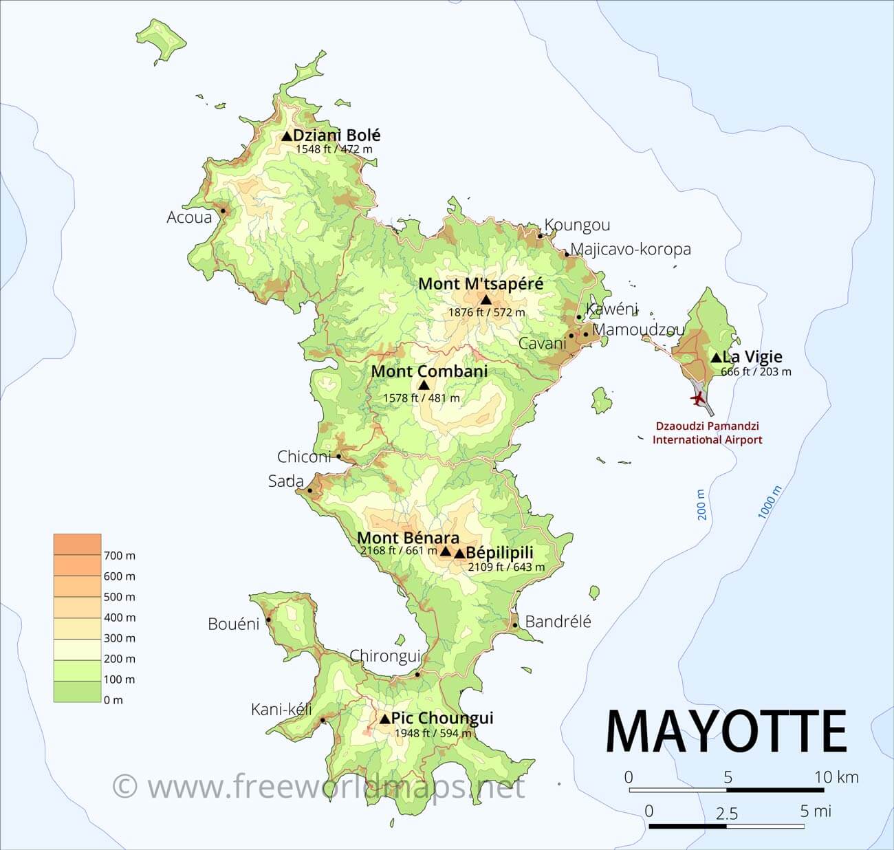
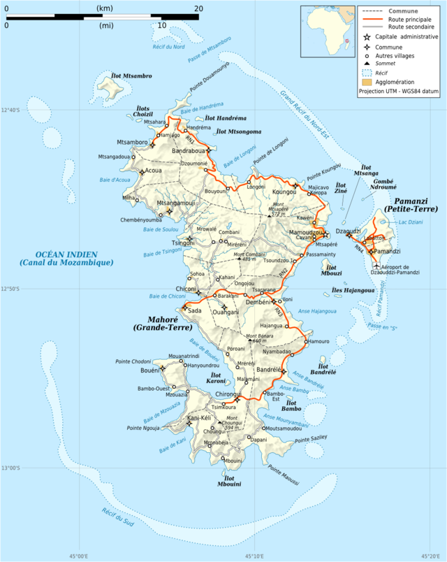
Mayotte Topographic Map
Detailed topographic map of Mayotte with elevations and key locationsThis map illustrates Mayotte’s geography, highlighting its two main islands, Grande-Terre and Petite-Terre, with detailed elevation markers. It features notable peaks like Mont Bénara (660m) and showcases the island’s coral reefs and surrounding islets in the Mozambique Channel.
Brief information about Mayotte
Mayotte, an archipelago in the Indian Ocean, is a French overseas department located between Madagascar and the African mainland. It consists of two main islands, Grande-Terre and Petite-Terre, surrounded by a coral reef lagoon, making it a stunning destination for marine biodiversity. Known for its rich ecosystems, Mayotte is home to rare marine species and offers diving and snorkelling in its turquoise waters.
The capital, Mamoudzou, is the economic and administrative centre of Mayotte. The island's culture reflects a mix of African, Malagasy and French influences, which are reflected in its traditions, language and cuisine. As part of France, Mayotte uses the euro and benefits from strong ties with the European Union, although it faces challenges such as high population density and economic disparity. Its natural beauty and cultural mix make it a unique and fascinating place in the Indian Ocean.
Where is located Mayotte on the World and Africa Map?
 Where is located Mauritius on the World Map
Mayotte is located in the Indian Ocean, between the east coast of Africa and the northern tip of Madagascar. As part of the Comoros archipelago, Mayotte is geographically close to countries such as Mozambique and Tanzania, making it an integral part of the southwest Indian Ocean region. Despite its proximity to Africa, Mayotte is a French overseas department, giving it a unique status.
Mayotte Tourism Map
On the world map, Mayotte is easily recognisable as a small group of islands surrounded by a massive coral reef lagoon, one of the largest in the world. The archipelago consists of two main islands, Grande-Terre and Petite-Terre, and several smaller islets. Its strategic location near major shipping routes has historically made it a vital link between Africa and the islands of the Indian Ocean.
Mayotte's location gives it a tropical climate, with warm weather and a rich marine ecosystem that attracts both researchers and tourists. Its location underlines its role as a cultural and geographical bridge, where African, Malagasy and French influences come together. Although remote, Mayotte's unique position in the Indian Ocean makes it an important part of the region's natural and cultural tapestry.
Here are some statistical information about Mayotte:
 Area: 374 km2 (144 sq mi)
 Map of Mayotte
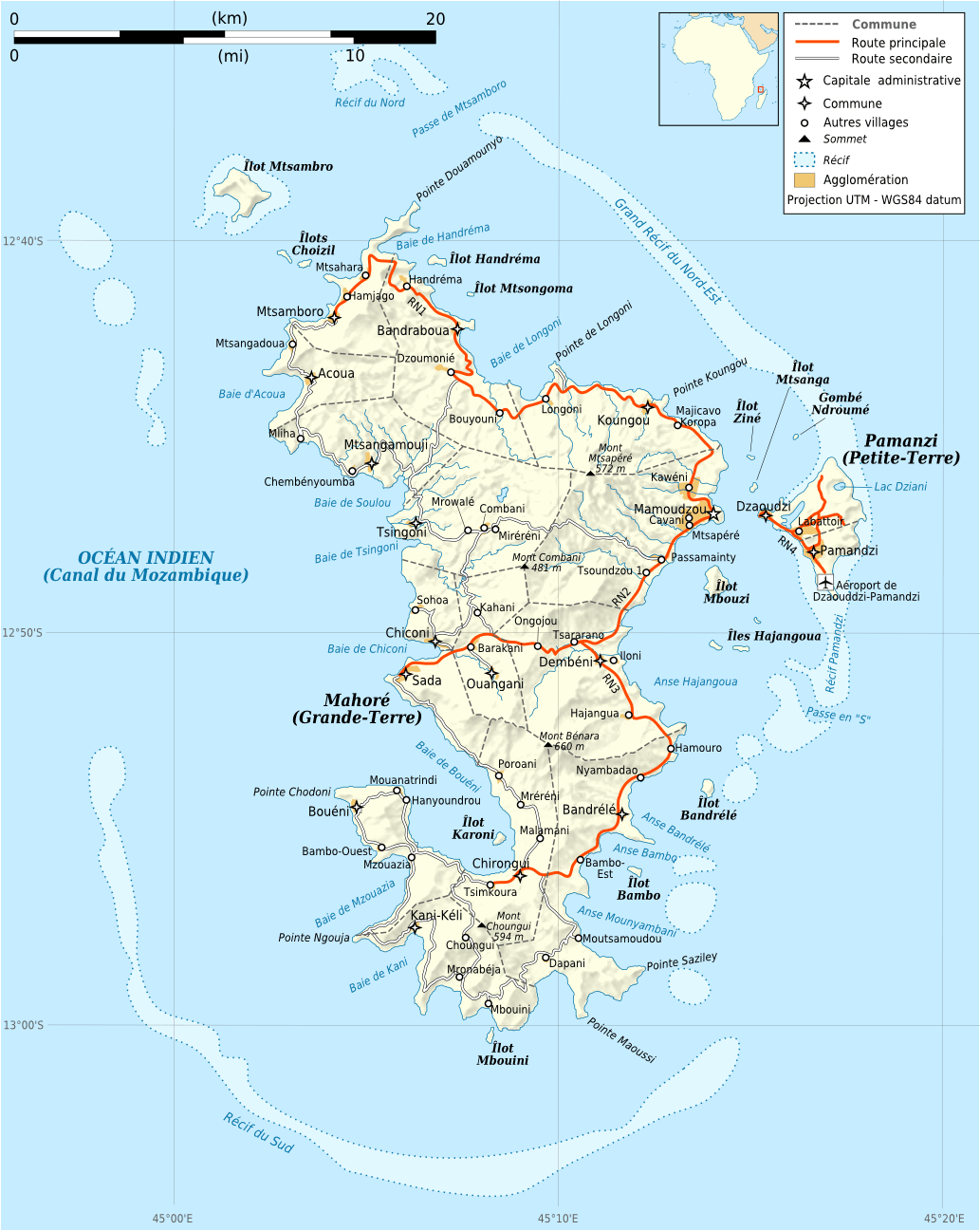
Mayotte Administrative Map
Map of Mayotte Africa
Map of Mayotte World
Map of Comoros Mayotte
Mayotte Regional Map
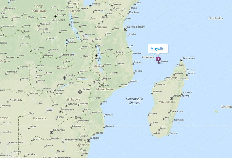
 Map showing Mayotte and the Comoros Islands in the Mozambique Channel.
This map displays Mayotte and its neighboring Comoros islands—Grande Comore, Anjouan, and Moheli—within the Mozambique Channel. It highlights their geographic relationship to Madagascar, the African mainland, and the Indian Ocean region.
Mayotte Tourism Map
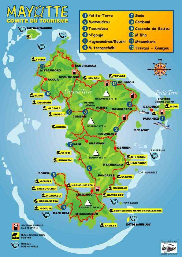 Map of Mayotte showing tourist attractions, beaches, and main towns.
This map highlights Mayotte’s major tourist spots, including Petite-Terre, Mamoudzou, and famous beaches like Bouéni and Saziley. It also features natural attractions like Mount Choungui and the coral reef lagoon, showcasing the island's vibrant tourism potential.
Mayotte Tourism Map
Mayotte Tourism Map
Feel free to explore these pages as well:
- Head of Performance Marketing
- Head of SEO
- Linkedin Profile: linkedin.com/in/arifcagrici