Detailed Map of Benin: Benin Political & Physical Maps
Where is Benin on the world and Africa map? Benin sits in West Africa, bordered by Togo to the west, Nigeria to the east, and Burkina Faso and Niger to the north. With a southern coastline on the Atlantic Ocean — part of the Gulf of Guinea — Benin occupies a strategic coastal position that links inland West Africa to major maritime routes.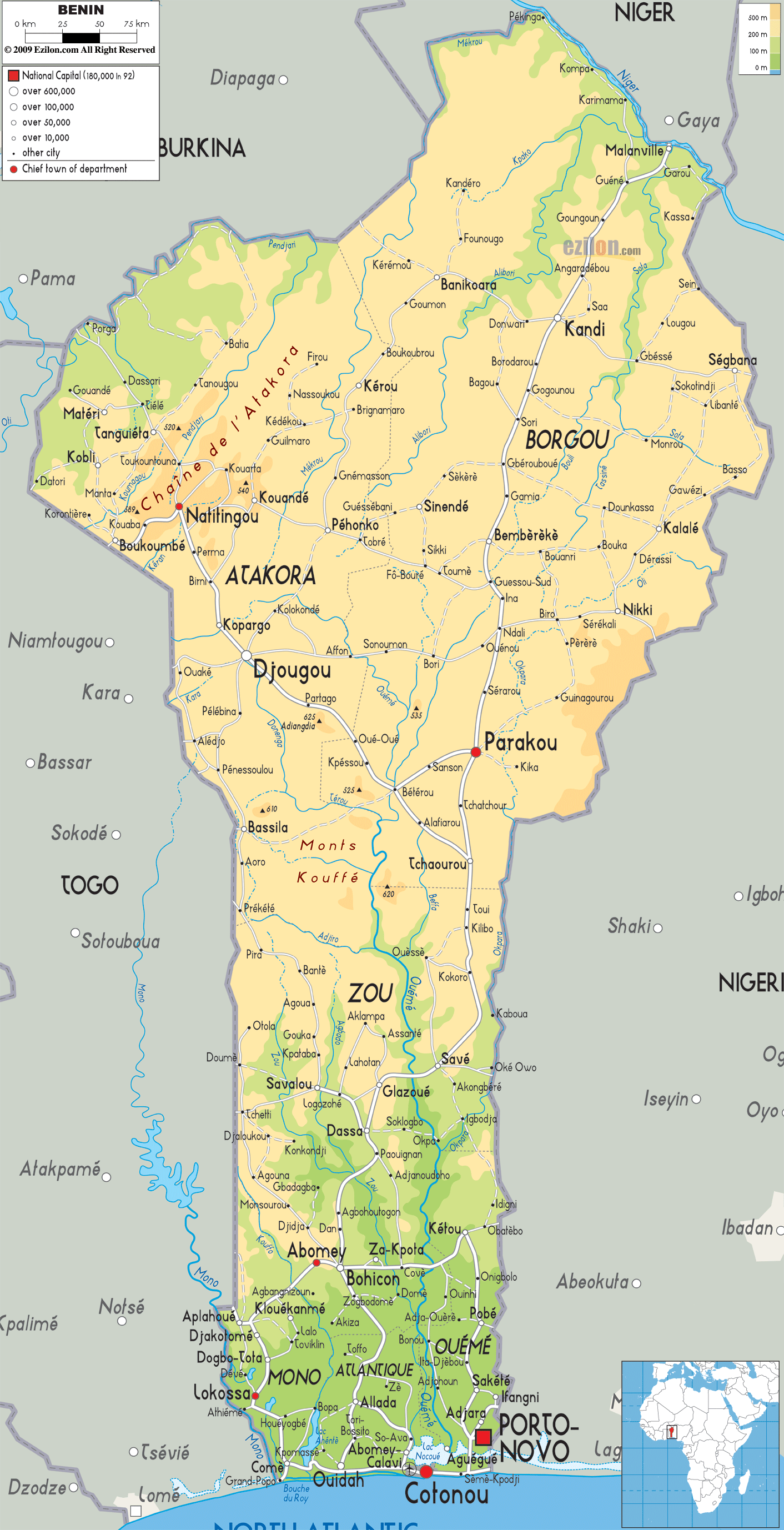
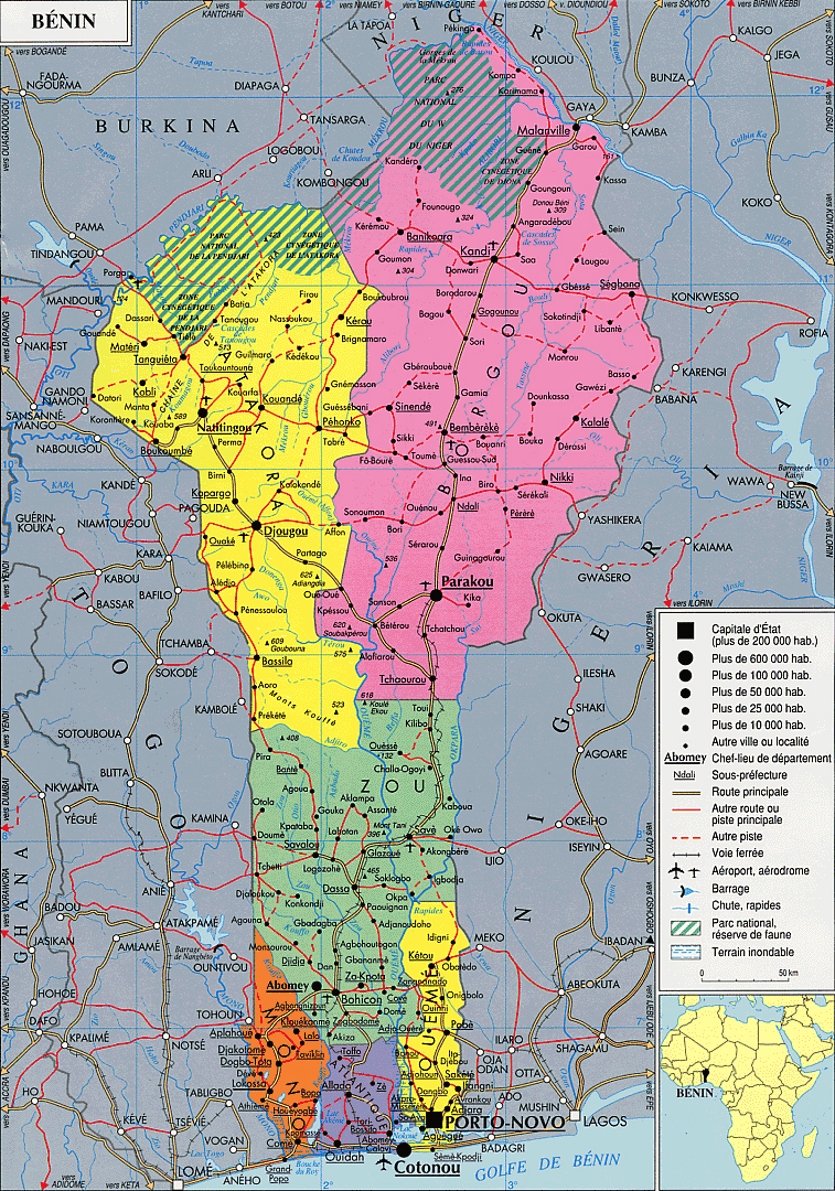
Benin Political Map
Benin Physical Map — Topography, Rivers & Major Cities
Benin physical map showing topography, rivers, major cities and borders.Detailed Benin physical map illustrating the country’s terrain from the Atakora highlands in the north to the coastal plains and lagoons in the south. Major rivers, elevation shading, principal cities (Cotonou, Porto-Novo, Parakou), regional boundaries and neighboring countries are clearly marked for easy reference.
Brief information about Benin
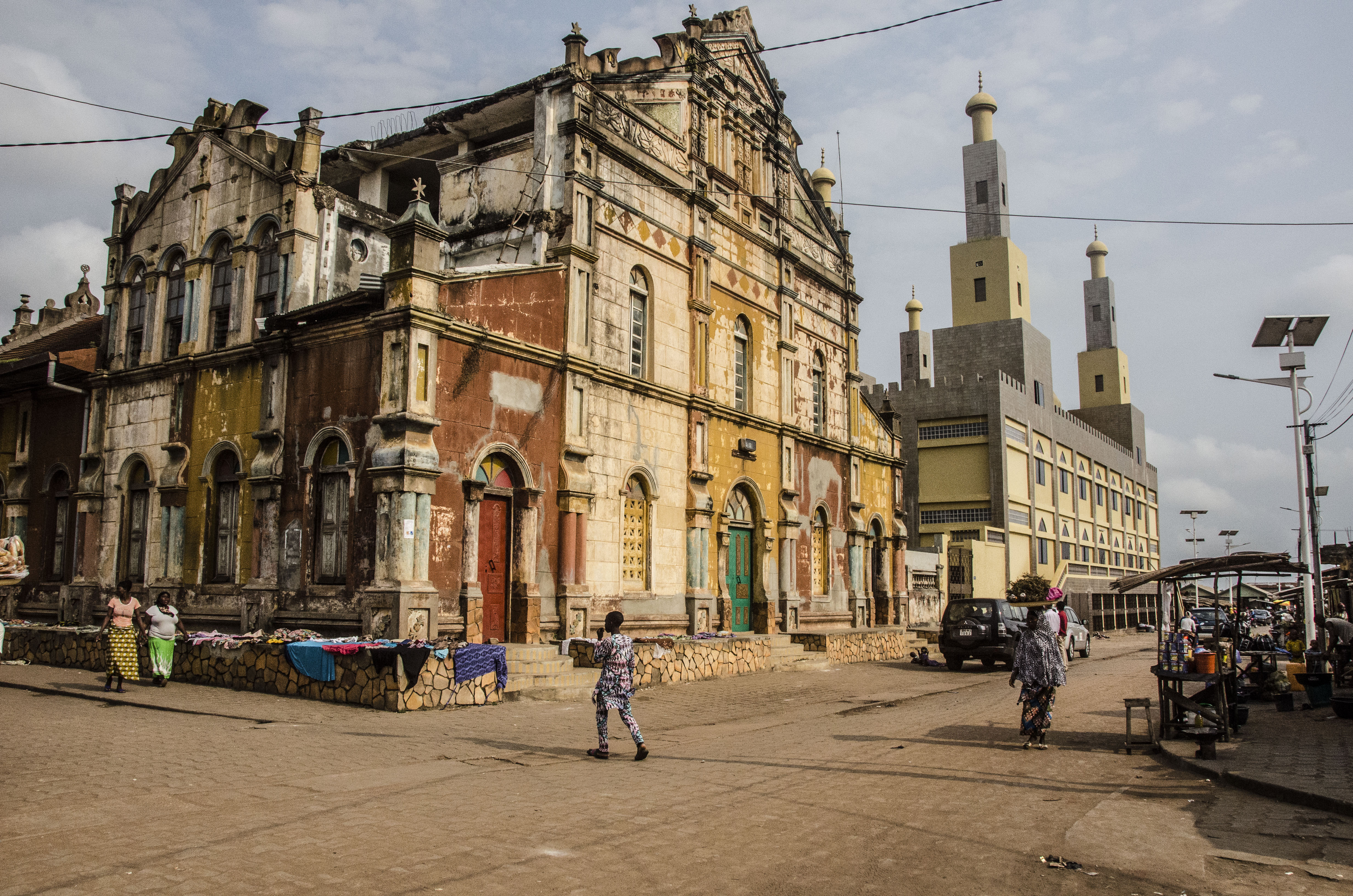
Benin is a small but culturally rich country in West Africa, renowned for its historical significance and artistic heritage. Once the centre of the powerful kingdom of Dahomey, it's now famous for its bronze sculptures, vibrant festivals and traditional voodoo practices. The locals are warm and welcoming, making it a great destination for travellers seeking authentic experiences.
From the bustling markets of Cotonou to the stilt village of Ganvié, Benin offers unique adventures at every turn. Visitors can explore the royal palaces of Abomey, a UNESCO World Heritage Site, or go on safari in Pendjari National Park to see elephants and lions in their natural habitat. It's the perfect blend of culture and nature.
Where is located Benin on the World and Africa Map?
 Where is located Benin on the World Map
Benin is located in West Africa, bordering Togo to the west, Nigeria to the east and Burkina Faso and Niger to the north. It has a coastline along the Atlantic Ocean to the south, making it a key part of the Gulf of Guinea. Its strategic location has made it an important cultural and commercial hub in the region.
The country lies just north of the equator, giving it a tropical climate with warm temperatures throughout the year. Its location in the heart of West Africa makes Benin easily accessible for travellers exploring the region. Major cities such as Cotonou and Porto-Novo serve as gateways to the country's rich history and natural beauty.
On a world map, Benin may seem small, but its location is central to many of West Africa's cultural and historical landmarks. From its bustling coastal cities to its northern savannahs, Benin's geography offers a diverse landscape that reflects its vibrant heritage.
Here are some statistical information about Benin:
 Area: 114,763 km2 (44,310 sq mi)
 Benin Location Map
Map of Benin Africa
 Religion: 52.2% Christianity, 24.6% Islam, 17.9% traditional faiths, 5.2% no religion, 0.1% other.
 Map of Benin
Benin Map
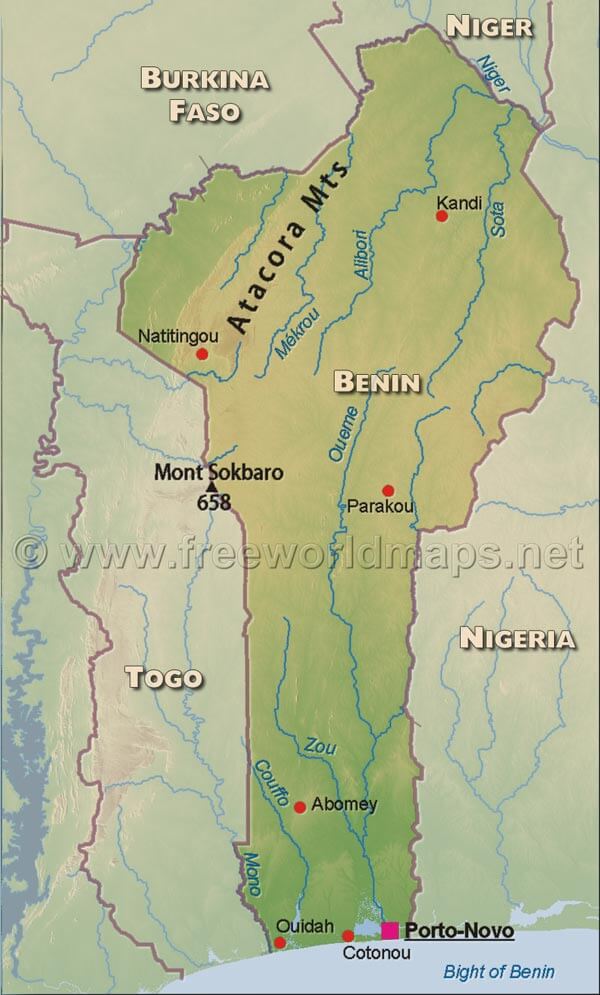 Benin physical map with cities, rivers, and Atacora Mountains.
This map illustrates Benin’s geography, highlighting the Atacora Mountains, Mont Sokbaro (658m), key cities like Porto-Novo, Cotonou, and Parakou, and major rivers like the Niger, Ouémé, and Mono. Neighboring countries are also shown.
Map Benin
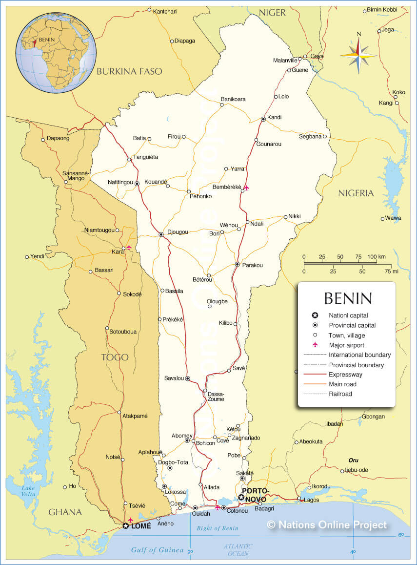
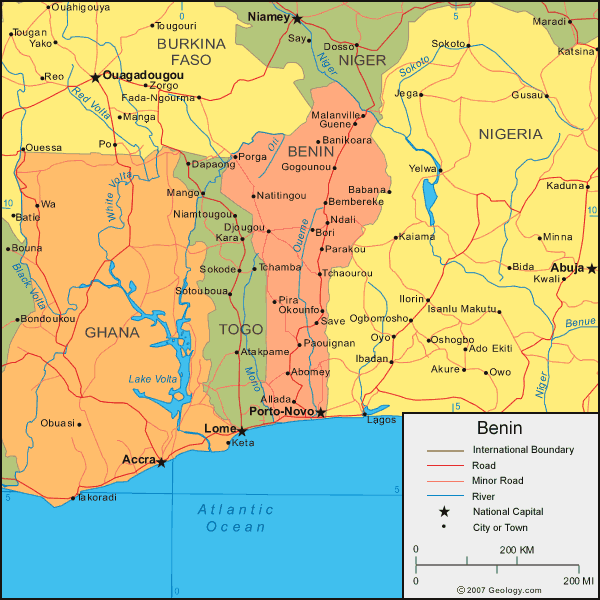
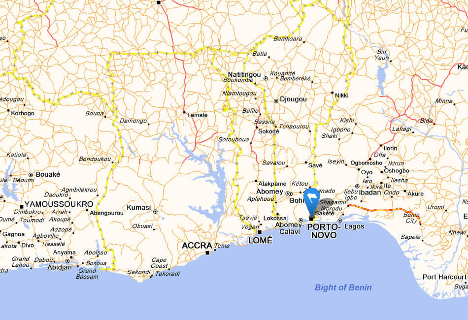 Map of Benin and neighboring countries with major cities and roads.
This map shows Benin in West Africa, bordered by Nigeria, Togo, Burkina Faso, and Niger. It highlights major cities like Porto-Novo and Cotonou, nearby capitals like Accra and Lomé, and its connection to the Gulf of Guinea.
Benin Map Africa
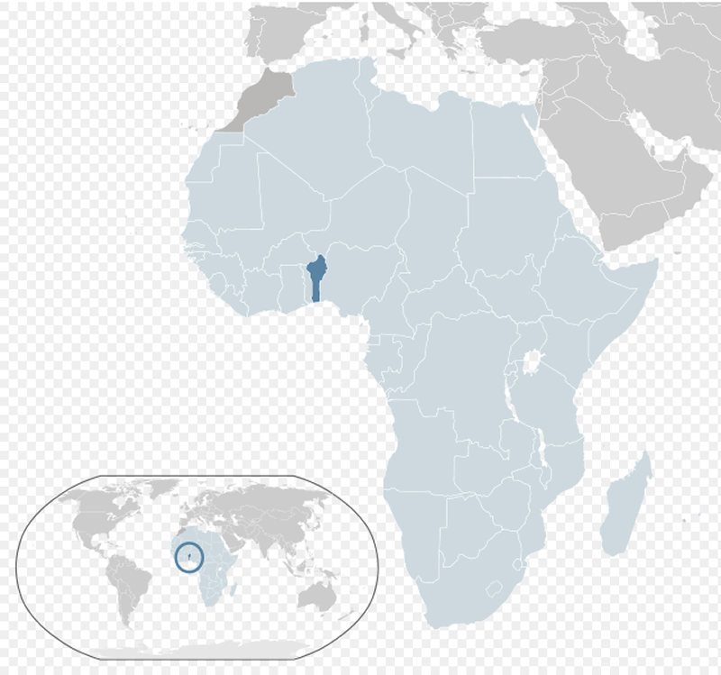
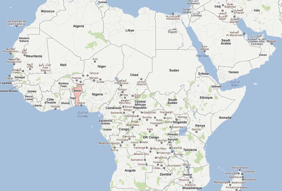
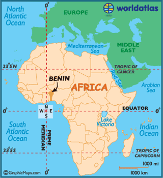 Map showing Benin in West Africa within the African continent.
This map places Benin in the broader context of Africa, highlighting its location in West Africa bordered by Nigeria, Togo, Burkina Faso, and Niger. It also shows its proximity to the Gulf of Guinea and other African countries.
Benin Maps
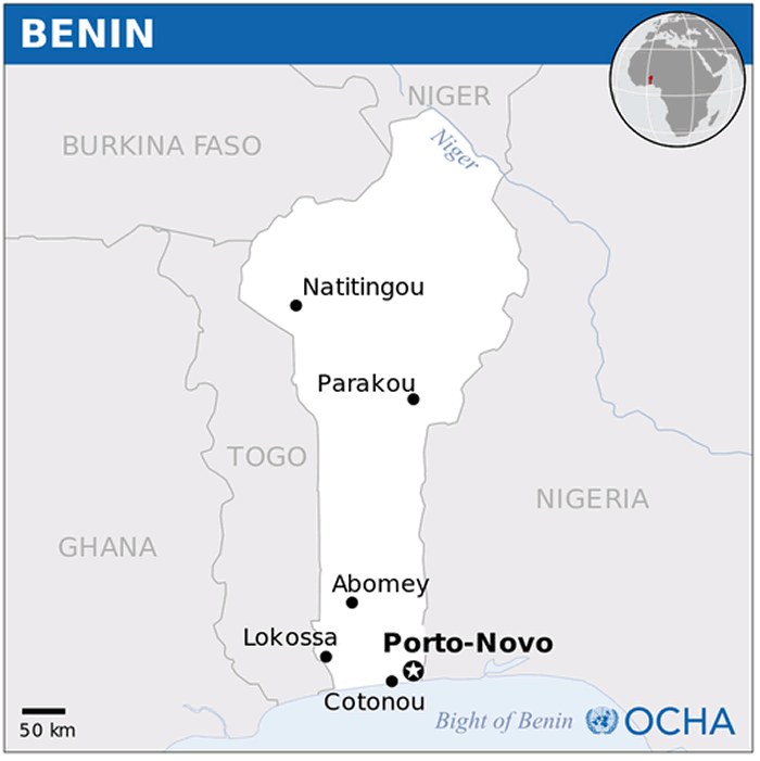
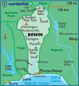 Map of Benin showing cities, rivers, and neighboring countries.
This map highlights Benin’s location in West Africa, bordered by Togo, Nigeria, Burkina Faso, and Niger. It features key cities like Porto-Novo and Cotonou, as well as natural landmarks like Pendjari National Park and the Niger River.
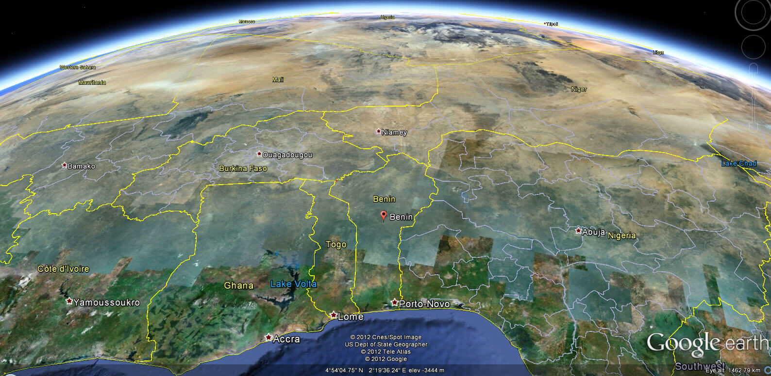
Benin Earth Map
Benin Cities Map
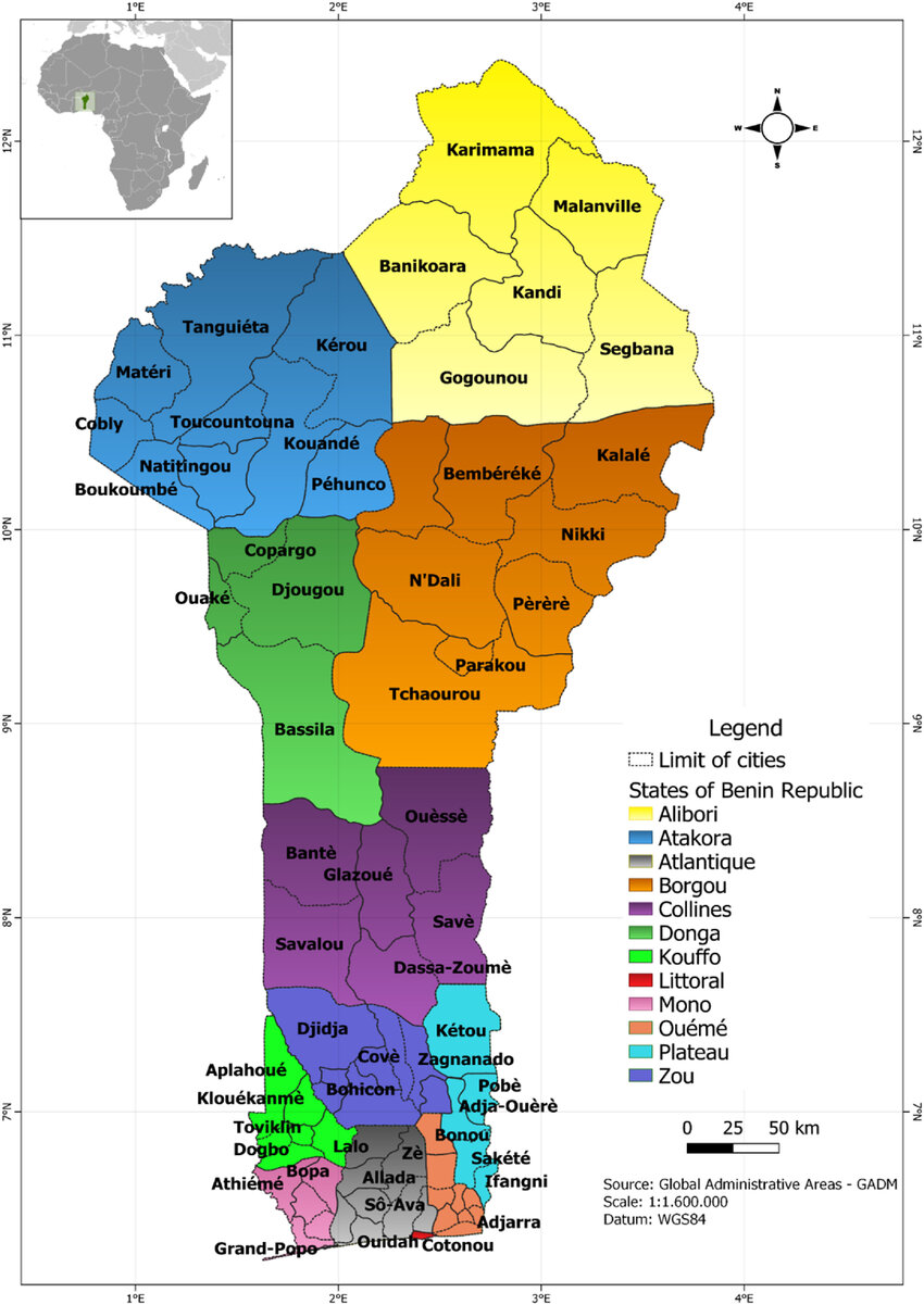
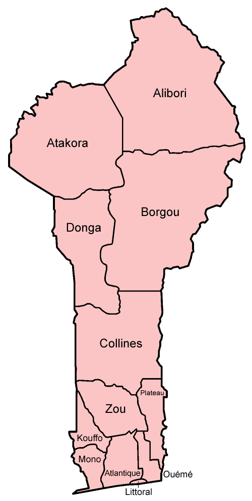
Benin administrative map
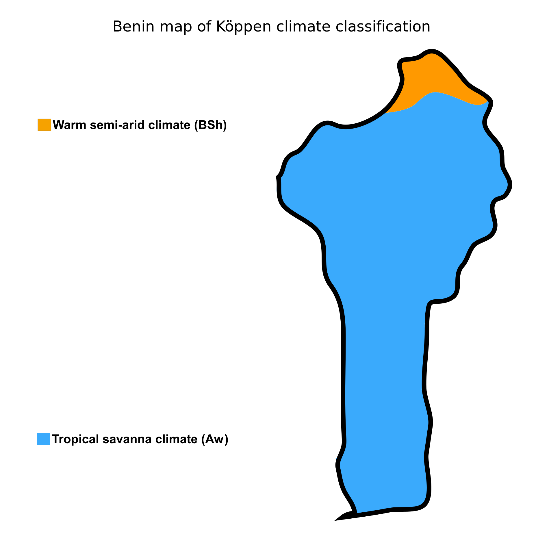
Benin map of koppen climate classification
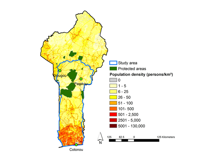
Benin population Map
Benin Road Map
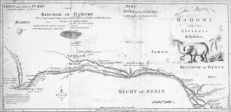
Kingdom of Dahomy 1793
Feel free to explore these pages as well:
- Head of Performance Marketing
- Head of SEO
- Linkedin Profile: linkedin.com/in/arifcagrici