Detailed Map of Botswana: Political, Physical, Topography, Rivers Maps
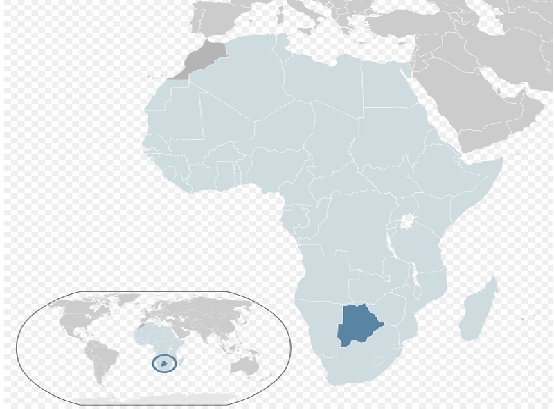
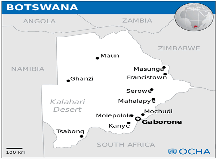
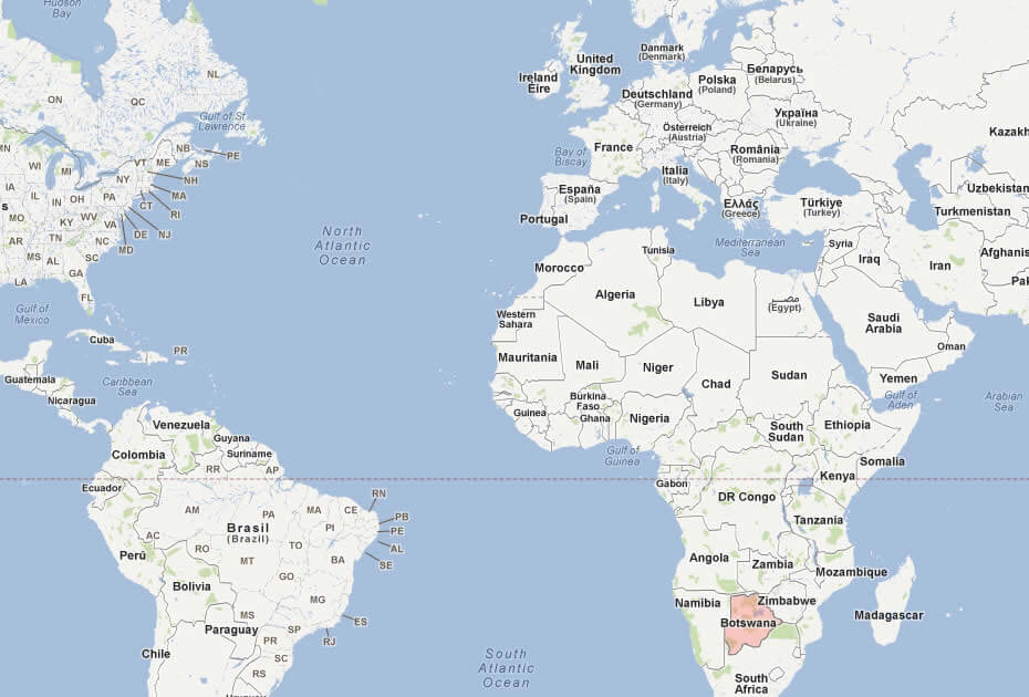
Where is Botswana located on the world and Africa map? Botswana sits in Southern Africa, a landlocked country bordered by Namibia to the west and north, Zimbabwe to the northeast, and South Africa to the south and southeast; it also shares a short northern border with Zambia. Positioned in the continent's southern interior, Botswana's location makes it a gateway between the arid Kalahari region and major southern African trade routes.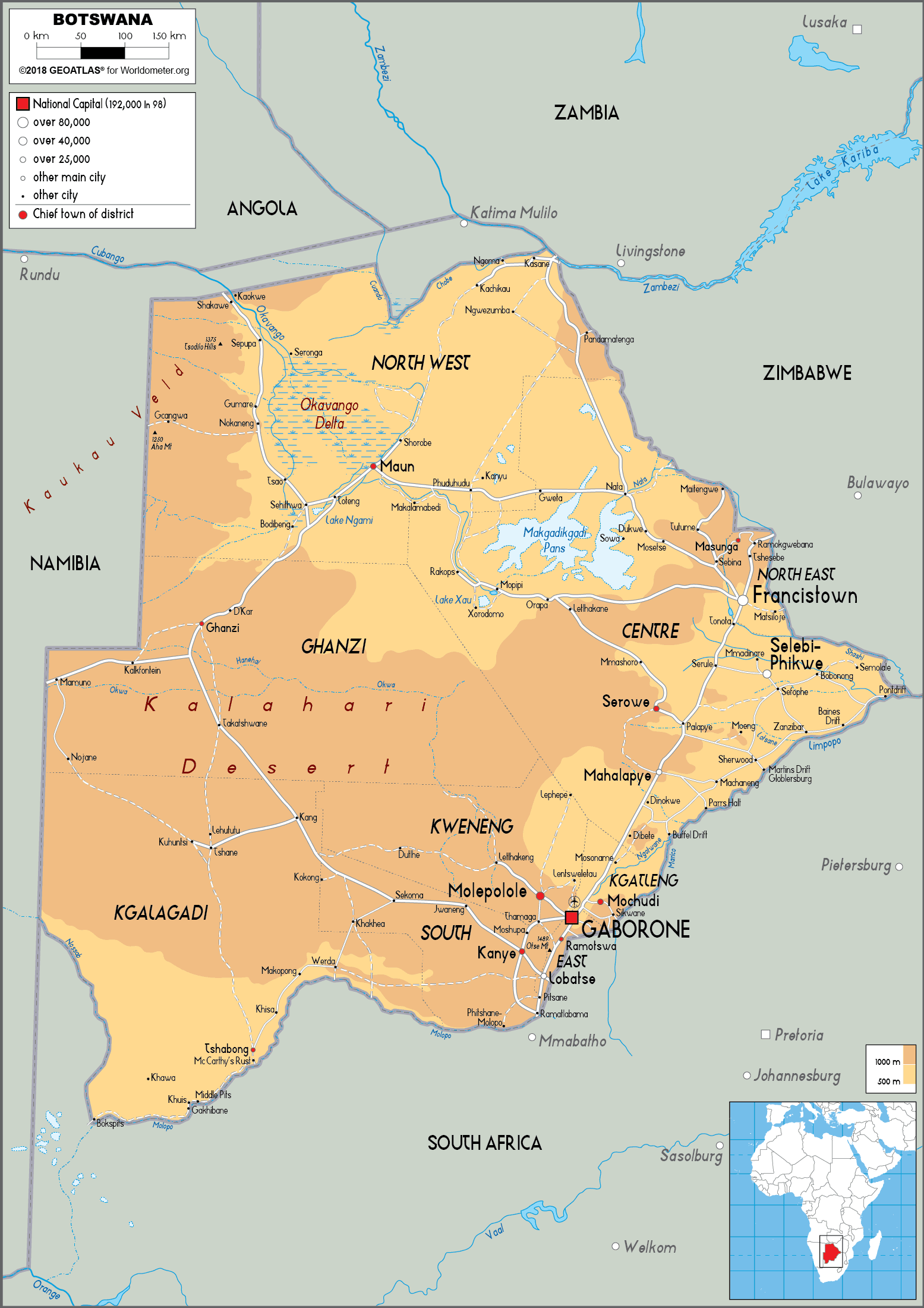
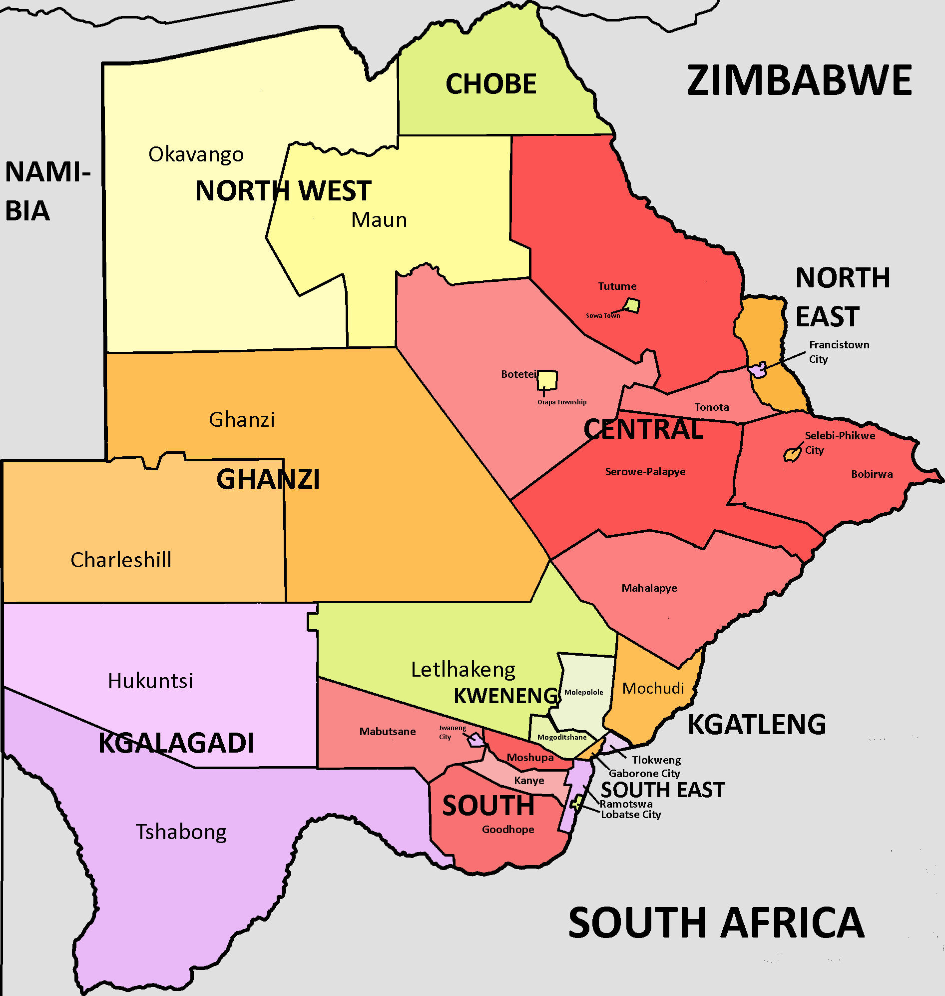
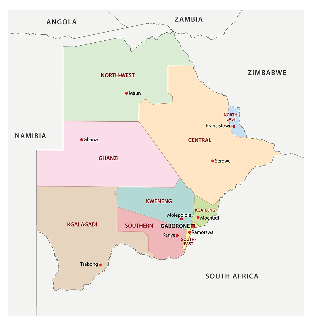
The subdistricts of Botswana map
Map of Botswana
Botswana Physical Map — Kalahari, Okavango & Major Cities
Botswana physical map showing Kalahari Desert, Okavango Delta and major cities.A detailed physical map of Botswana highlighting the Kalahari Desert, the wetlands of the Okavango Delta and Makgadikgadi Pans, elevation shading, major rivers and protected areas. Principal cities (Gaborone, Maun, Francistown), transport routes and international borders are clearly marked for geographic and travel reference.
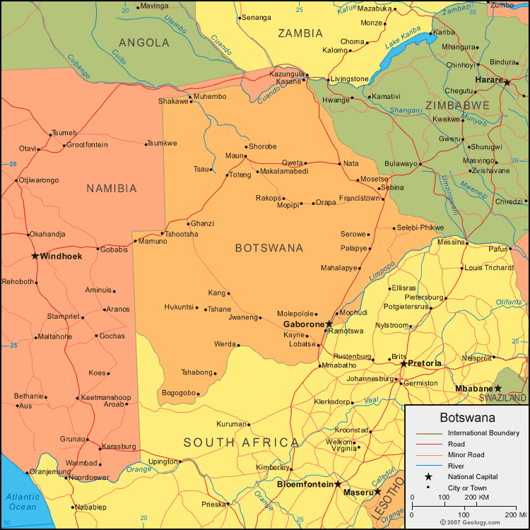
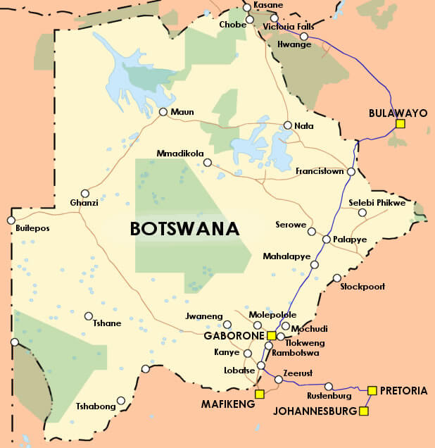
Botswana map with major cities, roads, and neighboring countries.This map displays Botswana’s main cities like Gaborone and Francistown, along with major roads and rivers. It highlights international boundaries with Namibia, Zambia, Zimbabwe, and South Africa, showing key transport routes and geographic features.
Brief information about Botswana
Located in southern Africa, Botswana is a landlocked country known for its stunning landscapes and rich wildlife. It borders South Africa, Namibia, Zimbabwe and Zambia. Famous for the Okavango Delta, a UNESCO World Heritage Site, Botswana is a haven for safari enthusiasts. The country is also home to the Kalahari Desert and Chobe National Park, renowned for its large elephant population.
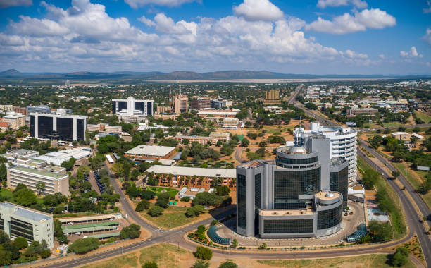
A stable democracy and one of Africa's fastest growing economies, Botswana is known for its diamond mining industry and strong commitment to conservation. The capital, Gaborone, serves as the administrative and economic centre.
Where is located Botswana on the World and Africa Map?
 Where is located Botswana on the World Map
Botswana is situated in southern Africa, landlocked between Namibia to the west and north, Zimbabwe to the north-east and South Africa to the south and south-east. It also shares a small border with Zambia to the north.
Situated just north of South Africa, Botswana lies at the heart of southern Africa and is renowned for its diverse ecosystems, from the Kalahari Desert to the lush Okavango Delta. Its location makes it an important destination for wildlife and nature lovers.
On the world map, Botswana is located near the Tropic of Capricorn, highlighting its predominantly semi-arid climate. Its central location in southern Africa connects it to the region's major trade and travel routes.
Here are some statistical information about Botswana:
 Area: 581,730 km2 (224,610 sq mi)
 Botswana Location Map Gaborone
Botswana population map
Botswana Map
 Detailed Botswana map with national parks, cities, and neighboring countries.
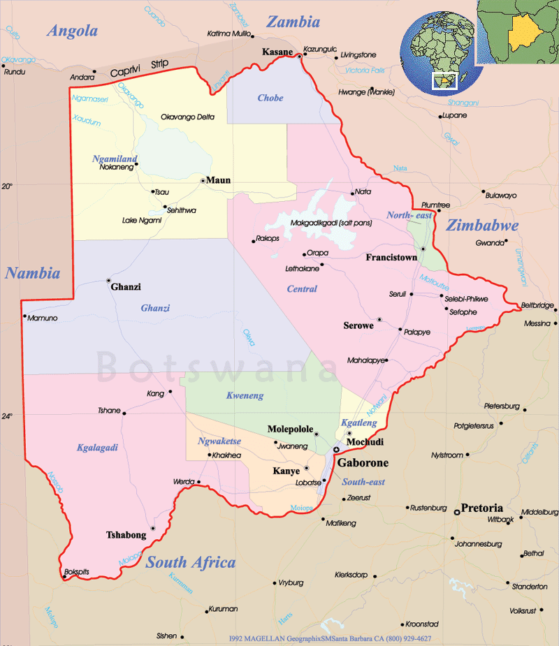
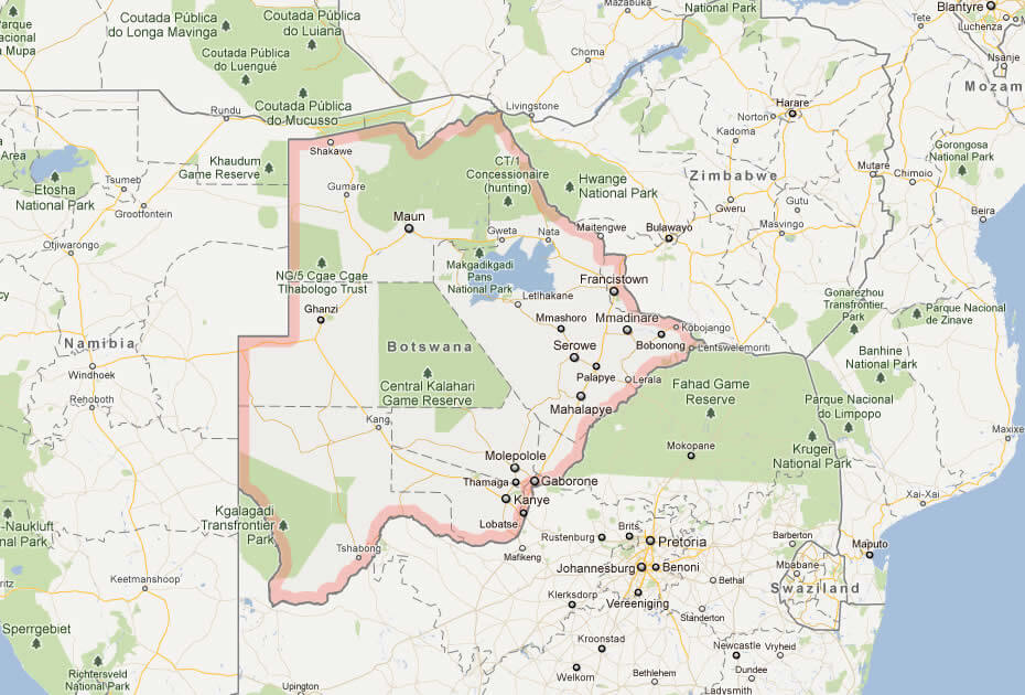
This map showcases Botswana’s key landmarks, including the Okavango Delta, Chobe National Park, and Central Kalahari Game Reserve. It also highlights major cities like Gaborone and Francistown, along with borders shared with Namibia, Zambia, Zimbabwe, and South Africa.
Botswana Maps
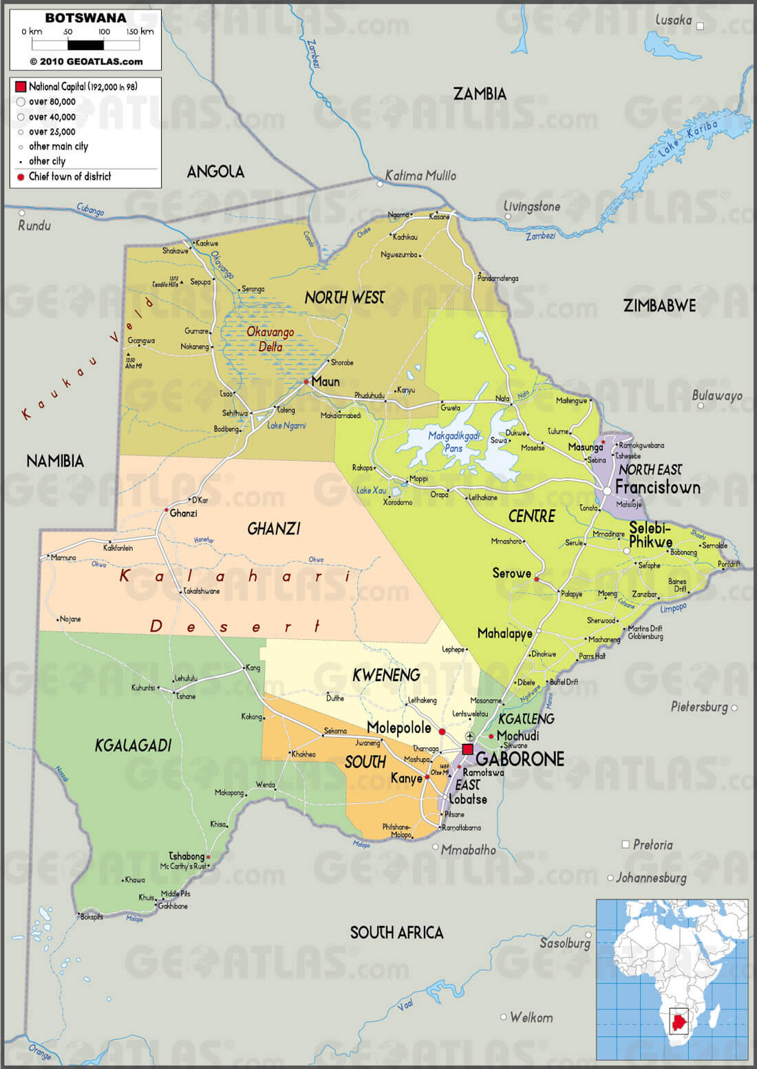 Botswana map with districts, major cities, and natural landmarks.
This map divides Botswana into regions, highlighting key cities like Gaborone and Francistown. It showcases the Okavango Delta, Kalahari Desert, and Makgadikgadi Pans. Borders with Namibia, Zambia, Zimbabwe, and South Africa are also clearly defined.
Botswana National Map
 Botswana map showing cities, landmarks, and bordering countries.
This map highlights Botswana’s location in southern Africa, featuring major cities like Gaborone, Francistown, and Maun. It also displays the Okavango Delta, Chobe National Park, and its borders with Namibia, Zimbabwe, and South Africa.
Botswana Political Map
Map of Botswana Africa
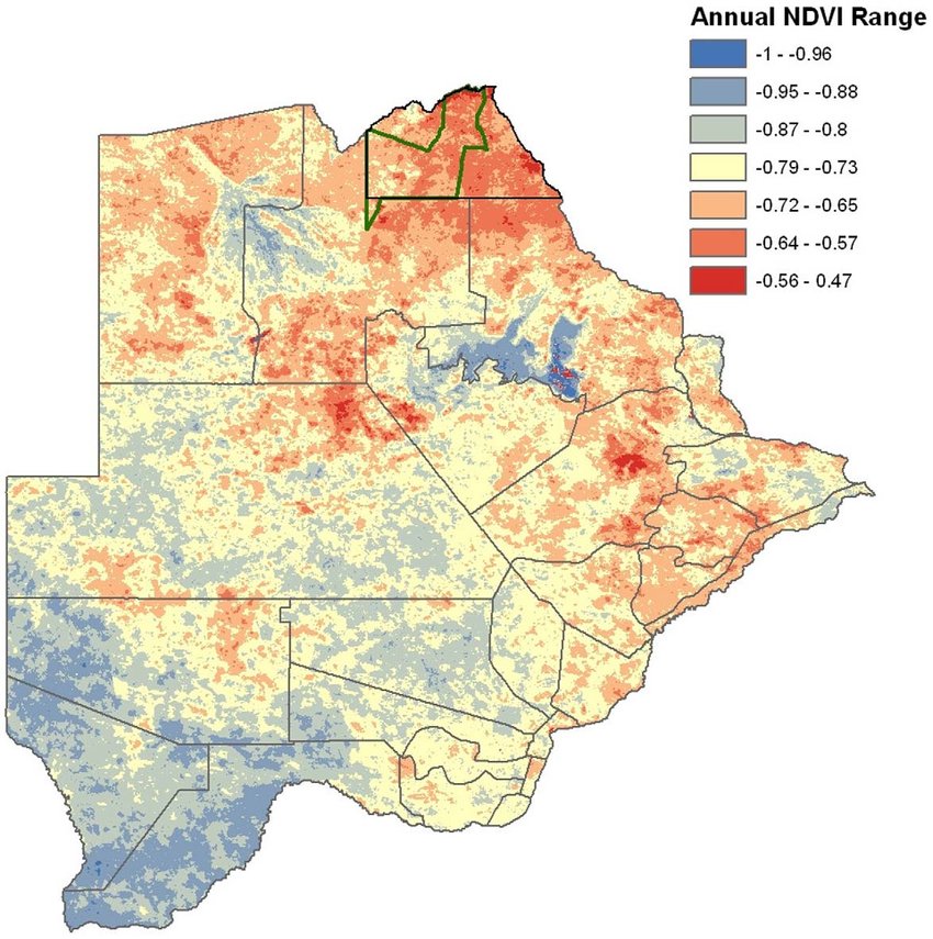
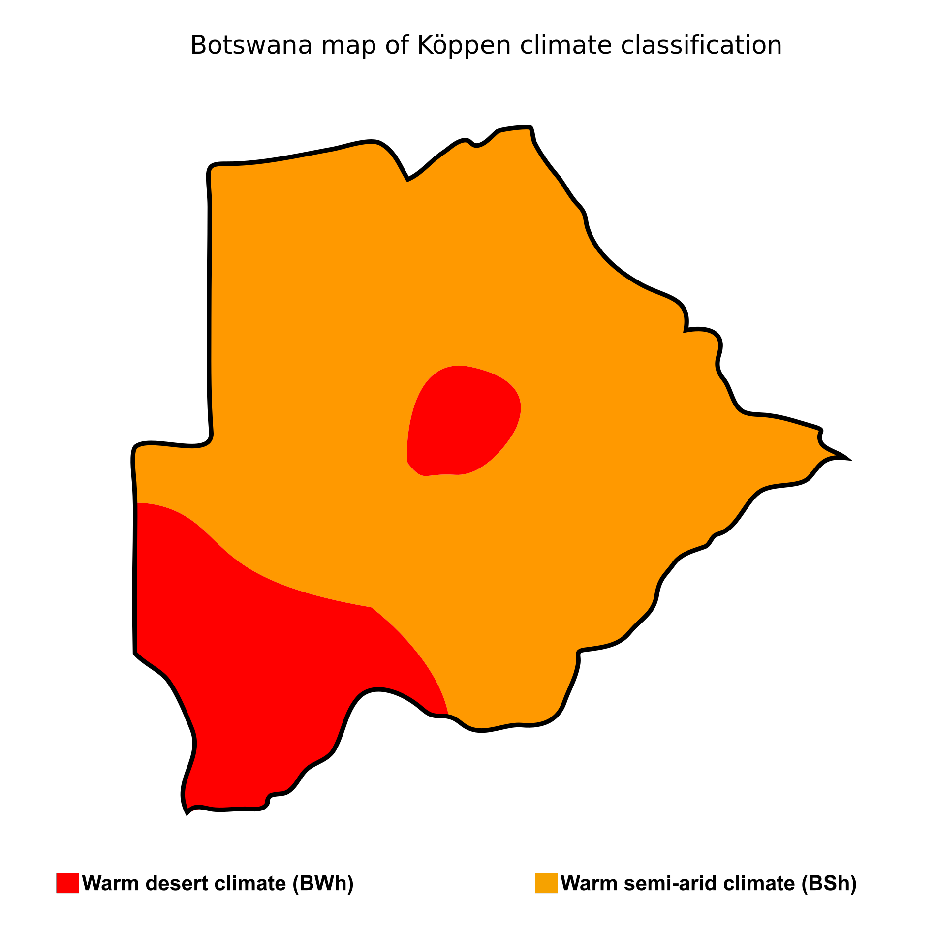
Botswana map of koppen climate classification
Maps of Botswana
Maps Botswana
 Map of Botswana with national parks, reserves, and cities.
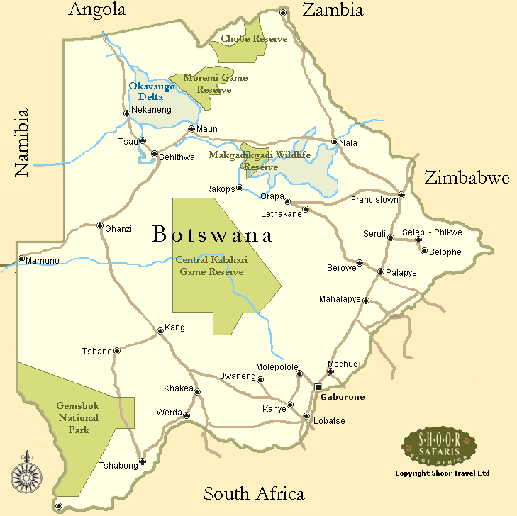
This map highlights Botswana’s key national parks and reserves, including the Okavango Delta, Chobe Reserve, and Central Kalahari Game Reserve. Major cities like Gaborone and Maun, as well as borders with Namibia, Zambia, Zimbabwe, and South Africa, are marked.
Botswana Earth Map
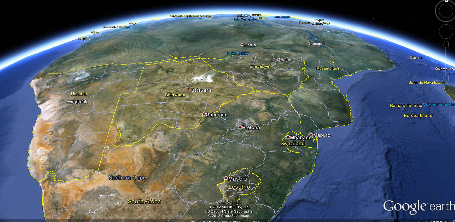
Botswana Earth Map
Botswana cities map
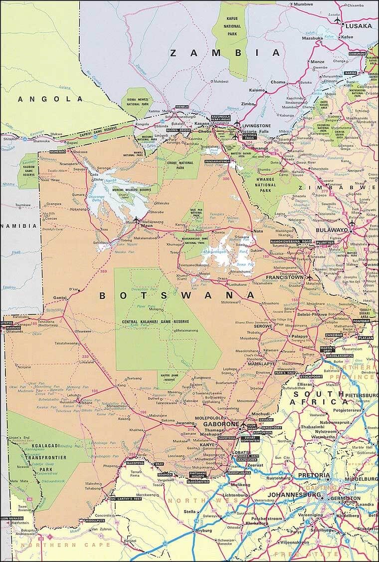
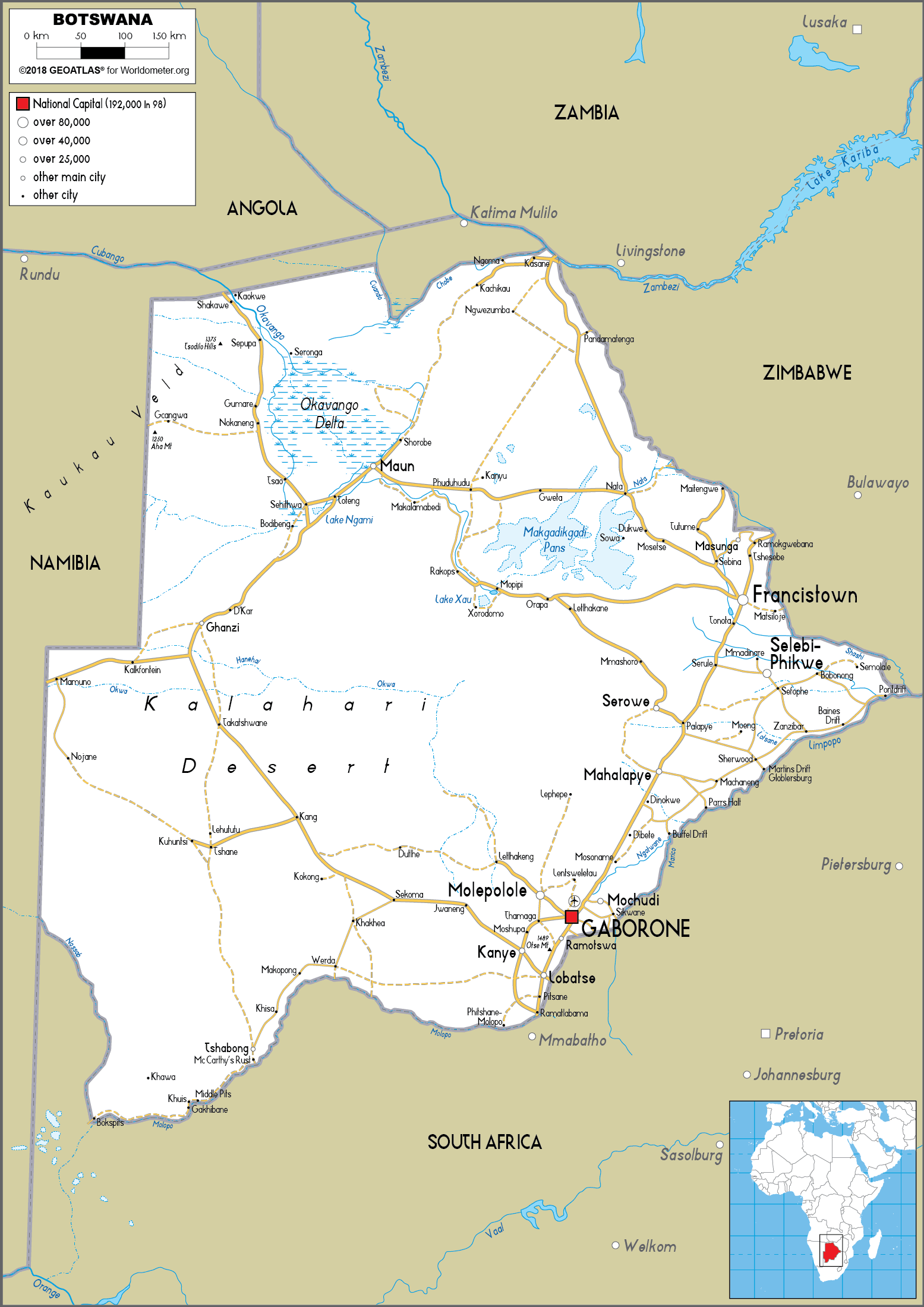
Botswana road map
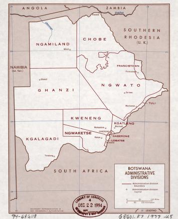
Districts of Botswana in 1977
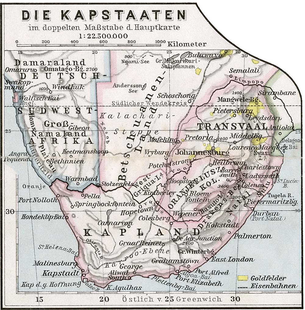
Kapstaaten 1905
Feel free to explore these pages as well:
- Head of Performance Marketing
- Head of SEO
- Linkedin Profile: linkedin.com/in/arifcagrici