Detailed Map of Cameroon: Political, Physical, Regions, and Cities Maps
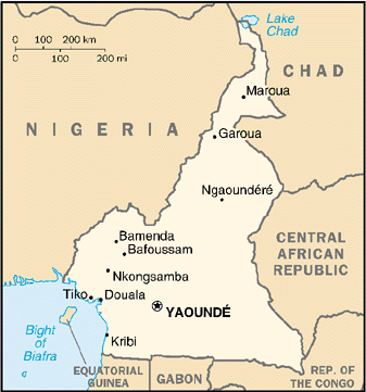
Cameroon is situated in Central Africa, making it a geographic bridge between West and Central Africa. On the map, it borders Nigeria to the west, Chad to the northeast and the Central African Republic to the east; to the south it meets Equatorial Guinea, Gabon and the Republic of the Congo. Its southwestern edge opens onto the Atlantic Ocean along the Gulf of Guinea, giving Cameroon strategic coastal access for trade and regional connectivity.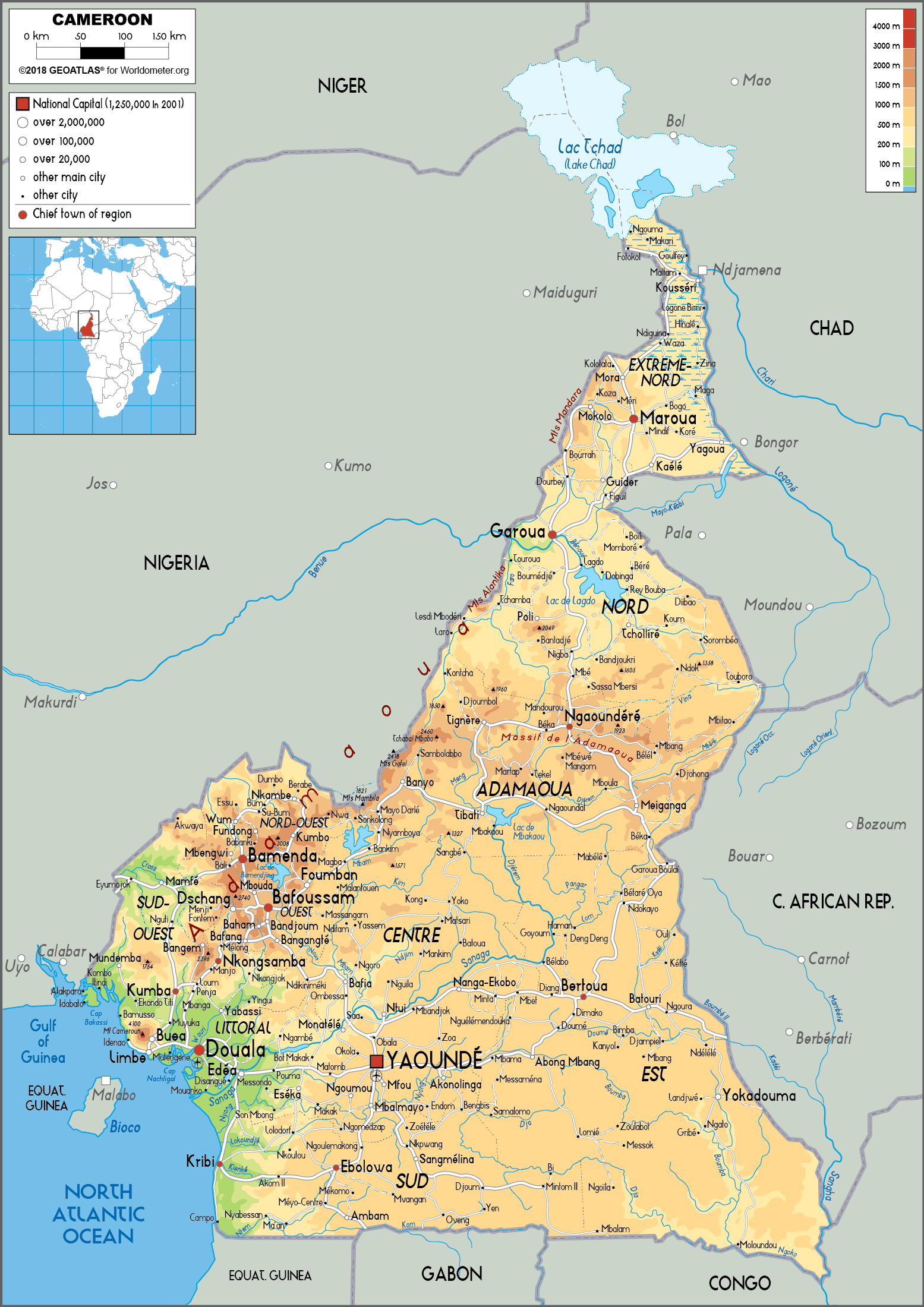
Map of Cameroon
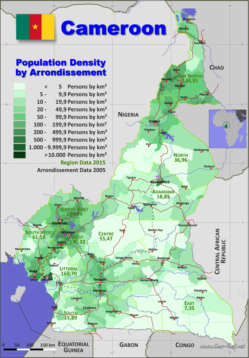
Cameroon population map
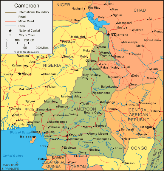
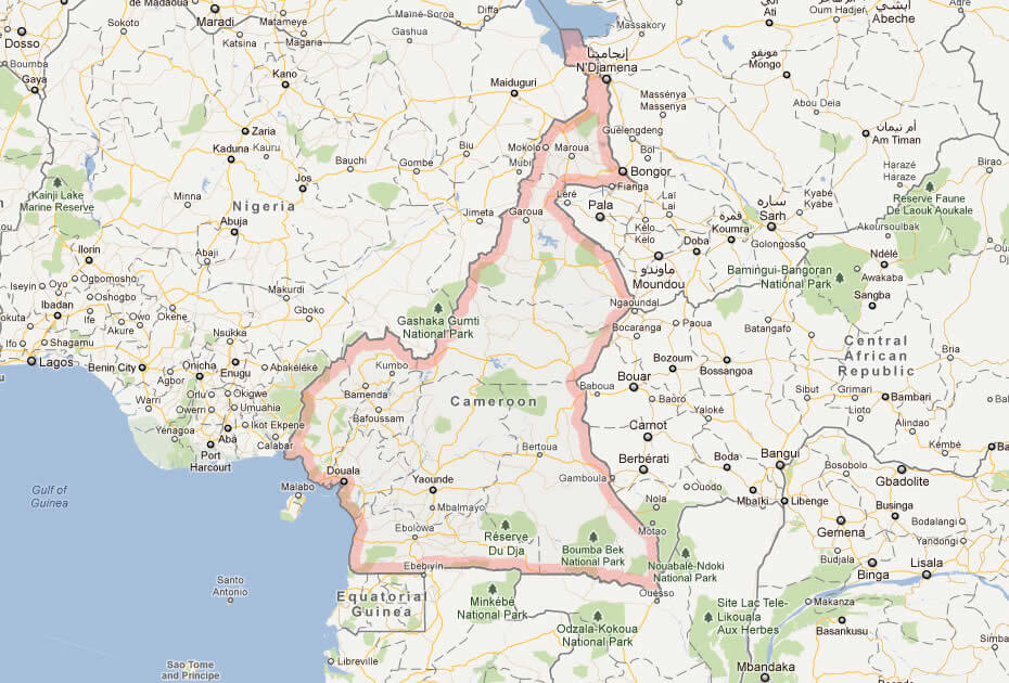
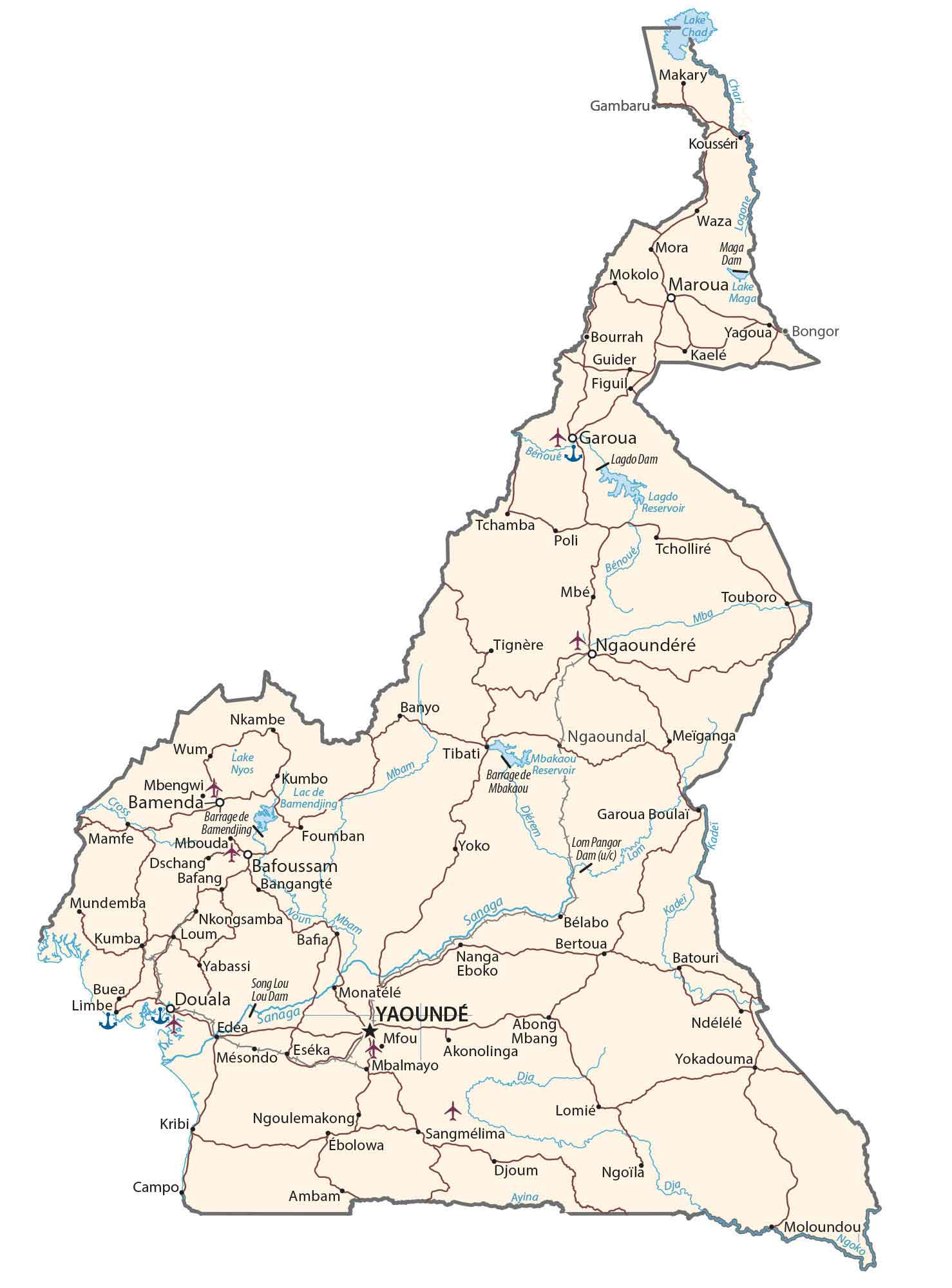
 Cameroon map with cities, roads, rivers, and neighboring countries.
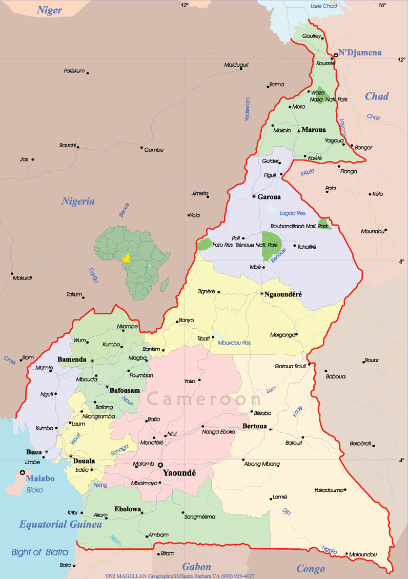
This map shows Cameroon’s major cities, including Yaoundé (capital) and Douala, along with its road networks, rivers, and borders with Nigeria, Chad, Central African Republic, Congo, Gabon, and Equatorial Guinea. Key geographical features include Lake Chad and the Gulf of Guinea.
Cameroon Physical Map — Topography, Rivers & Major Cities
Physical map of Cameroon showing regions, mountains, rivers, and major cities.This Cameroon physical map displays coastal plains, central plateaus and the Cameroon Highlands (including Mount Cameroon), major rivers like the Sanaga and Benue, lakes, vegetation zones, regional boundaries and principal cities (Yaoundé, Douala). Ideal for geographic reference and travel planning.
Brief information about Cameroon
Located in Central Africa, Cameroon is known as 'Africa in miniature' for its incredible diversity of geography, culture and climate. It borders Nigeria to the west, Chad to the north-east, the Central African Republic to the east and Equatorial Guinea, Gabon and the Republic of Congo to the south. Its coastline along the Atlantic Ocean connects it to global trade routes. The country has a variety of landscapes, from tropical rainforest and savannah to volcanic mountains, including Mount Cameroon, the highest peak in West Africa.
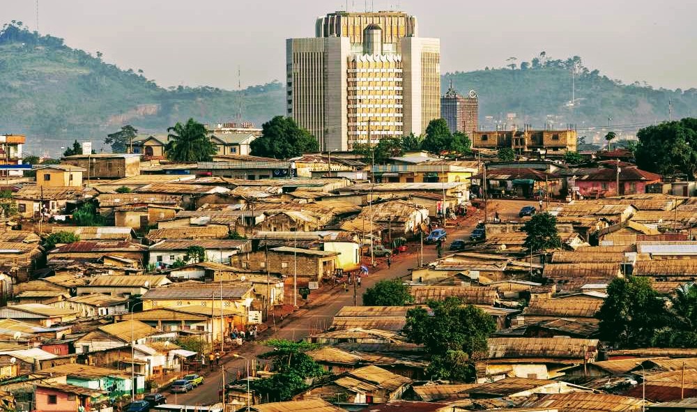
The country's cultural richness stems from its more than 250 ethnic groups, each with their own traditions and languages. Yaoundé, the capital, is the political centre, while Douala, the largest city, is the economic powerhouse. Cameroon's economy is based on agriculture, oil and forestry, with coffee and cocoa being the main exports. Its natural beauty, vibrant festivals and unique wildlife, such as in the Waza National Park, make it a fascinating destination.
Where is located Cameroon on the World and Africa Map?
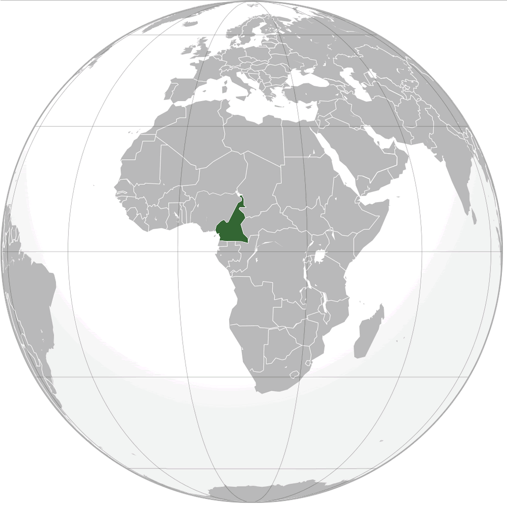 Where is located Cameroon on the World Map
Cameroon is located in Central Africa, bordering Nigeria to the west, Chad to the northeast and the Central African Republic to the east. To the south it borders Equatorial Guinea, Gabon and the Republic of Congo, while its western coast meets the Atlantic Ocean along the Gulf of Guinea.
Cameroon map Yaounde
Cameroon Location Map
Situated just above the equator, Cameroon's location gives it a tropical climate in the south and a more arid environment in the north. This geographical location allows for diverse ecosystems, ranging from rainforests and savannas to volcanic mountains such as Mount Cameroon, the highest peak in West Africa.
On a world map, Cameroon is located between West and Central Africa, acting as a natural gateway between these regions. Its central location makes it a strategic hub for trade, culture and economic activity across the continent.
Here are some statistical information about Cameroon:
 Area: 475,442 km2 (183,569 sq mi)
 Cameroon Political Map
 Religion: 66.3% Christianity, 30.6% Islam, 1.3% traditional faiths, 1.1% no religion, 0.7% others.
 Map of Cameroon Africa
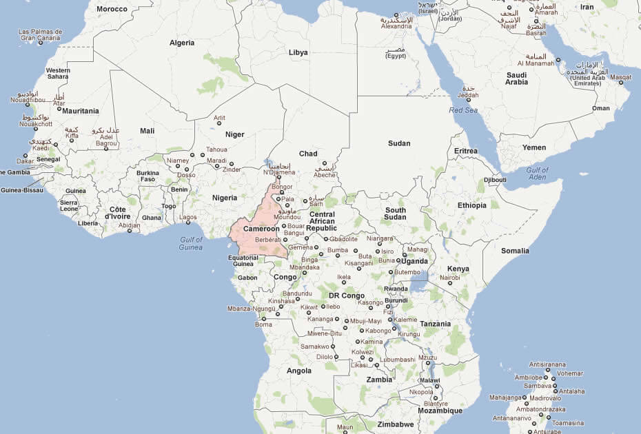 Map of Africa highlighting Cameroon and its neighboring countries.
This map places Cameroon in the central-western part of Africa, showing its location relative to neighboring countries like Nigeria, Chad, Central African Republic, Congo, Gabon, and Equatorial Guinea. Its access to the Gulf of Guinea is also highlighted.
Map of Cameroon World

Cameroon cities map
Physical Cameroon Map
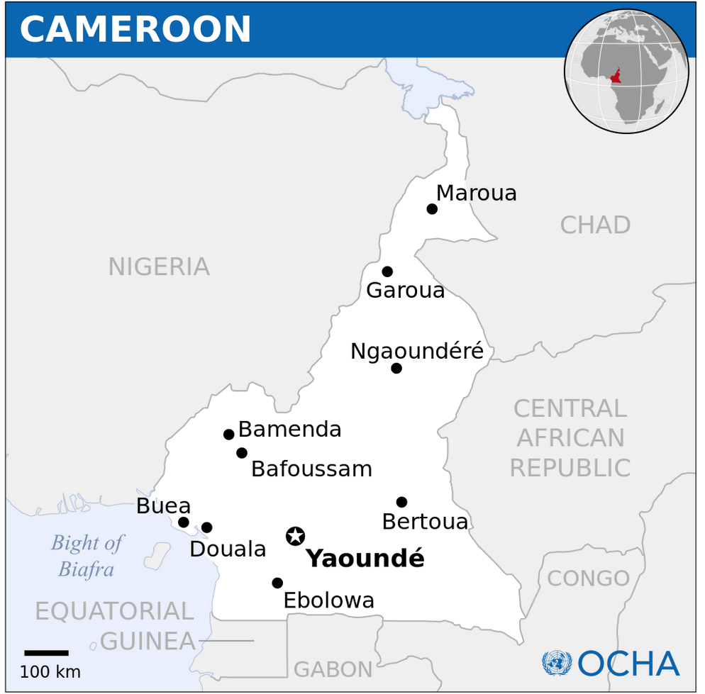
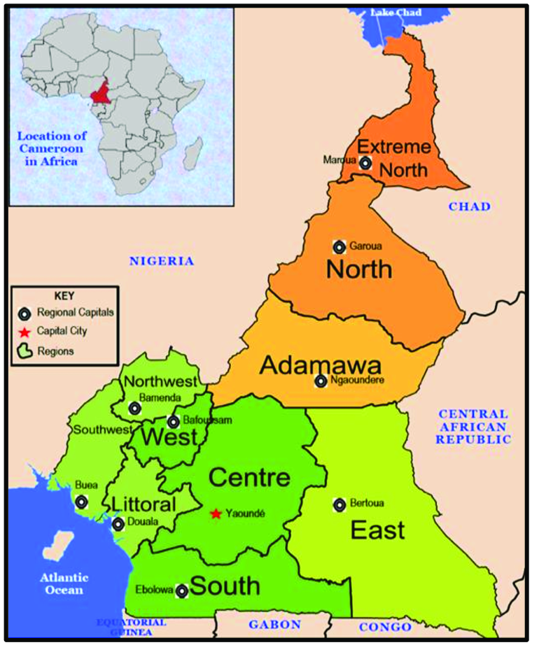
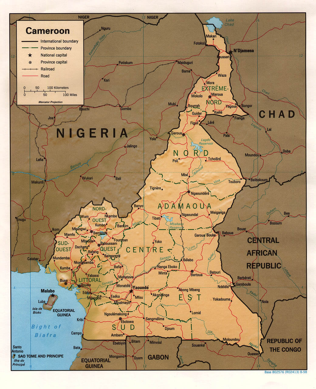 Map of Cameroon highlighting provinces, cities, and borders.
This map details Cameroon’s administrative provinces, including Extreme-Nord, Nord, Centre, and Littoral. It features major cities like Yaoundé, Douala, and Maroua, alongside international borders with Nigeria, Chad, the Central African Republic, and Congo. Roads, railroads, and Lake Chad are also shown.
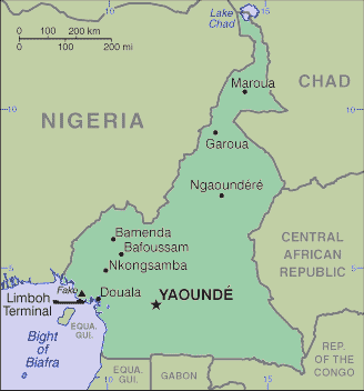
Cameroon Map Yaounde
Map of Cameroon showing Yaoundé, Douala, and surrounding borders.This map highlights Cameroon’s key cities, including the capital Yaoundé and economic hub Douala. It outlines borders with Nigeria, Chad, the Central African Republic, and other neighboring countries, along with Lake Chad and the Gulf of Guinea.
Maps of Cameroon
Cameroon Regional Map
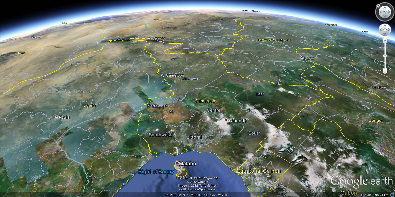
Cameroon Earth Map
Cameroon road map
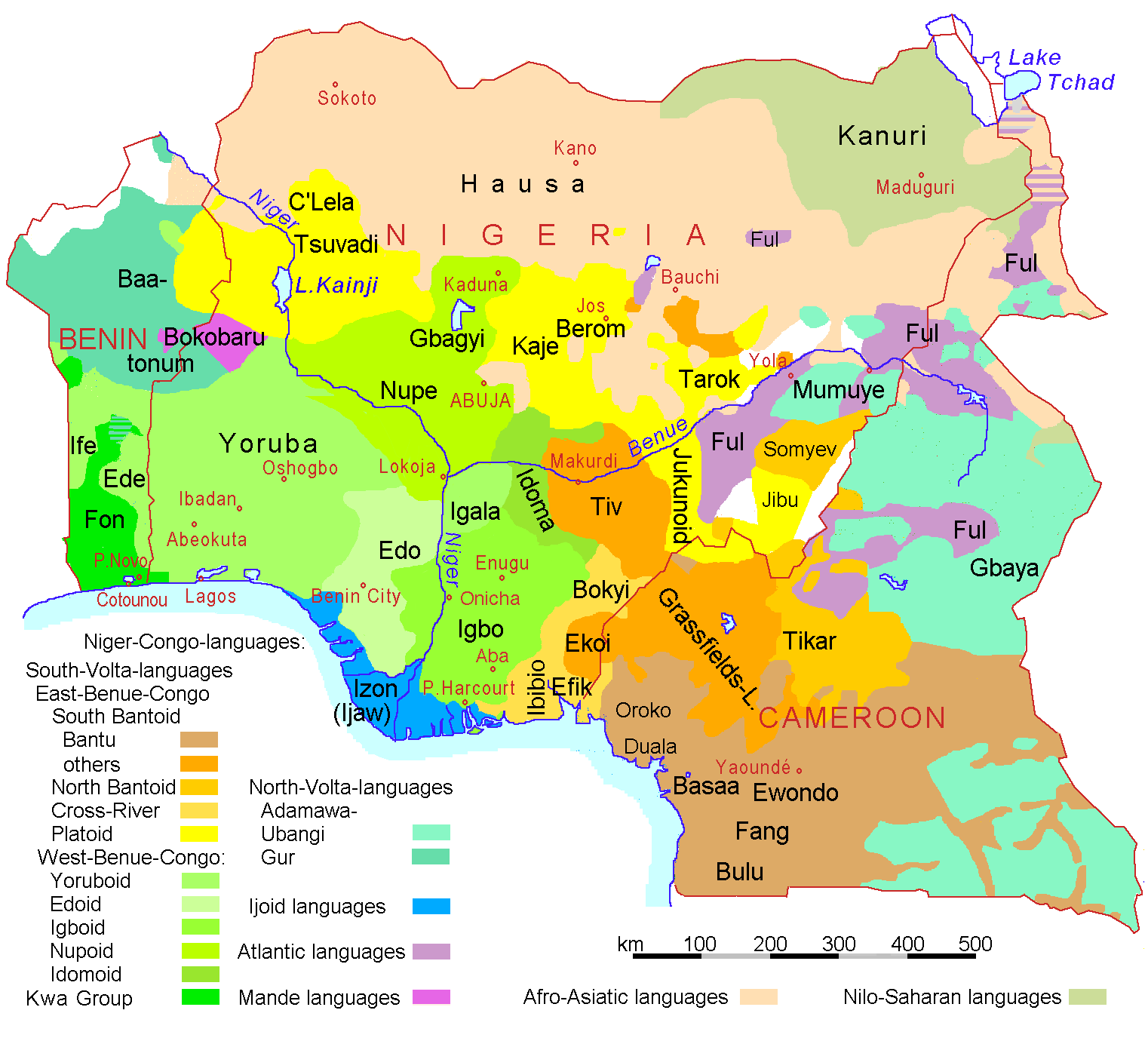
Nigeria Benin Cameroon languages
Provinces map of Cameroon

Feel free to explore these pages as well:
- Head of Performance Marketing
- Head of SEO
- Linkedin Profile: linkedin.com/in/arifcagrici