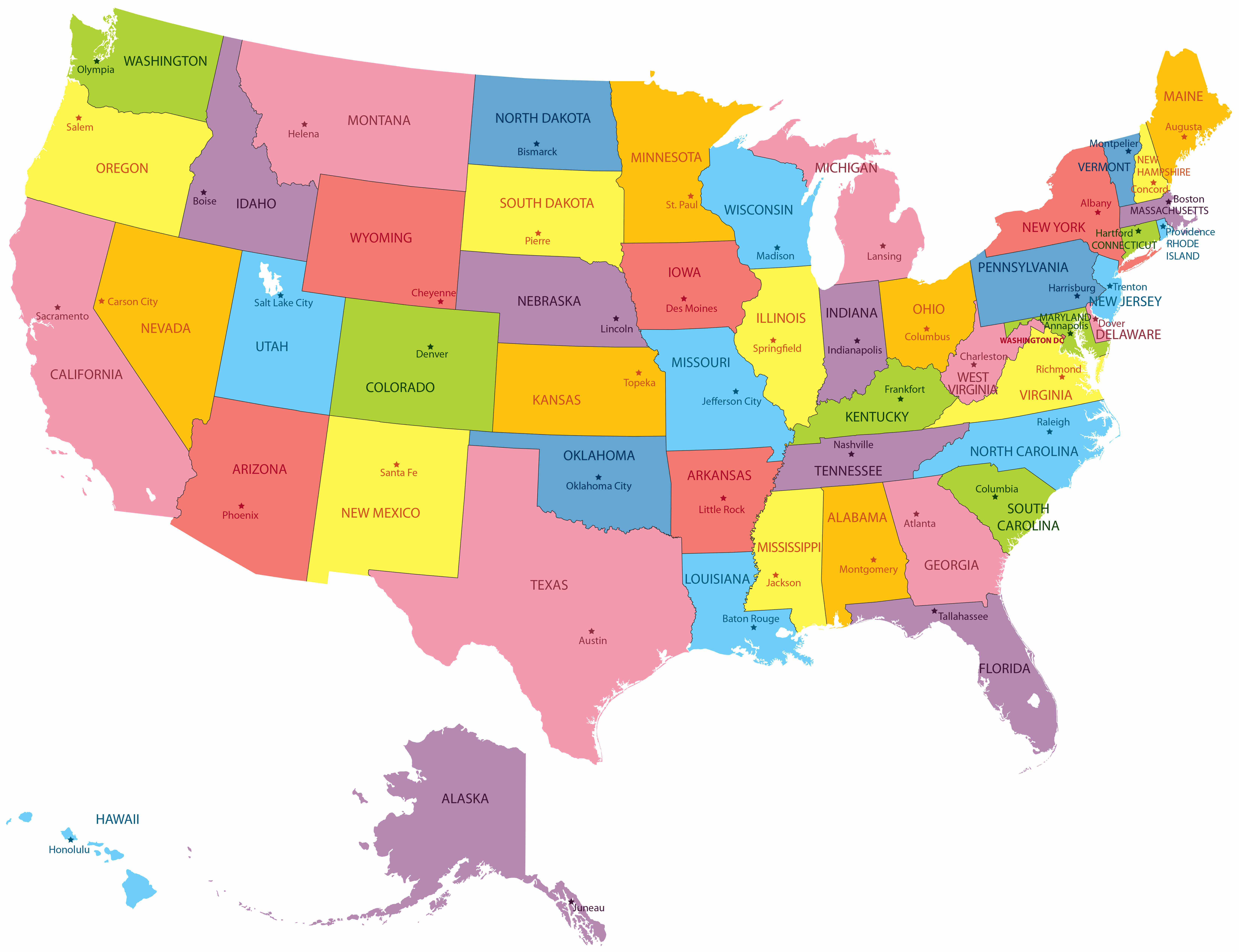
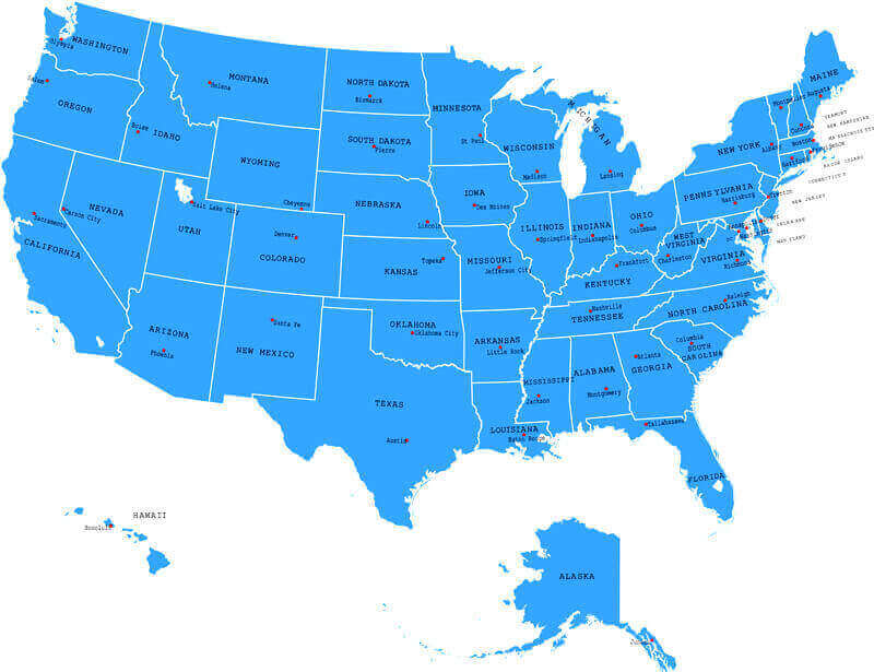
Colorful United States political map with states
 Texas USA map showing Central and Mountain time zones with surrounding states.
This Texas USA time zones map highlights how the state is divided between the Central and Mountain Time Zones, with most regions following Central Time and the far west in Mountain Time. The map also shows neighboring U.S. states, making it easier to compare local time differences across regions.
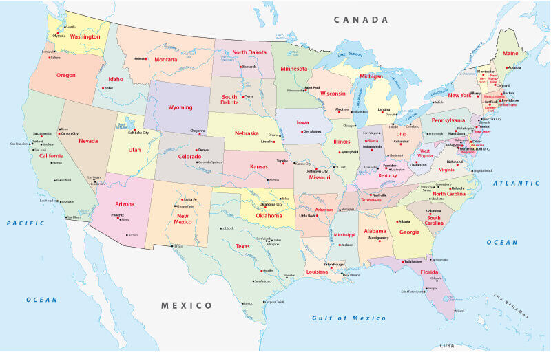
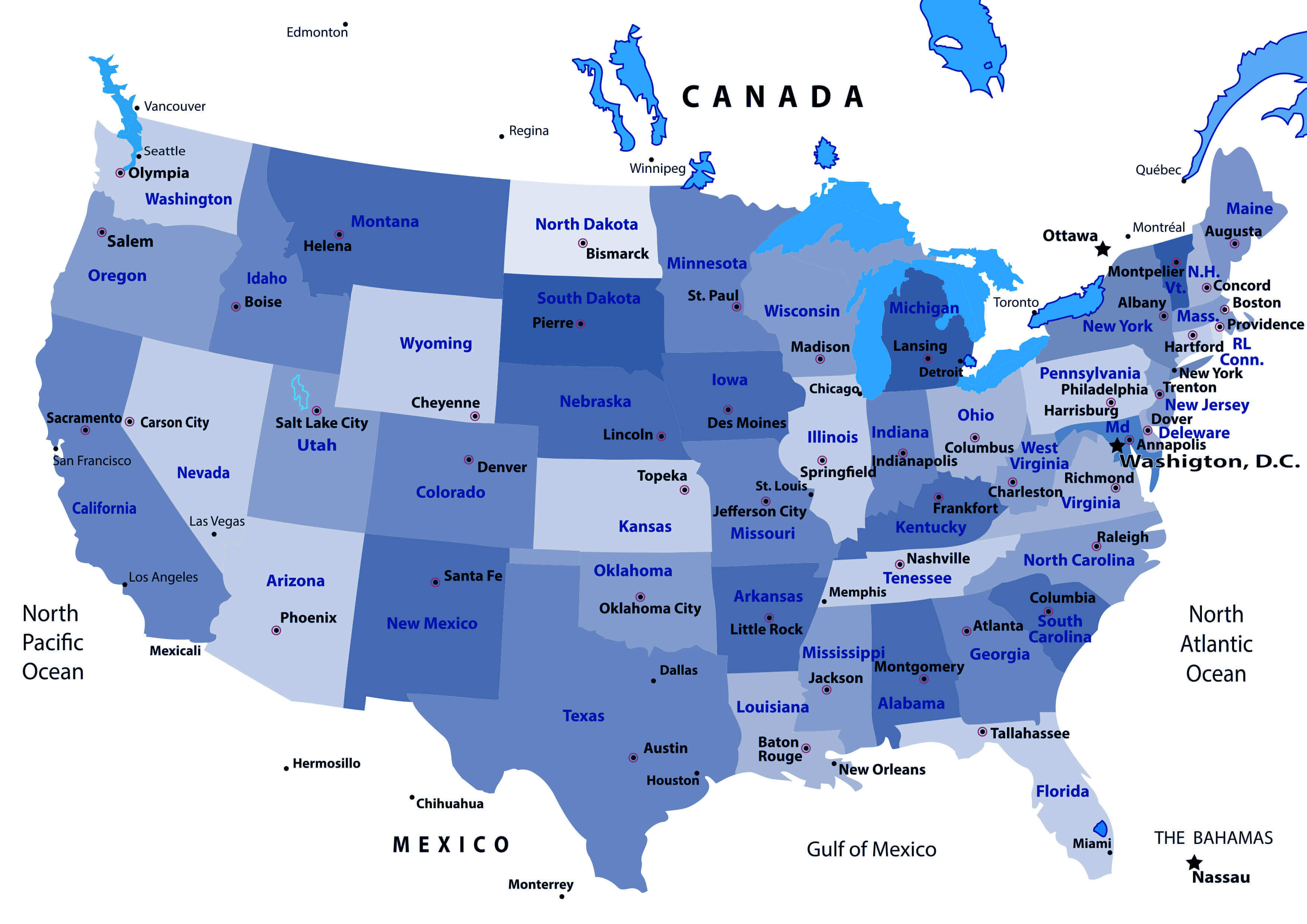
Political Map of the United States with States and Major Cities
 Texas USA map showing Central and Mountain time zones with surrounding states.
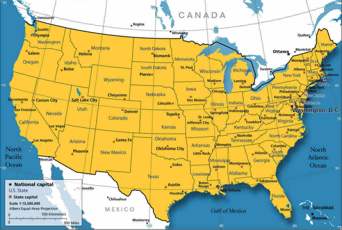
Explore the political map of the United States displaying all 50 states, capitals, and major cities. This map highlights boundaries, highways, rivers, and neighboring countries like Canada and Mexico. Ideal for learning about US geography, state divisions, and political regions.
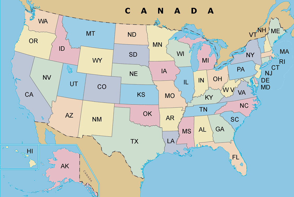
The United States map with states abbreviation
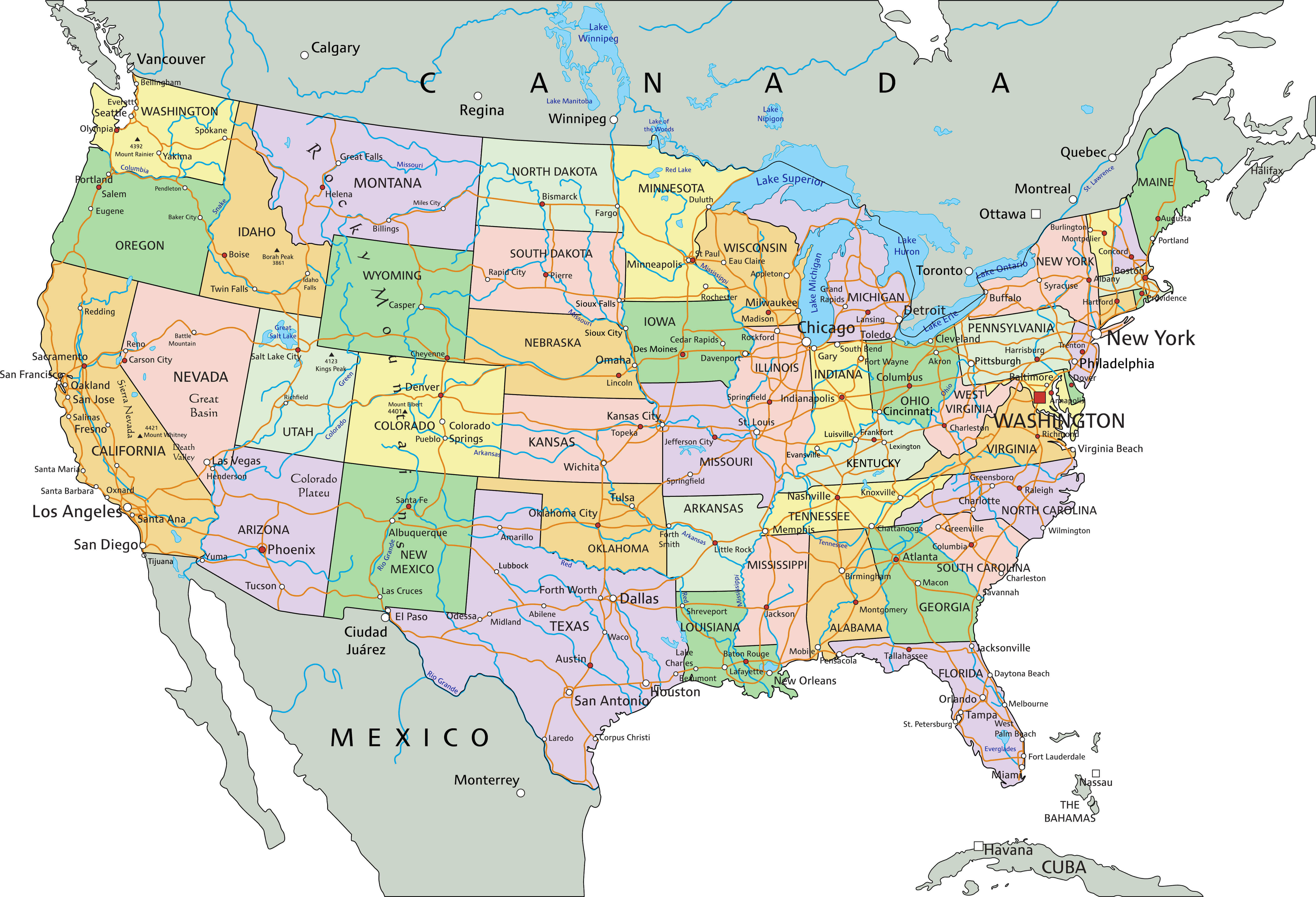
United States political map with US states and canada territorial
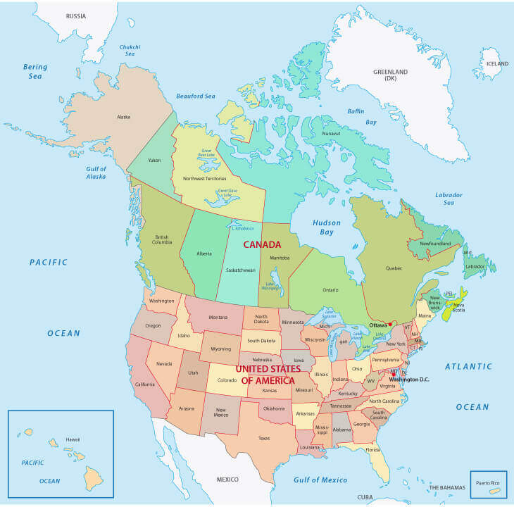
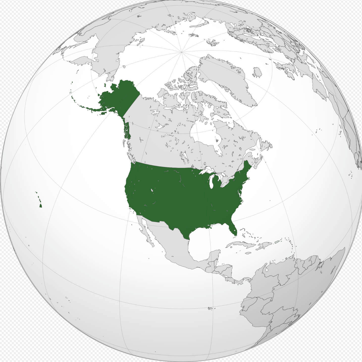
Where is United States on the World map
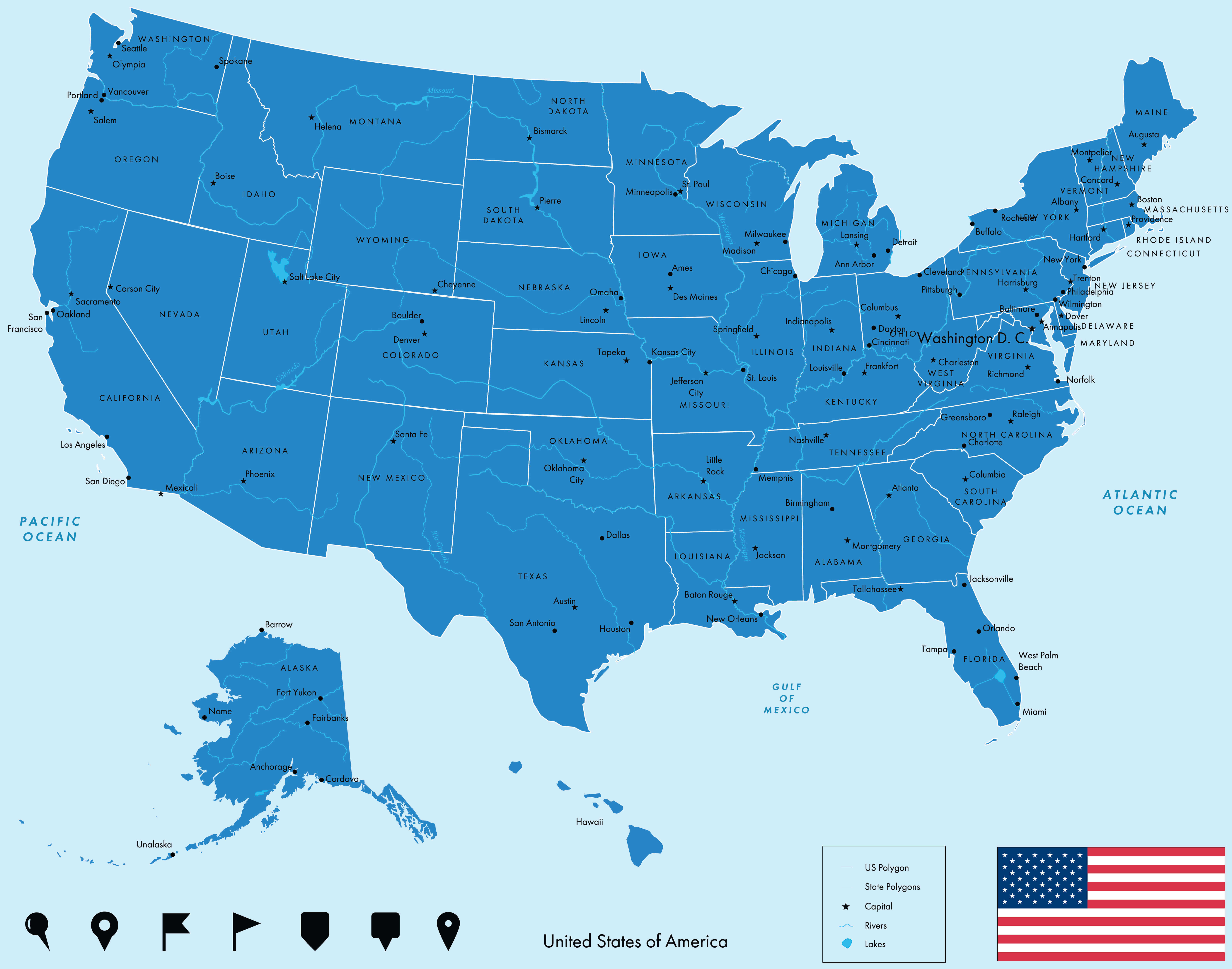
United States map states national capitals
United States political map with Alaska Hawaii
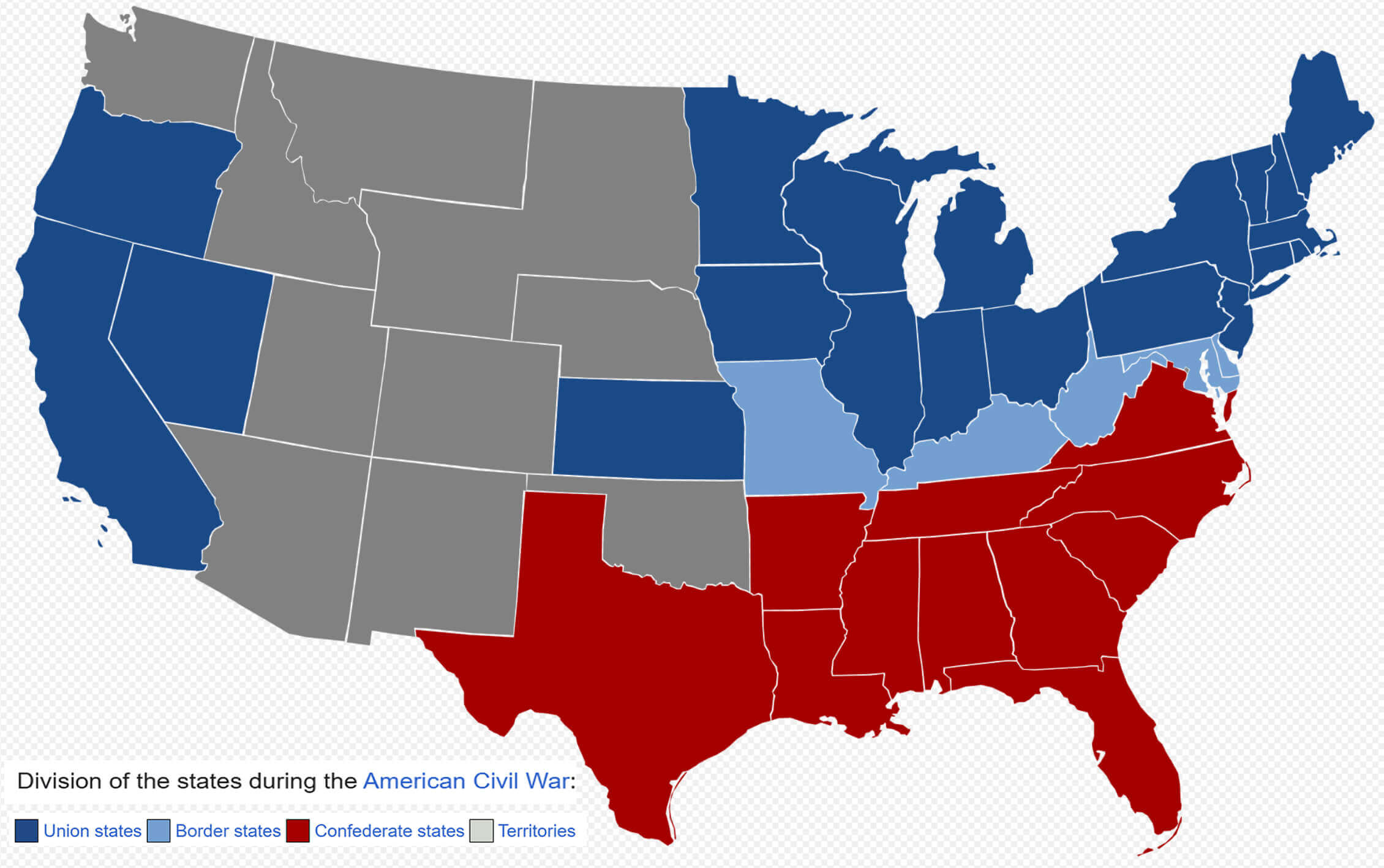
American civil war map 1800 1865
European colonization map with the United States in 1750
United States exclusive economic zone map

Political map of the United States with Alaska and Hawaii
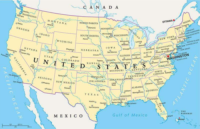
Political map of the United States with United States
The United States of America political map with major cities
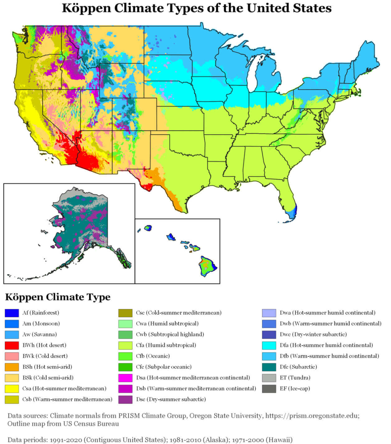
United States climate map
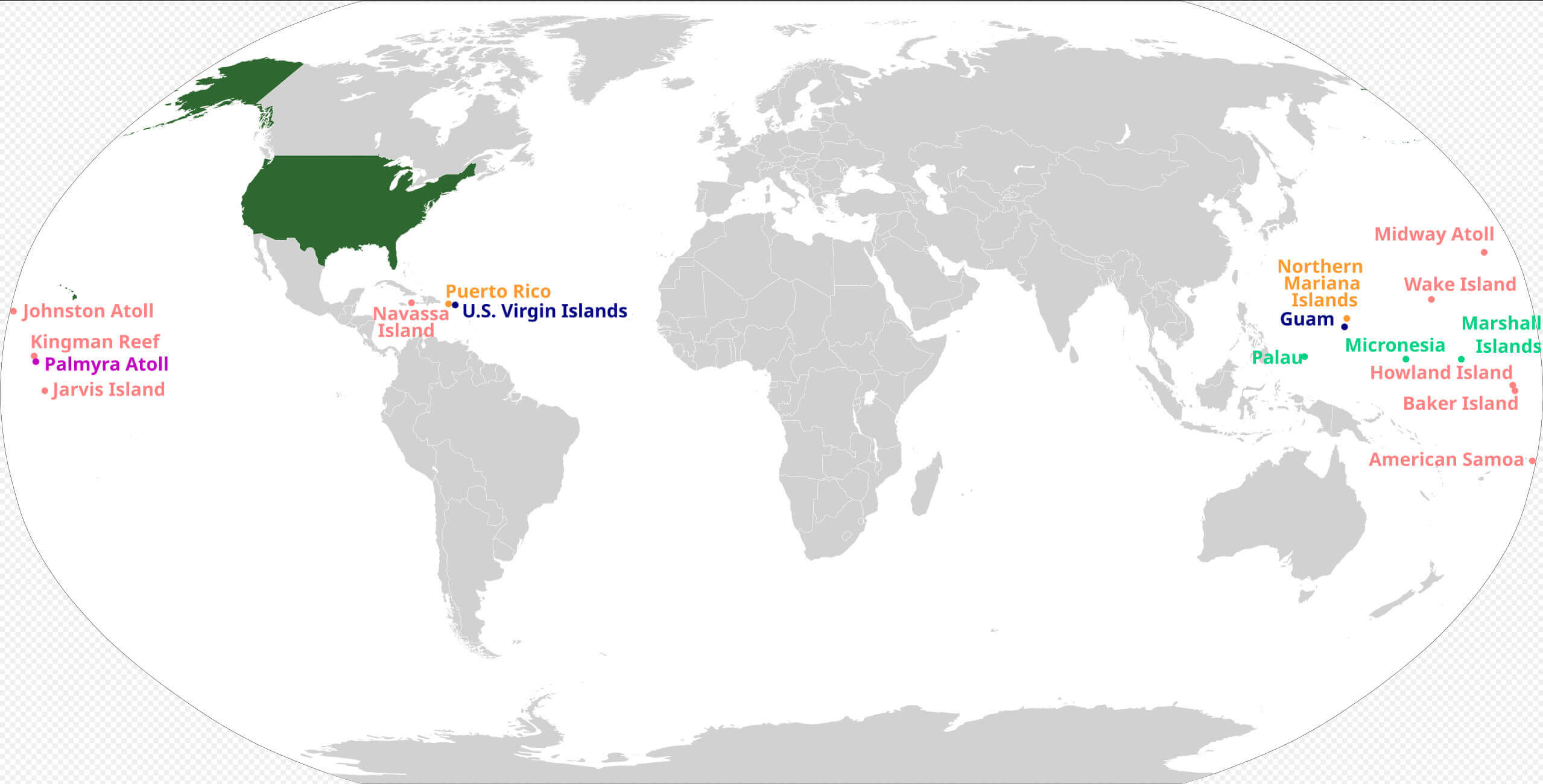
United States territories map around the World
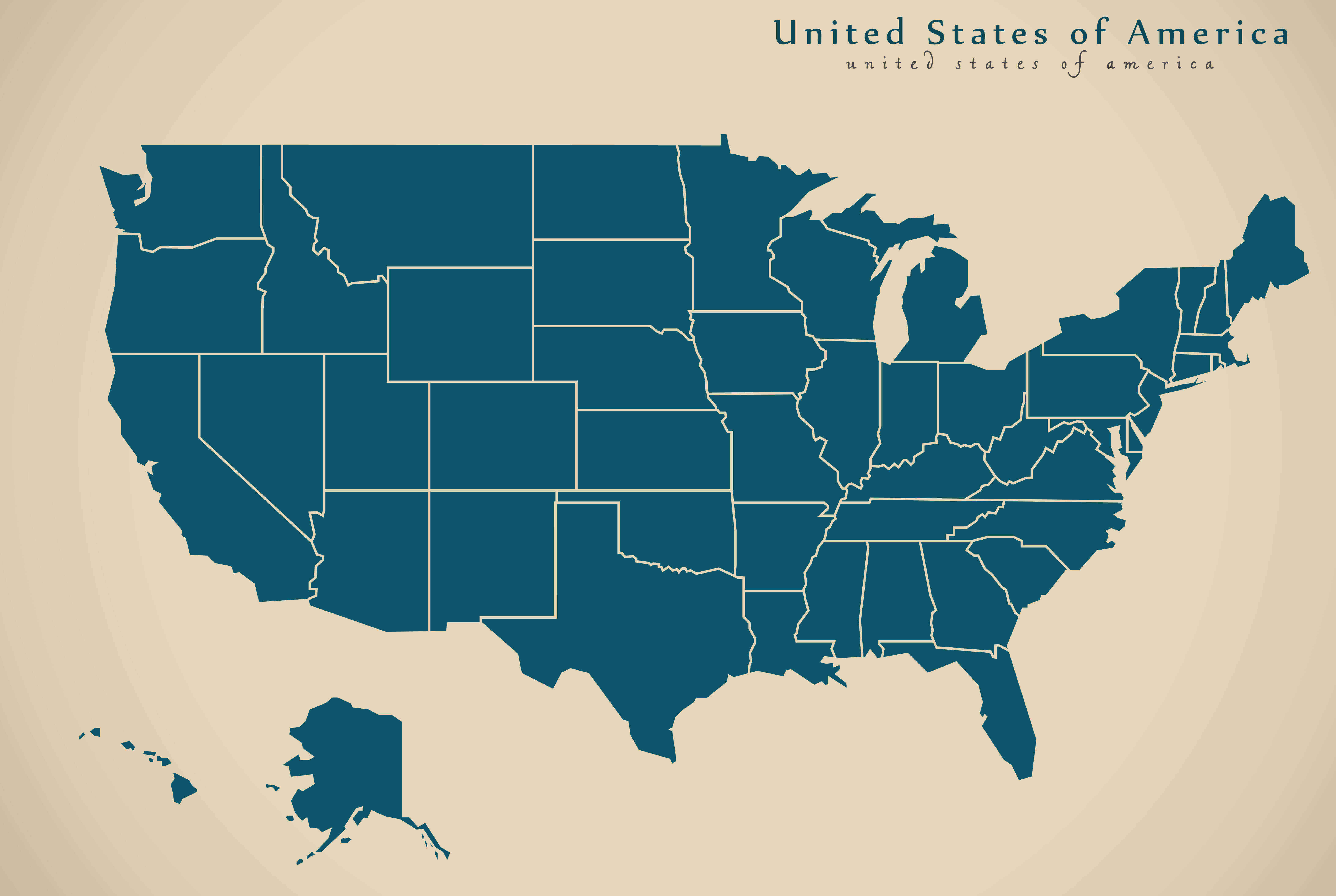
United States political blank map
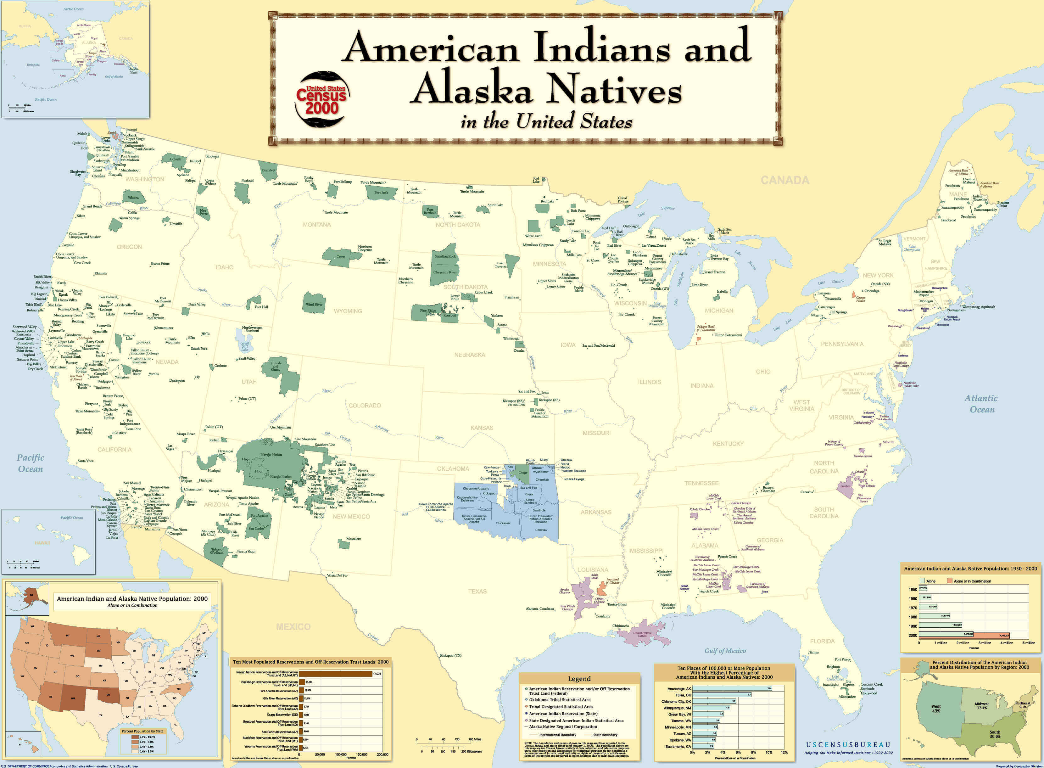
United States political Indian Tribes map
United States political map by states
United States political map with Hawaii and Alaska
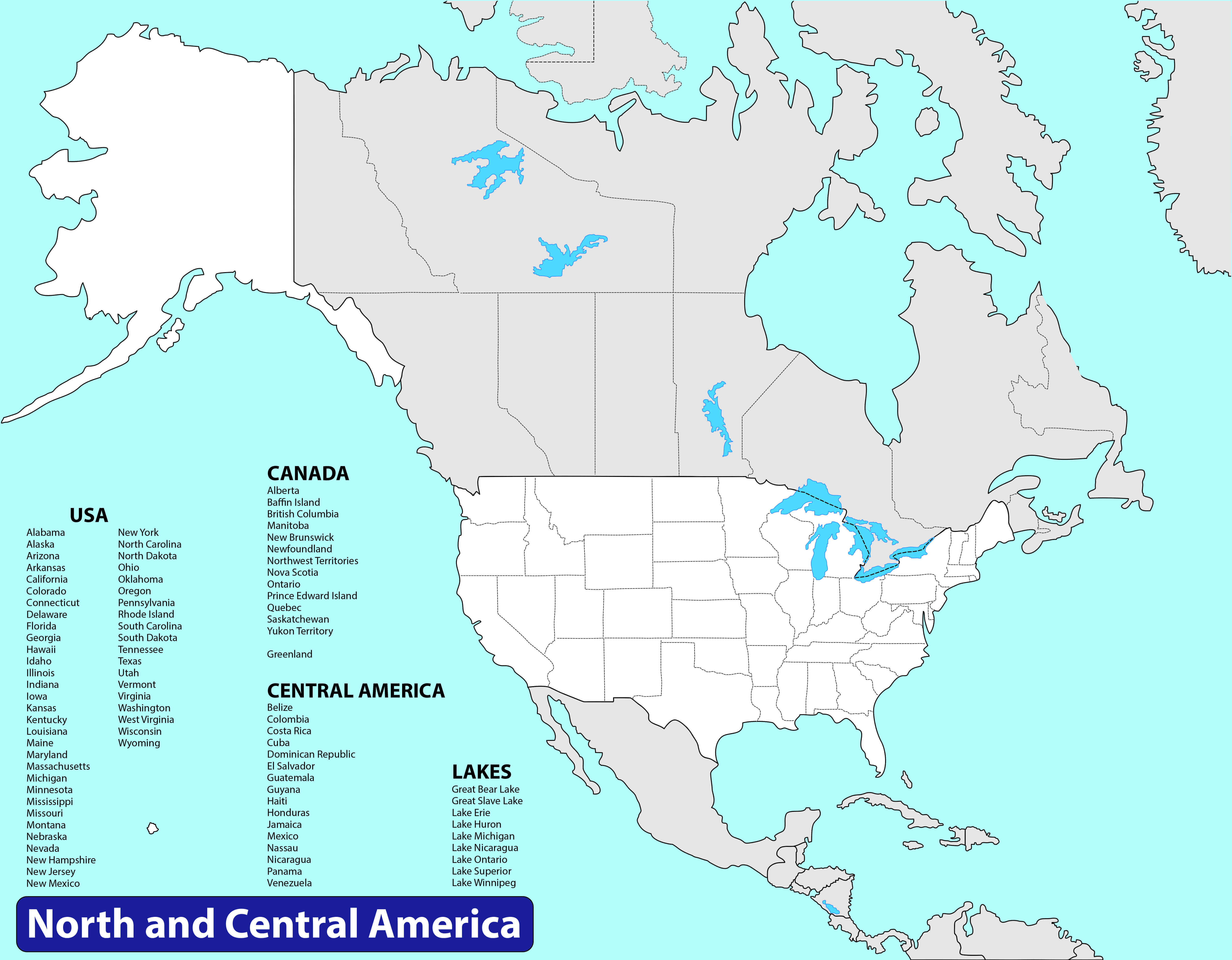
United States political map with north america and Central America
United States political map with rivers
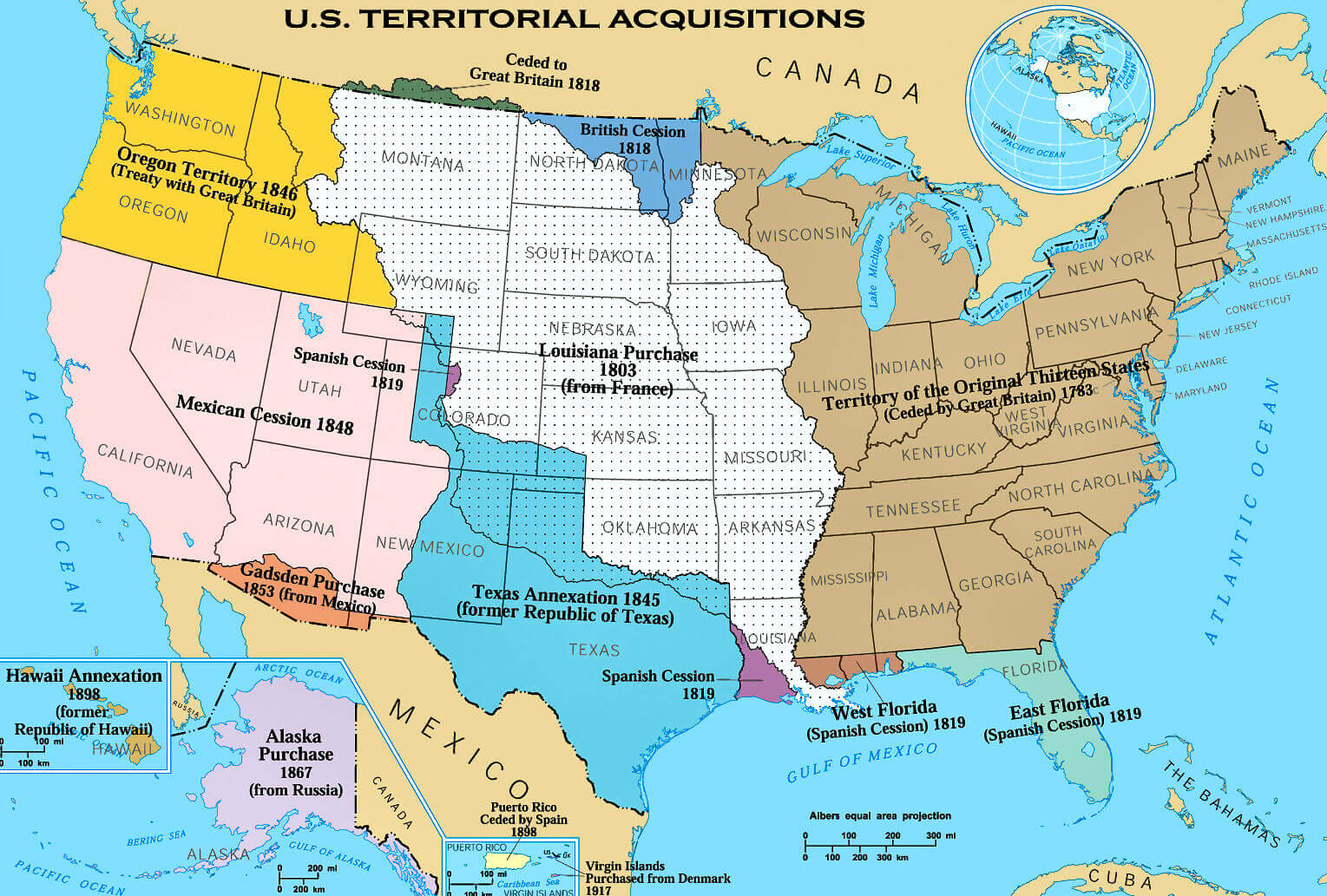
United States political territorial acquisitions map
United States states map with capitals
Feel free to explore these pages as well: