Time Zone Map of the USA: Explore Pacific, Mountain, Central & Eastern Time
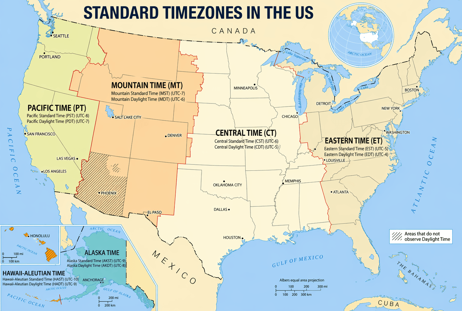
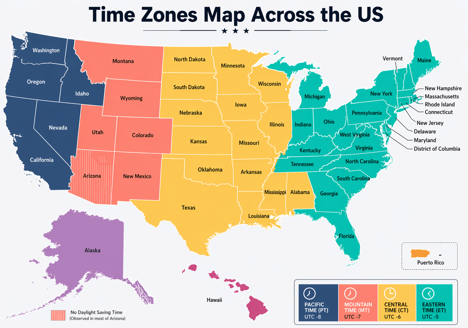
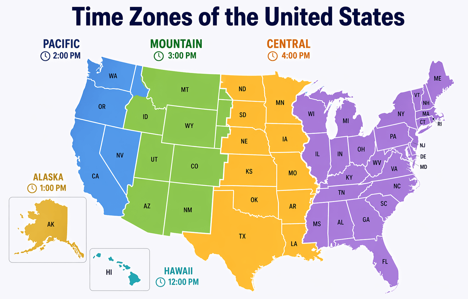
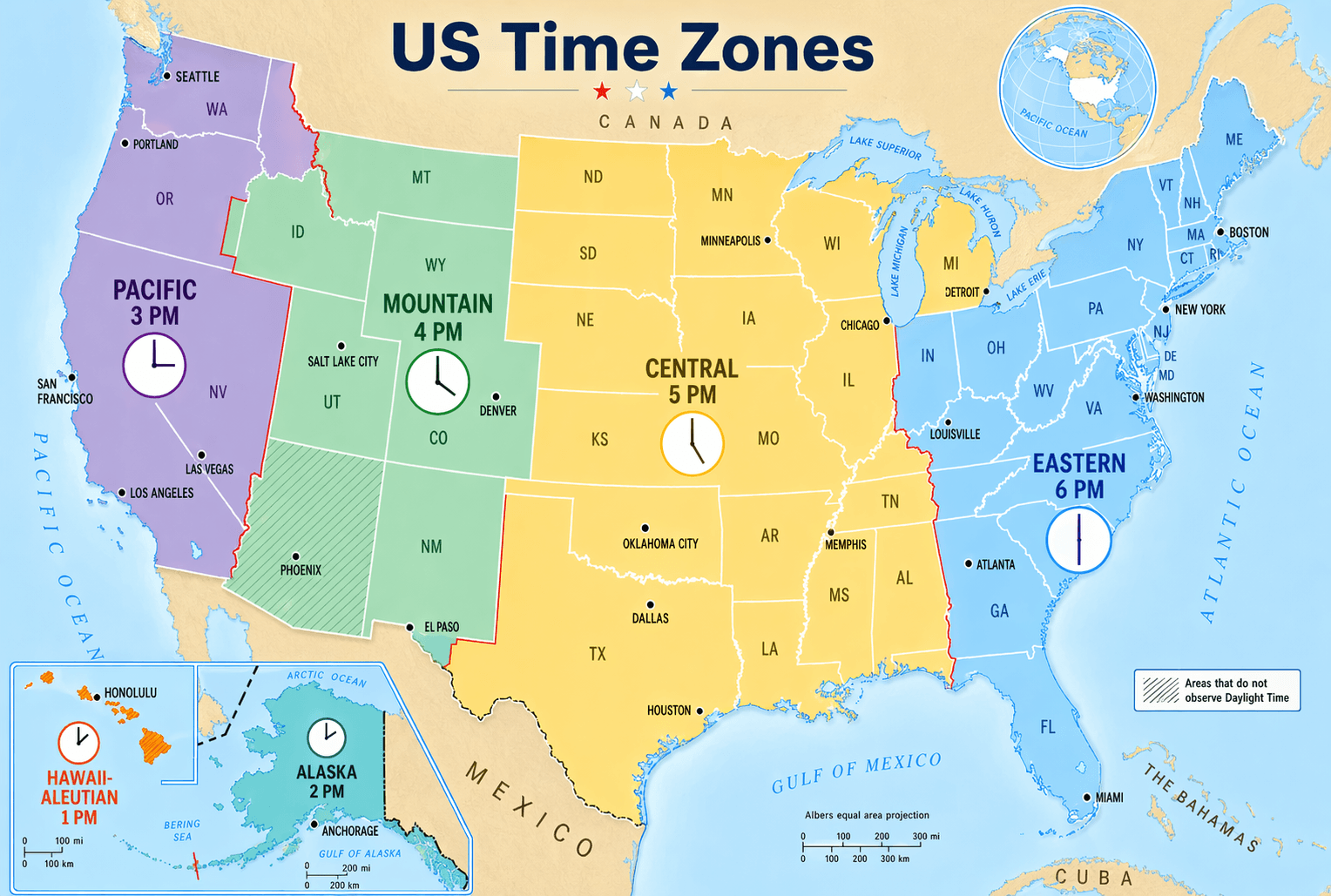
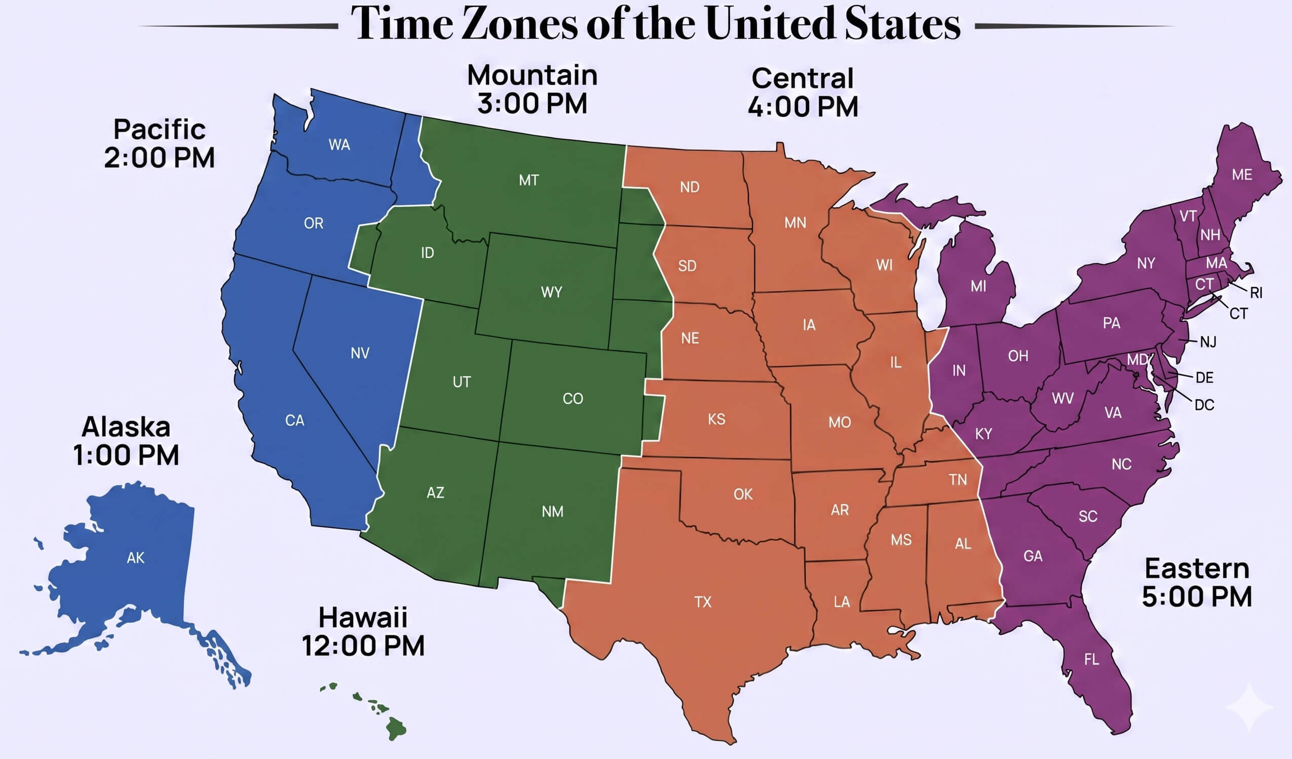
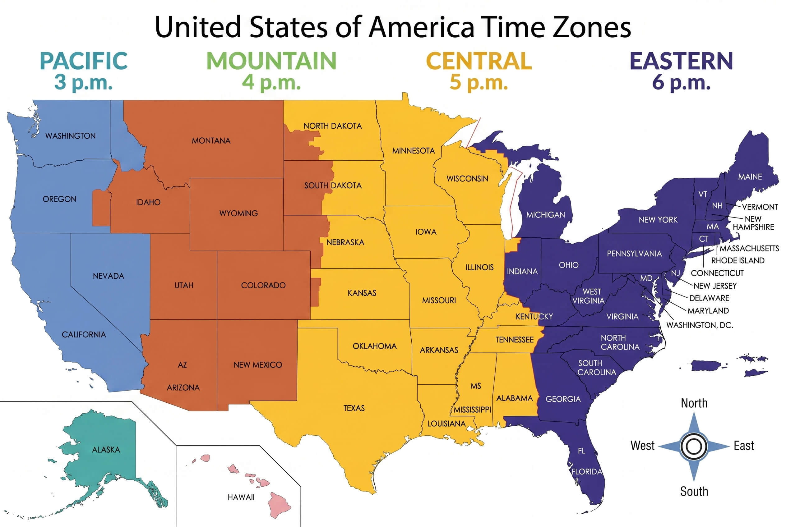
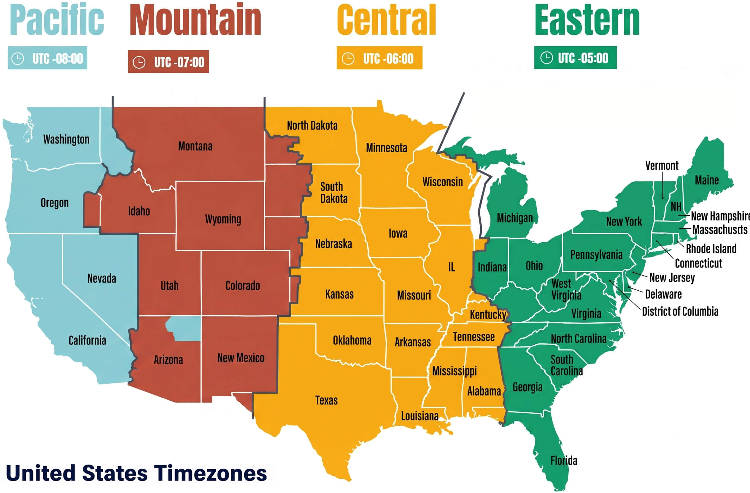
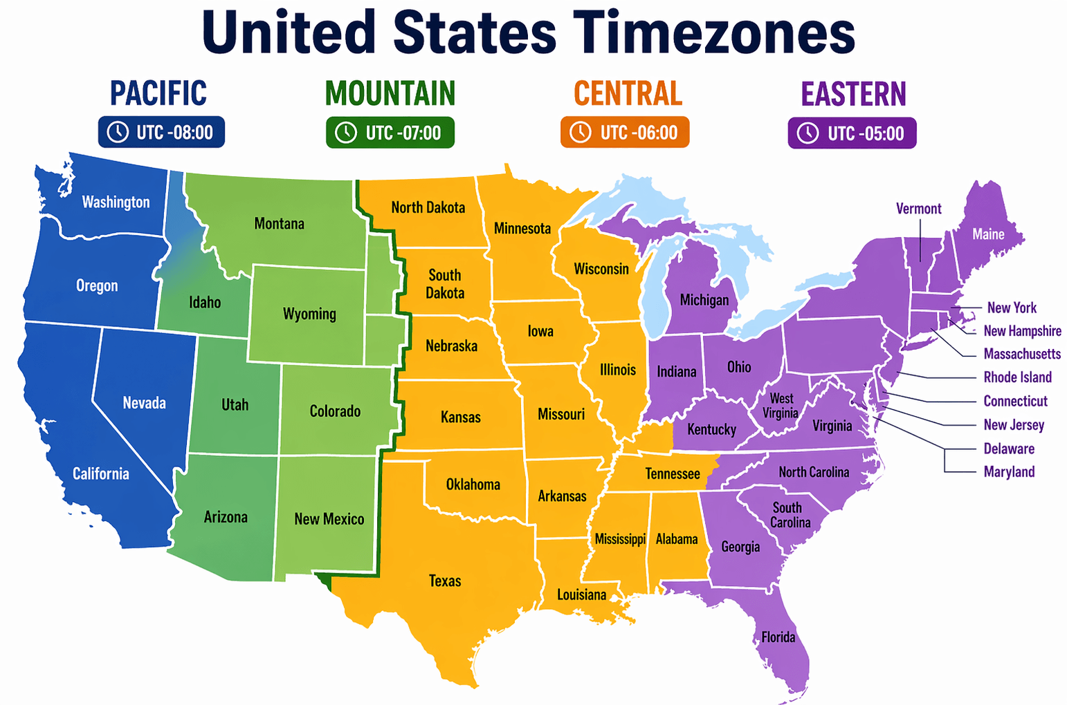
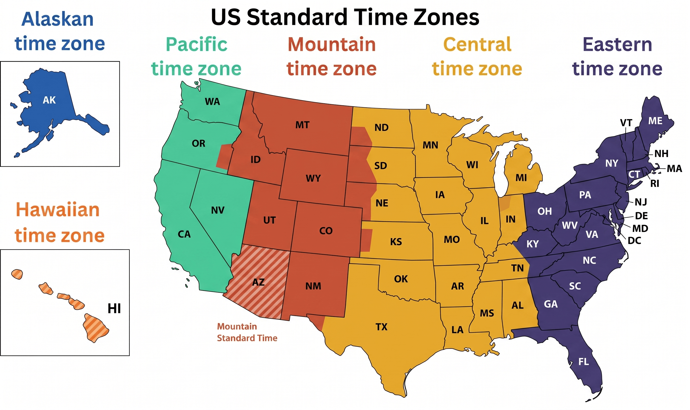
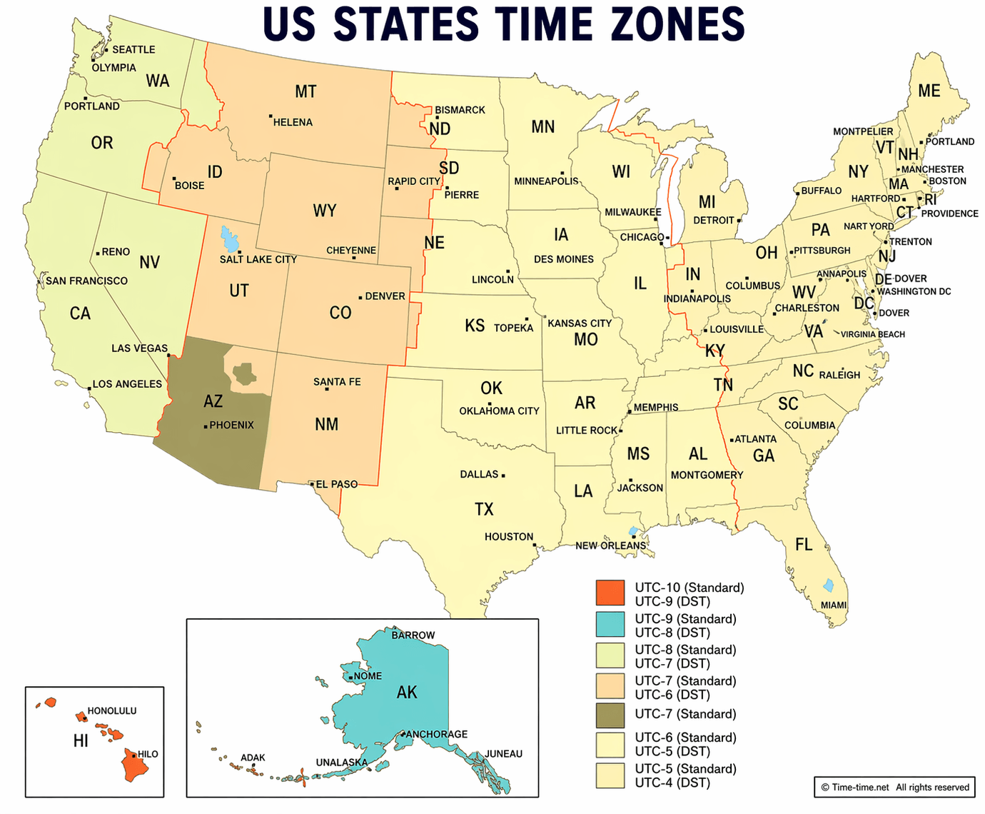
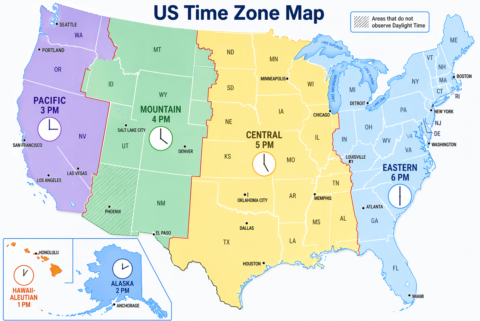
Discover the USA Time Zone Map to see how time is organized across the country, stretching from the Pacific Coast to the Eastern Seaboard and beyond. This map outlines the six primary U.S. time zones—Pacific, Mountain, Central, Eastern, Alaska, and Hawaii-Aleutian—along with their UTC offsets and daylight saving time adjustments. Whether you're planning a trip, coordinating meetings, or comparing local times between states, this guide makes it easy to understand time differences and stay accurately aligned across the nation.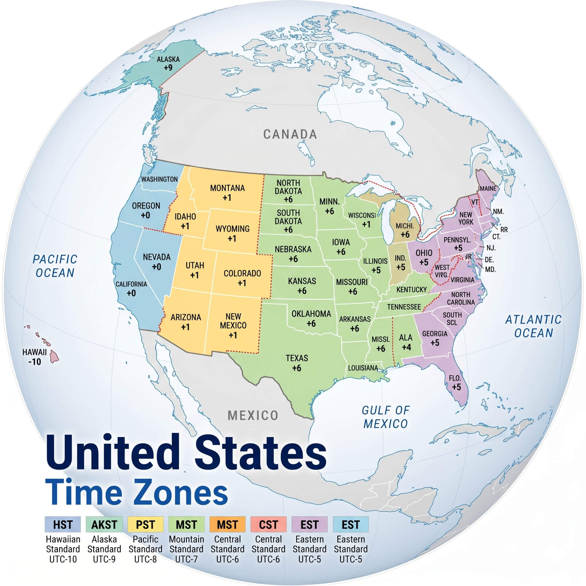
Standard time zones map in the US
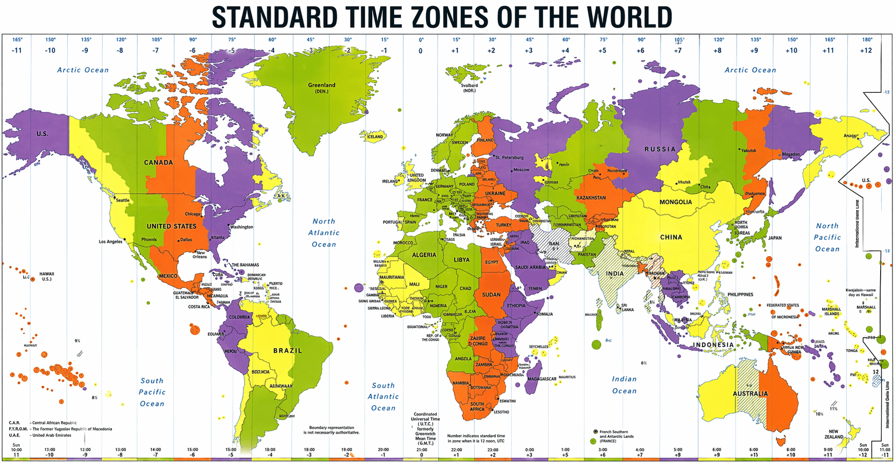
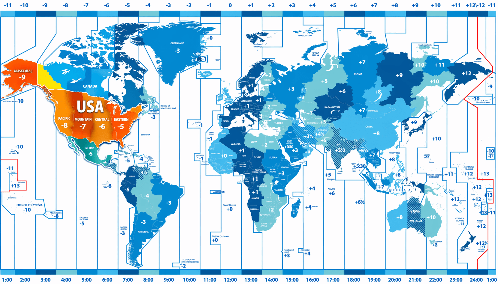
Standard time zones of the World map with USA
Time zones map across the United States
Time zones map of the United States
Time zones map of the US
Time zones of the United States map
United States of America time zones map
United States time zones map with Globe
United States time zones map
United States timezones map
US standard time zones map
US states time zones map
US time zone map
World time zones map with United States
How many time zones are there in the United States?
The United States has six main time zones: Pacific, Mountain, Central, Eastern, Alaska, and Hawaii-Aleutian, each with different UTC offsets.
What is the most commonly used time zone in the USA?
The Eastern Time Zone (ET) is the most widely used, covering major cities like New York, Washington D.C., and Miami.
Does the USA use Daylight Saving Time?
Yes, most states observe Daylight Saving Time, moving clocks forward in spring and back in fall, except for Hawaii and most of Arizona.
How can I check time differences between US states?
You can use a USA time zone map to easily compare time differences between states, helping with travel planning and scheduling.
Why are there multiple time zones in the United States?
Due to its large geographic size spanning several longitudes, the USA is divided into multiple time zones to standardize local time across regions.
Feel free to explore US states maps:
- Head of Performance Marketing
- Head of SEO
- Linkedin Profile: linkedin.com/in/arifcagrici