Explore Maine Time Zone Map & Details with Current Local Time
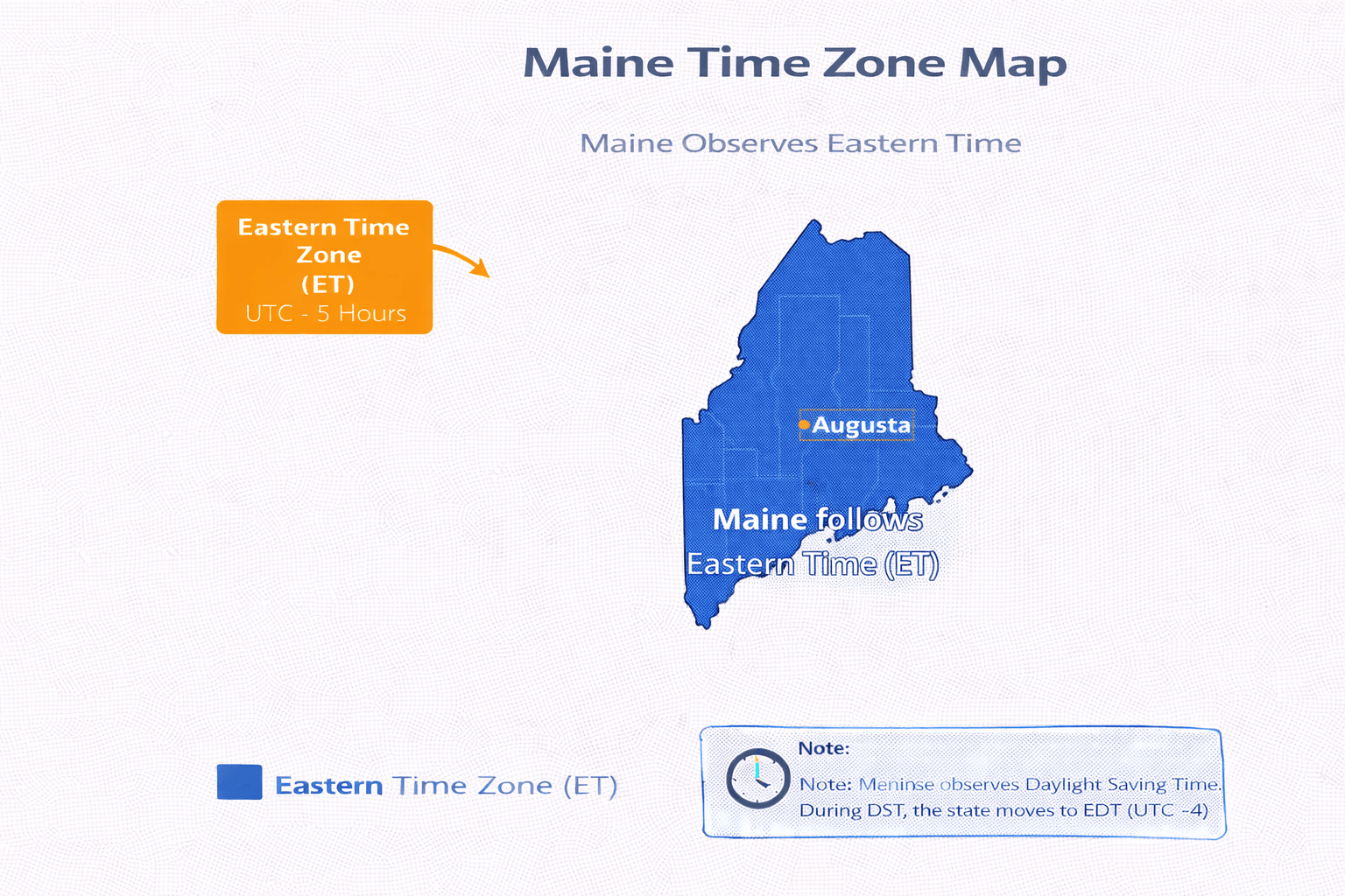
A Maine Time Zone Map is a clear and user-friendly guide to the time zone observed across the state of Maine, making it a valuable resource for residents, travelers, and businesses. Located in the northeasternmost United States, Maine operates ??????? within the Eastern Time Zone (ET), observing Eastern Standard Time (EST, UTC-5) during the winter and Eastern Daylight Time (EDT, UTC-4) in the summer when daylight saving time is in effect. This map highlights Maine's position in the New England region, its close alignment with nearby states like New Hampshire, and its proximity to Canada, which is especially important for cross-border coordination. Whether you're planning a trip, scheduling meetings, or checking the current local time, a Maine time zone map provides a reliable and practical tool for accurate time management.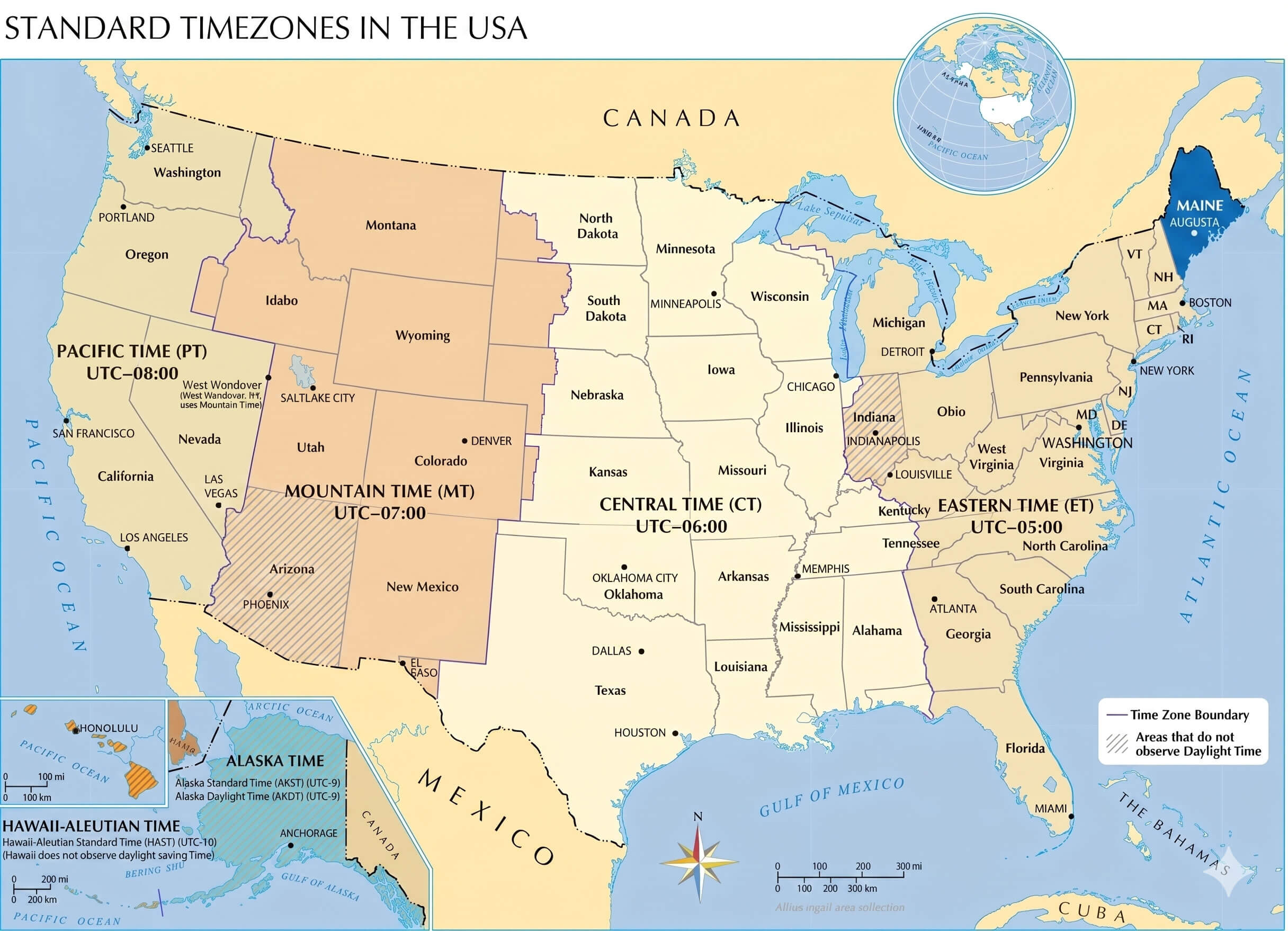
What Time Zone Does Maine Use?
Maine follows the Eastern Time Zone (ET), which corresponds to Eastern Standard Time (EST) or UTC-5 during the winter months. Located in the northeastern United States, Maine shares its time zone with major cities such as New York City, Boston, Washington, D.C., and Miami. This time zone plays an important role in transportation, commerce, and communication across the East Coast of the United States.
Maine Time Zone Map Infographic
Does Maine Use Daylight Saving Time?
Yes. Maine observes Daylight Saving Time. Clocks move forward by one hour in March, changing from Eastern Standard Time (EST, UTC-5) to Eastern Daylight Time (EDT, UTC-4). In November, clocks are set back one hour as Maine returns to standard time.
Maine Time Zone Map
What Time Is It in Maine Right Now?
Maine Time Zone
Maine Major cities in this time zone:
- Portland
- Lewiston
- Bangor
- South Portland
- Auburn
- Biddeford
Time Difference Between Maine and Major Cities
| City | Time Difference |
|---|---|
| New York | Same time (ET) |
| Washington, D.C. | Same time (ET) |
| Dallas | 1 hour behind (CT) |
| Denver | 2 hours behind (MT) |
| Los Angeles | 3 hours behind (PT) |
| London | 5 hours ahead |
| Paris | 6 hours ahead |
| Istanbul | 7 hours ahead |
| Tokyo | 13 hours ahead |
How Far Is Portland from Los Angeles? Distance in KM and Miles
The distance between Portland (Maine) and Los Angeles is approximately 4,200 kilometers (about 2,610 miles) when measured in a straight line. This route connects the northeastern United States to the West Coast and is one of the longest domestic travel corridors in the country. Actual travel distance may vary depending on the route and mode of transportation.
How Long Is the Flight Between Portland and Los Angeles?
A direct or connecting flight between Portland (Maine) and Los Angeles typically takes about 6 to 7 hours, depending on weather conditions, air traffic, and the exact route. Flights usually depart from Portland International Jetport (PWM) and arrive at Los Angeles International Airport (LAX). Major airlines offering flights include American Airlines, Delta Air Lines, and United Airlines.
Feel free to explore these pages as well:
- California Time Zone Map ↗️
- California Time Zone Map ↗️
- Texas Time Zone Map ↗️
- Florida Time Zone Map ↗️
- New York Time Zone Map ↗️
- Pennsylvania Time Zone Map ↗️
- Illinois Time Zone Map ↗️
- Ohio Time Zone Map ↗️
- Georgia Time Zone Map ↗️
- North Carolina Time Zone Map ↗️
- Michigan Time Zone Map ↗️
- New Jersey Time Zone Map ↗️
- Virginia Time Zone Map ↗️
- Washington Time Zone Map ↗️
- Arizona Time Zone Map ↗️
- Tennessee Time Zone Map ↗️
- Massachusetts Time Zone Map ↗️
- Indiana Time Zone Map ↗️
- Missouri Time Zone Map ↗️
- Maryland Time Zone Map ↗️
- Colorado Time Zone Map ↗️
- Wisconsin Time Zone Map ↗️
- Minnesota Time Zone Map ↗️
- South Carolina Time Zone Map ↗️
- Alabama Time Zone Map ↗️
- Head of Performance Marketing
- Head of SEO
- Linkedin Profile: linkedin.com/in/arifcagrici