South America Maps: Countries, Capitals, Borders and Geography
Explore our comprehensive collection of South America Maps, designed for students, researchers, travelers, and geography enthusiasts. This collection features a wide range of map types, including a South America political map, detailed South America countries map, major cities map, and road network map, providing valuable insights into national borders, transportation corridors, urban centers, and regional divisions. Whether you are studying the continent's political geography or planning a journey across South America, these maps serve as reliable and informative resources.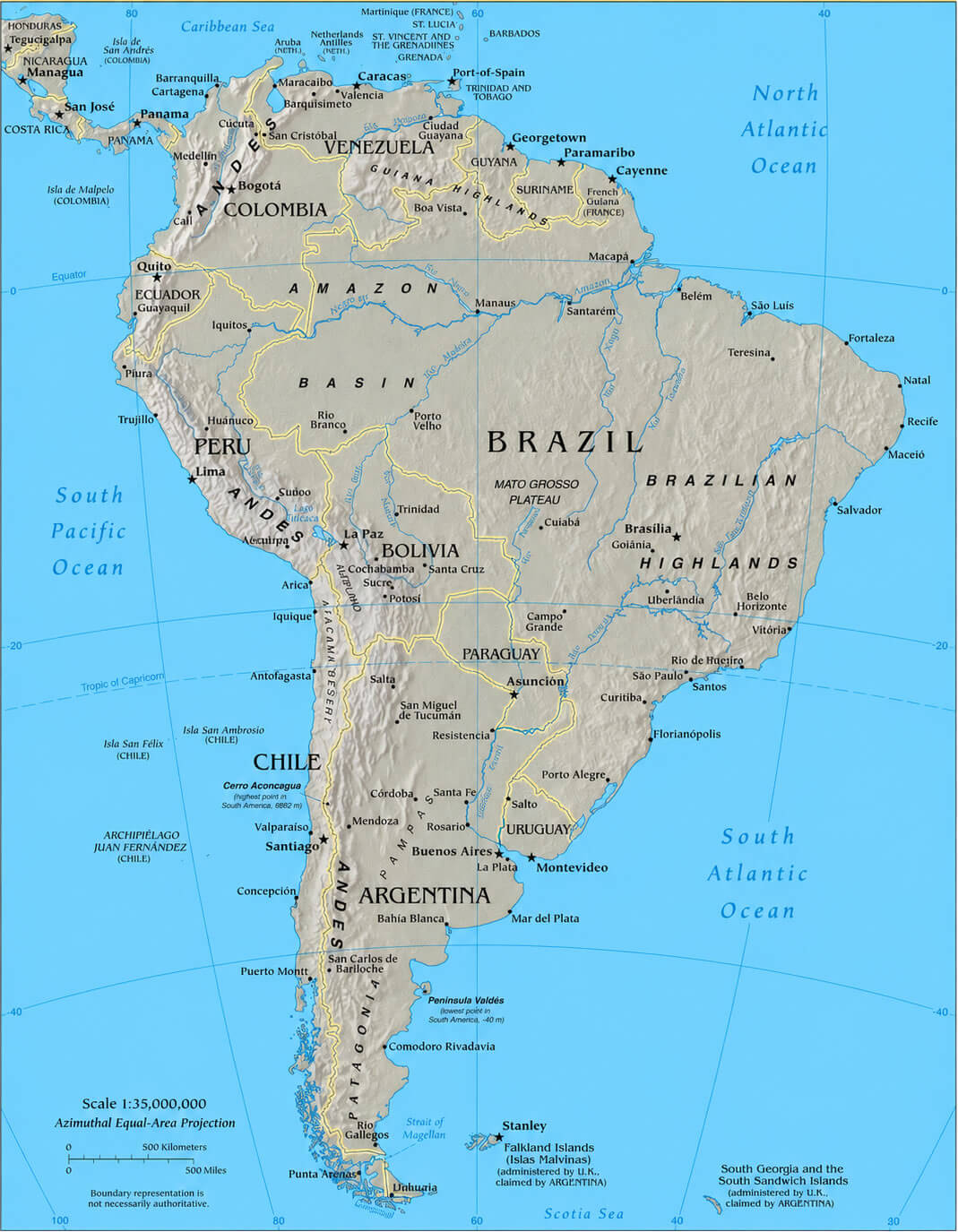
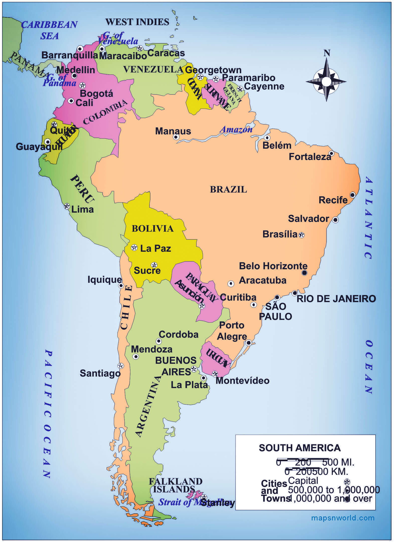
South America detailed political map
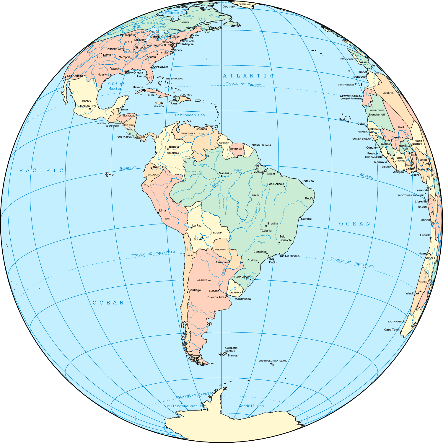
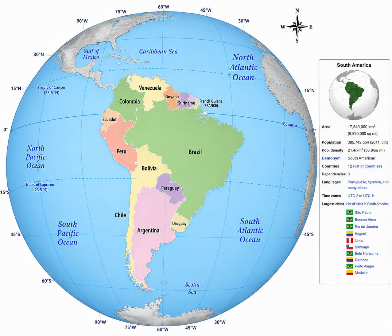
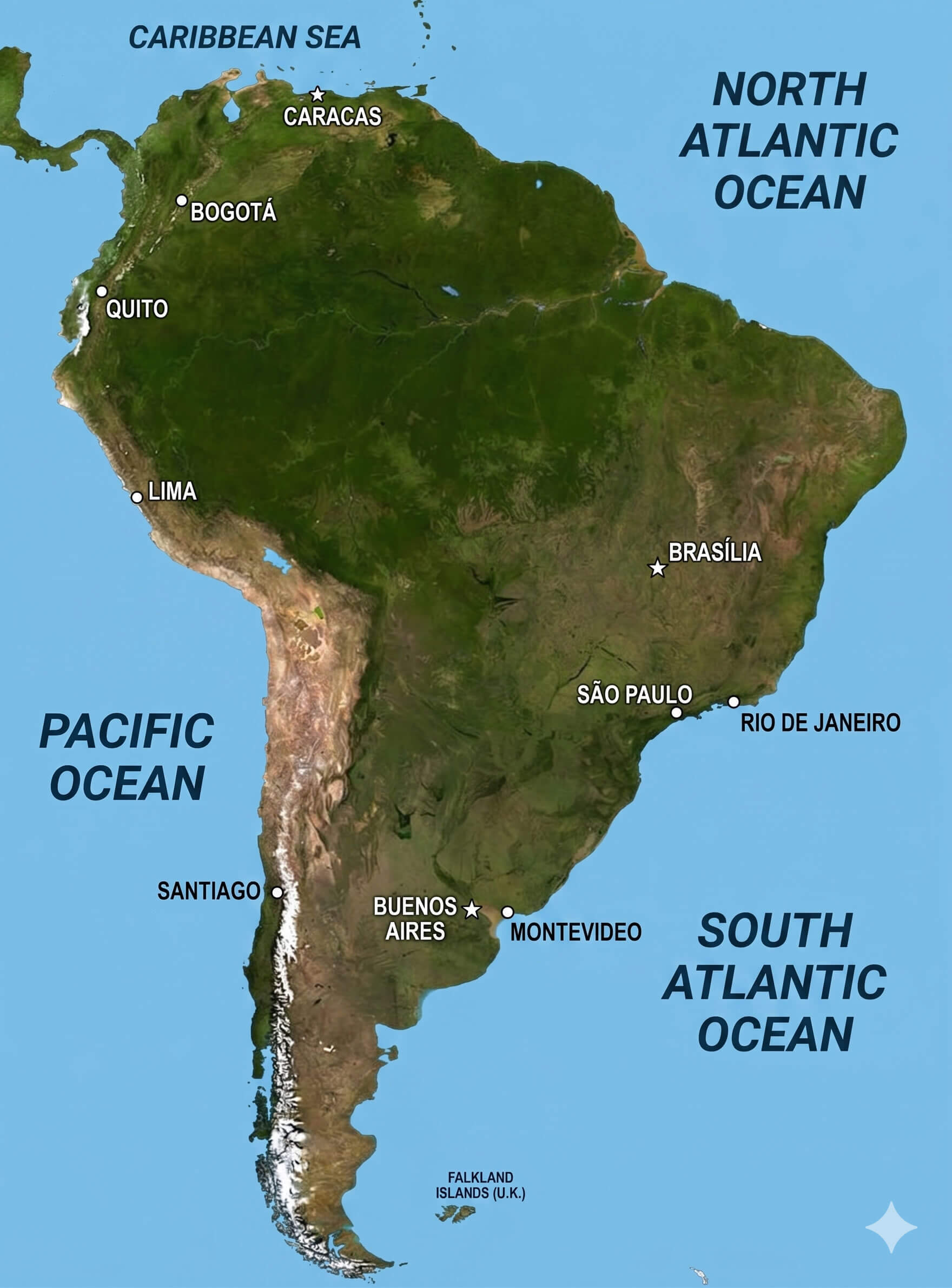
South America on World globe map
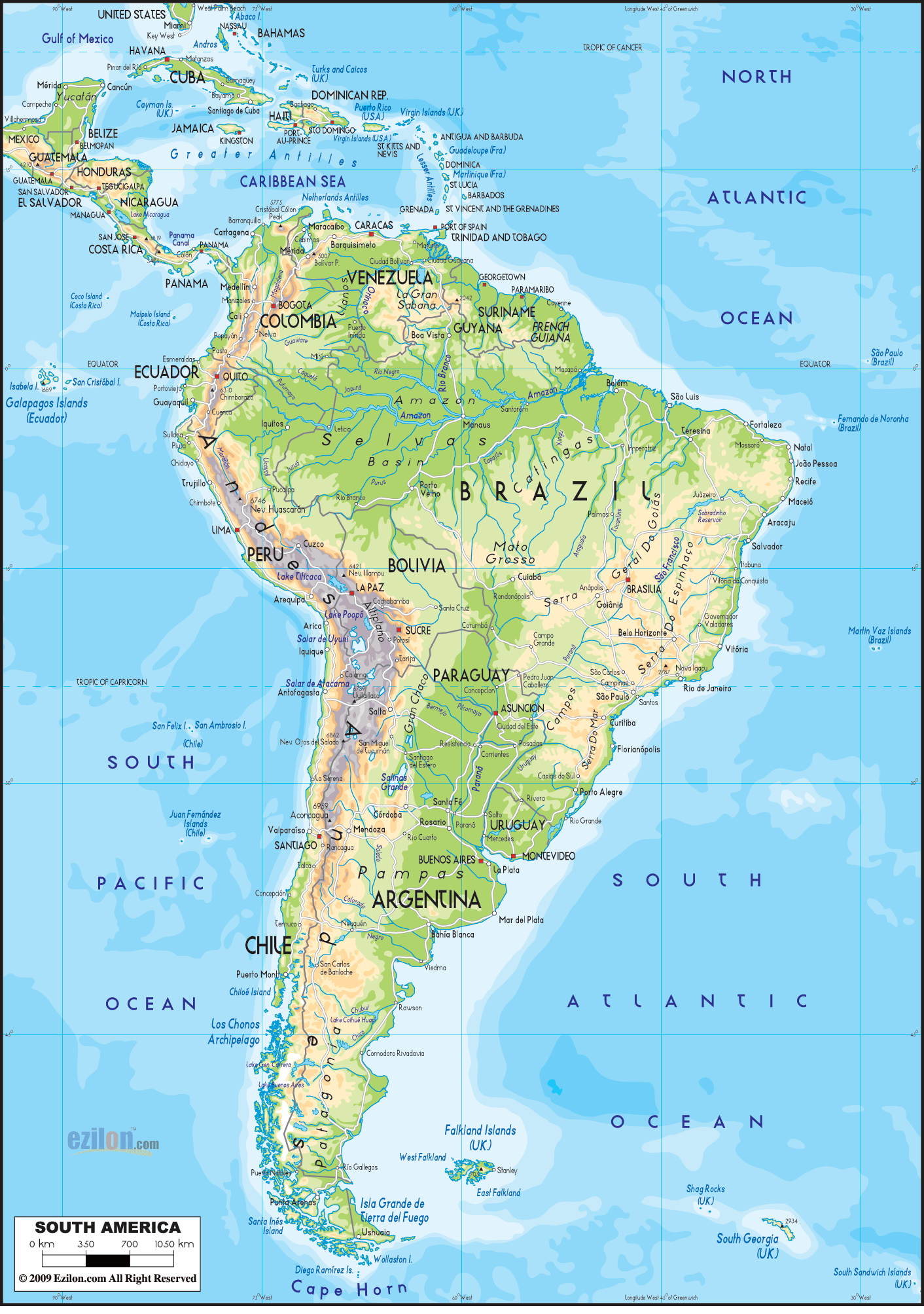
South America physical geography map
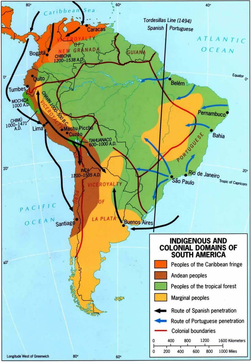
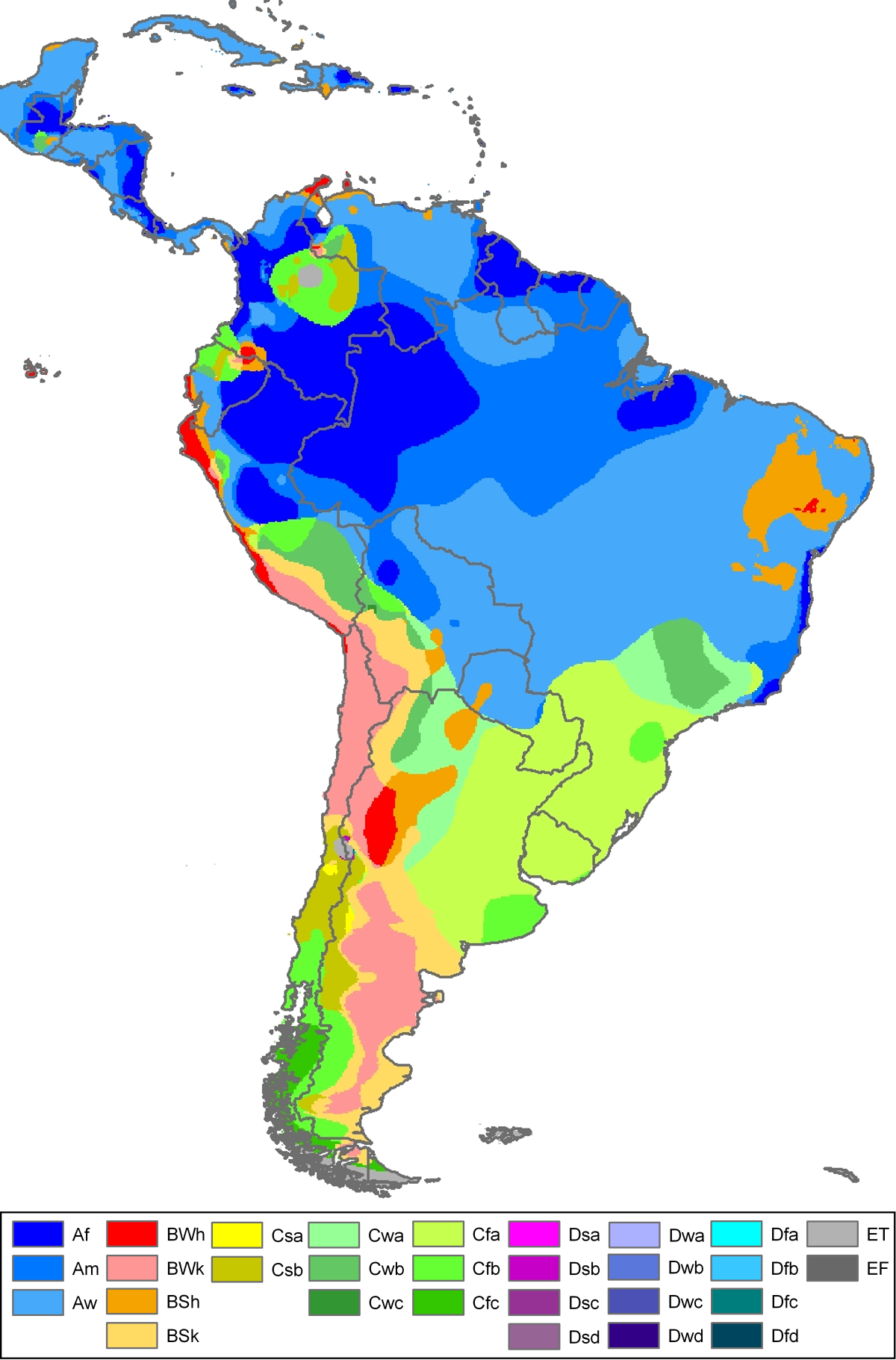
For those interested in natural landscapes and historical development, the collection offers a South America physical geography map, South America physical relief map, South America satellite globe map, and a South America on World globe map. You can also explore specialized resources such as a South America Köppen climate classification map and a South America indigenous and colonial domains map, which illustrate the continent’s climate zones, cultural heritage, and historical territorial influences. These South America maps are ideal for students, researchers, travelers, educators, and geography enthusiasts seeking accurate and detailed visual references.
North and South America physical relief map
South America globe view political map
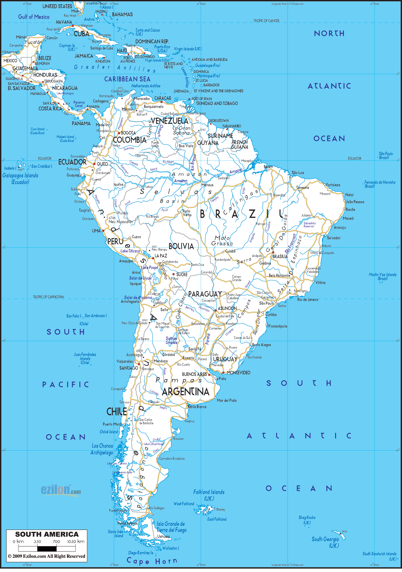
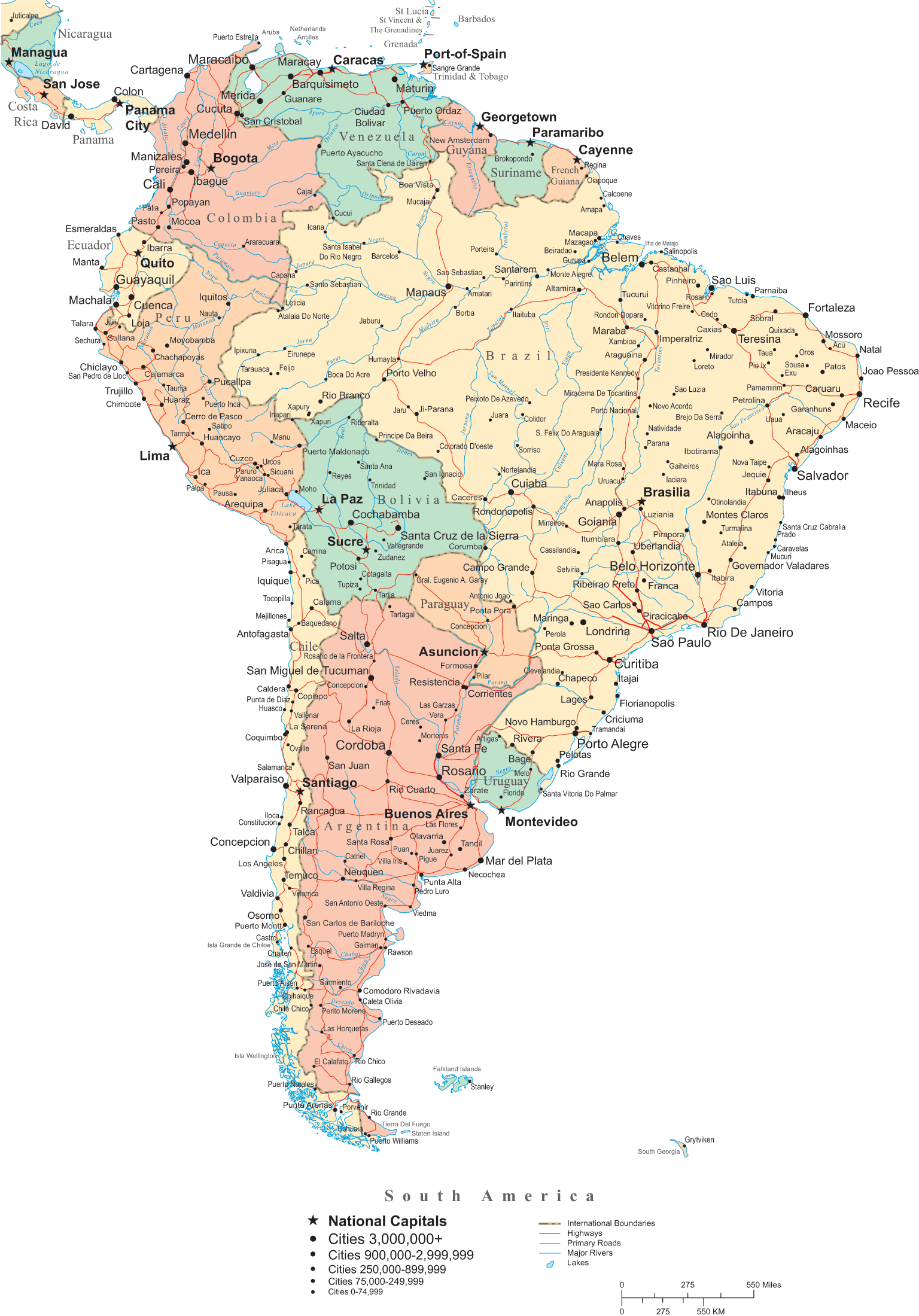
South America road network map
In addition to political and transportation maps, the collection includes a North and South America physical relief map that highlights mountains, rivers, plains, and other key geographic features. By combining political, physical, and thematic mapping perspectives, these South America maps help users better understand the continent’s diverse landscapes, interconnected regions, and its geographic relationship with the rest of the Americas. Ideal for education, research, and travel planning, this collection offers a complete visual guide to South America.
South America indigenous and colonial domains map
South America koppen climate classification map
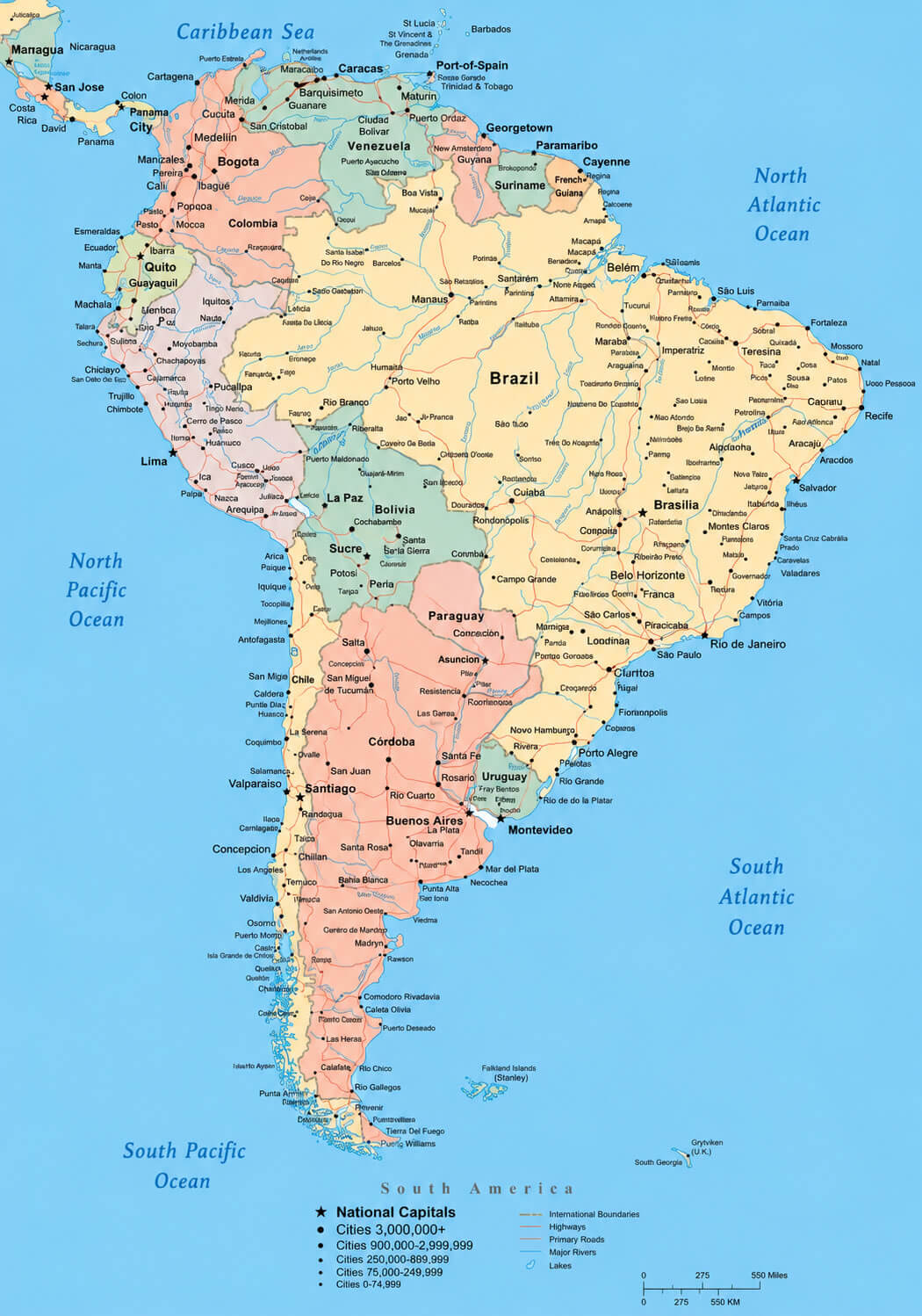
South America major cities map
South America physical relief map
South America political countries map
South America satellite globe map
Feel free to explore these pages as well:
- Head of Performance Marketing
- Head of SEO
- Linkedin Profile: linkedin.com/in/arifcagrici