Printable Burkina Faso Map: Interactive Political, Physical, Regions, Cities & Road Maps
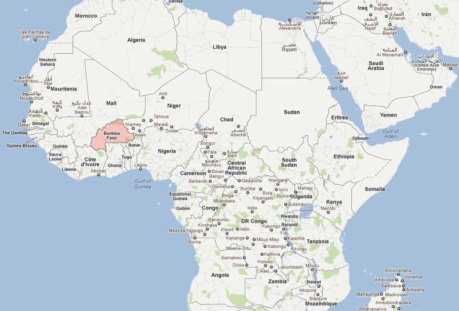
Where is Burkina Faso located on the world and Africa map? Burkina Faso sits in West Africa, an entirely landlocked nation that shares borders with six countries: Mali to the north and west, Niger to the east, and Benin, Togo, Ghana, and Côte d'Ivoire to the south. Positioned at the heart of the Sahel and West African region, Burkina Faso serves as a crossroads between the inland Sahelian zones and the coastal countries to its south, making its location important for regional trade and transit.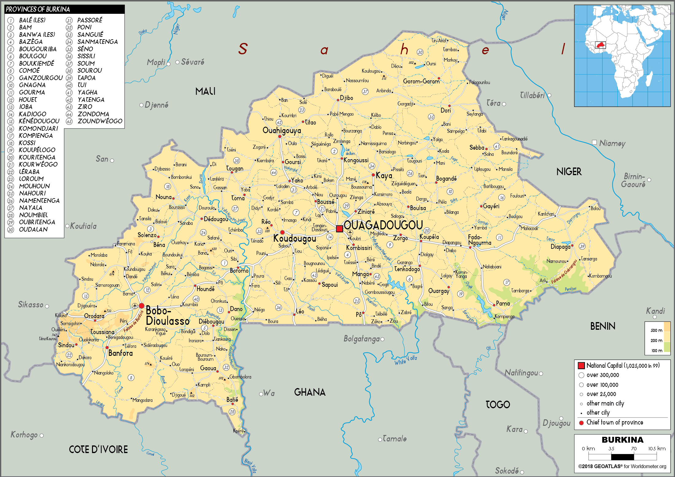
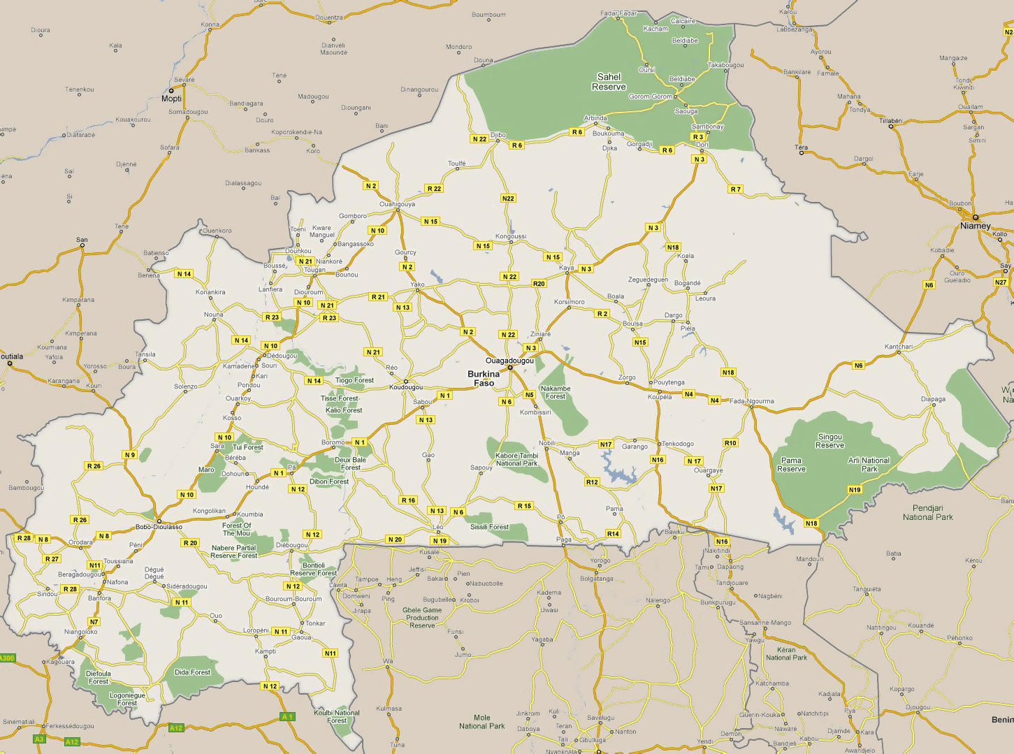
Map of Burkina Faso
 Burkina Faso map with major cities, roads, and neighboring countries.
Burkina Faso Physical Map — Topography, Rivers & Major Cities
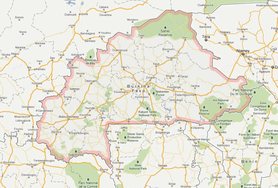
Burkina Faso physical map showing topography, rivers, cities and borders.Detailed physical map of Burkina Faso highlighting elevation changes from the Sahelian north to lower southern plains, major rivers (Volta tributaries), key cities like Ouagadougou and Bobo-Dioulasso, provincial boundaries, roads and natural features — ideal for geography, travel planning and educational reference.
Burkina Faso and alliance of Sahel States
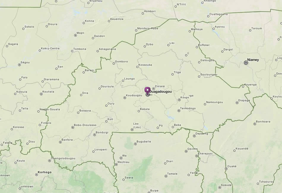
Burkina Faso cities map
This map illustrates Burkina Faso's major cities like Ouagadougou and Bobo-Dioulasso, rivers, and road networks. It highlights its borders with Mali, Niger, Benin, Togo, Ghana, Côte d’Ivoire, and Guinea, showing connections across West Africa.
Brief information about Burkina Faso
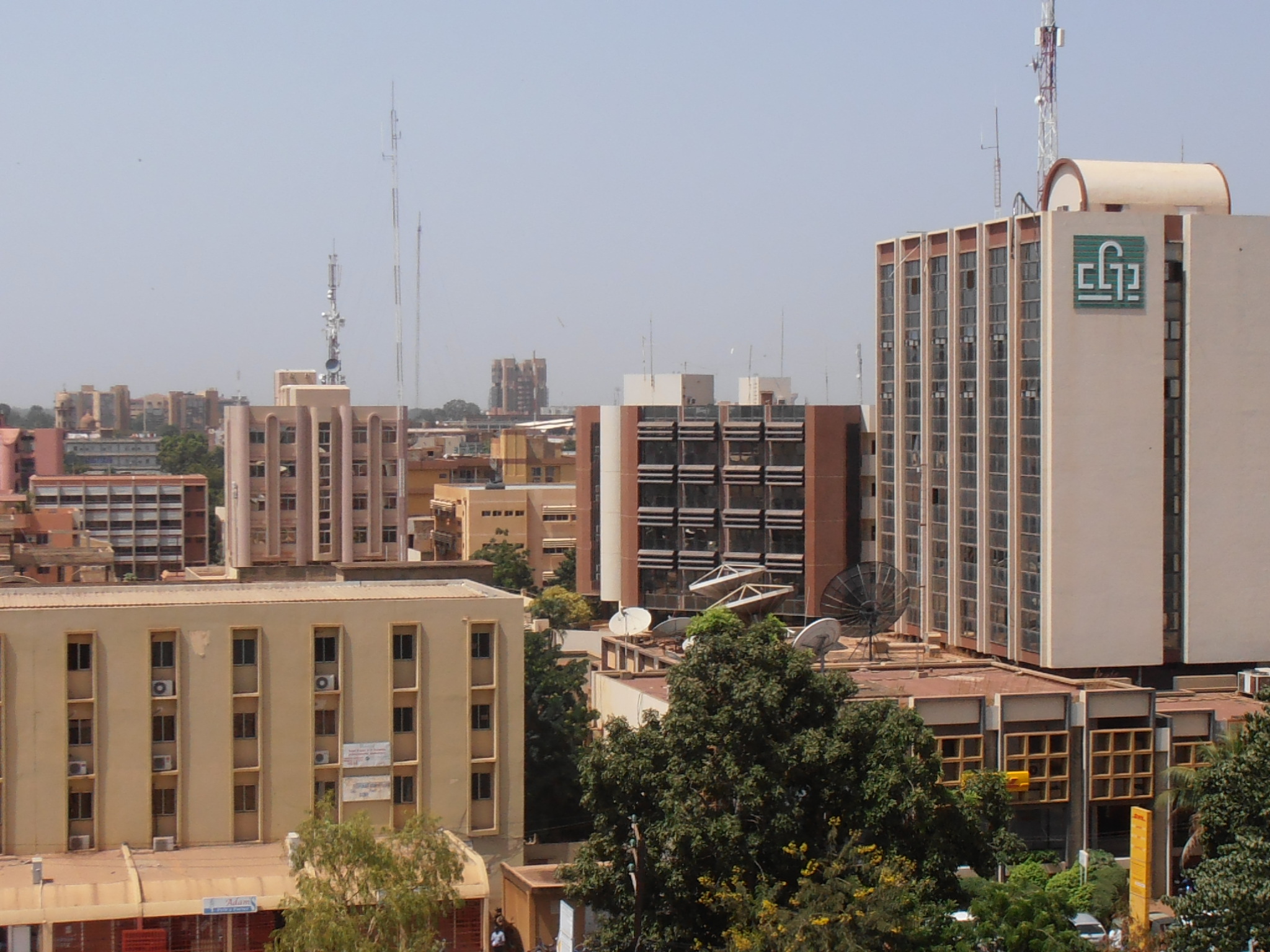
Burkina Faso is a landlocked country in West Africa, bordered by Mali, Niger, Benin, Togo, Ghana and Côte d'Ivoire. Its capital, Ouagadougou, is the cultural and economic centre of the country. Known for its vibrant traditions and craftsmanship, Burkina Faso is famous for its festivals, including FESPACO, Africa's largest film festival.
The country has a tropical climate with a mix of savannah and arid regions. Agriculture is the backbone of the economy, with cotton and livestock the main exports. Despite facing challenges such as desertification and economic difficulties, Burkina Faso has a rich cultural heritage and a strong sense of community.
Burkina Faso road map
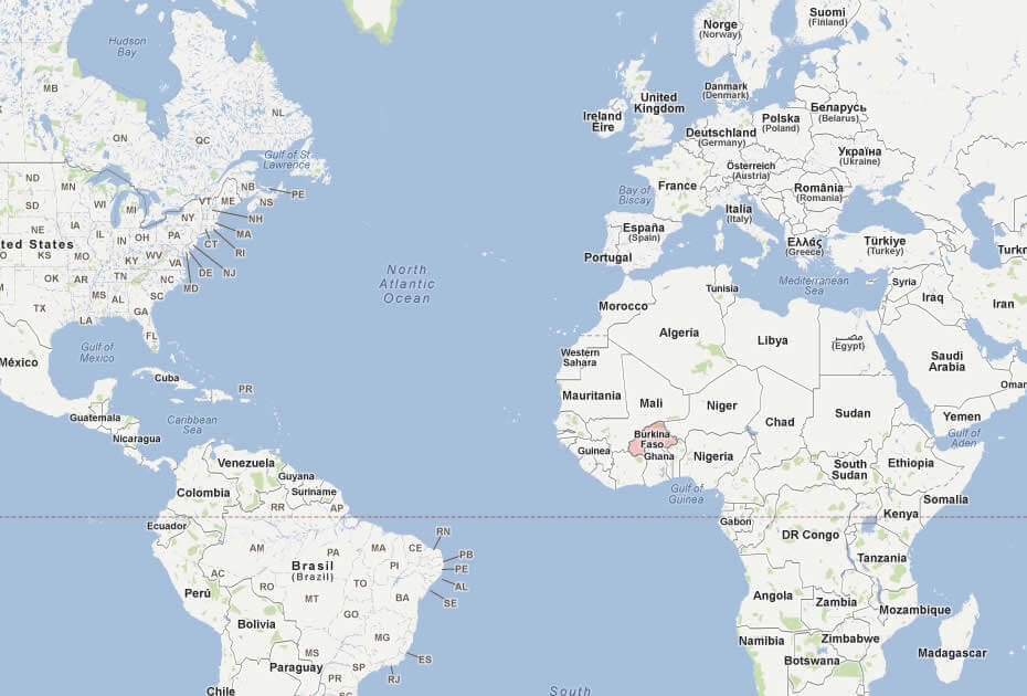
Where is located Burkina Faso on the World and Africa Map?
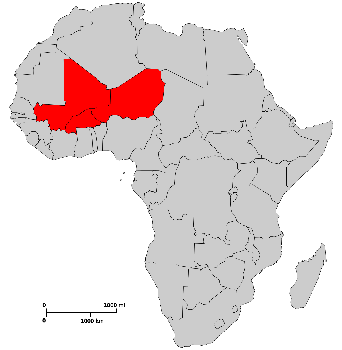
 Where is located Burkina Faso on the World Map
Burkina Faso is located in West Africa and borders six countries: Mali to the north and west, Niger to the east and Benin, Togo, Ghana and Côte d'Ivoire to the south. It is entirely landlocked and has no coastline.
Situated just above the equator, Burkina Faso lies in the Sahel region, so its climate is a mixture of arid and tropical conditions. Its central location in West Africa positions it as a crossroads for cultural and commercial exchange within the region.
On a world map, Burkina Faso is close to the heart of Africa, demonstrating its geographical link to the vast savannahs and deserts that define much of its landscape. Its proximity to the countries of the Gulf of Guinea gives it cultural and economic links with the coastal regions.
Here are some statistical information about Burkina Faso:
 Area: 274,223 km2 (105,878 sq mi)
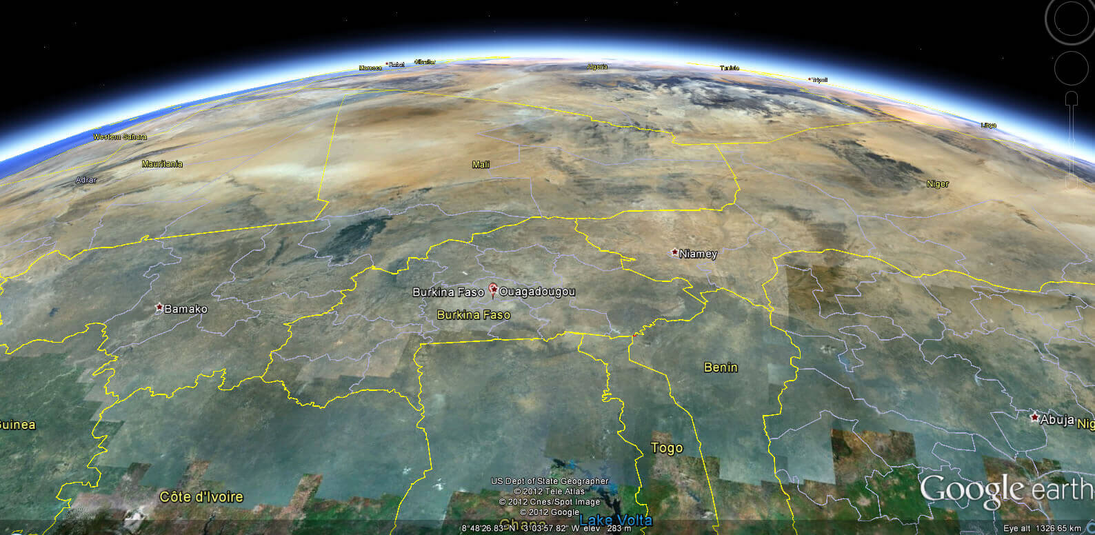
 Burkina Faso satellite map
Burkina Faso map
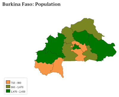
Burkina Faso population map
 Religion: 63.8% Islam (majority Sunni, with a minority Shia and Tijaniyah Sufi order), 26.3% Christianity (20.1% Roman Catholic, 6.2% Protestant), 9.0% traditional indigenous beliefs, 0.2% other religions, 0.7% non-religious.
 Burkina Faso Location Map
Burkiana Faso Population Map 1968
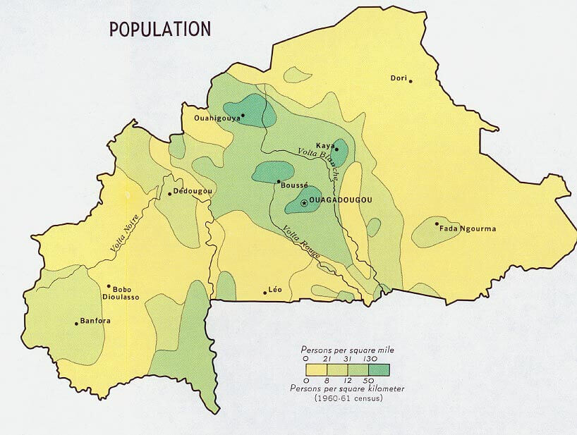 Population density map of Burkina Faso highlighting regions.
This map shows Burkina Faso’s population distribution per square mile during the 1960-61 census. Key cities like Ouagadougou, Bobo-Dioulasso, and Kaya are highlighted, with denser populations in central and southern regions compared to the north.
Burkina Faso Earth Map
Burkina Faso Maps
Burkina Faso and west africa map in 1875
Burkina Faso Political Map
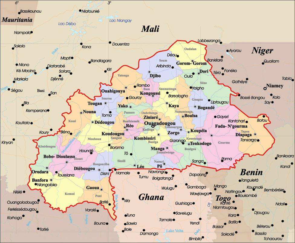
 Political map of Burkina Faso with regions, cities, and borders.
This map highlights Burkina Faso’s administrative regions and major cities, including Ouagadougou and Bobo-Dioulasso. It shows borders with neighboring countries Mali, Niger, Benin, Togo, Ghana, and Côte d’Ivoire, with detailed road and region divisions.
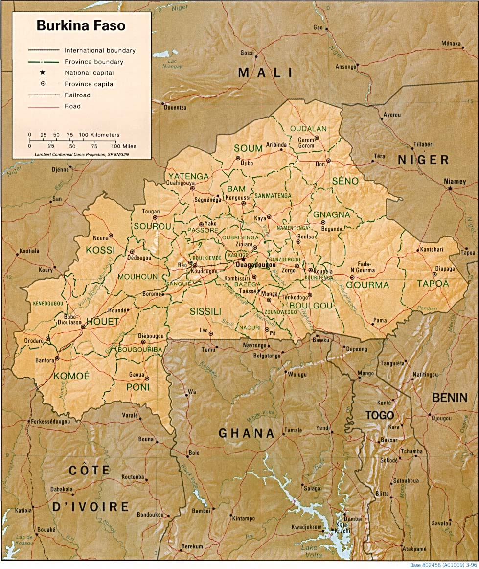
Burkina Faso Relief Map
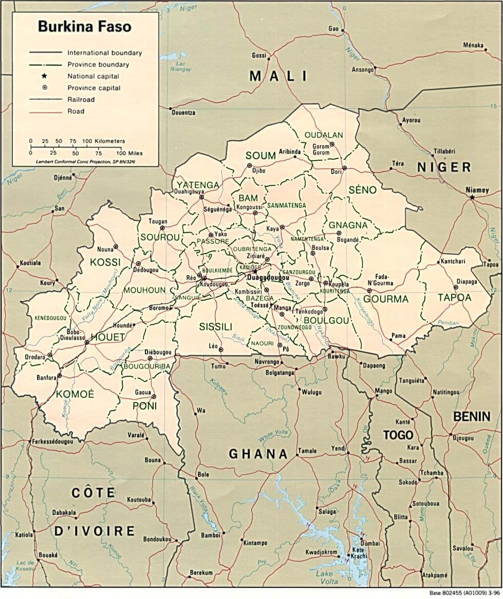 Burkina Faso map with provinces, cities, and international borders.
This map outlines Burkina Faso's provinces, national capital Ouagadougou, and major cities. It features provincial and international boundaries, railroads, and roads. Neighboring countries include Mali, Niger, Benin, Togo, Ghana, and Côte d’Ivoire.
Map of Burkina Faso Africa
Map of Burkina Faso World
Map Burkina Faso
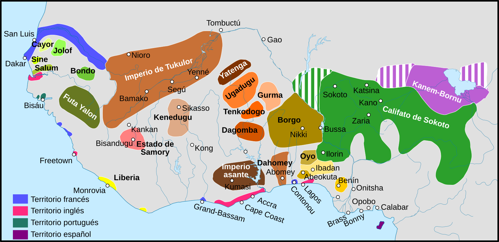
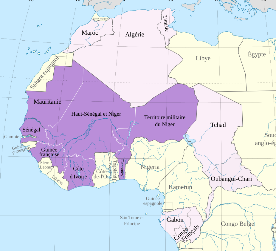
Map of French west Africa 1914
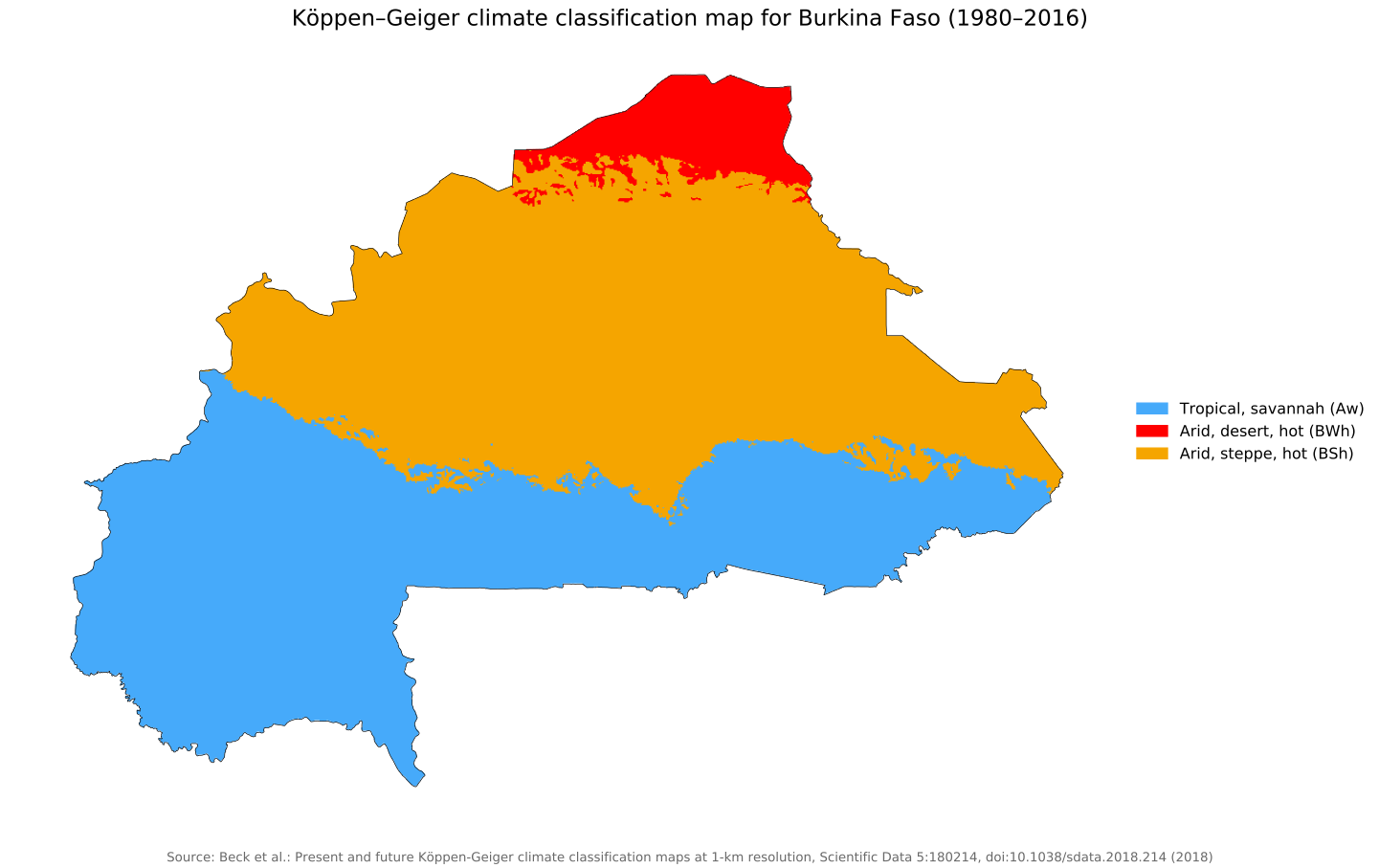
Koppen geiger map bfa present
Feel free to explore these pages as well:
- Head of Performance Marketing
- Head of SEO
- Linkedin Profile: linkedin.com/in/arifcagrici