High Resolution Burundi Map: Political, Physical, Regions, Cities and Road Maps
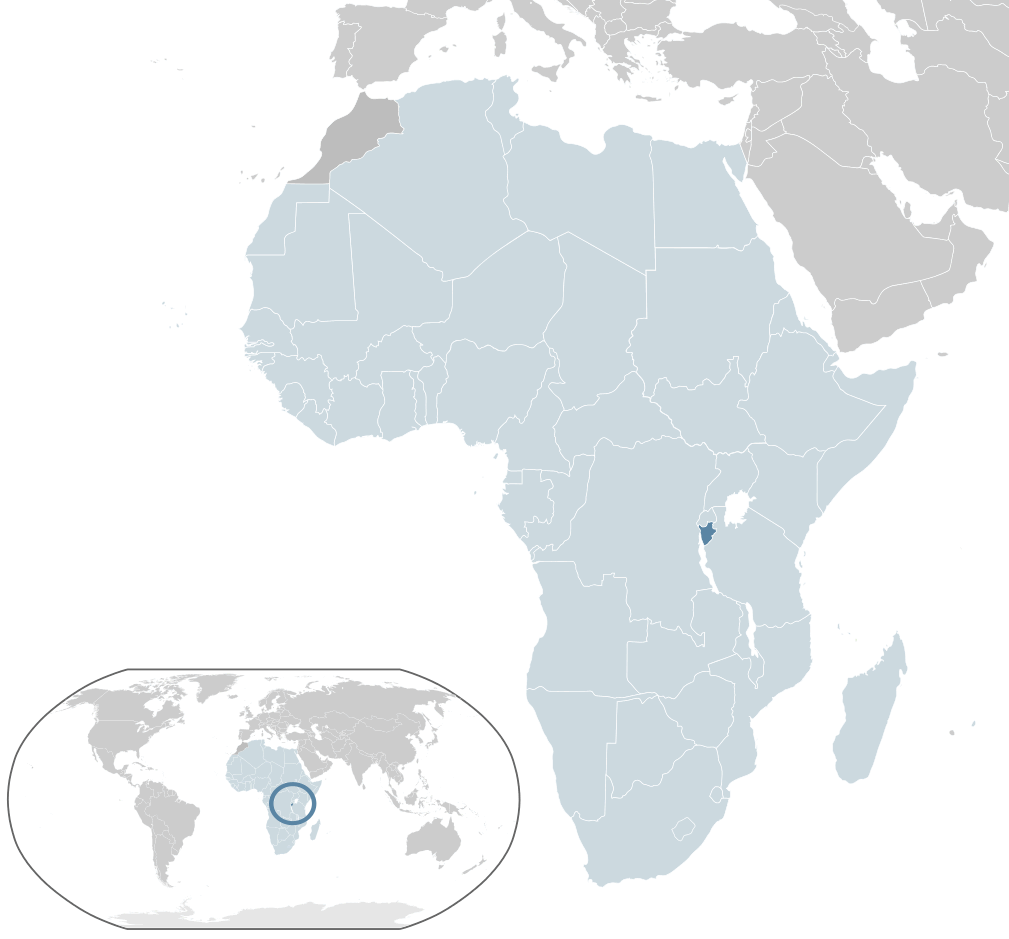
Where is Burundi located on the world and Africa map? Burundi is a small, landlocked country in East Africa's Great Lakes region, bordered by Rwanda to the north, Tanzania to the east and south, and the Democratic Republic of the Congo to the west. Positioned near Lake Tanganyika, Burundi's central location links the Great Lakes area with East African trade and transport routes.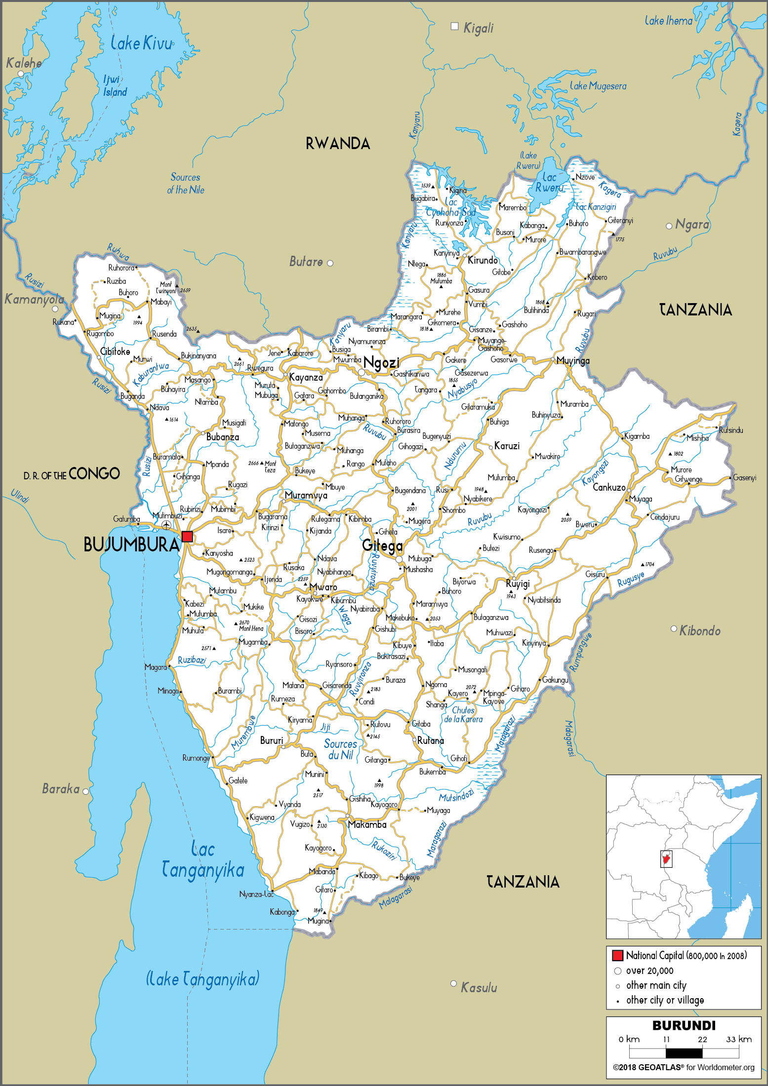
Burundi Politic Map
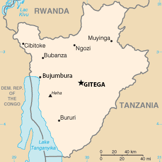
 Burundi map with provinces, cities, and borders.
This map highlights Burundi’s provinces, major cities like Gitega (capital) and Bujumbura, as well as international borders with Rwanda, Tanzania, and D.R. Congo. It features provincial capitals, towns, roads, and Lake Tanganyika along the western boundary.
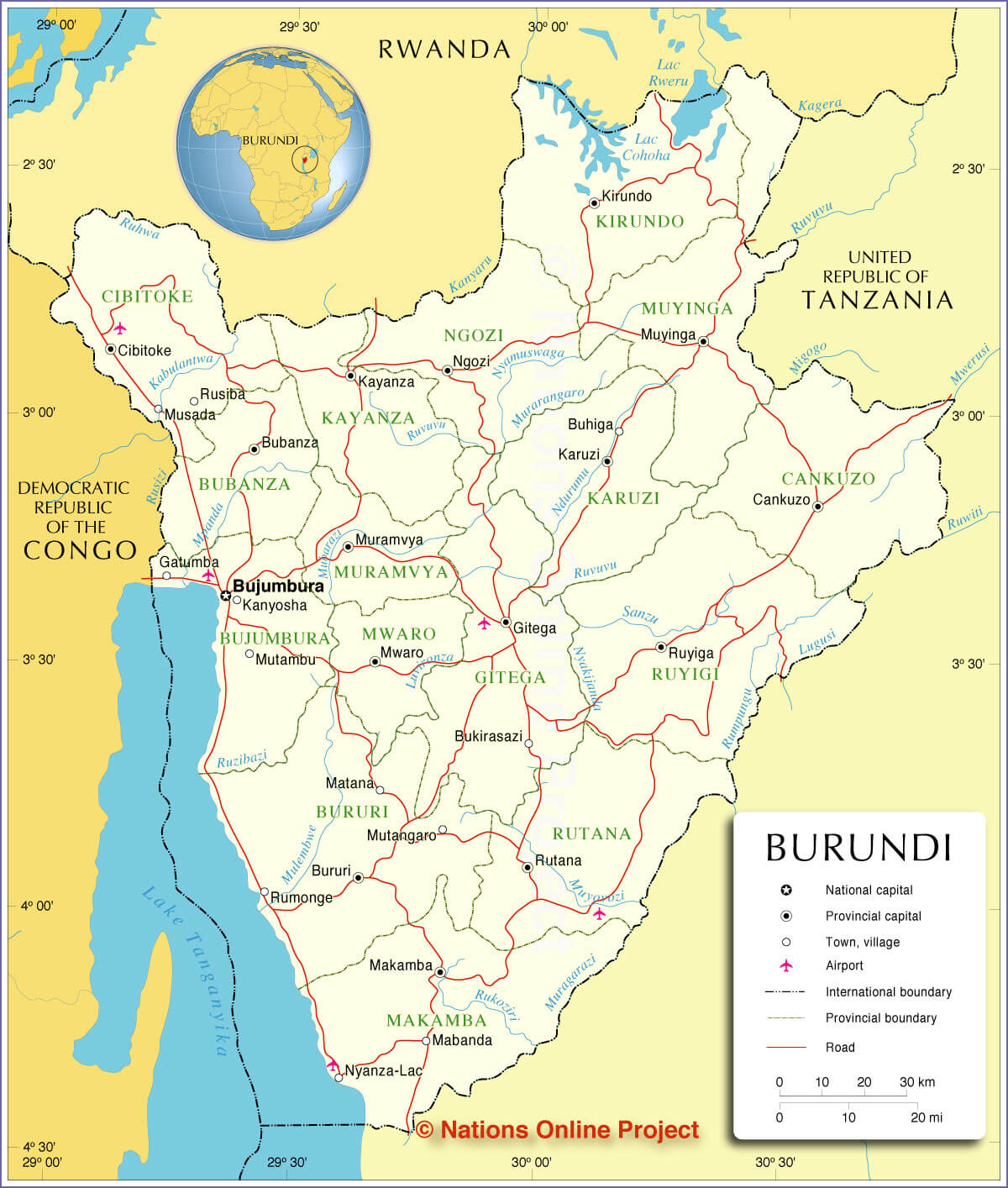
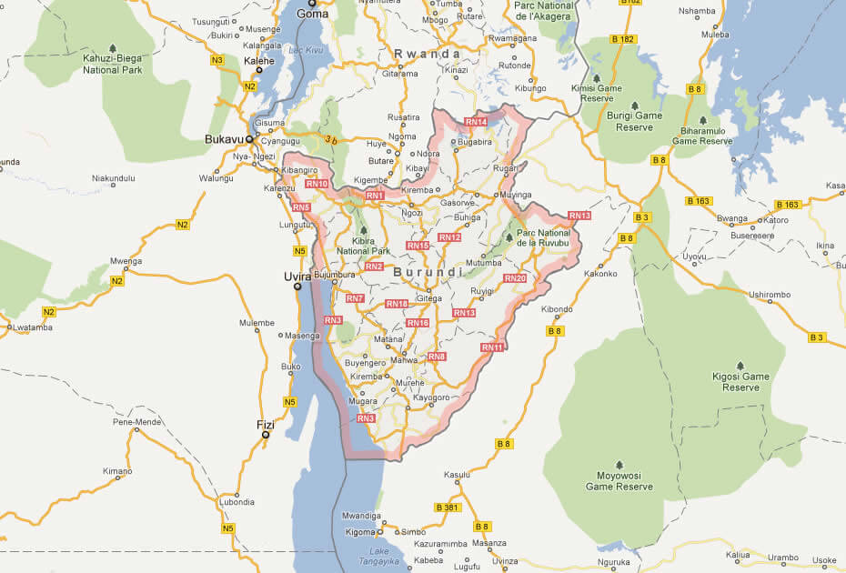
Burundi Road Map — Major Routes, Cities & Lake Tanganyika
Burundi road map showing major roads, cities and Lake Tanganyika.Detailed road map of Burundi displaying primary and secondary routes connecting key cities (Bujumbura on Lake Tanganyika and Gitega), plus border links to Rwanda, Tanzania and the DRC. Shows terrain, river crossings and transport corridors — useful for travel planning, logistics and regional navigation.
Burundi Location Map
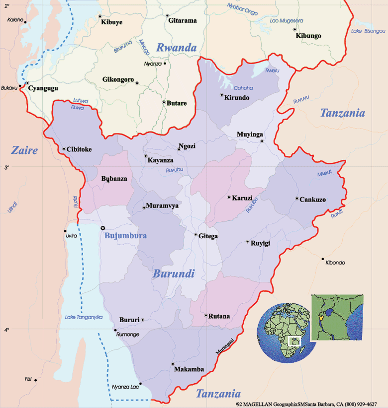
Political Map of Burundi
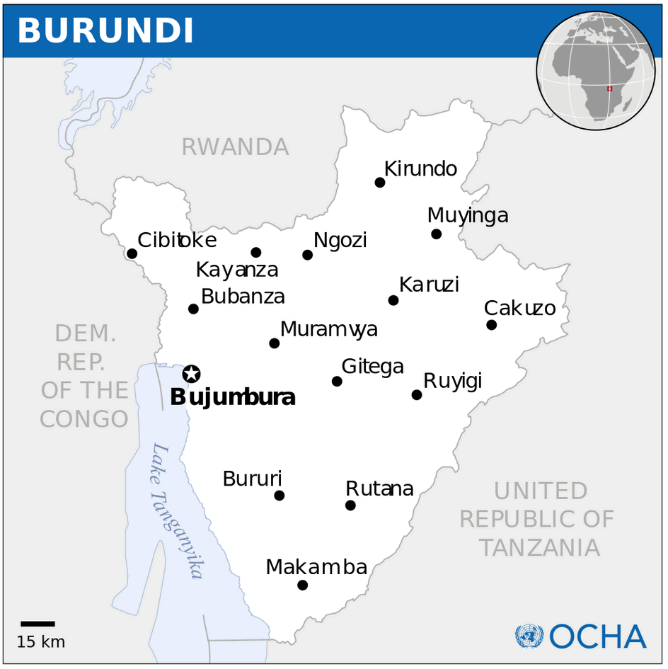
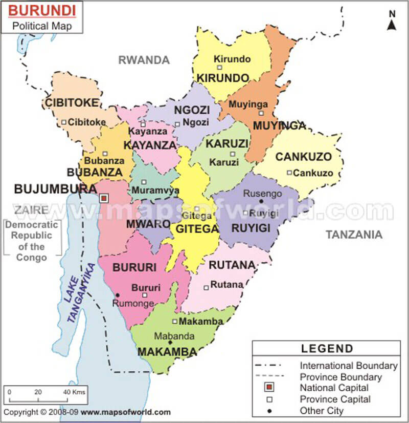
 Political map of Burundi highlighting provinces and major cities.
This map details Burundi’s administrative divisions, including provinces like Ngozi, Gitega, and Bujumbura. It also shows key cities, the national capital Gitega, and Lake Tanganyika on the western border. Neighboring countries include Rwanda, Tanzania, and D.R. Congo.
Brief information about Burundi
Burundi is a small landlocked country in East Africa, bordered by Rwanda to the north, Tanzania to the east and south, and the Democratic Republic of Congo to the west. It lies on the shores of Lake Tanganyika, one of Africa's largest lakes.
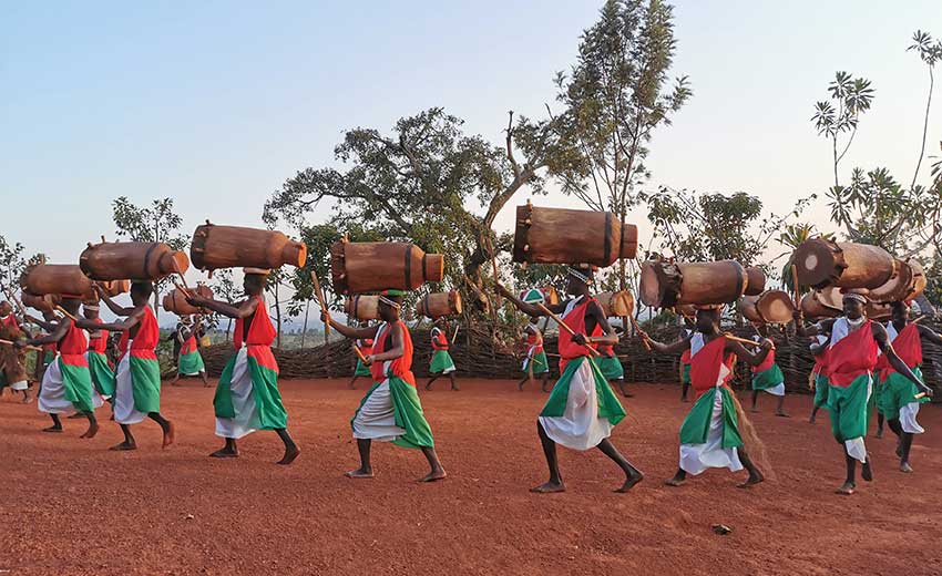
The capital, Gitega, is the political centre, while Bujumbura is the economic centre. Burundi's economy is largely based on agriculture, with coffee and tea being the main exports. Known for its vibrant culture, the country is home to traditional drumming and dancing, reflecting its rich heritage despite its troubled history.
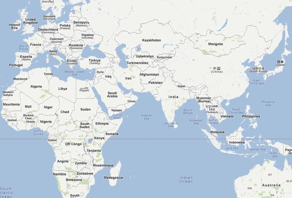
Where is located Burundi on the World and Africa Map?
 Where is located Burundi on the World Map
Burundi is a small, landlocked country in East Africa, in the heart of the Great Lakes region. It borders Rwanda to the north, Tanzania to the east and south, and the Democratic Republic of Congo to the west. Lake Tanganyika, one of the deepest and largest freshwater lakes in the world, forms much of the country's western border and is an important natural resource for the country.
Burundi physical map
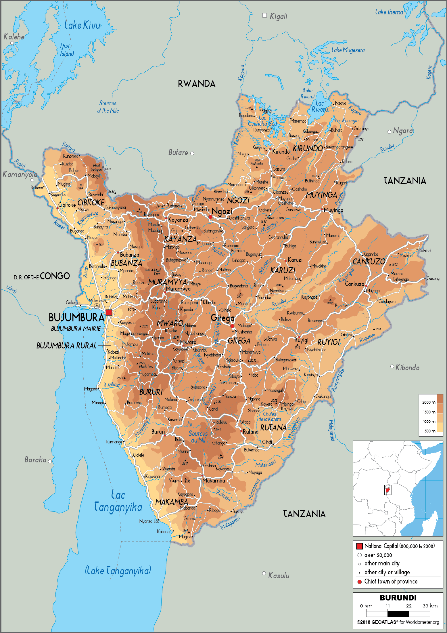
Map of Burundi
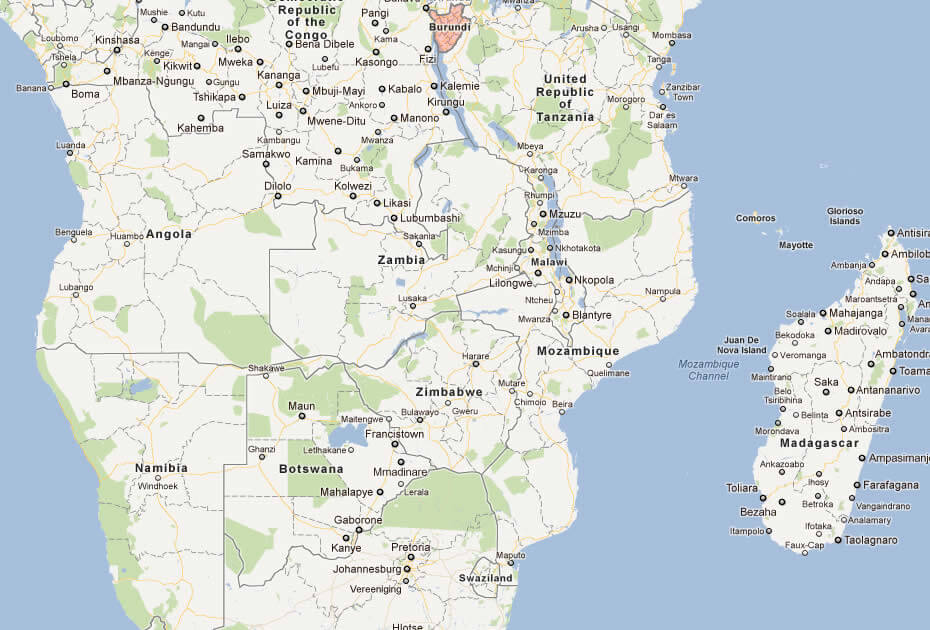
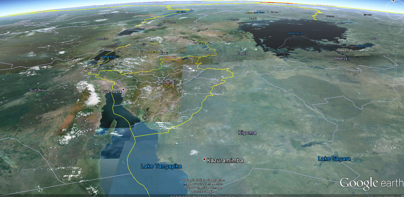
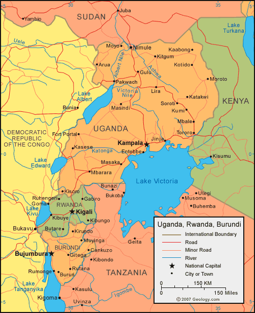 Regional map showing Uganda, Rwanda, and Burundi with key features.
This map highlights Uganda, Rwanda, and Burundi, including major cities like Kampala, Kigali, and Bujumbura. It also shows prominent lakes like Victoria and Albert, rivers, roads, and international borders with neighboring countries such as Tanzania, Kenya, and the D.R. Congo.
Situated just south of the equator, Burundi's position on the world map places it in a region known for its stunning natural landscapes, including rolling hills, fertile valleys and mountainous terrain. The country is part of the Great Rift Valley, which contributes to its unique biodiversity and scenic beauty. Its central location in Africa gives it cultural and economic links with neighbouring countries in the region.
Although landlocked, Burundi benefits from its proximity to Lake Tanganyika, which serves as a vital link in trade routes and regional commerce. Its strategic location has historically made it a crossroads for different cultures, with local traditions blending with influences from East and Central Africa. This geographical position underlines its importance as a crossroads within the continent.
Here are some statistical information about Burundi:
 Area: 27,834 km2 (10,747 sq mi)
 The map of Burundi
 Official languages: Kirundi, French, English, Swahili.
 Burundi cities map
Burundi Map
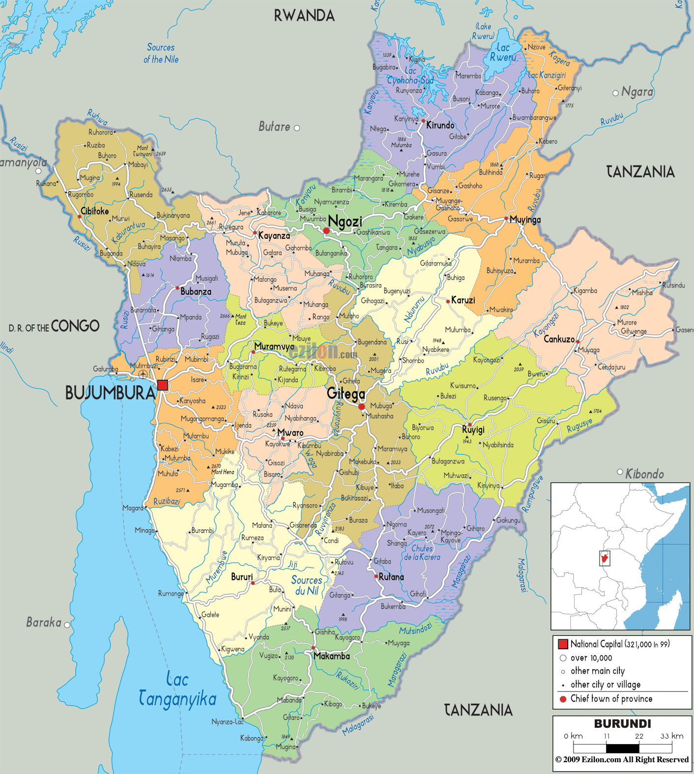
 Burundi political map with provinces, capitals, and major cities.
This map displays Burundi’s provinces in distinct colors, highlighting major cities such as Gitega (national capital) and Bujumbura. It outlines international boundaries with Rwanda, Tanzania, and D.R. Congo, along with Lake Tanganyika to the west.
Map of Burundi Africa
 Map showing Burundi’s position in East Africa with nearby countries.
This map places Burundi in East Africa, bordered by Rwanda, Tanzania, and D.R. Congo. It highlights its proximity to Lake Tanganyika and neighboring countries like Zambia, Malawi, and Mozambique, showcasing its strategic location in the Great Lakes region.
Map of Burundi World
Maps of Burundi
Burundi Maps
Burundi Earth Map
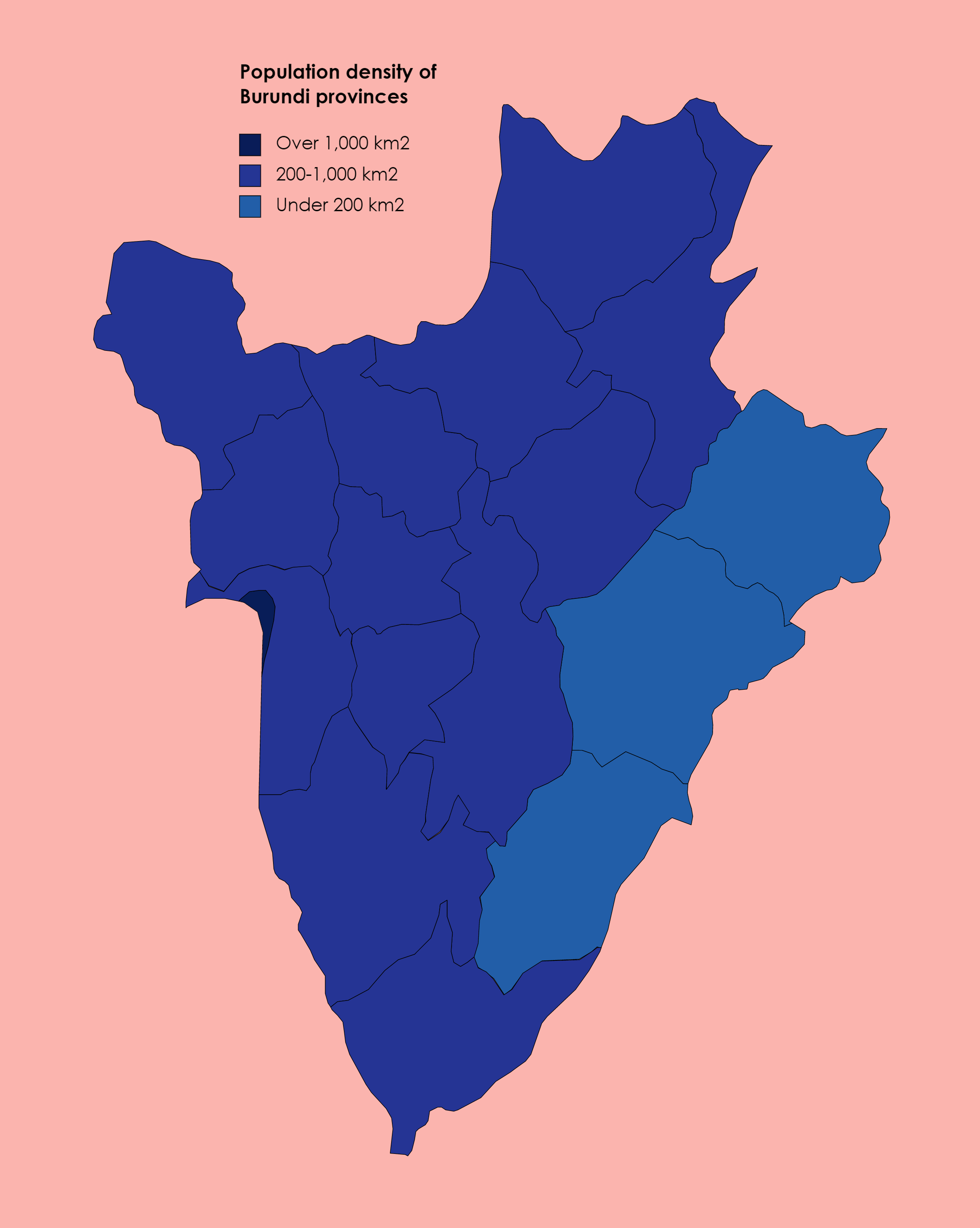
Burundi population map
Map of Burundi World
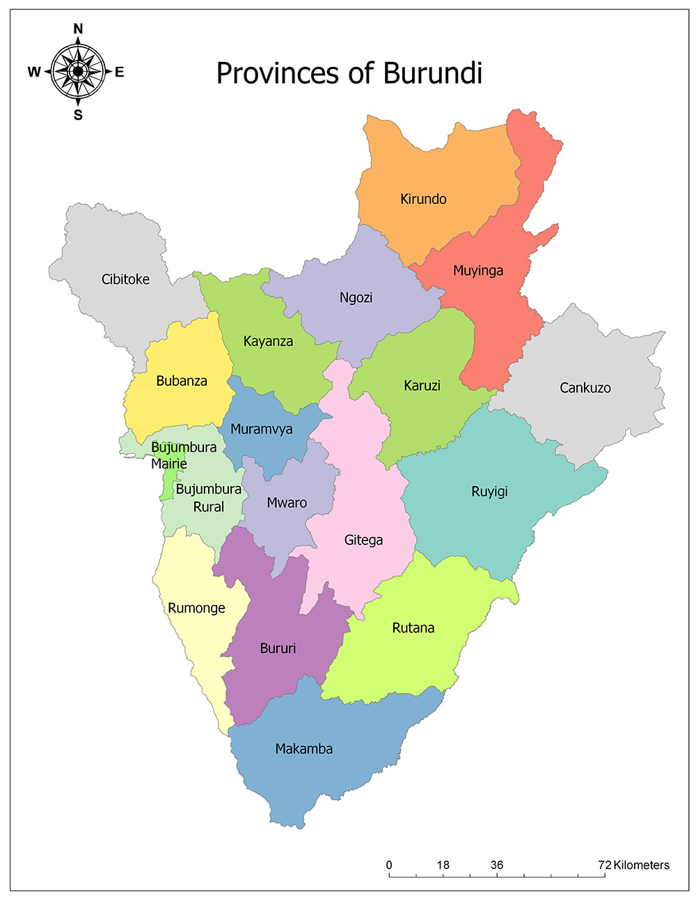
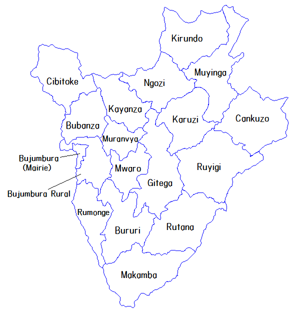
Provinces of Burundi 2014
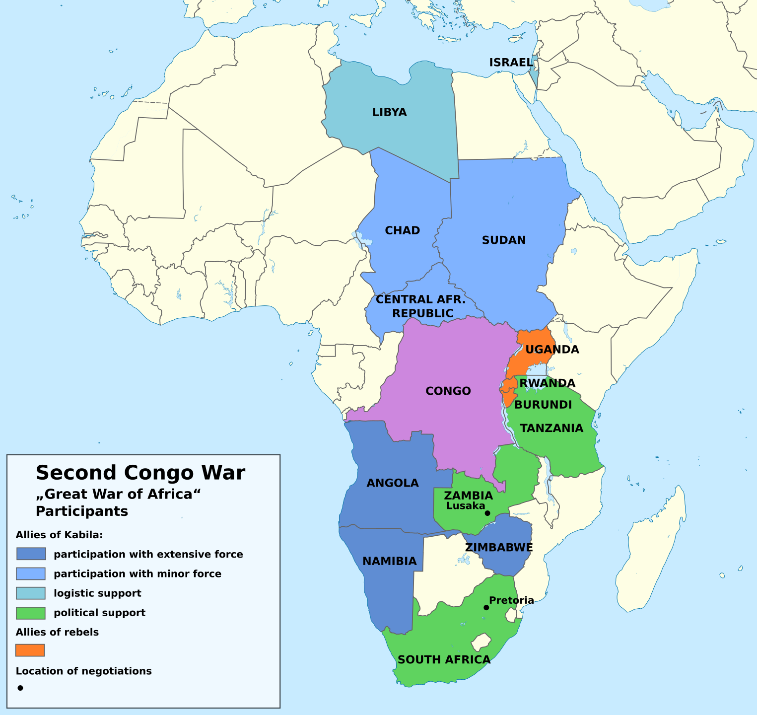
Second Congo war Africa map
Feel free to explore these pages as well:
- Head of Performance Marketing
- Head of SEO
- Linkedin Profile: linkedin.com/in/arifcagrici