Londonderry New Hampshire Map
Navigate Londonderry, New Hampshire Map, map of Londonderry, Londonderry New Hampshire regions map, Londonderry satellite image, towns map, road map of Londonderry.
Londonderry New Hampshire Map FQA
Can I download a high-resolution map of Londonderry New Hampshire ?
Yes. Download high-resolution political and physical maps of Londonderry New Hampshire for personal or educational use. Redistribution is subject to the terms of our license.New Hampshire Map
States Map of USA
Map of Londonderry New Hampshire, New Hampshire
Londonderry map
A Collection of Londonderry New Hampshire Maps
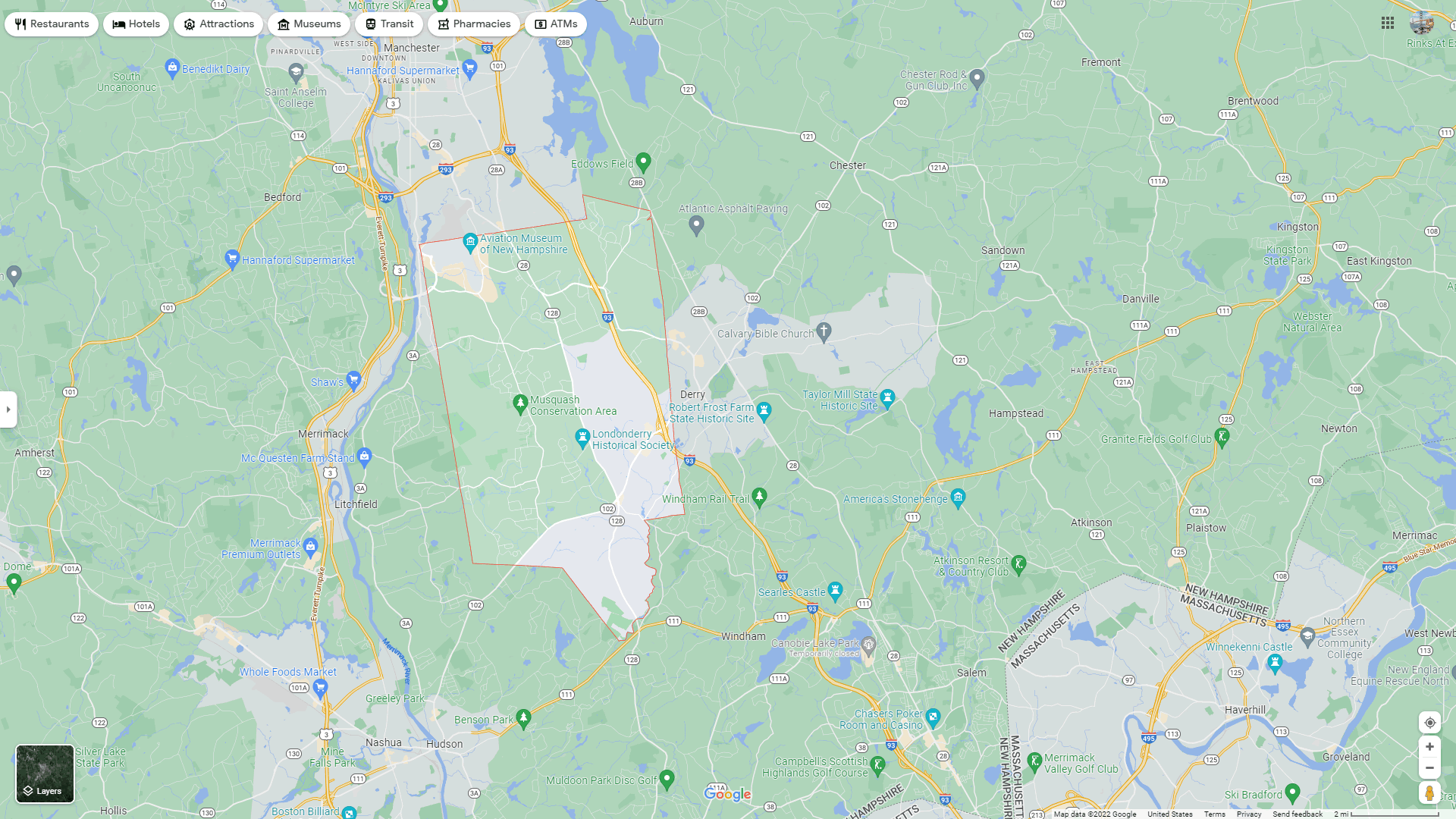
LONDONDERRY MAP

LONDONDERRY MAP NEW HAMPSHIRE
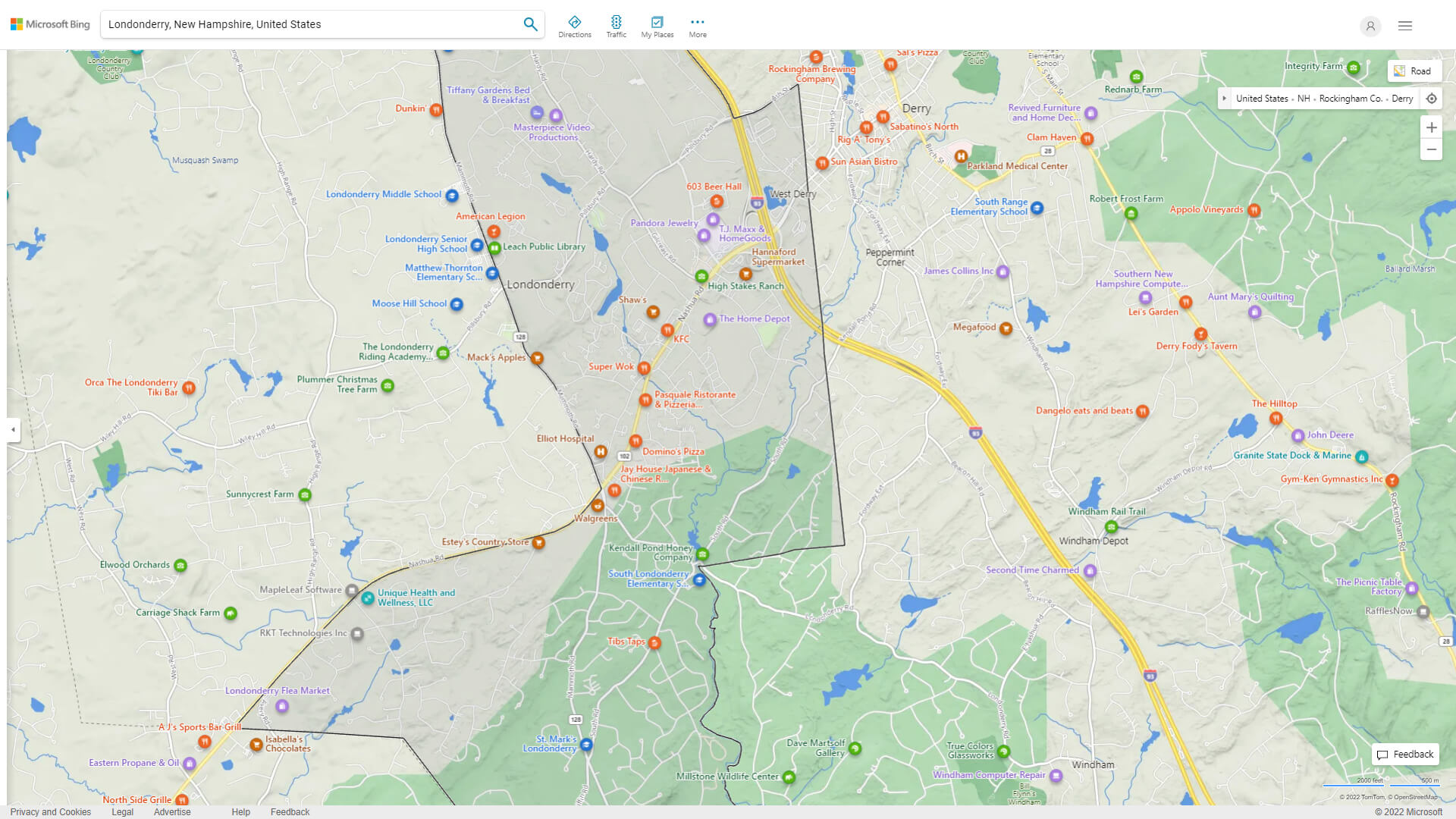
LONDONDERRY DETAILED MAP
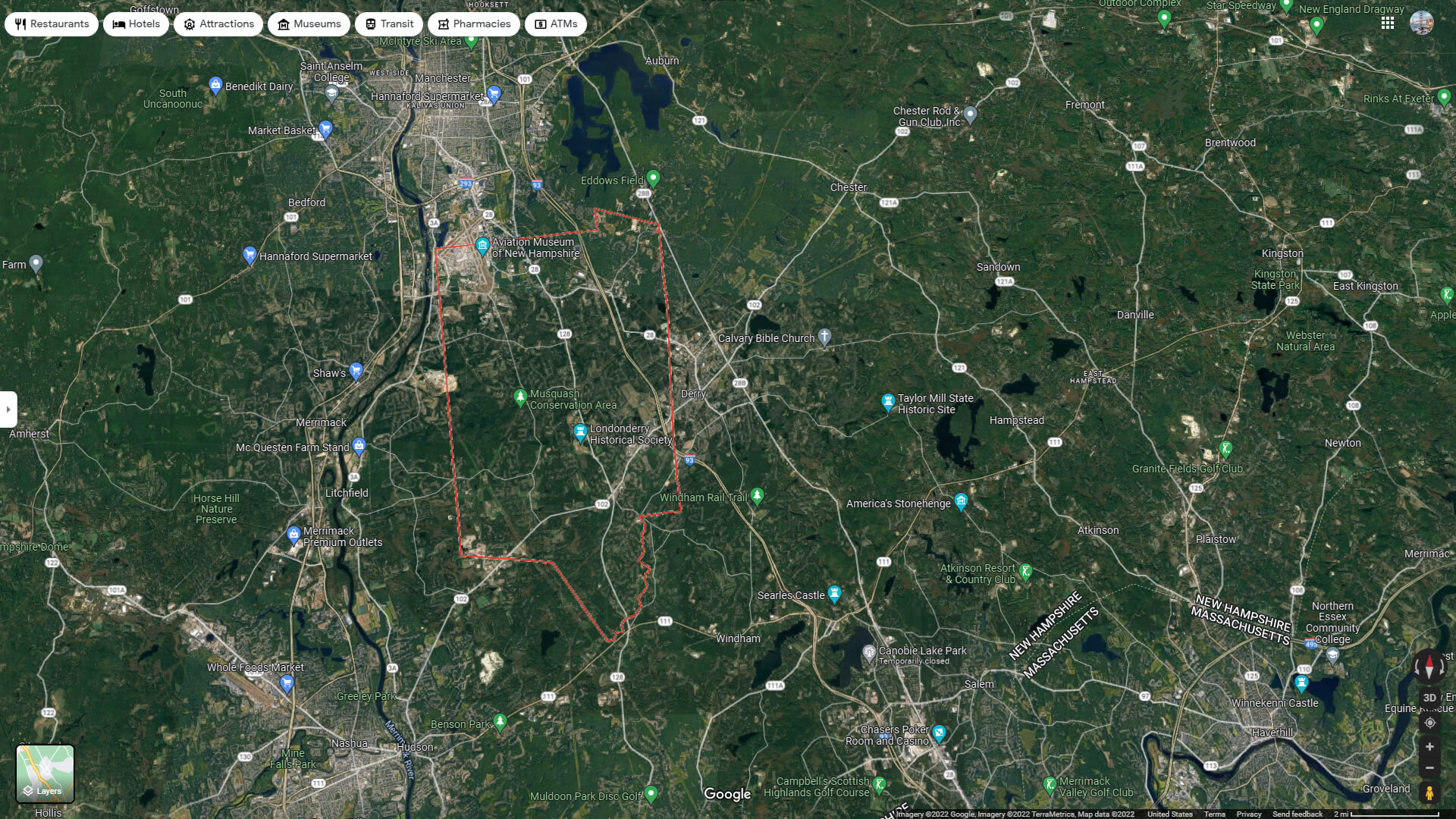
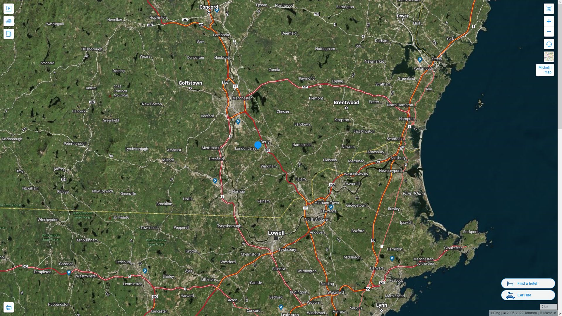
LONDONDERRY AERIAL MAP NEW HAMPSHIRE
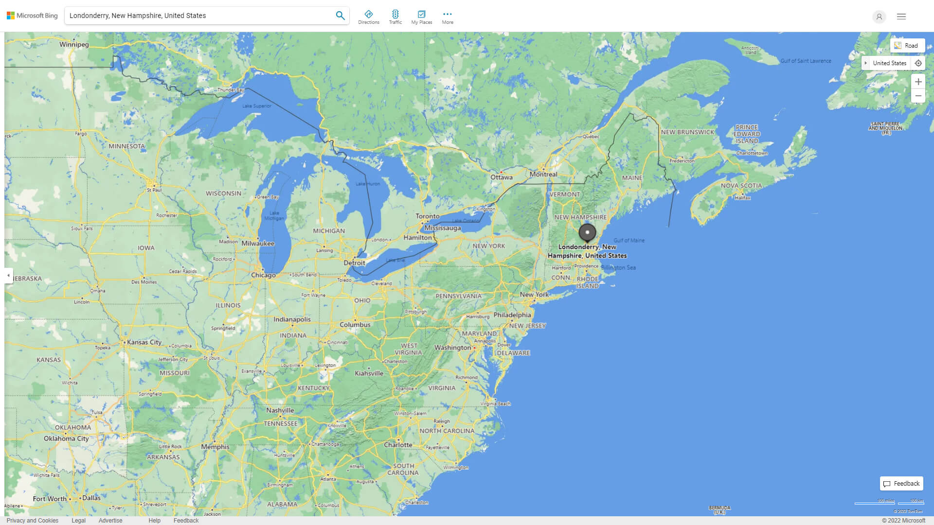
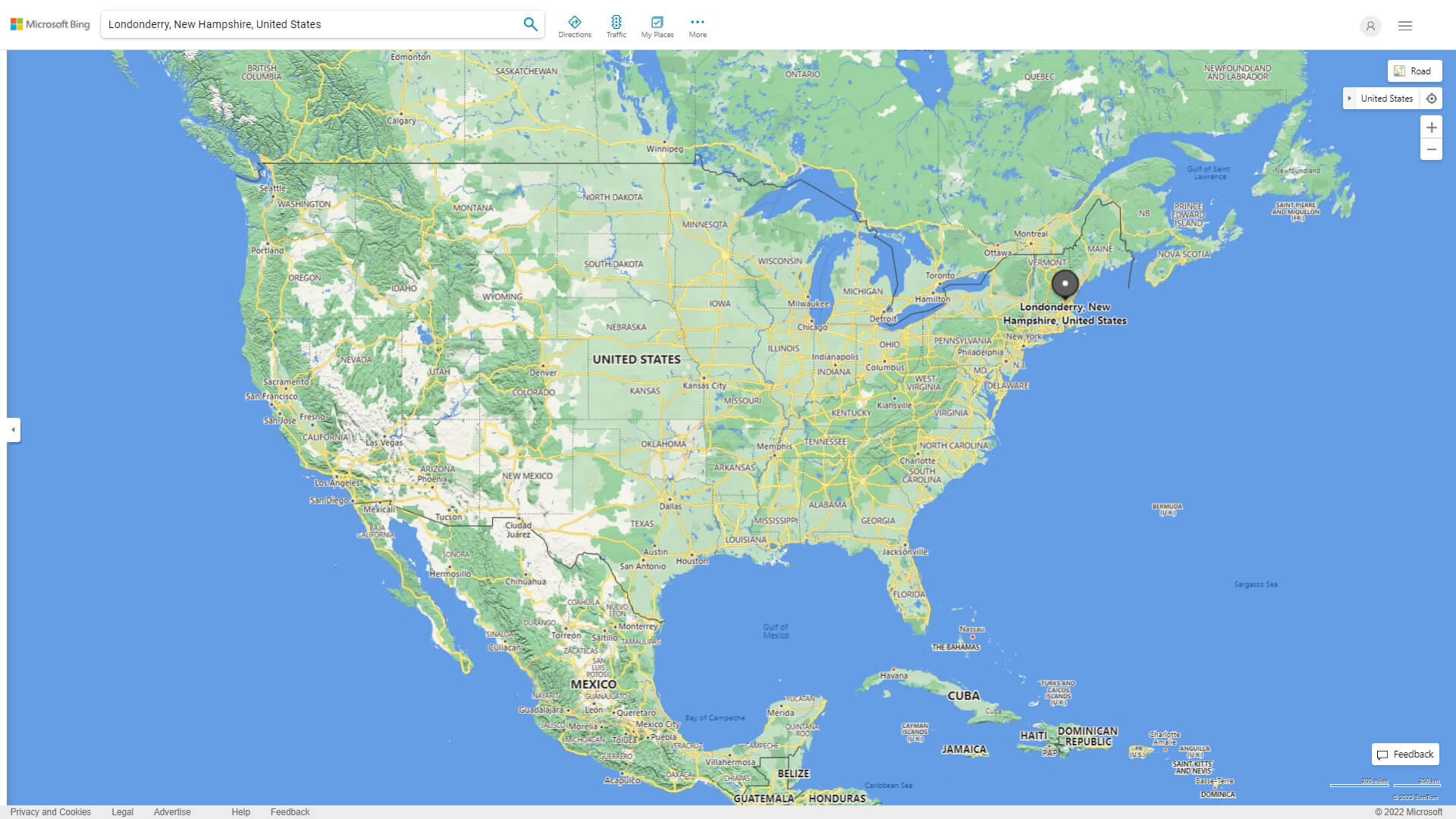
WHERE IS LONDONDERRY IN THE US
LONDONDERRY NEW HAMPSHIRE HIGHWAY AND ROAD MAP WITH SATELLITE VIEW
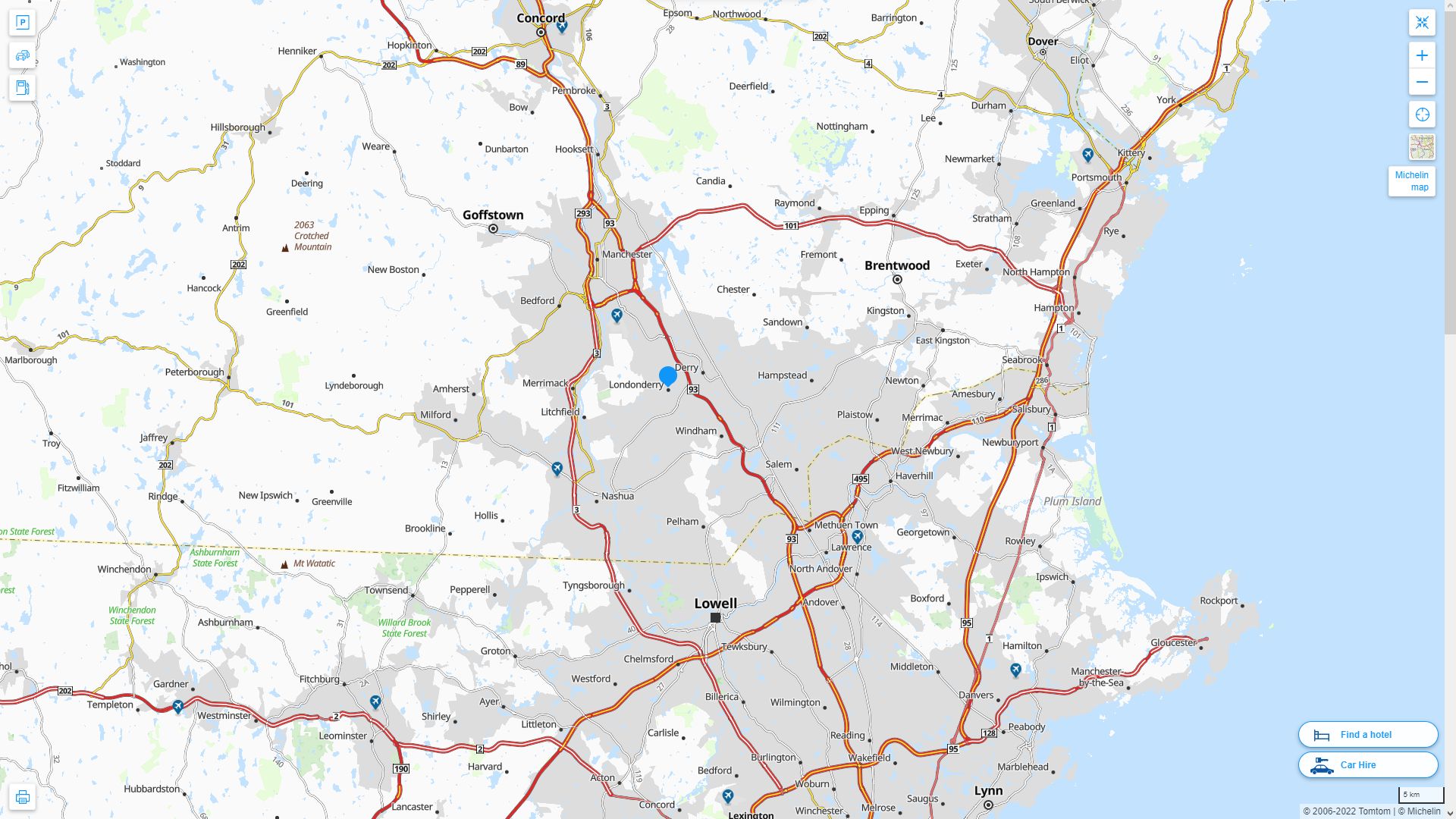
LONDONDERRY NEW HAMPSHIRE HIGHWAY AND ROAD MAP
Largest New Hampshire Cities by Population
Manchester Map Nashua Map Concord Map Dover Map Rochester Map Keene Map Derry Map Portsmouth Map Laconia Map Claremont Map Lebanon Map Somersworth Map Londonderry Map Durham Map Berlin MapFor all New Hampshire Cities Map
Londonderry New Hampshire Google Map, Street Views, Maps Directions, Satellite Images
WorldMap1.com offers a collection of Londonderry New Hampshire map, google map, Londonderry New Hampshire atlas, political, physical, satellite view, country infos, cities map and more map of Londonderry New Hampshire.